![](/images/other/stat-length.png)
![Excursión Senderismo Wimereux - Vallée du Denacre - Wimereux - Photo](https://media.geolcdn.com/t/1900/400/ext.pjpeg?maxdim=2&url=https%3A%2F%2Fservices.sitytrail.com%2FGeolivesWS%2FDownloadMedia.ashx%3FTrailID%3D118659%26Media%3D12821_2.jpg)
Vallée du Denacre - Wimereux
tracegps
Usuario
![Longitud](/images/other/stat-length.png)
Longitud
22 km
![Altitud máxima](https://static1.geolcdn.com/siteimages/upload/files/1508320355ic_sort_altitude_max_24dp.png)
Altitud máxima
102 m
![Desnivel positivo](https://static1.geolcdn.com/siteimages/upload/files/1508320355ic_sort_den_pos_24dp.png)
Desnivel positivo
346 m
![Km-Effort](/images/other/stat-length.png)
Km-Effort
27 km
![Altitud mínima](https://static1.geolcdn.com/siteimages/upload/files/1508320355ic_sort_altitude_min_24dp.png)
Altitud mínima
4 m
![Desnivel negativo](https://static1.geolcdn.com/siteimages/upload/files/1508320355ic_sort_den_neg_24dp.png)
Desnivel negativo
346 m
![Boucle](https://static1.geolcdn.com/siteimages/upload/files/16400158638029165_repeat_loop_refresh_sync_direction_icon.png)
Boucle
Sí
Fecha de creación :
2014-12-10 00:00:00.0
Última modificación :
2014-12-10 00:00:00.0
![Senderismo](https://static1.geolcdn.com/sitytour/trail-icons/101.png)
5h00
Dificultad : Difícil
![Escanee este código QR para abrir la excursión en la aplicación SityTrail](https://capi.geolives.com/qq0zvz2zws4bq2lad0pu/sitytour/trails/118659/qr.png?size=200)
Aplicación GPS de excursión GRATIS
A propósito
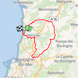
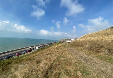
Ruta Senderismo de 22 km a descubrir en Alta Francia, Paso de Calais, Wimereux. Esta ruta ha sido propuesta por tracegps.
Descripción
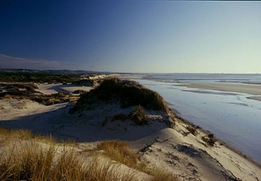
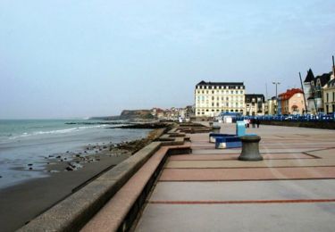
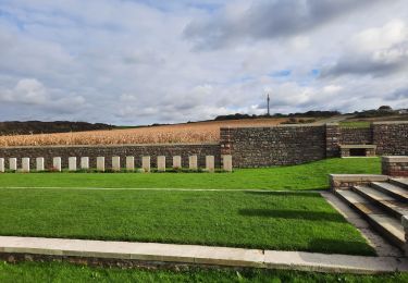
C'est au Nord dans le Pas de Calais et sa jolie Cote d'Opale. Au départ de Wimereux vers l'arrière pays vallonné, vous y découvrirez une petite vallée bucolique, où coule le Denacre. 23km de nature...A voir château et manoir...
Localización
País:
France
Región :
Alta Francia
Departamento/provincia :
Paso de Calais
Municipio :
Wimereux
Localidad:
Unknown
Salida:(Dec)
Salida:(UTM)
401941 ; 5624535 (31U) N.
Comentarios
Excursiones cerca
![Excursión Senderismo Wimereux - Promenade des Dunes de la Slack - Photo](https://media.geolcdn.com/t/375/260/ext.jpg?maxdim=2&url=https%3A%2F%2Fservices.sitytrail.com%2FGeolivesWS%2FDownloadMedia.ashx%3FTrailID%3D647521%26Media%3D59f52238-6e50-4f13-bf2d-3775f9e51a6a.jpg)
![Senderismo Senderismo](https://static1.geolcdn.com/sitytour/trail-icons/101.png)
Promenade des Dunes de la Slack
Senderismo
Muy fácil
(9)
Wimereux,
Alta Francia,
Paso de Calais,
France
![](/images/other/stat-length.png)
6 km | 6,8 km-effort
1h 30min
![](https://static1.geolcdn.com/siteimages/upload/files/16400158638029165_repeat_loop_refresh_sync_direction_icon.png)
Sí
![Excursión Senderismo Wimille - Balade sur le sentier du Denacre - Photo](https://media.geolcdn.com/t/375/260/ext.jpg?maxdim=2&url=https%3A%2F%2Fservices.sitytrail.com%2FGeolivesWS%2FDownloadMedia.ashx%3FTrailID%3D638580%26Media%3Dbb03aebe-b688-479d-8773-5a86670387c9.jpg)
![Senderismo Senderismo](https://static1.geolcdn.com/sitytour/trail-icons/101.png)
Balade sur le sentier du Denacre
Senderismo
Muy fácil
(5)
Wimille,
Alta Francia,
Paso de Calais,
France
![](/images/other/stat-length.png)
9,8 km | 11,4 km-effort
2h 30min
![](https://static1.geolcdn.com/siteimages/upload/files/16400158638029165_repeat_loop_refresh_sync_direction_icon.png)
Sí
![Excursión Bici de montaña Wimereux - Le littoral de Wimereux à Etaples - Photo](https://media.geolcdn.com/t/375/260/ext.jpg?maxdim=2&url=https%3A%2F%2Fservices.sitytrail.com%2FGeolivesWS%2FDownloadMedia.ashx%3FTrailID%3D191453%26Media%3D15044_1.jpg)
![Bici de montaña Bici de montaña](https://static1.geolcdn.com/sitytour/trail-icons/202.png)
Le littoral de Wimereux à Etaples
Bici de montaña
Medio
(1)
Wimereux,
Alta Francia,
Paso de Calais,
France
![](/images/other/stat-length.png)
35 km | 41 km-effort
3h 0min
![](https://static1.geolcdn.com/siteimages/upload/files/16400158638029165_repeat_loop_refresh_sync_direction_icon.png)
No
![Excursión Senderismo Wimereux - Wimereux - La Crèche - Photo](https://media.geolcdn.com/t/375/260/ext.jpg?maxdim=2&url=https%3A%2F%2Fservices.sitytrail.com%2FGeolivesWS%2FDownloadMedia.ashx%3FTrailID%3D103740%26Media%3D6466_2.jpg)
![Senderismo Senderismo](https://static1.geolcdn.com/sitytour/trail-icons/101.png)
Wimereux - La Crèche
Senderismo
Medio
(4)
Wimereux,
Alta Francia,
Paso de Calais,
France
![](/images/other/stat-length.png)
9,3 km | 11,4 km-effort
2h 15min
![](https://static1.geolcdn.com/siteimages/upload/files/16400158638029165_repeat_loop_refresh_sync_direction_icon.png)
Sí
![Excursión Senderismo Boulogne-sur-Mer - Boulogne sur mer- street art partiel - Photo](https://media.geolcdn.com/t/375/260/21a82651-a443-44ee-88e9-87624e35cba5.jpg&format=jpg&maxdim=2)
![Senderismo Senderismo](https://static1.geolcdn.com/sitytour/trail-icons/101.png)
Boulogne sur mer- street art partiel
Senderismo
Fácil
Boulogne-sur-Mer,
Alta Francia,
Paso de Calais,
France
![](/images/other/stat-length.png)
4,9 km | 6 km-effort
1h 22min
![](https://static1.geolcdn.com/siteimages/upload/files/16400158638029165_repeat_loop_refresh_sync_direction_icon.png)
No
![Excursión Senderismo Boulogne-sur-Mer - Boulogne sur mer, les remparts de nuit - Photo](https://media.geolcdn.com/t/375/260/ae64799f-0eb3-4576-bf19-e061448b8b88.jpg&format=jpg&maxdim=2)
![Senderismo Senderismo](https://static1.geolcdn.com/sitytour/trail-icons/101.png)
Boulogne sur mer, les remparts de nuit
Senderismo
Fácil
Boulogne-sur-Mer,
Alta Francia,
Paso de Calais,
France
![](/images/other/stat-length.png)
2,4 km | 2,9 km-effort
51min
![](https://static1.geolcdn.com/siteimages/upload/files/16400158638029165_repeat_loop_refresh_sync_direction_icon.png)
Sí
![Excursión Senderismo Wimereux - Boulogne-wimereux entre mer et terre - Photo](https://media.geolcdn.com/t/375/260/1d66f2e1-445b-431b-8fe1-79432c93e018.jpg&format=jpg&maxdim=2)
![Senderismo Senderismo](https://static1.geolcdn.com/sitytour/trail-icons/101.png)
Boulogne-wimereux entre mer et terre
Senderismo
Fácil
Wimereux,
Alta Francia,
Paso de Calais,
France
![](/images/other/stat-length.png)
10,3 km | 12,5 km-effort
2h 42min
![](https://static1.geolcdn.com/siteimages/upload/files/16400158638029165_repeat_loop_refresh_sync_direction_icon.png)
Sí
![Excursión Senderismo Wimereux - Wimereux Boulogne - Photo](https://media.geolcdn.com/t/375/260/c5b357de-a1ef-4826-80ff-4a1d95018f9a.jpg&format=jpg&maxdim=2)
![Senderismo Senderismo](https://static1.geolcdn.com/sitytour/trail-icons/101.png)
Wimereux Boulogne
Senderismo
Wimereux,
Alta Francia,
Paso de Calais,
France
![](/images/other/stat-length.png)
8,1 km | 10,1 km-effort
2h 35min
![](https://static1.geolcdn.com/siteimages/upload/files/16400158638029165_repeat_loop_refresh_sync_direction_icon.png)
Sí
![Excursión Senderismo Boulogne-sur-Mer - Boulogne sur Mer - Photo](https://media.geolcdn.com/t/375/260/e3e7049b-cb5c-4294-ad5f-939f0221d130.jpg&format=jpg&maxdim=2)
![Senderismo Senderismo](https://static1.geolcdn.com/sitytour/trail-icons/101.png)
Boulogne sur Mer
Senderismo
Boulogne-sur-Mer,
Alta Francia,
Paso de Calais,
France
![](/images/other/stat-length.png)
7 km | 8,1 km-effort
2h 8min
![](https://static1.geolcdn.com/siteimages/upload/files/16400158638029165_repeat_loop_refresh_sync_direction_icon.png)
No