![](/images/other/stat-length.png)
![Excursión Senderismo Huisnes-sur-Mer - Mont-St-Michel - 14km 64m 4h30 - 2017 06 26 - Photo](https://media.geolcdn.com/t/1900/400/9d39b175-437c-4c0f-9152-c4bc208b1660.jpg&format=pjpeg&maxdim=2)
Mont-St-Michel - 14km 64m 4h30 - 2017 06 26
Orcal37
Usuario GUIDE
![Longitud](/images/other/stat-length.png)
Longitud
14 km
![Altitud máxima](https://static1.geolcdn.com/siteimages/upload/files/1508320355ic_sort_altitude_max_24dp.png)
Altitud máxima
30 m
![Desnivel positivo](https://static1.geolcdn.com/siteimages/upload/files/1508320355ic_sort_den_pos_24dp.png)
Desnivel positivo
75 m
![Km-Effort](/images/other/stat-length.png)
Km-Effort
15 km
![Altitud mínima](https://static1.geolcdn.com/siteimages/upload/files/1508320355ic_sort_altitude_min_24dp.png)
Altitud mínima
0 m
![Desnivel negativo](https://static1.geolcdn.com/siteimages/upload/files/1508320355ic_sort_den_neg_24dp.png)
Desnivel negativo
74 m
![Boucle](https://static1.geolcdn.com/siteimages/upload/files/16400158638029165_repeat_loop_refresh_sync_direction_icon.png)
Boucle
Sí
Fecha de creación :
2019-05-07 01:57:24.983
Última modificación :
2019-08-14 18:34:37.159
![Senderismo](https://static1.geolcdn.com/sitytour/trail-icons/101.png)
4h30
Dificultad : Fácil
![Escanee este código QR para abrir la excursión en la aplicación SityTrail](https://capi.geolives.com/qq0zvz2zws4bq2lad0pu/sitytour/trails/1140684/qr.png?size=200)
Aplicación GPS de excursión GRATIS
A propósito
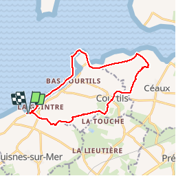
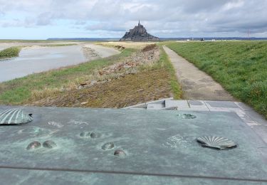
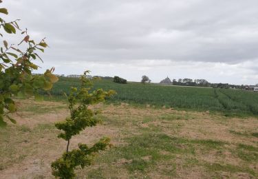
Ruta Senderismo de 14 km a descubrir en Normandía, Mancha, Huisnes-sur-Mer. Esta ruta ha sido propuesta por Orcal37.
Descripción
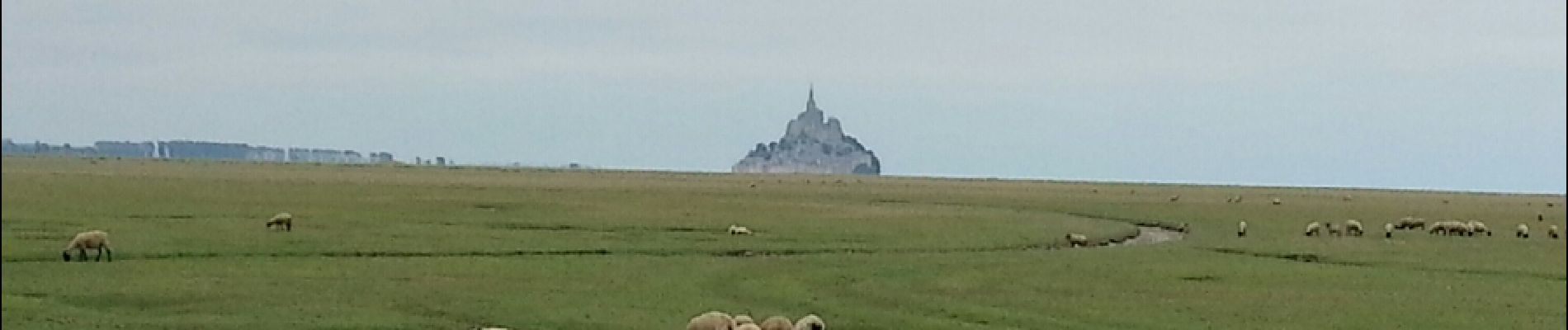
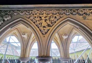
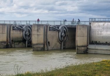
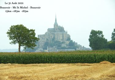
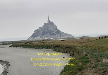
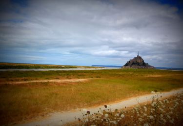
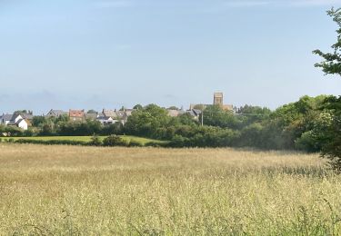
Mont-St-Michel - Pointe de Roche Torin - 14km 64m 4h30 45mn dej - 2017 06 26
Localización
País:
France
Región :
Normandía
Departamento/provincia :
Mancha
Municipio :
Huisnes-sur-Mer
Localidad:
Unknown
Salida:(Dec)
Salida:(UTM)
614099 ; 5386675 (30U) N.
Comentarios
Excursiones cerca
![Excursión Senderismo Monte Saint-Michel - Mont St Michel J2 - Photo](https://media.geolcdn.com/t/375/260/b4e16eca-62f6-4a45-b3f4-364badeabd8c.jpg&format=jpg&maxdim=2)
![Senderismo Senderismo](https://static1.geolcdn.com/sitytour/trail-icons/101.png)
Mont St Michel J2
Senderismo
Muy fácil
Monte Saint-Michel,
Normandía,
Mancha,
France
![](/images/other/stat-length.png)
17,4 km | 21 km-effort
4h 22min
![](https://static1.geolcdn.com/siteimages/upload/files/16400158638029165_repeat_loop_refresh_sync_direction_icon.png)
Sí
![Excursión Senderismo Monte Saint-Michel - Mont St Michel J1 - Photo](https://media.geolcdn.com/t/375/260/2b75de4d-6596-478a-9a3f-dcd60f498a33.jpg&format=jpg&maxdim=2)
![Senderismo Senderismo](https://static1.geolcdn.com/sitytour/trail-icons/101.png)
Mont St Michel J1
Senderismo
Difícil
Monte Saint-Michel,
Normandía,
Mancha,
France
![](/images/other/stat-length.png)
12,1 km | 14 km-effort
2h 46min
![](https://static1.geolcdn.com/siteimages/upload/files/16400158638029165_repeat_loop_refresh_sync_direction_icon.png)
Sí
![Excursión Senderismo Beauvoir - N°0 GR34 Beauvoir -- Mont St Michel -- Beauvoir - Photo](https://media.geolcdn.com/t/375/260/ad92d366-53f3-47e6-821c-d2813336be7e.jpg&format=jpg&maxdim=2)
![Senderismo Senderismo](https://static1.geolcdn.com/sitytour/trail-icons/101.png)
N°0 GR34 Beauvoir -- Mont St Michel -- Beauvoir
Senderismo
Difícil
Beauvoir,
Normandía,
Mancha,
France
![](/images/other/stat-length.png)
14,9 km | 17,3 km-effort
3h 55min
![](https://static1.geolcdn.com/siteimages/upload/files/16400158638029165_repeat_loop_refresh_sync_direction_icon.png)
Sí
![Excursión Senderismo Beauvoir - N°1 GR34 Beauvoir -- Le Vivier-sur-Mer - Photo](https://media.geolcdn.com/t/375/260/d6dcce93-6874-4297-ba3a-4d6b0fb11eaf.jpg&format=jpg&maxdim=2)
![Senderismo Senderismo](https://static1.geolcdn.com/sitytour/trail-icons/101.png)
N°1 GR34 Beauvoir -- Le Vivier-sur-Mer
Senderismo
Fácil
Beauvoir,
Normandía,
Mancha,
France
![](/images/other/stat-length.png)
25 km | 27 km-effort
6h 9min
![](https://static1.geolcdn.com/siteimages/upload/files/16400158638029165_repeat_loop_refresh_sync_direction_icon.png)
No
![Bici de montaña Bici de montaña](https://static1.geolcdn.com/sitytour/trail-icons/202.png)
SityTrail - 2506836 - beauvoir_20200724_092923
Bici de montaña
Medio
Beauvoir,
Normandía,
Mancha,
France
![](/images/other/stat-length.png)
29 km | 32 km-effort
Desconocido
![](https://static1.geolcdn.com/siteimages/upload/files/16400158638029165_repeat_loop_refresh_sync_direction_icon.png)
Sí
![Excursión Senderismo Courtils - La roche taurin Mont st michel - Photo](https://media.geolcdn.com/t/375/260/ext.jpg?maxdim=2&url=https%3A%2F%2Fstatic1.geolcdn.com%2Fsiteimages%2Fupload%2Ffiles%2F1553511878bg_sport_marche.png)
![Senderismo Senderismo](https://static1.geolcdn.com/sitytour/trail-icons/101.png)
La roche taurin Mont st michel
Senderismo
Fácil
(1)
Courtils,
Normandía,
Mancha,
France
![](/images/other/stat-length.png)
10,8 km | 11,4 km-effort
3h 52min
![](https://static1.geolcdn.com/siteimages/upload/files/16400158638029165_repeat_loop_refresh_sync_direction_icon.png)
No
![Excursión Senderismo Vains - Le Grouin du Sud - Photo](https://media.geolcdn.com/t/375/260/9dafd13c-f37c-41f6-8e8a-4f36b76425a7.jpg&format=jpg&maxdim=2)
![Senderismo Senderismo](https://static1.geolcdn.com/sitytour/trail-icons/101.png)
Le Grouin du Sud
Senderismo
Fácil
Vains,
Normandía,
Mancha,
France
![](/images/other/stat-length.png)
5,3 km | 6,1 km-effort
1h 30min
![](https://static1.geolcdn.com/siteimages/upload/files/16400158638029165_repeat_loop_refresh_sync_direction_icon.png)
Sí
![Excursión Senderismo Monte Saint-Michel - GR_34_AA_01_Mt-St-Michel_St-Marcan_20230318 - Photo](https://media.geolcdn.com/t/375/260/a17250a1-0bf7-444e-8b49-3029941c7cbf.jpg&format=jpg&maxdim=2)
![Senderismo Senderismo](https://static1.geolcdn.com/sitytour/trail-icons/101.png)
GR_34_AA_01_Mt-St-Michel_St-Marcan_20230318
Senderismo
Muy fácil
Monte Saint-Michel,
Normandía,
Mancha,
France
![](/images/other/stat-length.png)
16,7 km | 18,7 km-effort
4h 1min
![](https://static1.geolcdn.com/siteimages/upload/files/16400158638029165_repeat_loop_refresh_sync_direction_icon.png)
No
![Excursión Senderismo Beauvoir - GR_37_AA_15_Beauvoir_Pleine-Fougeres_20210521 - Photo](https://media.geolcdn.com/t/375/260/45a2928d-2310-48d8-b8a4-fe1aa26383e2.jpg&format=jpg&maxdim=2)
![Senderismo Senderismo](https://static1.geolcdn.com/sitytour/trail-icons/101.png)
GR_37_AA_15_Beauvoir_Pleine-Fougeres_20210521
Senderismo
Muy fácil
Beauvoir,
Normandía,
Mancha,
France
![](/images/other/stat-length.png)
14,2 km | 15,5 km-effort
3h 8min
![](https://static1.geolcdn.com/siteimages/upload/files/16400158638029165_repeat_loop_refresh_sync_direction_icon.png)
No