![](/images/other/stat-length.png)
![Excursión Senderismo Perche en Nocé - Préaux du Perche (Boucle) - Photo](https://media.geolcdn.com/t/1900/400/ext.pjpeg?maxdim=2&url=https%3A%2F%2Fstatic1.geolcdn.com%2Fsiteimages%2Fupload%2Ffiles%2F1553511878bg_sport_marche.png)
Préaux du Perche (Boucle)
neitag61
Usuario
![Longitud](/images/other/stat-length.png)
Longitud
20 km
![Altitud máxima](https://static1.geolcdn.com/siteimages/upload/files/1508320355ic_sort_altitude_max_24dp.png)
Altitud máxima
199 m
![Desnivel positivo](https://static1.geolcdn.com/siteimages/upload/files/1508320355ic_sort_den_pos_24dp.png)
Desnivel positivo
264 m
![Km-Effort](/images/other/stat-length.png)
Km-Effort
24 km
![Altitud mínima](https://static1.geolcdn.com/siteimages/upload/files/1508320355ic_sort_altitude_min_24dp.png)
Altitud mínima
114 m
![Desnivel negativo](https://static1.geolcdn.com/siteimages/upload/files/1508320355ic_sort_den_neg_24dp.png)
Desnivel negativo
264 m
![Boucle](https://static1.geolcdn.com/siteimages/upload/files/16400158638029165_repeat_loop_refresh_sync_direction_icon.png)
Boucle
Sí
Fecha de creación :
2016-04-15 00:00:00.0
Última modificación :
2016-04-15 00:00:00.0
![Senderismo](https://static1.geolcdn.com/sitytour/trail-icons/101.png)
5h30
Dificultad : Medio
![Escanee este código QR para abrir la excursión en la aplicación SityTrail](https://capi.geolives.com/qq0zvz2zws4bq2lad0pu/sitytour/trails/113689/qr.png?size=200)
Aplicación GPS de excursión GRATIS
A propósito
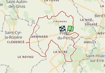
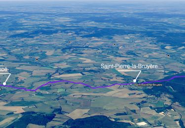
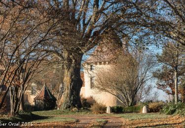
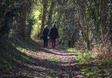
Ruta Senderismo de 20 km a descubrir en Normandía, Orne, Perche en Nocé. Esta ruta ha sido propuesta por neitag61.
Descripción
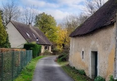
Très beau circuit de 20Km
Départ de l''église de Préaux du Perche
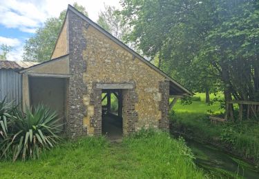
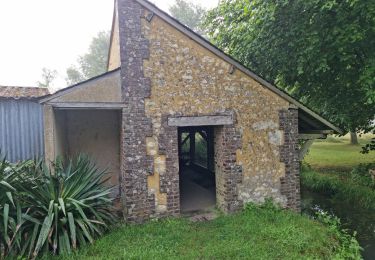
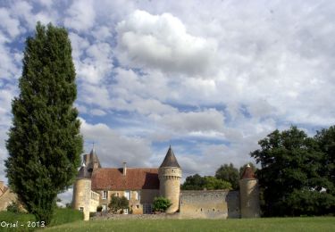
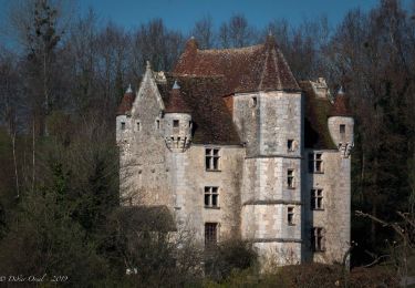
Passage à mi chemin au Prieuré de Ste Gauburge et Ecomusée du Perche
Localización
País:
France
Región :
Normandía
Departamento/provincia :
Orne
Municipio :
Perche en Nocé
Localidad:
Unknown
Salida:(Dec)
Salida:(UTM)
329737 ; 5355565 (31U) N.
Comentarios
Excursiones cerca
![Excursión Senderismo Perche en Nocé - Préaux-du-Perche Nord - Photo](https://media.geolcdn.com/t/375/260/a79e2268-207b-49cb-8d2a-d633dd57f73d.jpg&format=jpg&maxdim=2)
![Senderismo Senderismo](https://static1.geolcdn.com/sitytour/trail-icons/101.png)
Préaux-du-Perche Nord
Senderismo
Fácil
(1)
Perche en Nocé,
Normandía,
Orne,
France
![](/images/other/stat-length.png)
11,3 km | 13,2 km-effort
2h 59min
![](https://static1.geolcdn.com/siteimages/upload/files/16400158638029165_repeat_loop_refresh_sync_direction_icon.png)
Sí
![Excursión Senderismo Perche en Nocé - Préaux-du-Perche Sud - Photo](https://media.geolcdn.com/t/375/260/0969c1bf-78c8-4ceb-9cf9-65ed34443adf.jpg&format=jpg&maxdim=2)
![Senderismo Senderismo](https://static1.geolcdn.com/sitytour/trail-icons/101.png)
Préaux-du-Perche Sud
Senderismo
Medio
Perche en Nocé,
Normandía,
Orne,
France
![](/images/other/stat-length.png)
7,9 km | 9,5 km-effort
2h 9min
![](https://static1.geolcdn.com/siteimages/upload/files/16400158638029165_repeat_loop_refresh_sync_direction_icon.png)
Sí
![Excursión Senderismo Berd'huis - SityTrail - Berd'huis - Condé-sur-Huisne 14 km - Photo](https://media.geolcdn.com/t/375/260/e562d127-d462-4485-b928-bb7147049073.png&format=jpg&maxdim=2)
![Senderismo Senderismo](https://static1.geolcdn.com/sitytour/trail-icons/101.png)
SityTrail - Berd'huis - Condé-sur-Huisne 14 km
Senderismo
Difícil
Berd'huis,
Normandía,
Orne,
France
![](/images/other/stat-length.png)
13,9 km | 16,7 km-effort
3h 37min
![](https://static1.geolcdn.com/siteimages/upload/files/16400158638029165_repeat_loop_refresh_sync_direction_icon.png)
No
![Excursión Senderismo Berd'huis - SityTrail - Berd'huis - Saint-Cyr-la-Rosière via Préaux-du-Perche 12 km - Photo](https://media.geolcdn.com/t/375/260/9f597d4c-6499-477b-a914-13f046dbb439.jpg&format=jpg&maxdim=2)
![Senderismo Senderismo](https://static1.geolcdn.com/sitytour/trail-icons/101.png)
SityTrail - Berd'huis - Saint-Cyr-la-Rosière via Préaux-du-Perche 12 km
Senderismo
Muy fácil
Berd'huis,
Normandía,
Orne,
France
![](/images/other/stat-length.png)
4,1 km | 4,9 km-effort
1h 0min
![](https://static1.geolcdn.com/siteimages/upload/files/16400158638029165_repeat_loop_refresh_sync_direction_icon.png)
No
![Excursión Senderismo Saint-Cyr-la-Rosière - Au fil de la Rosière 7,1 Km - Photo](https://media.geolcdn.com/t/375/260/6ffb02c5-f518-43cf-b25f-e24d8f031465.jpg&format=jpg&maxdim=2)
![Senderismo Senderismo](https://static1.geolcdn.com/sitytour/trail-icons/101.png)
Au fil de la Rosière 7,1 Km
Senderismo
Medio
Saint-Cyr-la-Rosière,
Normandía,
Orne,
France
![](/images/other/stat-length.png)
7,1 km | 8,7 km-effort
1h 57min
![](https://static1.geolcdn.com/siteimages/upload/files/16400158638029165_repeat_loop_refresh_sync_direction_icon.png)
Sí
![Excursión Senderismo Perche en Nocé - Nocé-Courboyer - Saint-Aubin-des-Grois 9,5 km - Photo](https://media.geolcdn.com/t/375/260/74d7cd8d-75a9-4a6d-8570-ba2a55254fab.jpg&format=jpg&maxdim=2)
![Senderismo Senderismo](https://static1.geolcdn.com/sitytour/trail-icons/101.png)
Nocé-Courboyer - Saint-Aubin-des-Grois 9,5 km
Senderismo
Fácil
Perche en Nocé,
Normandía,
Orne,
France
![](/images/other/stat-length.png)
9,5 km | 11,2 km-effort
2h 25min
![](https://static1.geolcdn.com/siteimages/upload/files/16400158638029165_repeat_loop_refresh_sync_direction_icon.png)
No
![Excursión Senderismo Perche en Nocé - Val d'Enfer 17Km - Photo](https://media.geolcdn.com/t/375/260/285f82a6-4b4a-437a-b428-48270f65e19b.jpg&format=jpg&maxdim=2)
![Senderismo Senderismo](https://static1.geolcdn.com/sitytour/trail-icons/101.png)
Val d'Enfer 17Km
Senderismo
Medio
Perche en Nocé,
Normandía,
Orne,
France
![](/images/other/stat-length.png)
16,7 km | 19,5 km-effort
4h 16min
![](https://static1.geolcdn.com/siteimages/upload/files/16400158638029165_repeat_loop_refresh_sync_direction_icon.png)
Sí
![Excursión Senderismo Perche en Nocé - Nobles logis (Préaux-du-Perche) 9,4Km - Photo](https://media.geolcdn.com/t/375/260/4db8b454-889b-47d7-bd12-5d83e5cd02fb.jpg&format=jpg&maxdim=2)
![Senderismo Senderismo](https://static1.geolcdn.com/sitytour/trail-icons/101.png)
Nobles logis (Préaux-du-Perche) 9,4Km
Senderismo
Fácil
Perche en Nocé,
Normandía,
Orne,
France
![](/images/other/stat-length.png)
9,3 km | 10,9 km-effort
2h 19min
![](https://static1.geolcdn.com/siteimages/upload/files/16400158638029165_repeat_loop_refresh_sync_direction_icon.png)
Sí
![Excursión Senderismo Perche en Nocé - Les Panoramas 5,5 Km - Photo](https://media.geolcdn.com/t/375/260/3ecdb278-3826-4aa6-b1de-61f0366a9a2c.jpg&format=jpg&maxdim=2)
![Senderismo Senderismo](https://static1.geolcdn.com/sitytour/trail-icons/101.png)
Les Panoramas 5,5 Km
Senderismo
Muy fácil
Perche en Nocé,
Normandía,
Orne,
France
![](/images/other/stat-length.png)
5,4 km | 6,5 km-effort
1h 15min
![](https://static1.geolcdn.com/siteimages/upload/files/16400158638029165_repeat_loop_refresh_sync_direction_icon.png)
Sí