![](/images/other/stat-length.png)
![Excursión Senderismo Clamensane - L'Aqueduc des Sagniéres - Clamensane - Photo](https://media.geolcdn.com/t/1900/400/ext.pjpeg?maxdim=2&url=https%3A%2F%2Fservices.sitytrail.com%2FGeolivesWS%2FDownloadMedia.ashx%3FTrailID%3D112782%26Media%3D12380_5.jpg)
L'Aqueduc des Sagniéres - Clamensane
tracegps
Usuario
![Longitud](/images/other/stat-length.png)
![Altitud máxima](https://static1.geolcdn.com/siteimages/upload/files/1508320355ic_sort_altitude_max_24dp.png)
![Desnivel positivo](https://static1.geolcdn.com/siteimages/upload/files/1508320355ic_sort_den_pos_24dp.png)
![Km-Effort](/images/other/stat-length.png)
![Altitud mínima](https://static1.geolcdn.com/siteimages/upload/files/1508320355ic_sort_altitude_min_24dp.png)
![Desnivel negativo](https://static1.geolcdn.com/siteimages/upload/files/1508320355ic_sort_den_neg_24dp.png)
![Boucle](https://static1.geolcdn.com/siteimages/upload/files/16400158638029165_repeat_loop_refresh_sync_direction_icon.png)
![Senderismo](https://static1.geolcdn.com/sitytour/trail-icons/101.png)
2h00
Dificultad : Medio
![Escanee este código QR para abrir la excursión en la aplicación SityTrail](https://capi.geolives.com/qq0zvz2zws4bq2lad0pu/sitytour/trails/112782/qr.png?size=200)
Aplicación GPS de excursión GRATIS
A propósito
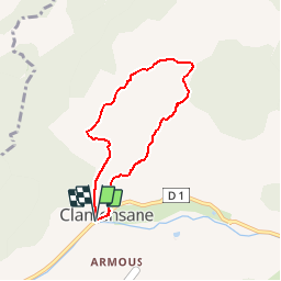
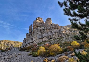
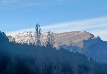
Ruta Senderismo de 5,9 km a descubrir en Provenza-Alpes-Costa Azul, Alpes de Alta Provenza, Clamensane. Esta ruta ha sido propuesta por tracegps.
Descripción
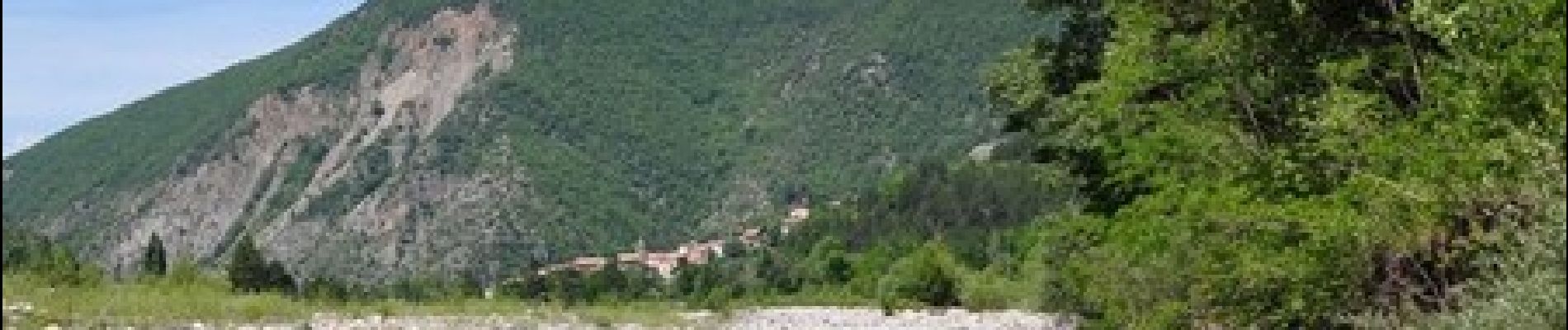
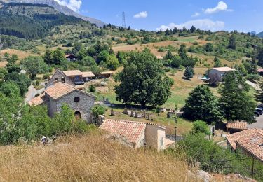
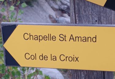
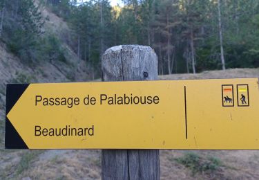
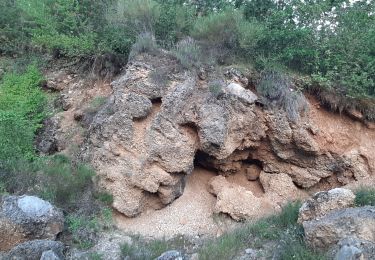
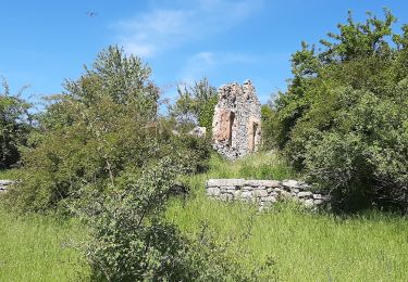
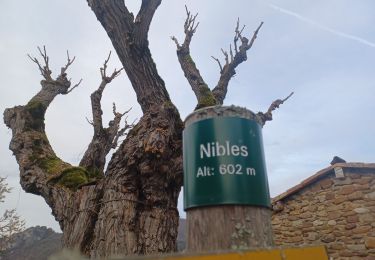
Départ à proximité du pont au Sud-Ouest du village. Le départ de cette jolie boucle démarre au sud ouest du village, à proximité du pont qui enjambe le torrent de Vermeil. Par un court sentier, vous rejoignez la piste qui porte le même nom. 1km plus loin, un magnifique sentier ombragé vous guidera jusqu’à l’aqueduc des Sagnières. Poursuivez votre circuit par une piste jusqu’aux Basses-Graves. Redescendre par cette route goudronnée durant 1km, que vous quitterez sur la droite pour rejoindre Clamensane par le haut du village. Retrouvez le circuit sur le site des Hautes Terres de Provence.
Localización
Comentarios
Excursiones cerca
![Excursión Senderismo Clamensane - Clamensane - Col de la Croix - Chapelle St-Amand - Photo](https://media.geolcdn.com/t/375/260/03bf31a1-ae5a-4bc8-81f0-352f4f7d4b3d.jpg&format=jpg&maxdim=2)
![Senderismo Senderismo](https://static1.geolcdn.com/sitytour/trail-icons/101.png)
Senderismo
![](/images/other/stat-length.png)
![](https://static1.geolcdn.com/siteimages/upload/files/16400158638029165_repeat_loop_refresh_sync_direction_icon.png)
![Excursión Senderismo Valavoire - Sommet de Jouère - Photo](https://media.geolcdn.com/t/375/260/d8443deb-7a4b-44b3-ac6b-fcb5789c326f.jpg&format=jpg&maxdim=2)
![Senderismo Senderismo](https://static1.geolcdn.com/sitytour/trail-icons/101.png)
Senderismo
![](/images/other/stat-length.png)
![](https://static1.geolcdn.com/siteimages/upload/files/16400158638029165_repeat_loop_refresh_sync_direction_icon.png)
![Excursión Senderismo Clamensane - CLAMENSANE. TROU DU DIABLR . CHAPELLE S AMAND . COL LA CROIX . O L M S. IX - Photo](https://media.geolcdn.com/t/375/260/10d9eaa1-fd55-4233-9c4f-5d12e1744ffc.jpg&format=jpg&maxdim=2)
![Senderismo Senderismo](https://static1.geolcdn.com/sitytour/trail-icons/101.png)
Senderismo
![](/images/other/stat-length.png)
![](https://static1.geolcdn.com/siteimages/upload/files/16400158638029165_repeat_loop_refresh_sync_direction_icon.png)
![Excursión Senderismo Clamensane - VALAVOIRE Pas de Palabiouse , bergerie de Premarche o l s - Photo](https://media.geolcdn.com/t/375/260/0c200d5e-0f59-43cc-96e6-d7b8947343f2.jpg&format=jpg&maxdim=2)
![Senderismo Senderismo](https://static1.geolcdn.com/sitytour/trail-icons/101.png)
Senderismo
![](/images/other/stat-length.png)
![](https://static1.geolcdn.com/siteimages/upload/files/16400158638029165_repeat_loop_refresh_sync_direction_icon.png)
![Excursión Senderismo Clamensane - VALAVOIRE. Pas de Palabrouse. Fontaine de Pouille o l s - Photo](https://media.geolcdn.com/t/375/260/d94e99f0-0c27-4f39-bd9c-c7d2b68f013f.jpg&format=jpg&maxdim=2)
![Senderismo Senderismo](https://static1.geolcdn.com/sitytour/trail-icons/101.png)
Senderismo
![](/images/other/stat-length.png)
![](https://static1.geolcdn.com/siteimages/upload/files/16400158638029165_repeat_loop_refresh_sync_direction_icon.png)
![Excursión Senderismo La Motte-du-Caire - LA MOTTE DU CAIRE .Le tour de la Blachere o - Photo](https://media.geolcdn.com/t/375/260/181c511a-92a7-4933-9888-9e2bc6024806.jpg&format=jpg&maxdim=2)
![Senderismo Senderismo](https://static1.geolcdn.com/sitytour/trail-icons/101.png)
Senderismo
![](/images/other/stat-length.png)
![](https://static1.geolcdn.com/siteimages/upload/files/16400158638029165_repeat_loop_refresh_sync_direction_icon.png)
![Excursión Senderismo Valavoire - Château de la mole - Col de la Sapie - Photo](https://media.geolcdn.com/t/375/260/4daf6a52-01d9-480a-9c8c-120e5682afb7.jpg&format=jpg&maxdim=2)
![Senderismo Senderismo](https://static1.geolcdn.com/sitytour/trail-icons/101.png)
Senderismo
![](/images/other/stat-length.png)
![](https://static1.geolcdn.com/siteimages/upload/files/16400158638029165_repeat_loop_refresh_sync_direction_icon.png)
![Excursión Senderismo Nibles - NIBLES . CANAL DU MOULIN . PASSAGE DE L HOMME MORT . S JACQUES O L - Photo](https://media.geolcdn.com/t/375/260/2fa73386-20dc-44c2-aea9-4ca90b12e862.jpg&format=jpg&maxdim=2)
![Senderismo Senderismo](https://static1.geolcdn.com/sitytour/trail-icons/101.png)
Senderismo
![](/images/other/stat-length.png)
![](https://static1.geolcdn.com/siteimages/upload/files/16400158638029165_repeat_loop_refresh_sync_direction_icon.png)
![Excursión Senderismo Clamensane - CLAMENSANE BERGERIE BERGIE ROCHER CHABRIER O S L - Photo](https://media.geolcdn.com/t/375/260/220e1021-cc5e-48e0-8055-b6a13c355da7.jpg&format=jpg&maxdim=2)
![Senderismo Senderismo](https://static1.geolcdn.com/sitytour/trail-icons/101.png)
Senderismo
![](/images/other/stat-length.png)
![](https://static1.geolcdn.com/siteimages/upload/files/16400158638029165_repeat_loop_refresh_sync_direction_icon.png)