![](/images/other/stat-length.png)
![Excursión Senderismo Châtillon-en-Diois - GTV - Tour du Vercors à pied - Les Nonnières - Forêt de Jocou - Glandage - Photo](https://media.geolcdn.com/t/1900/400/ext.pjpeg?maxdim=2&url=https%3A%2F%2Fservices.sitytrail.com%2FGeolivesWS%2FDownloadMedia.ashx%3FTrailID%3D112675%26Media%3D11457_2.jpg)
GTV - Tour du Vercors à pied - Les Nonnières - Forêt de Jocou - Glandage
tracegps
Usuario
![Longitud](/images/other/stat-length.png)
![Altitud máxima](https://static1.geolcdn.com/siteimages/upload/files/1508320355ic_sort_altitude_max_24dp.png)
![Desnivel positivo](https://static1.geolcdn.com/siteimages/upload/files/1508320355ic_sort_den_pos_24dp.png)
![Km-Effort](/images/other/stat-length.png)
![Altitud mínima](https://static1.geolcdn.com/siteimages/upload/files/1508320355ic_sort_altitude_min_24dp.png)
![Desnivel negativo](https://static1.geolcdn.com/siteimages/upload/files/1508320355ic_sort_den_neg_24dp.png)
![Boucle](https://static1.geolcdn.com/siteimages/upload/files/16400158638029165_repeat_loop_refresh_sync_direction_icon.png)
![Senderismo](https://static1.geolcdn.com/sitytour/trail-icons/101.png)
16h00
Dificultad : Difícil
![Escanee este código QR para abrir la excursión en la aplicación SityTrail](https://capi.geolives.com/qq0zvz2zws4bq2lad0pu/sitytour/trails/112675/qr.png?size=200)
Aplicación GPS de excursión GRATIS
A propósito
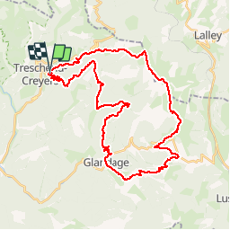
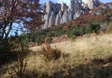
Ruta Senderismo de 42 km a descubrir en Auvergne-Rhône-Alpes, Drôme, Châtillon-en-Diois. Esta ruta ha sido propuesta por tracegps.
Descripción
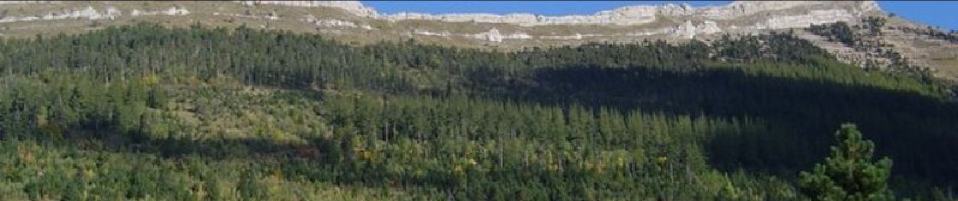
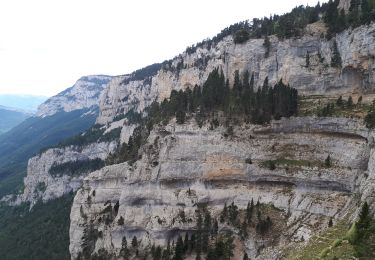
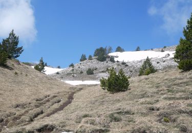
GTV - Tour du Vercors à pied - Les Nonnières - Forêt de Jocou – Glandage Ce tronçon forme une boucle qui revient aux Nonnières. L’itinéraire emprunte une ligne de crête très esthétique avec une vue exceptionnelle au milieu des prairies d’alpage. Il passe au sommet du Jocou par une montée assez raide. Attention de bien suivre la sente, pas toujours marquée sur les crêtes. Par temps de brouillard, l’orientation peut devenir difficile sur cette section. Une petite partie très pentue est souvent glissante, entre le Col de Seysse et la crête de l’Archat. Après les crêtes, c’est la redescente au hameau de Grimone suivi d’un crochet au col de Grimone. Puis vous cheminez sur l’arête de Serre les Tètes avant de descendre sur Glandage par le col des Aiguilles. A Glandage, l’itinéraire reprend progressivement de l’altitude avec un parcours essentiellement forestier jusqu’aux Sucettes de Borne. Au hameau de Borne, le sentier monte encore au milieu d’une végétation caractéristique du Diois (pins, chênes, hêtres et buis). Passage aux cols de Plainie et de Sambue avant de rejoindre, par sentier en lacet, les Nonnières. Tracé officiel labellisé GTV. Le découpage proposé est indicatif et les tronçons ne sont pas imposés. Construisez autour votre propre itinéraire en fonction de votre forme physique et des conditions climatiques. Pour vous aider, consultez les informations de Vercors-GTV.com et retrouvez les itinéraires en détail dans les topo-guides du Parc.
Localización
Comentarios
Excursiones cerca
![Senderismo Senderismo](https://static1.geolcdn.com/sitytour/trail-icons/101.png)
Senderismo
![](/images/other/stat-length.png)
![](https://static1.geolcdn.com/siteimages/upload/files/16400158638029165_repeat_loop_refresh_sync_direction_icon.png)
![Excursión Senderismo Châtillon-en-Diois - 2015-05-30 11:51 - Photo](https://media.geolcdn.com/t/375/260/f6b04bda-399a-4e8f-a718-7c3ac5f32c3c.jpg&format=jpg&maxdim=2)
![Senderismo Senderismo](https://static1.geolcdn.com/sitytour/trail-icons/101.png)
Senderismo
![](/images/other/stat-length.png)
![](https://static1.geolcdn.com/siteimages/upload/files/16400158638029165_repeat_loop_refresh_sync_direction_icon.png)
![Senderismo Senderismo](https://static1.geolcdn.com/sitytour/trail-icons/101.png)
Senderismo
![](/images/other/stat-length.png)
![](https://static1.geolcdn.com/siteimages/upload/files/16400158638029165_repeat_loop_refresh_sync_direction_icon.png)
![Excursión Senderismo Châtillon-en-Diois - F26 Combau Fontaine Pourrie - Photo](https://media.geolcdn.com/t/375/260/ext.jpg?maxdim=2&url=https%3A%2F%2Fservices.sitytrail.com%2FGeolivesWS%2FDownloadMedia.ashx%3FTrailID%3D311756%26Media%3Dfix__20140611142210.jpg)
![Senderismo Senderismo](https://static1.geolcdn.com/sitytour/trail-icons/101.png)
Senderismo
![](/images/other/stat-length.png)
![](https://static1.geolcdn.com/siteimages/upload/files/16400158638029165_repeat_loop_refresh_sync_direction_icon.png)
![Excursión Senderismo Châtillon-en-Diois - 26 vallon combeau - Photo](https://media.geolcdn.com/t/375/260/5dff522d-7866-41ae-b85a-1900434d82e5.jpg&format=jpg&maxdim=2)
![Senderismo Senderismo](https://static1.geolcdn.com/sitytour/trail-icons/101.png)
Senderismo
![](/images/other/stat-length.png)
![](https://static1.geolcdn.com/siteimages/upload/files/16400158638029165_repeat_loop_refresh_sync_direction_icon.png)
![Excursión Senderismo Châtillon-en-Diois - 26 grimone j1 - Photo](https://media.geolcdn.com/t/375/260/781a4ae6-6994-4c28-83c7-bfb5368271f2.jpg&format=jpg&maxdim=2)
![Senderismo Senderismo](https://static1.geolcdn.com/sitytour/trail-icons/101.png)
Senderismo
![](/images/other/stat-length.png)
![](https://static1.geolcdn.com/siteimages/upload/files/16400158638029165_repeat_loop_refresh_sync_direction_icon.png)
![Excursión Senderismo Châtillon-en-Diois - Les crêtes du cirque d'Archiane - Photo](https://media.geolcdn.com/t/375/260/09133ccd-d124-4373-a8e4-85c1f4032737.jpg&format=jpg&maxdim=2)
![Senderismo Senderismo](https://static1.geolcdn.com/sitytour/trail-icons/101.png)
Senderismo
![](/images/other/stat-length.png)
![](https://static1.geolcdn.com/siteimages/upload/files/16400158638029165_repeat_loop_refresh_sync_direction_icon.png)
![Excursión Senderismo Châtillon-en-Diois - 2017-06-04 15:45:22 - Photo](https://media.geolcdn.com/t/375/260/4049bbeb-10e6-465f-8c97-cefb4daee153.jpg&format=jpg&maxdim=2)
![Senderismo Senderismo](https://static1.geolcdn.com/sitytour/trail-icons/101.png)
Senderismo
![](/images/other/stat-length.png)
![](https://static1.geolcdn.com/siteimages/upload/files/16400158638029165_repeat_loop_refresh_sync_direction_icon.png)
![Excursión Senderismo Châtillon-en-Diois - La boucle du Mont Barral - Photo](https://media.geolcdn.com/t/375/260/ext.jpg?maxdim=2&url=https%3A%2F%2Fservices.sitytrail.com%2FGeolivesWS%2FDownloadMedia.ashx%3FTrailID%3D634749%26Media%3Dc20ca353-82d8-44c0-a4a4-ad6f8b92275b.JPG)
![Senderismo Senderismo](https://static1.geolcdn.com/sitytour/trail-icons/101.png)
Senderismo
![](/images/other/stat-length.png)
![](https://static1.geolcdn.com/siteimages/upload/files/16400158638029165_repeat_loop_refresh_sync_direction_icon.png)