![](/images/other/stat-length.png)
![Excursión Bici de montaña Château-Arnoux-Saint-Auban - Base VTT FFCT Val de Durance - Le Pas des Boeufs - Circuit n°4 - Château-Arnoux - Photo](https://media.geolcdn.com/t/1900/400/ext.pjpeg?maxdim=2&url=https%3A%2F%2Fservices.sitytrail.com%2FGeolivesWS%2FDownloadMedia.ashx%3FTrailID%3D111985%26Media%3D9338_1.jpg)
Base VTT FFCT Val de Durance - Le Pas des Boeufs - Circuit n°4 - Château-Arnoux
tracegps
Usuario
![Longitud](/images/other/stat-length.png)
![Altitud máxima](https://static1.geolcdn.com/siteimages/upload/files/1508320355ic_sort_altitude_max_24dp.png)
![Desnivel positivo](https://static1.geolcdn.com/siteimages/upload/files/1508320355ic_sort_den_pos_24dp.png)
![Km-Effort](/images/other/stat-length.png)
![Altitud mínima](https://static1.geolcdn.com/siteimages/upload/files/1508320355ic_sort_altitude_min_24dp.png)
![Desnivel negativo](https://static1.geolcdn.com/siteimages/upload/files/1508320355ic_sort_den_neg_24dp.png)
![Boucle](https://static1.geolcdn.com/siteimages/upload/files/16400158638029165_repeat_loop_refresh_sync_direction_icon.png)
![Bici de montaña](https://static1.geolcdn.com/sitytour/trail-icons/202.png)
3h30
Dificultad : Muy difícil
![Escanee este código QR para abrir la excursión en la aplicación SityTrail](https://capi.geolives.com/qq0zvz2zws4bq2lad0pu/sitytour/trails/111985/qr.png?size=200)
Aplicación GPS de excursión GRATIS
A propósito
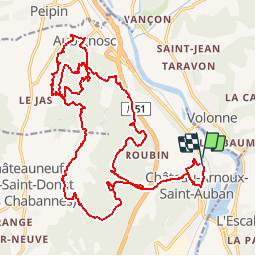
Ruta Bici de montaña de 28 km a descubrir en Provenza-Alpes-Costa Azul, Alpes de Alta Provenza, Château-Arnoux-Saint-Auban. Esta ruta ha sido propuesta por tracegps.
Descripción
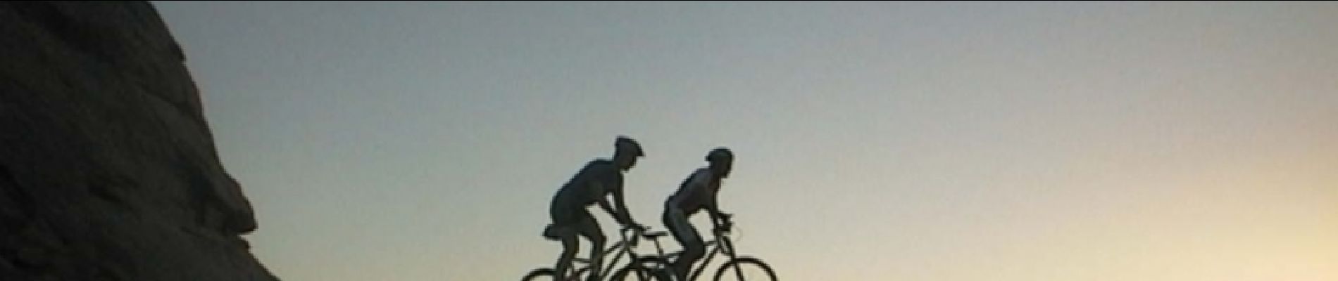
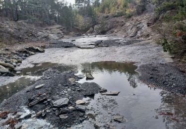
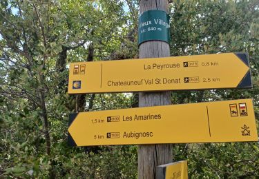
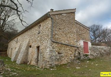
Le Pas des Bœufs est notre fleuron. Un florilège de sensations fortes; des sentiers magnifiques empruntant des vallons sauvages et arides, puis la fraicheur des sous bois, l'enivrant parfum des genêts, un impressionnant passage en crête, des robins, des gués à traverser, un sentier qui se faufile au milieu des bruyères arborescentes... Le plaisir absolu ! Mais attention, c'est un circuit noir, parfois très technique (minimum 3 portages) qui requiert de bonnes capacités physiques.
Localización
Comentarios
Excursiones cerca
![Excursión Senderismo Peipin - PEIPIN . PAR LES CHEMINS ABANDONNÉS DE PEIPIN O L S - Photo](https://media.geolcdn.com/t/375/260/7475f192-1a04-4ae2-85f2-46dfbe426939.jpg&format=jpg&maxdim=2)
![Senderismo Senderismo](https://static1.geolcdn.com/sitytour/trail-icons/101.png)
Senderismo
![](/images/other/stat-length.png)
![](https://static1.geolcdn.com/siteimages/upload/files/16400158638029165_repeat_loop_refresh_sync_direction_icon.png)
![Excursión Senderismo Aubignosc - AUBIGNOSC. Vieil Chateau Neuf , canyons o l m s - Photo](https://media.geolcdn.com/t/375/260/65ebcf05-a4c8-4543-8e63-050694c809e9.jpg&format=jpg&maxdim=2)
![Senderismo Senderismo](https://static1.geolcdn.com/sitytour/trail-icons/101.png)
Senderismo
![](/images/other/stat-length.png)
![](https://static1.geolcdn.com/siteimages/upload/files/16400158638029165_repeat_loop_refresh_sync_direction_icon.png)
![Excursión Senderismo Aubignosc - AUBIGNOSC . LE PETIT COLORADO . O L S - Photo](https://media.geolcdn.com/t/375/260/9769e6c8-7278-4da5-a931-29d787d20283.jpg&format=jpg&maxdim=2)
![Senderismo Senderismo](https://static1.geolcdn.com/sitytour/trail-icons/101.png)
Senderismo
![](/images/other/stat-length.png)
![](https://static1.geolcdn.com/siteimages/upload/files/16400158638029165_repeat_loop_refresh_sync_direction_icon.png)
![Excursión Senderismo Château-Arnoux-Saint-Auban - SAINT AUBAN . SENTIER DE DÉCOUVERTE DE L AÉRODROME O L - Photo](https://media.geolcdn.com/t/375/260/5308a4ad-7d11-40e8-b20c-9444363024fd.jpg&format=jpg&maxdim=2)
![Senderismo Senderismo](https://static1.geolcdn.com/sitytour/trail-icons/101.png)
Senderismo
![](/images/other/stat-length.png)
![](https://static1.geolcdn.com/siteimages/upload/files/16400158638029165_repeat_loop_refresh_sync_direction_icon.png)
![Excursión Senderismo Châteauneuf-Val-Saint-Donat - CHÂTEAU NEUF VAL SAINT DONAT . Vieux village , voie Romaine o l s o - Photo](https://media.geolcdn.com/t/375/260/103fcb20-d34f-4e88-ac50-6ebe3201aea7.jpg&format=jpg&maxdim=2)
![Senderismo Senderismo](https://static1.geolcdn.com/sitytour/trail-icons/101.png)
Senderismo
![](/images/other/stat-length.png)
![](https://static1.geolcdn.com/siteimages/upload/files/16400158638029165_repeat_loop_refresh_sync_direction_icon.png)
![Excursión Senderismo Château-Arnoux-Saint-Auban - CHATEAU ARNOUX. S Jean , chemin des Bruyères, les Grandes Côtes o l s - Photo](https://media.geolcdn.com/t/375/260/053ba967-5713-4669-b325-8e9d67549d6c.jpg&format=jpg&maxdim=2)
![Senderismo Senderismo](https://static1.geolcdn.com/sitytour/trail-icons/101.png)
Senderismo
![](/images/other/stat-length.png)
![](https://static1.geolcdn.com/siteimages/upload/files/16400158638029165_repeat_loop_refresh_sync_direction_icon.png)
![Excursión Senderismo Châteauneuf-Val-Saint-Donat - Bergeries en pierres sèches - Châteauneuf Val Saint Donat - Photo](https://media.geolcdn.com/t/375/260/ext.jpg?maxdim=2&url=https%3A%2F%2Fservices.sitytrail.com%2FGeolivesWS%2FDownloadMedia.ashx%3FTrailID%3D107740%26Media%3D12806_6.jpg)
![Senderismo Senderismo](https://static1.geolcdn.com/sitytour/trail-icons/101.png)
Senderismo
![](/images/other/stat-length.png)
![](https://static1.geolcdn.com/siteimages/upload/files/16400158638029165_repeat_loop_refresh_sync_direction_icon.png)
![Excursión Senderismo Peipin - PEIPIN . aubignosc. Le vieux village Château Neuf Val Saint Donnât par GR7 o 53D - Photo](https://media.geolcdn.com/t/375/260/ext.jpg?maxdim=2&url=https%3A%2F%2Fstatic1.geolcdn.com%2Fsiteimages%2Fupload%2Ffiles%2F1553511878bg_sport_marche.png)
![Senderismo Senderismo](https://static1.geolcdn.com/sitytour/trail-icons/101.png)
Senderismo
![](/images/other/stat-length.png)
![](https://static1.geolcdn.com/siteimages/upload/files/16400158638029165_repeat_loop_refresh_sync_direction_icon.png)
![Excursión Carrera Volonne - les 2 sommets sr Jean et tigne - Photo](https://media.geolcdn.com/t/375/260/ext.jpg?maxdim=2&url=https%3A%2F%2Fservices.sitytrail.com%2FGeolivesWS%2FDownloadMedia.ashx%3FTrailID%3D506279%26Media%3Dfix__20151226163303.jpg)
![Carrera Carrera](https://static1.geolcdn.com/sitytour/trail-icons/103.png)
Carrera
![](/images/other/stat-length.png)
![](https://static1.geolcdn.com/siteimages/upload/files/16400158638029165_repeat_loop_refresh_sync_direction_icon.png)