![](/images/other/stat-length.png)
![Excursión Senderismo Bréhal - Le Chemin du Bois - Bréhal - Photo](https://media.geolcdn.com/t/1900/400/ext.pjpeg?maxdim=2&url=https%3A%2F%2Fservices.sitytrail.com%2FGeolivesWS%2FDownloadMedia.ashx%3FTrailID%3D111762%26Media%3D8245_1.jpg)
Le Chemin du Bois - Bréhal
tracegps
Usuario
![Longitud](/images/other/stat-length.png)
Longitud
5,8 km
![Altitud máxima](https://static1.geolcdn.com/siteimages/upload/files/1508320355ic_sort_altitude_max_24dp.png)
Altitud máxima
61 m
![Desnivel positivo](https://static1.geolcdn.com/siteimages/upload/files/1508320355ic_sort_den_pos_24dp.png)
Desnivel positivo
64 m
![Km-Effort](/images/other/stat-length.png)
Km-Effort
6,6 km
![Altitud mínima](https://static1.geolcdn.com/siteimages/upload/files/1508320355ic_sort_altitude_min_24dp.png)
Altitud mínima
14 m
![Desnivel negativo](https://static1.geolcdn.com/siteimages/upload/files/1508320355ic_sort_den_neg_24dp.png)
Desnivel negativo
62 m
![Boucle](https://static1.geolcdn.com/siteimages/upload/files/16400158638029165_repeat_loop_refresh_sync_direction_icon.png)
Boucle
Sí
Fecha de creación :
2014-12-10 00:00:00.0
Última modificación :
2014-12-10 00:00:00.0
![Senderismo](https://static1.geolcdn.com/sitytour/trail-icons/101.png)
1h45
Dificultad : Medio
![Escanee este código QR para abrir la excursión en la aplicación SityTrail](https://capi.geolives.com/qq0zvz2zws4bq2lad0pu/sitytour/trails/111762/qr.png?size=200)
Aplicación GPS de excursión GRATIS
A propósito
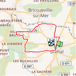
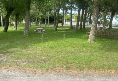
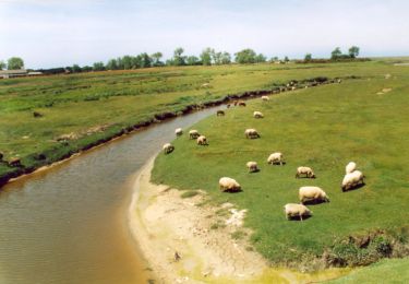
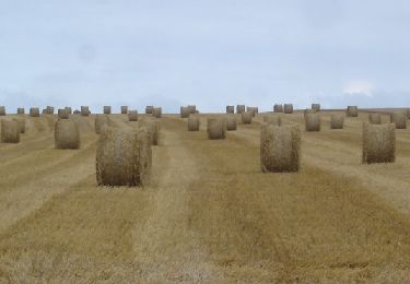
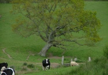
Ruta Senderismo de 5,8 km a descubrir en Normandía, Mancha, Bréhal. Esta ruta ha sido propuesta por tracegps.
Descripción
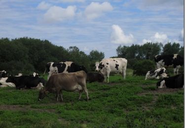
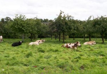
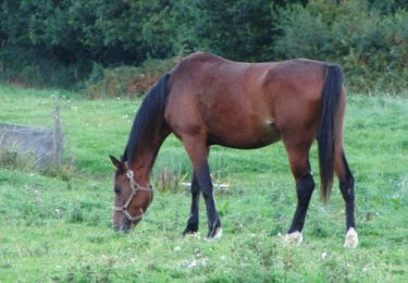
Jolie promenade, sans aucune difficulté, au travers du bocage normand départ de la halle centrale de Bréhal.
Localización
País:
France
Región :
Normandía
Departamento/provincia :
Mancha
Municipio :
Bréhal
Localidad:
Unknown
Salida:(Dec)
Salida:(UTM)
608996 ; 5417251 (30U) N.
Comentarios
Excursiones cerca
![Excursión Senderismo Bréville-sur-Mer - Balade à Breville sur Mer - Photo](https://media.geolcdn.com/t/375/260/ext.jpg?maxdim=2&url=https%3A%2F%2Fservices.sitytrail.com%2FGeolivesWS%2FDownloadMedia.ashx%3FTrailID%3D172624%26Media%3D13990_6.jpg)
![Senderismo Senderismo](https://static1.geolcdn.com/sitytour/trail-icons/101.png)
Balade à Breville sur Mer
Senderismo
Medio
Bréville-sur-Mer,
Normandía,
Mancha,
France
![](/images/other/stat-length.png)
14,2 km | 15,4 km-effort
3h 0min
![](https://static1.geolcdn.com/siteimages/upload/files/16400158638029165_repeat_loop_refresh_sync_direction_icon.png)
Sí
![Excursión Bici de montaña Bréhal - brehal 1 - Photo](https://media.geolcdn.com/t/375/260/ext.jpg?maxdim=2&url=https%3A%2F%2Fservices.sitytrail.com%2FGeolivesWS%2FDownloadMedia.ashx%3FTrailID%3D141198%26Media%3D20120725112747.jpg)
![Bici de montaña Bici de montaña](https://static1.geolcdn.com/sitytour/trail-icons/202.png)
brehal 1
Bici de montaña
Muy fácil
Bréhal,
Normandía,
Mancha,
France
![](/images/other/stat-length.png)
30 km | 35 km-effort
2h 45min
![](https://static1.geolcdn.com/siteimages/upload/files/16400158638029165_repeat_loop_refresh_sync_direction_icon.png)
Sí
![Excursión Paseo ecuestre Lingreville - Balade Sarah samedi - Photo](https://media.geolcdn.com/t/375/260/1ff22927-12ef-4acd-8c7d-2098b1cdad3c.jpg&format=jpg&maxdim=2)
![Paseo ecuestre Paseo ecuestre](https://static1.geolcdn.com/sitytour/trail-icons/301.png)
Balade Sarah samedi
Paseo ecuestre
Medio
Lingreville,
Normandía,
Mancha,
France
![](/images/other/stat-length.png)
19,7 km | 21 km-effort
45min
![](https://static1.geolcdn.com/siteimages/upload/files/16400158638029165_repeat_loop_refresh_sync_direction_icon.png)
Sí
![Excursión Senderismo Chanteloup - Le chant des Loups - Chanteloup - Photo](https://media.geolcdn.com/t/375/260/ext.jpg?maxdim=2&url=https%3A%2F%2Fservices.sitytrail.com%2FGeolivesWS%2FDownloadMedia.ashx%3FTrailID%3D111880%26Media%3D8727_2.jpg)
![Senderismo Senderismo](https://static1.geolcdn.com/sitytour/trail-icons/101.png)
Le chant des Loups - Chanteloup
Senderismo
Medio
Chanteloup,
Normandía,
Mancha,
France
![](/images/other/stat-length.png)
9 km | 10,4 km-effort
2h 0min
![](https://static1.geolcdn.com/siteimages/upload/files/16400158638029165_repeat_loop_refresh_sync_direction_icon.png)
Sí
![Excursión Senderismo Hudimesnil - Le Moulin du Pont - Hudimesnil - Photo](https://media.geolcdn.com/t/375/260/ext.jpg?maxdim=2&url=https%3A%2F%2Fservices.sitytrail.com%2FGeolivesWS%2FDownloadMedia.ashx%3FTrailID%3D111879%26Media%3D8726_1.jpg)
![Senderismo Senderismo](https://static1.geolcdn.com/sitytour/trail-icons/101.png)
Le Moulin du Pont - Hudimesnil
Senderismo
Medio
(1)
Hudimesnil,
Normandía,
Mancha,
France
![](/images/other/stat-length.png)
14,8 km | 17,3 km-effort
3h 30min
![](https://static1.geolcdn.com/siteimages/upload/files/16400158638029165_repeat_loop_refresh_sync_direction_icon.png)
Sí
![Excursión Senderismo Hudimesnil - La Chapelle Sainte Suzanne - Hudimesnil - Photo](https://media.geolcdn.com/t/375/260/ext.jpg?maxdim=2&url=https%3A%2F%2Fservices.sitytrail.com%2FGeolivesWS%2FDownloadMedia.ashx%3FTrailID%3D111877%26Media%3D8720_1.jpg)
![Senderismo Senderismo](https://static1.geolcdn.com/sitytour/trail-icons/101.png)
La Chapelle Sainte Suzanne - Hudimesnil
Senderismo
Medio
Hudimesnil,
Normandía,
Mancha,
France
![](/images/other/stat-length.png)
5,2 km | 6,2 km-effort
1h 4min
![](https://static1.geolcdn.com/siteimages/upload/files/16400158638029165_repeat_loop_refresh_sync_direction_icon.png)
Sí
![Excursión Senderismo Muneville-sur-Mer - Les Vallées - Muneville sur Mer - Photo](https://media.geolcdn.com/t/375/260/ext.jpg?maxdim=2&url=https%3A%2F%2Fservices.sitytrail.com%2FGeolivesWS%2FDownloadMedia.ashx%3FTrailID%3D111858%26Media%3D8634_1.jpg)
![Senderismo Senderismo](https://static1.geolcdn.com/sitytour/trail-icons/101.png)
Les Vallées - Muneville sur Mer
Senderismo
Medio
Muneville-sur-Mer,
Normandía,
Mancha,
France
![](/images/other/stat-length.png)
8,6 km | 9,8 km-effort
1h 45min
![](https://static1.geolcdn.com/siteimages/upload/files/16400158638029165_repeat_loop_refresh_sync_direction_icon.png)
Sí
![Excursión Senderismo Muneville-sur-Mer - Les Quatre Chemins - Muneville sur Mer - Photo](https://media.geolcdn.com/t/375/260/ext.jpg?maxdim=2&url=https%3A%2F%2Fservices.sitytrail.com%2FGeolivesWS%2FDownloadMedia.ashx%3FTrailID%3D111857%26Media%3D8633_1.jpg)
![Senderismo Senderismo](https://static1.geolcdn.com/sitytour/trail-icons/101.png)
Les Quatre Chemins - Muneville sur Mer
Senderismo
Fácil
Muneville-sur-Mer,
Normandía,
Mancha,
France
![](/images/other/stat-length.png)
5,5 km | 6,2 km-effort
1h 4min
![](https://static1.geolcdn.com/siteimages/upload/files/16400158638029165_repeat_loop_refresh_sync_direction_icon.png)
Sí
![Excursión Senderismo Bricqueville-sur-Mer - Le Havre de la Vanlée - Bricqueville sur Mer - Photo](https://media.geolcdn.com/t/375/260/ext.jpg?maxdim=2&url=https%3A%2F%2Fservices.sitytrail.com%2FGeolivesWS%2FDownloadMedia.ashx%3FTrailID%3D111856%26Media%3D8632_1.jpg)
![Senderismo Senderismo](https://static1.geolcdn.com/sitytour/trail-icons/101.png)
Le Havre de la Vanlée - Bricqueville sur Mer
Senderismo
Medio
Bricqueville-sur-Mer,
Normandía,
Mancha,
France
![](/images/other/stat-length.png)
10 km | 10,6 km-effort
2h 0min
![](https://static1.geolcdn.com/siteimages/upload/files/16400158638029165_repeat_loop_refresh_sync_direction_icon.png)
Sí