![](/images/other/stat-length.png)
![Excursión Senderismo Avon-les-Roches - Avon-les-Roches - Photo](https://media.geolcdn.com/t/1900/400/ext.pjpeg?maxdim=2&url=https%3A%2F%2Fservices.sitytrail.com%2FGeolivesWS%2FDownloadMedia.ashx%3FTrailID%3D111437%26Media%3D7266_3.jpg)
Avon-les-Roches
tracegps
Usuario
![Longitud](/images/other/stat-length.png)
![Altitud máxima](https://static1.geolcdn.com/siteimages/upload/files/1508320355ic_sort_altitude_max_24dp.png)
![Desnivel positivo](https://static1.geolcdn.com/siteimages/upload/files/1508320355ic_sort_den_pos_24dp.png)
![Km-Effort](/images/other/stat-length.png)
![Altitud mínima](https://static1.geolcdn.com/siteimages/upload/files/1508320355ic_sort_altitude_min_24dp.png)
![Desnivel negativo](https://static1.geolcdn.com/siteimages/upload/files/1508320355ic_sort_den_neg_24dp.png)
![Boucle](https://static1.geolcdn.com/siteimages/upload/files/16400158638029165_repeat_loop_refresh_sync_direction_icon.png)
![Senderismo](https://static1.geolcdn.com/sitytour/trail-icons/101.png)
3h19
Dificultad : Difícil
![Escanee este código QR para abrir la excursión en la aplicación SityTrail](https://capi.geolives.com/qq0zvz2zws4bq2lad0pu/sitytour/trails/111437/qr.png?size=200)
Aplicación GPS de excursión GRATIS
A propósito
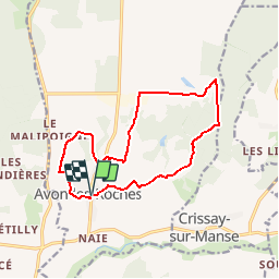
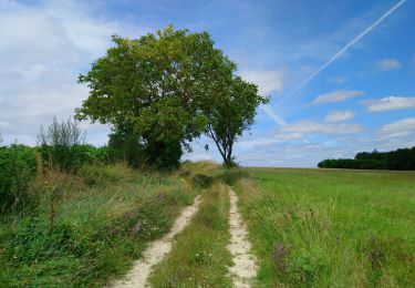
Ruta Senderismo de 13,4 km a descubrir en Centro, Indre y Loira, Avon-les-Roches. Esta ruta ha sido propuesta por tracegps.
Descripción
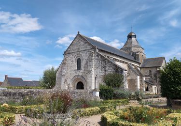
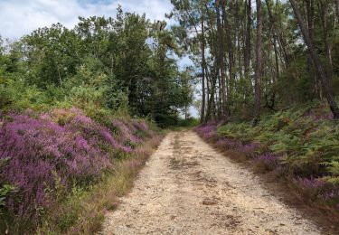
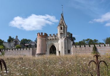
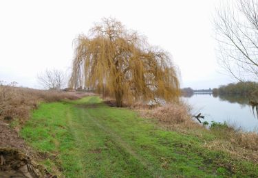
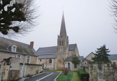
Circuit proposé par la Communauté de Communes du Bouchardais et le comité départemental d’Indre et Loire. Célèbre pour ses 11 lavoirs bordés de ruisseaux, ce village présente bien d’autres attraits à découvrir le long de ses sentiers. Départ place de la mairie d’Avon-les-Roches. Retrouvez le descriptif et la carte sur le site du comité départemental d’Indre et Loire. Ce circuit a été numérisé par les randonneurs du CODEPEM. Merci à Jean-Marie.
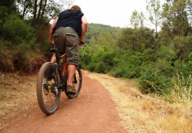
Localización
Comentarios
Excursiones cerca
![Excursión Bici de montaña Neuil - De Neuil à Avon les Roches - Photo](https://media.geolcdn.com/t/375/260/ext.jpg?maxdim=2&url=https%3A%2F%2Fservices.sitytrail.com%2FGeolivesWS%2FDownloadMedia.ashx%3FTrailID%3D101407%26Media%3D1368_1.jpg)
![Bici de montaña Bici de montaña](https://static1.geolcdn.com/sitytour/trail-icons/202.png)
Bici de montaña
![](/images/other/stat-length.png)
![](https://static1.geolcdn.com/siteimages/upload/files/16400158638029165_repeat_loop_refresh_sync_direction_icon.png)
![Excursión Senderismo Tavant - Tavant - Sazilly PM - 11.6km 105m 2h25 - 2024 08 07 - Photo](https://media.geolcdn.com/t/375/260/abc5bc1f-e7e4-4fe4-9ad9-f3c8d4bd0cfd.jpg&format=jpg&maxdim=2)
![Senderismo Senderismo](https://static1.geolcdn.com/sitytour/trail-icons/101.png)
Senderismo
![](/images/other/stat-length.png)
![](https://static1.geolcdn.com/siteimages/upload/files/16400158638029165_repeat_loop_refresh_sync_direction_icon.png)
![Excursión Senderismo Panzoult - Panzoult - Zig zag Bois de Juche-Pie - 14.8km 270m 3h15 (50mn) - 2024 07 31 - Photo](https://media.geolcdn.com/t/375/260/677c1551-8a40-4fb1-a141-bc0abd35b1fa.jpg&format=jpg&maxdim=2)
![Senderismo Senderismo](https://static1.geolcdn.com/sitytour/trail-icons/101.png)
Senderismo
![](/images/other/stat-length.png)
![](https://static1.geolcdn.com/siteimages/upload/files/16400158638029165_repeat_loop_refresh_sync_direction_icon.png)
![Excursión Senderismo L'Île-Bouchard - l'île-Bouchard - Brizay Theneuil Parçay-sur-Vienne - 24km 300m 5h10 (1h05) - 2024 07 24 - Photo](https://media.geolcdn.com/t/375/260/58cfa1f3-c850-4e1f-95d7-8dc1096183f9.jpg&format=jpg&maxdim=2)
![Senderismo Senderismo](https://static1.geolcdn.com/sitytour/trail-icons/101.png)
Senderismo
![](/images/other/stat-length.png)
![](https://static1.geolcdn.com/siteimages/upload/files/16400158638029165_repeat_loop_refresh_sync_direction_icon.png)
![Excursión Senderismo Crouzilles - Crouzilles - St-Gilles GR48 Mougon Trogues Beauvais - 22km 175m 4h45 - 2022 01 22 - Photo](https://media.geolcdn.com/t/375/260/24b1ce6d-1612-4107-9a27-8859bd4a3123.jpg&format=jpg&maxdim=2)
![Senderismo Senderismo](https://static1.geolcdn.com/sitytour/trail-icons/101.png)
Senderismo
![](/images/other/stat-length.png)
![](https://static1.geolcdn.com/siteimages/upload/files/16400158638029165_repeat_loop_refresh_sync_direction_icon.png)
![Excursión Senderismo Panzoult - Panzoult - GR48 PR Avon-les-Roches St-Gilles - 21.5km 265m 4h30 - 2022 01 15 - Photo](https://media.geolcdn.com/t/375/260/95b9f3f6-7463-4c37-9033-2074d373505a.jpg&format=jpg&maxdim=2)
![Senderismo Senderismo](https://static1.geolcdn.com/sitytour/trail-icons/101.png)
Senderismo
![](/images/other/stat-length.png)
![](https://static1.geolcdn.com/siteimages/upload/files/16400158638029165_repeat_loop_refresh_sync_direction_icon.png)
![Excursión Senderismo Crissay-sur-Manse - Crissay-sur-Manse - Neuil Avon-les-Roches - 24.9km 370m 5h20 (30mn) - 2021 07 11 - Photo](https://media.geolcdn.com/t/375/260/683e7d2b-8630-4bdc-a689-c6aa57c47030.jpg&format=jpg&maxdim=2)
![Senderismo Senderismo](https://static1.geolcdn.com/sitytour/trail-icons/101.png)
Senderismo
![](/images/other/stat-length.png)
![](https://static1.geolcdn.com/siteimages/upload/files/16400158638029165_repeat_loop_refresh_sync_direction_icon.png)
![Excursión Senderismo Neuil - Neuil - Circuit 2 - 12.6km 120m 2h20 - 2019 08 16 - Photo](https://media.geolcdn.com/t/375/260/124a2bd0-41da-449e-aa3b-94b5534d5b66.jpg&format=jpg&maxdim=2)
![Senderismo Senderismo](https://static1.geolcdn.com/sitytour/trail-icons/101.png)
Senderismo
![](/images/other/stat-length.png)
![](https://static1.geolcdn.com/siteimages/upload/files/16400158638029165_repeat_loop_refresh_sync_direction_icon.png)
![Excursión Senderismo Avon-les-Roches - Avon-les-Roches - Au pays des lavoirs - circuit court - 10.9km 130m 2h35 - 2019 06 01 - Photo](https://media.geolcdn.com/t/375/260/6c34328e-f641-4856-bd13-212bbd01020b.jpg&format=jpg&maxdim=2)
![Senderismo Senderismo](https://static1.geolcdn.com/sitytour/trail-icons/101.png)
Senderismo
![](/images/other/stat-length.png)
![](https://static1.geolcdn.com/siteimages/upload/files/16400158638029165_repeat_loop_refresh_sync_direction_icon.png)