![](/images/other/stat-length.png)
![Excursión Senderismo Tessy-Bocage - Circuit de Fervaches - C10 III - Photo](https://media.geolcdn.com/t/1900/400/ext.pjpeg?maxdim=2&url=https%3A%2F%2Fservices.sitytrail.com%2FGeolivesWS%2FDownloadMedia.ashx%3FTrailID%3D111260%26Media%3D6863_2.jpg)
Circuit de Fervaches - C10 III
tracegps
Usuario
![Longitud](/images/other/stat-length.png)
Longitud
1,8 km
![Altitud máxima](https://static1.geolcdn.com/siteimages/upload/files/1508320355ic_sort_altitude_max_24dp.png)
Altitud máxima
100 m
![Desnivel positivo](https://static1.geolcdn.com/siteimages/upload/files/1508320355ic_sort_den_pos_24dp.png)
Desnivel positivo
15 m
![Km-Effort](/images/other/stat-length.png)
Km-Effort
2,1 km
![Altitud mínima](https://static1.geolcdn.com/siteimages/upload/files/1508320355ic_sort_altitude_min_24dp.png)
Altitud mínima
85 m
![Desnivel negativo](https://static1.geolcdn.com/siteimages/upload/files/1508320355ic_sort_den_neg_24dp.png)
Desnivel negativo
16 m
![Boucle](https://static1.geolcdn.com/siteimages/upload/files/16400158638029165_repeat_loop_refresh_sync_direction_icon.png)
Boucle
Sí
Fecha de creación :
2014-12-10 00:00:00.0
Última modificación :
2014-12-10 00:00:00.0
![Senderismo](https://static1.geolcdn.com/sitytour/trail-icons/101.png)
30m
Dificultad : Fácil
![Escanee este código QR para abrir la excursión en la aplicación SityTrail](https://capi.geolives.com/qq0zvz2zws4bq2lad0pu/sitytour/trails/111260/qr.png?size=200)
Aplicación GPS de excursión GRATIS
A propósito
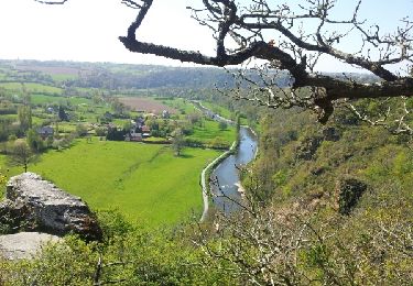
Ruta Senderismo de 1,8 km a descubrir en Normandía, Mancha, Tessy-Bocage. Esta ruta ha sido propuesta por tracegps.
Descripción
Circuit proposé par la Communauté de Communes de Tessy sur Vire. Départ de l’église de Fervaches. Retrouvez le descriptif et les commentaires du circuit sur le site de la Communauté de Communes de Tessy sur Vire.
Localización
País:
France
Región :
Normandía
Departamento/provincia :
Mancha
Municipio :
Tessy-Bocage
Localidad:
Fervaches
Salida:(Dec)
Salida:(UTM)
640068 ; 5428676 (30U) N.
Comentarios
Excursiones cerca
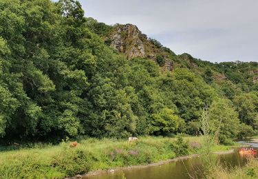
![Excursión Senderismo Condé-sur-Vire - Le rocher de Ham - Photo](https://media.geolcdn.com/t/375/260/8542ca5d-28d3-484e-89d2-e8c026fb9d47.jpg&format=jpg&maxdim=2)
![Senderismo Senderismo](https://static1.geolcdn.com/sitytour/trail-icons/101.png)
Le rocher de Ham
Senderismo
Fácil
(1)
Condé-sur-Vire,
Normandía,
Mancha,
France
![](/images/other/stat-length.png)
10,9 km | 13,4 km-effort
2h 24min
![](https://static1.geolcdn.com/siteimages/upload/files/16400158638029165_repeat_loop_refresh_sync_direction_icon.png)
Sí
![Excursión Senderismo Condé-sur-Vire - Roches de ham - Photo](https://media.geolcdn.com/t/375/260/ext.jpg?maxdim=2&url=https%3A%2F%2Fservices.sitytrail.com%2FGeolivesWS%2FDownloadMedia.ashx%3FTrailID%3D267550%26Media%3Dfix__20140417152802.jpg)
![Senderismo Senderismo](https://static1.geolcdn.com/sitytour/trail-icons/101.png)
Roches de ham
Senderismo
Fácil
(1)
Condé-sur-Vire,
Normandía,
Mancha,
France
![](/images/other/stat-length.png)
11,1 km | 13,5 km-effort
2h 58min
![](https://static1.geolcdn.com/siteimages/upload/files/16400158638029165_repeat_loop_refresh_sync_direction_icon.png)
Sí
![Excursión Bici de montaña Domjean - Au coeur de la vallée de la Vire - Photo](https://media.geolcdn.com/t/375/260/ext.jpg?maxdim=2&url=https%3A%2F%2Fservices.sitytrail.com%2FGeolivesWS%2FDownloadMedia.ashx%3FTrailID%3D109294%26Media%3D3496_1.jpg)
![Bici de montaña Bici de montaña](https://static1.geolcdn.com/sitytour/trail-icons/202.png)
Au coeur de la vallée de la Vire
Bici de montaña
Difícil
(2)
Domjean,
Normandía,
Mancha,
France
![](/images/other/stat-length.png)
32 km | 39 km-effort
4h 0min
![](https://static1.geolcdn.com/siteimages/upload/files/16400158638029165_repeat_loop_refresh_sync_direction_icon.png)
Sí
![Excursión Senderismo Domjean - Rando gorge de la Vire - Photo](https://media.geolcdn.com/t/375/260/078dd238-3b4c-4f3c-9933-8f29f8ae0807.jpg&format=jpg&maxdim=2)
![Senderismo Senderismo](https://static1.geolcdn.com/sitytour/trail-icons/101.png)
Rando gorge de la Vire
Senderismo
Fácil
Domjean,
Normandía,
Mancha,
France
![](/images/other/stat-length.png)
35 km | 42 km-effort
10h 25min
![](https://static1.geolcdn.com/siteimages/upload/files/16400158638029165_repeat_loop_refresh_sync_direction_icon.png)
Sí
![Excursión Senderismo Tessy-Bocage - Tessy-sur-Vire - C 13-V - Photo](https://media.geolcdn.com/t/375/260/ext.jpg?maxdim=2&url=https%3A%2F%2Fservices.sitytrail.com%2FGeolivesWS%2FDownloadMedia.ashx%3FTrailID%3D111302%26Media%3D6947_5.jpg)
![Senderismo Senderismo](https://static1.geolcdn.com/sitytour/trail-icons/101.png)
Tessy-sur-Vire - C 13-V
Senderismo
Fácil
Tessy-Bocage,
Normandía,
Mancha,
France
![](/images/other/stat-length.png)
3,4 km | 4,1 km-effort
1h 0min
![](https://static1.geolcdn.com/siteimages/upload/files/16400158638029165_repeat_loop_refresh_sync_direction_icon.png)
Sí
![Excursión Bici de montaña Tessy-Bocage - Tessy-sur-Vire - C 13-II - Photo](https://media.geolcdn.com/t/375/260/ext.jpg?maxdim=2&url=https%3A%2F%2Fservices.sitytrail.com%2FGeolivesWS%2FDownloadMedia.ashx%3FTrailID%3D111296%26Media%3D6939_4.jpg)
![Bici de montaña Bici de montaña](https://static1.geolcdn.com/sitytour/trail-icons/202.png)
Tessy-sur-Vire - C 13-II
Bici de montaña
Fácil
Tessy-Bocage,
Normandía,
Mancha,
France
![](/images/other/stat-length.png)
8,8 km | 10,5 km-effort
1h 0min
![](https://static1.geolcdn.com/siteimages/upload/files/16400158638029165_repeat_loop_refresh_sync_direction_icon.png)
Sí
![Excursión Senderismo Tessy-Bocage - Tessy-sur-Vire - C 13-II - Photo](https://media.geolcdn.com/t/375/260/ext.jpg?maxdim=2&url=https%3A%2F%2Fservices.sitytrail.com%2FGeolivesWS%2FDownloadMedia.ashx%3FTrailID%3D111295%26Media%3D6939_4.jpg)
![Senderismo Senderismo](https://static1.geolcdn.com/sitytour/trail-icons/101.png)
Tessy-sur-Vire - C 13-II
Senderismo
Medio
Tessy-Bocage,
Normandía,
Mancha,
France
![](/images/other/stat-length.png)
8,8 km | 10,5 km-effort
2h 15min
![](https://static1.geolcdn.com/siteimages/upload/files/16400158638029165_repeat_loop_refresh_sync_direction_icon.png)
Sí
![Excursión Senderismo Tessy-Bocage - Tessy-sur-Vire - C 13-I - Photo](https://media.geolcdn.com/t/375/260/ext.jpg?maxdim=2&url=https%3A%2F%2Fservices.sitytrail.com%2FGeolivesWS%2FDownloadMedia.ashx%3FTrailID%3D111294%26Media%3D6938_3.jpg)
![Senderismo Senderismo](https://static1.geolcdn.com/sitytour/trail-icons/101.png)
Tessy-sur-Vire - C 13-I
Senderismo
Fácil
Tessy-Bocage,
Normandía,
Mancha,
France
![](/images/other/stat-length.png)
3,6 km | 4,7 km-effort
1h 0min
![](https://static1.geolcdn.com/siteimages/upload/files/16400158638029165_repeat_loop_refresh_sync_direction_icon.png)
Sí
![Excursión Bici de montaña Moyon-Villages - Le Mesnil-Opac C12-II - Photo](https://media.geolcdn.com/t/375/260/ext.jpg?maxdim=2&url=https%3A%2F%2Fservices.sitytrail.com%2FGeolivesWS%2FDownloadMedia.ashx%3FTrailID%3D111292%26Media%3D6934_3.jpg)
![Bici de montaña Bici de montaña](https://static1.geolcdn.com/sitytour/trail-icons/202.png)
Le Mesnil-Opac C12-II
Bici de montaña
Fácil
Moyon-Villages,
Normandía,
Mancha,
France
![](/images/other/stat-length.png)
7,2 km | 8,4 km-effort
45min
![](https://static1.geolcdn.com/siteimages/upload/files/16400158638029165_repeat_loop_refresh_sync_direction_icon.png)
Sí