![](/images/other/stat-length.png)
![Excursión Senderismo Clermont-Soubiran - Clermont-Soubiran, aux portes du Tarn-et-Garonne - Pays de l'Agenais - Photo](https://media.geolcdn.com/t/1900/400/ext.pjpeg?maxdim=2&url=https%3A%2F%2Fservices.sitytrail.com%2FGeolivesWS%2FDownloadMedia.ashx%3FTrailID%3D110593%26Media%3D6133_1.jpg)
Clermont-Soubiran, aux portes du Tarn-et-Garonne - Pays de l'Agenais
tracegps
Usuario
![Longitud](/images/other/stat-length.png)
![Altitud máxima](https://static1.geolcdn.com/siteimages/upload/files/1508320355ic_sort_altitude_max_24dp.png)
![Desnivel positivo](https://static1.geolcdn.com/siteimages/upload/files/1508320355ic_sort_den_pos_24dp.png)
![Km-Effort](/images/other/stat-length.png)
![Altitud mínima](https://static1.geolcdn.com/siteimages/upload/files/1508320355ic_sort_altitude_min_24dp.png)
![Desnivel negativo](https://static1.geolcdn.com/siteimages/upload/files/1508320355ic_sort_den_neg_24dp.png)
![Boucle](https://static1.geolcdn.com/siteimages/upload/files/16400158638029165_repeat_loop_refresh_sync_direction_icon.png)
![Senderismo](https://static1.geolcdn.com/sitytour/trail-icons/101.png)
2h30
Dificultad : Medio
![Escanee este código QR para abrir la excursión en la aplicación SityTrail](https://capi.geolives.com/qq0zvz2zws4bq2lad0pu/sitytour/trails/110593/qr.png?size=200)
Aplicación GPS de excursión GRATIS
A propósito
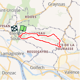
Ruta Senderismo de 9,2 km a descubrir en Nueva Aquitania, Lot y Garona, Clermont-Soubiran. Esta ruta ha sido propuesta por tracegps.
Descripción
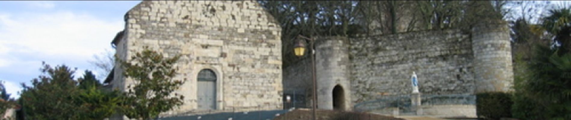
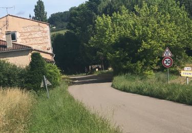
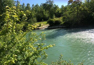
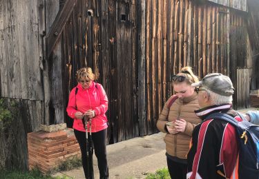
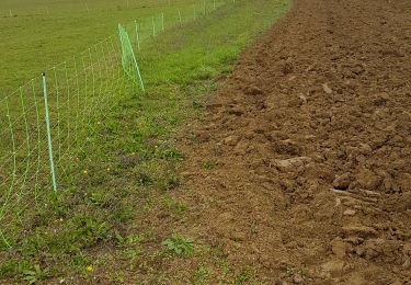
Clermont Soubiran Cté de Communes des Deux Séounes. A l’aller, le circuit utilise des routes et des chemins panoramiques dominant la vallée de la Garonne. Le retour s’effectue sur l’ancienne voie romaine tracée au pied du coteau, hors d’eau des crues du fleuve. Téléchargez la fiche de cette randonnée sur le site du Tourisme du Lot et Garonne.
Localización
Comentarios
Excursiones cerca
![Excursión sport Valence - 08/07/2024 - Photo](https://media.geolcdn.com/t/375/260/02acc9ee-7c4c-41fe-bef4-167218db40e8.jpg&format=jpg&maxdim=2)
sport
![](/images/other/stat-length.png)
![](https://static1.geolcdn.com/siteimages/upload/files/16400158638029165_repeat_loop_refresh_sync_direction_icon.png)
![Excursión sport Valence - 05/07/2024 - Photo](https://media.geolcdn.com/t/375/260/84bb87fd-d366-464e-b431-244375a9f25d.jpg&format=jpg&maxdim=2)
sport
![](/images/other/stat-length.png)
![](https://static1.geolcdn.com/siteimages/upload/files/16400158638029165_repeat_loop_refresh_sync_direction_icon.png)
![Excursión sport Valence - Ballade 29/06/24 - Photo](https://media.geolcdn.com/t/375/260/74cd2fc9-f021-476e-b08b-146858c09e5c.jpg&format=jpg&maxdim=2)
sport
![](/images/other/stat-length.png)
![](https://static1.geolcdn.com/siteimages/upload/files/16400158638029165_repeat_loop_refresh_sync_direction_icon.png)
![Excursión sport Valence - Lundi 22avril 2024 - Photo](https://media.geolcdn.com/t/375/260/aa7242f5-a0f4-4f88-9610-5938dbe858ee.jpg&format=jpg&maxdim=2)
sport
![](/images/other/stat-length.png)
![](https://static1.geolcdn.com/siteimages/upload/files/16400158638029165_repeat_loop_refresh_sync_direction_icon.png)
![Excursión sport Valence - Les marcheurs du Pontus 18 avril 2024 - Photo](https://media.geolcdn.com/t/375/260/462dfb00-e608-49e4-92cf-bae19c6c9ef9.jpg&format=jpg&maxdim=2)
sport
![](/images/other/stat-length.png)
![](https://static1.geolcdn.com/siteimages/upload/files/16400158638029165_repeat_loop_refresh_sync_direction_icon.png)
![Excursión Senderismo Clermont-Soubiran - Coteaux depuis maison Roiatti - Photo](https://media.geolcdn.com/t/375/260/00d8c168-eeb7-45cf-a950-8b81643238bd.jpg&format=jpg&maxdim=2)
![Senderismo Senderismo](https://static1.geolcdn.com/sitytour/trail-icons/101.png)
Senderismo
![](/images/other/stat-length.png)
![](https://static1.geolcdn.com/siteimages/upload/files/16400158638029165_repeat_loop_refresh_sync_direction_icon.png)
![Excursión Senderismo Clermont-Soubiran - coupet autour de labro - Photo](https://media.geolcdn.com/t/375/260/ext.jpg?maxdim=2&url=https%3A%2F%2Fstatic1.geolcdn.com%2Fsiteimages%2Fupload%2Ffiles%2F1553511878bg_sport_marche.png)
![Senderismo Senderismo](https://static1.geolcdn.com/sitytour/trail-icons/101.png)
Senderismo
![](/images/other/stat-length.png)
![](https://static1.geolcdn.com/siteimages/upload/files/16400158638029165_repeat_loop_refresh_sync_direction_icon.png)
![Excursión Bici de montaña Donzac - Les sentiers du Brulhois - Donzac - Photo](https://media.geolcdn.com/t/375/260/ext.jpg?maxdim=2&url=https%3A%2F%2Fservices.sitytrail.com%2FGeolivesWS%2FDownloadMedia.ashx%3FTrailID%3D106609%26Media%3D11209_1.jpg)
![Bici de montaña Bici de montaña](https://static1.geolcdn.com/sitytour/trail-icons/202.png)
Bici de montaña
![](/images/other/stat-length.png)
![](https://static1.geolcdn.com/siteimages/upload/files/16400158638029165_repeat_loop_refresh_sync_direction_icon.png)
![Excursión Bici de montaña Saint-Romain-le-Noble - St Romain le Noble / St Pierre de Clairac / Puymirol - Photo](https://media.geolcdn.com/t/375/260/ext.jpg?maxdim=2&url=https%3A%2F%2Fservices.sitytrail.com%2FGeolivesWS%2FDownloadMedia.ashx%3FTrailID%3D101505%26Media%3D1611_4.jpg)
![Bici de montaña Bici de montaña](https://static1.geolcdn.com/sitytour/trail-icons/202.png)
Bici de montaña
![](/images/other/stat-length.png)
![](https://static1.geolcdn.com/siteimages/upload/files/16400158638029165_repeat_loop_refresh_sync_direction_icon.png)