![](/images/other/stat-length.png)
![Excursión Senderismo La Chapelle-Gauthier - La Mare Péreuse - La Chapelle-Gauthier - Photo](https://media.geolcdn.com/t/1900/400/ext.pjpeg?maxdim=2&url=https%3A%2F%2Fservices.sitytrail.com%2FGeolivesWS%2FDownloadMedia.ashx%3FTrailID%3D110446%26Media%3D5936_3.jpg)
La Mare Péreuse - La Chapelle-Gauthier
tracegps
Usuario
![Longitud](/images/other/stat-length.png)
Longitud
10,3 km
![Altitud máxima](https://static1.geolcdn.com/siteimages/upload/files/1508320355ic_sort_altitude_max_24dp.png)
Altitud máxima
201 m
![Desnivel positivo](https://static1.geolcdn.com/siteimages/upload/files/1508320355ic_sort_den_pos_24dp.png)
Desnivel positivo
121 m
![Km-Effort](/images/other/stat-length.png)
Km-Effort
11,9 km
![Altitud mínima](https://static1.geolcdn.com/siteimages/upload/files/1508320355ic_sort_altitude_min_24dp.png)
Altitud mínima
134 m
![Desnivel negativo](https://static1.geolcdn.com/siteimages/upload/files/1508320355ic_sort_den_neg_24dp.png)
Desnivel negativo
121 m
![Boucle](https://static1.geolcdn.com/siteimages/upload/files/16400158638029165_repeat_loop_refresh_sync_direction_icon.png)
Boucle
Sí
Fecha de creación :
2014-12-10 00:00:00.0
Última modificación :
2014-12-10 00:00:00.0
![Senderismo](https://static1.geolcdn.com/sitytour/trail-icons/101.png)
2h45
Dificultad : Medio
![Escanee este código QR para abrir la excursión en la aplicación SityTrail](https://capi.geolives.com/qq0zvz2zws4bq2lad0pu/sitytour/trails/110446/qr.png?size=200)
Aplicación GPS de excursión GRATIS
A propósito
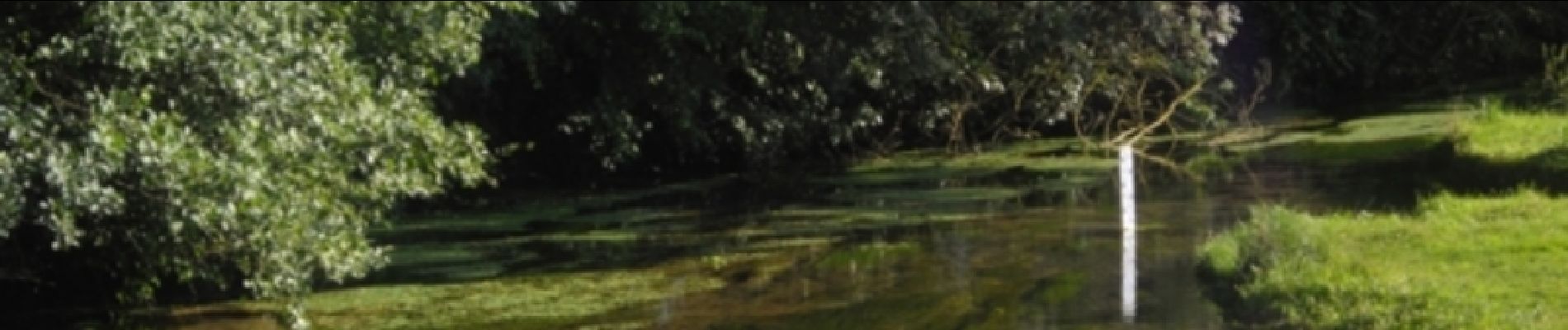
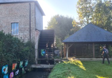
Ruta Senderismo de 10,3 km a descubrir en Normandía, Eure, La Chapelle-Gauthier. Esta ruta ha sido propuesta por tracegps.
Descripción
Circuit proposé par la Communauté de Communes du canton de Broglie. Départ de la mairie de La Chapelle-Gauthier. Ce circuit a été numérisé par les randonneurs du CODEPEM. Merci à Jean-Marie.
Localización
País:
France
Región :
Normandía
Departamento/provincia :
Eure
Municipio :
La Chapelle-Gauthier
Localidad:
Unknown
Salida:(Dec)
Salida:(UTM)
314305 ; 5429075 (31U) N.
Comentarios
Excursiones cerca
![Excursión Senderismo Saint-Aubin-du-Thenney - boucle de St Aubin - Photo](https://media.geolcdn.com/t/375/260/22b229be-1ffc-465d-84c7-a658d5646130.jpg&format=jpg&maxdim=2)
![Senderismo Senderismo](https://static1.geolcdn.com/sitytour/trail-icons/101.png)
boucle de St Aubin
Senderismo
Fácil
Saint-Aubin-du-Thenney,
Normandía,
Eure,
France
![](/images/other/stat-length.png)
5,2 km | 5,7 km-effort
1h 1min
![](https://static1.geolcdn.com/siteimages/upload/files/16400158638029165_repeat_loop_refresh_sync_direction_icon.png)
Sí
![Excursión Senderismo La Trinité-de-Réville - la trinite de Reville - Photo](https://media.geolcdn.com/t/375/260/3d651fcd-4702-45e6-b71c-7213c89a3859.jpg&format=jpg&maxdim=2)
![Senderismo Senderismo](https://static1.geolcdn.com/sitytour/trail-icons/101.png)
la trinite de Reville
Senderismo
Medio
La Trinité-de-Réville,
Normandía,
Eure,
France
![](/images/other/stat-length.png)
9,8 km | 12 km-effort
2h 3min
![](https://static1.geolcdn.com/siteimages/upload/files/16400158638029165_repeat_loop_refresh_sync_direction_icon.png)
Sí
![Excursión Senderismo Broglie - autour de Broglie - Photo](https://media.geolcdn.com/t/375/260/3e3d641f-d5df-4246-a92b-99488b8494dd.jpg&format=jpg&maxdim=2)
![Senderismo Senderismo](https://static1.geolcdn.com/sitytour/trail-icons/101.png)
autour de Broglie
Senderismo
Muy fácil
Broglie,
Normandía,
Eure,
France
![](/images/other/stat-length.png)
8,6 km | 9,6 km-effort
1h 45min
![](https://static1.geolcdn.com/siteimages/upload/files/16400158638029165_repeat_loop_refresh_sync_direction_icon.png)
Sí
![Excursión Senderismo Saint-Aubin-du-Thenney - Saint aubin du thenney - Photo](https://media.geolcdn.com/t/375/260/8db32888-bcba-44a5-8d8d-55dd23dd48be.jpg&format=jpg&maxdim=2)
![Senderismo Senderismo](https://static1.geolcdn.com/sitytour/trail-icons/101.png)
Saint aubin du thenney
Senderismo
Muy fácil
Saint-Aubin-du-Thenney,
Normandía,
Eure,
France
![](/images/other/stat-length.png)
7,8 km | 8,6 km-effort
1h 42min
![](https://static1.geolcdn.com/siteimages/upload/files/16400158638029165_repeat_loop_refresh_sync_direction_icon.png)
Sí
![Excursión Senderismo La Vespière-Friardel - La Vespiere - Photo](https://media.geolcdn.com/t/375/260/da48bb98-df54-46a8-9e2f-aee2a972f759.jpg&format=jpg&maxdim=2)
![Senderismo Senderismo](https://static1.geolcdn.com/sitytour/trail-icons/101.png)
La Vespiere
Senderismo
Medio
La Vespière-Friardel,
Normandía,
Calvados,
France
![](/images/other/stat-length.png)
22 km | 27 km-effort
4h 22min
![](https://static1.geolcdn.com/siteimages/upload/files/16400158638029165_repeat_loop_refresh_sync_direction_icon.png)
Sí
![Excursión Senderismo La Goulafrière - Circuit de la Grande Vallée - La Goulafrière - Photo](https://media.geolcdn.com/t/375/260/ext.jpg?maxdim=2&url=https%3A%2F%2Fservices.sitytrail.com%2FGeolivesWS%2FDownloadMedia.ashx%3FTrailID%3D110461%26Media%3D5968_1.jpg)
![Senderismo Senderismo](https://static1.geolcdn.com/sitytour/trail-icons/101.png)
Circuit de la Grande Vallée - La Goulafrière
Senderismo
Medio
La Goulafrière,
Normandía,
Eure,
France
![](/images/other/stat-length.png)
11,2 km | 13,1 km-effort
2h 45min
![](https://static1.geolcdn.com/siteimages/upload/files/16400158638029165_repeat_loop_refresh_sync_direction_icon.png)
Sí
![Excursión Senderismo Saint-Agnan-de-Cernières - Boucle des Cernières - Saint-Agnan de Cernières - Photo](https://media.geolcdn.com/t/375/260/ext.jpg?maxdim=2&url=https%3A%2F%2Fservices.sitytrail.com%2FGeolivesWS%2FDownloadMedia.ashx%3FTrailID%3D110442%26Media%3D5925_1.jpg)
![Senderismo Senderismo](https://static1.geolcdn.com/sitytour/trail-icons/101.png)
Boucle des Cernières - Saint-Agnan de Cernières
Senderismo
Fácil
Saint-Agnan-de-Cernières,
Normandía,
Eure,
France
![](/images/other/stat-length.png)
14,3 km | 15,8 km-effort
1h 0min
![](https://static1.geolcdn.com/siteimages/upload/files/16400158638029165_repeat_loop_refresh_sync_direction_icon.png)
Sí
![Excursión Senderismo La Folletière-Abenon - Source de l'Orbiquet avec Cressonnière - Photo](https://media.geolcdn.com/t/375/260/ext.jpg?maxdim=2&url=https%3A%2F%2Fstatic1.geolcdn.com%2Fsiteimages%2Fupload%2Ffiles%2F1553511878bg_sport_marche.png)
![Senderismo Senderismo](https://static1.geolcdn.com/sitytour/trail-icons/101.png)
Source de l'Orbiquet avec Cressonnière
Senderismo
Fácil
La Folletière-Abenon,
Normandía,
Calvados,
France
![](/images/other/stat-length.png)
14,1 km | 17,5 km-effort
3h 58min
![](https://static1.geolcdn.com/siteimages/upload/files/16400158638029165_repeat_loop_refresh_sync_direction_icon.png)
Sí
![Excursión Marcha nórdica Orbec - ORBIQUET - Photo](https://media.geolcdn.com/t/375/260/7f04b9d6-25e6-4f48-81f6-b0bbe0e5856c.jpg&format=jpg&maxdim=2)
![Marcha nórdica Marcha nórdica](https://static1.geolcdn.com/sitytour/trail-icons/102.png)
ORBIQUET
Marcha nórdica
Muy fácil
Orbec,
Normandía,
Calvados,
France
![](/images/other/stat-length.png)
10,5 km | 12,8 km-effort
2h 14min
![](https://static1.geolcdn.com/siteimages/upload/files/16400158638029165_repeat_loop_refresh_sync_direction_icon.png)
Sí