![](/images/other/stat-length.png)
![Excursión Bicicleta Pontarlier - La Côte aux Fées - Les Verrières - Doubs - Photo](https://media.geolcdn.com/t/1900/400/ext.pjpeg?maxdim=2&url=https%3A%2F%2Fservices.sitytrail.com%2FGeolivesWS%2FDownloadMedia.ashx%3FTrailID%3D109438%26Media%3D3790_1.jpg)
La Côte aux Fées - Les Verrières - Doubs
tracegps
Usuario
![Longitud](/images/other/stat-length.png)
![Altitud máxima](https://static1.geolcdn.com/siteimages/upload/files/1508320355ic_sort_altitude_max_24dp.png)
![Desnivel positivo](https://static1.geolcdn.com/siteimages/upload/files/1508320355ic_sort_den_pos_24dp.png)
![Km-Effort](/images/other/stat-length.png)
![Altitud mínima](https://static1.geolcdn.com/siteimages/upload/files/1508320355ic_sort_altitude_min_24dp.png)
![Desnivel negativo](https://static1.geolcdn.com/siteimages/upload/files/1508320355ic_sort_den_neg_24dp.png)
![Boucle](https://static1.geolcdn.com/siteimages/upload/files/16400158638029165_repeat_loop_refresh_sync_direction_icon.png)
![Bicicleta](https://static1.geolcdn.com/sitytour/trail-icons/200.png)
3h00
Dificultad : Difícil
![Escanee este código QR para abrir la excursión en la aplicación SityTrail](https://capi.geolives.com/qq0zvz2zws4bq2lad0pu/sitytour/trails/109438/qr.png?size=200)
Aplicación GPS de excursión GRATIS
A propósito
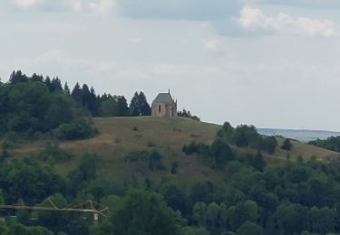
Ruta Bicicleta de 57 km a descubrir en Borgoña-Franco Condado, Doubs, Pontarlier. Esta ruta ha sido propuesta por tracegps.
Descripción
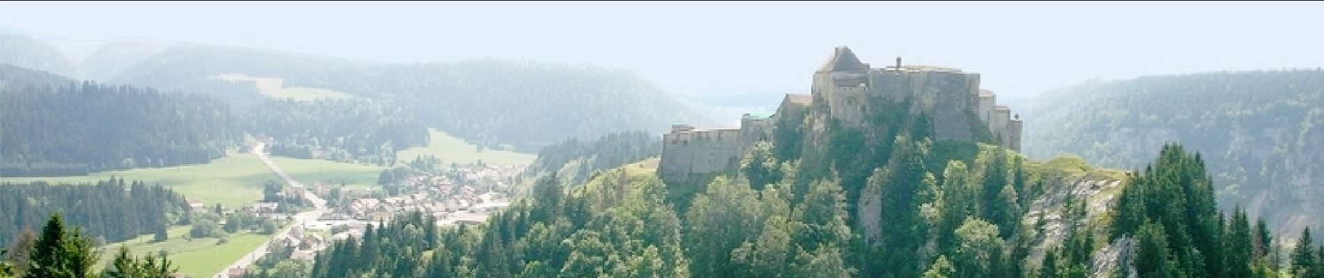
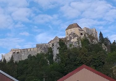
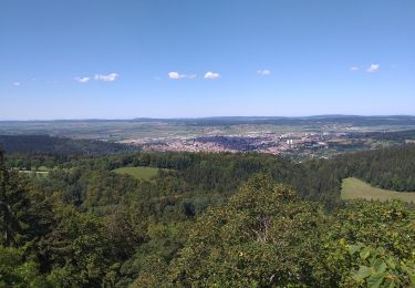
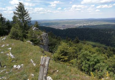
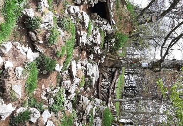
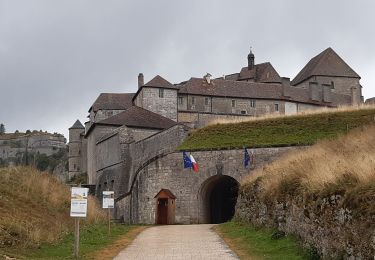
Le Doubs, réserve naturelle d’idées neuves ! La Côte aux Fées - Les Verrières Office de tourisme à Pontarlier (03 81 46 48 33) - Musée municipal (03 81 38 82 14) - Eglise Saint-Bénigne - Porte Saint-Pierre - Distilleries Pierre Guy (03 81 39 04 70) et Les Fils d’Emile Pernot (03 81 39 04 28) : fabrication artisanale d’absinthe, apéritifs anisés, liqueurs et eaux de vie… A proximité Montagne du Larmont, Grand taureau (1323 m), Château de Joux (03 81 69 47 95) à la Cluse et Mijoux, témoignage de l’évolution de l’architecture fortifiée (du XIe au XIXe), « tombeau » du général haïtien Toussaint Louverture (héros de la lutte pour l’abolition de l’esclavage), très complet musée d’armes anciennes… Ferme des Produits régionaux (03 81 69 55 00) à la Cluse et Mijoux, salaisons et fumaisons du Haut-Doubs Syndicat d’initiative aux Fourgs (03 81 69 44 91) A proximité Belvédère de la Roche sarrazine aux Fourgs Entrée en Suisse Musée des automates à l’Auberson A proximité Mouille de la Vraconnaz (tourbière) Musée de boîtes à musique et d’automates à Sainte-Croix A proximité Sommet du Chasseron (1667 m) Vallon de Noirvaux A proximité Val de Travers : Fleurier, Gorges de la Poëta-Raisse, Mines d’asphalte… Le Mont des Verrières Retour en France
Localización
Comentarios
Excursiones cerca
![Excursión Bici de montaña Pontarlier - favrotte 2013 - Photo](https://media.geolcdn.com/t/375/260/ext.jpg?maxdim=2&url=https%3A%2F%2Fstatic1.geolcdn.com%2Fsiteimages%2Fupload%2Ffiles%2F1524743154velo.jpg)
![Bici de montaña Bici de montaña](https://static1.geolcdn.com/sitytour/trail-icons/202.png)
Bici de montaña
![](/images/other/stat-length.png)
![](https://static1.geolcdn.com/siteimages/upload/files/16400158638029165_repeat_loop_refresh_sync_direction_icon.png)
![Excursión Raquetas de nieve Pontarlier - Pontarlier Gounfay Grand Taureau 2021-01-19 CAF - Photo](https://media.geolcdn.com/t/375/260/6d3d4614-7fee-4759-a4c2-7b058386012d.jpg&format=jpg&maxdim=2)
![Raquetas de nieve Raquetas de nieve](https://static1.geolcdn.com/sitytour/trail-icons/504.png)
Raquetas de nieve
![](/images/other/stat-length.png)
![](https://static1.geolcdn.com/siteimages/upload/files/16400158638029165_repeat_loop_refresh_sync_direction_icon.png)
![Excursión Senderismo La Cluse-et-Mijoux - le grand taureau, la Cluse et Mijoux - Photo](https://media.geolcdn.com/t/375/260/0cb61e11-ae8c-43af-9765-5d7fbec9633a.jpg&format=jpg&maxdim=2)
![Senderismo Senderismo](https://static1.geolcdn.com/sitytour/trail-icons/101.png)
Senderismo
![](/images/other/stat-length.png)
![](https://static1.geolcdn.com/siteimages/upload/files/16400158638029165_repeat_loop_refresh_sync_direction_icon.png)
![Excursión Senderismo Pontarlier - le grand taureau, Pontarlier - Photo](https://media.geolcdn.com/t/375/260/d15871e2-3d8a-47b8-b9b7-cb07d343a2f0.jpg&format=jpg&maxdim=2)
![Senderismo Senderismo](https://static1.geolcdn.com/sitytour/trail-icons/101.png)
Senderismo
![](/images/other/stat-length.png)
![](https://static1.geolcdn.com/siteimages/upload/files/16400158638029165_repeat_loop_refresh_sync_direction_icon.png)
![Excursión Senderismo Pontarlier - le grand taureau - Photo](https://media.geolcdn.com/t/375/260/c493226f-a63a-474e-b09f-e012657de2cb.jpg&format=jpg&maxdim=2)
![Senderismo Senderismo](https://static1.geolcdn.com/sitytour/trail-icons/101.png)
Senderismo
![](/images/other/stat-length.png)
![](https://static1.geolcdn.com/siteimages/upload/files/16400158638029165_repeat_loop_refresh_sync_direction_icon.png)
![Excursión Senderismo Pontarlier - Le Grand Taureau 19.3 km D+661 m 20240512 - Photo](https://media.geolcdn.com/t/375/260/cb93b4ef-1227-4efa-ae03-315ee0ca5b8b.jpg&format=jpg&maxdim=2)
![Senderismo Senderismo](https://static1.geolcdn.com/sitytour/trail-icons/101.png)
Senderismo
![](/images/other/stat-length.png)
![](https://static1.geolcdn.com/siteimages/upload/files/16400158638029165_repeat_loop_refresh_sync_direction_icon.png)
![Excursión Senderismo La Cluse-et-Mijoux - GTJ 2 La Cluse et Mijoux, Metabief - Photo](https://media.geolcdn.com/t/375/260/7d9920e8-a7cf-43a6-9d76-a34068b88805.jpg&format=jpg&maxdim=2)
![Senderismo Senderismo](https://static1.geolcdn.com/sitytour/trail-icons/101.png)
Senderismo
![](/images/other/stat-length.png)
![](https://static1.geolcdn.com/siteimages/upload/files/16400158638029165_repeat_loop_refresh_sync_direction_icon.png)
![Excursión Senderismo Pontarlier - GTJ 1 Pontarlier, La Cluse et Mijoux - Photo](https://media.geolcdn.com/t/375/260/efd36da2-9ee9-4b66-84f3-28ba542eecaf.jpg&format=jpg&maxdim=2)
![Senderismo Senderismo](https://static1.geolcdn.com/sitytour/trail-icons/101.png)
Senderismo
![](/images/other/stat-length.png)
![](https://static1.geolcdn.com/siteimages/upload/files/16400158638029165_repeat_loop_refresh_sync_direction_icon.png)
![Excursión Senderismo Pontarlier - FORT MALHER DEPUIS LE CAMPING DU LARMONT - Photo](https://media.geolcdn.com/t/375/260/fcd3995e-a5cd-4fa5-b475-d58fca508406.jpg&format=jpg&maxdim=2)
![Senderismo Senderismo](https://static1.geolcdn.com/sitytour/trail-icons/101.png)
Senderismo
![](/images/other/stat-length.png)
![](https://static1.geolcdn.com/siteimages/upload/files/16400158638029165_repeat_loop_refresh_sync_direction_icon.png)