![](/images/other/stat-length.png)
![Excursión Senderismo Saint-Geniès-de-Varensal - Le sentier des mouflons à Nébuzon Croix de Marcou - Photo](https://media.geolcdn.com/t/1900/400/ext.pjpeg?maxdim=2&url=https%3A%2F%2Fservices.sitytrail.com%2FGeolivesWS%2FDownloadMedia.ashx%3FTrailID%3D109009%26Media%3D2960_1.jpg)
Le sentier des mouflons à Nébuzon Croix de Marcou
tracegps
Usuario
![Longitud](/images/other/stat-length.png)
![Altitud máxima](https://static1.geolcdn.com/siteimages/upload/files/1508320355ic_sort_altitude_max_24dp.png)
![Desnivel positivo](https://static1.geolcdn.com/siteimages/upload/files/1508320355ic_sort_den_pos_24dp.png)
![Km-Effort](/images/other/stat-length.png)
![Altitud mínima](https://static1.geolcdn.com/siteimages/upload/files/1508320355ic_sort_altitude_min_24dp.png)
![Desnivel negativo](https://static1.geolcdn.com/siteimages/upload/files/1508320355ic_sort_den_neg_24dp.png)
![Boucle](https://static1.geolcdn.com/siteimages/upload/files/16400158638029165_repeat_loop_refresh_sync_direction_icon.png)
![Senderismo](https://static1.geolcdn.com/sitytour/trail-icons/101.png)
5h00
Dificultad : Difícil
![Escanee este código QR para abrir la excursión en la aplicación SityTrail](https://capi.geolives.com/qq0zvz2zws4bq2lad0pu/sitytour/trails/109009/qr.png?size=200)
Aplicación GPS de excursión GRATIS
A propósito
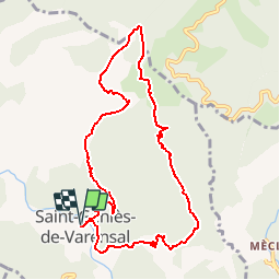
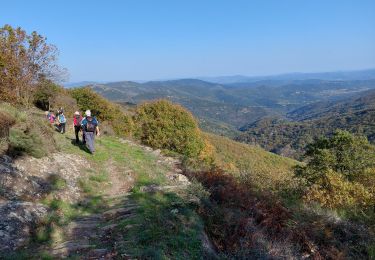
Ruta Senderismo de 10 km a descubrir en Occitania, Hérault, Saint-Geniès-de-Varensal. Esta ruta ha sido propuesta por tracegps.
Descripción
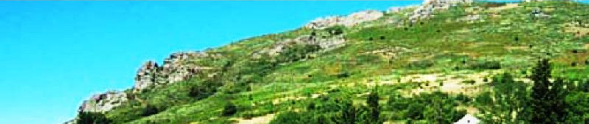
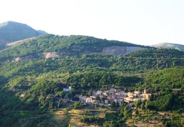
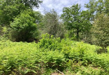
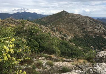
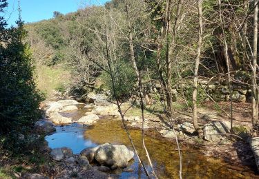
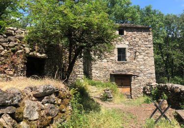
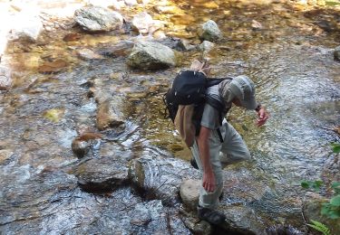
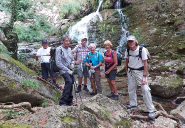
Source La Maison Cévenole des Arts et Traditions Populaires Saint Gervais sur Mare est situé dans le haut Hérault, aux confins du Tarn et de l'Aveyron. Le village qui se trouve à environ 350m d'altitude est entouré de sommets qui atteignent 1000 mètres et qui font la limite de partage des eaux entre les versants méditerranéen et atlantique. Circuit n°13 Longue randonnée amenant au plus beau belvédère de la région, le Mont de Marcou. Toutes les infos sont disponibles sur les fiches téléchargeables ICI
Localización
Comentarios
Excursiones cerca
![Excursión Senderismo Saint-Gervais-sur-Mare - Les Nières et ses anciennes découvertes de houille - Photo](https://media.geolcdn.com/t/375/260/ext.jpg?maxdim=2&url=https%3A%2F%2Fservices.sitytrail.com%2FGeolivesWS%2FDownloadMedia.ashx%3FTrailID%3D108891%26Media%3D2468_1.jpg)
![Senderismo Senderismo](https://static1.geolcdn.com/sitytour/trail-icons/101.png)
Senderismo
![](/images/other/stat-length.png)
![](https://static1.geolcdn.com/siteimages/upload/files/16400158638029165_repeat_loop_refresh_sync_direction_icon.png)
![Excursión Senderismo Saint-Gervais-sur-Mare - Tour du Caroux Arsel - Photo](https://media.geolcdn.com/t/375/260/38436cc7-eed3-45cf-a5b1-a12f25d9e4ac.jpeg&format=jpg&maxdim=2)
![Senderismo Senderismo](https://static1.geolcdn.com/sitytour/trail-icons/101.png)
Senderismo
![](/images/other/stat-length.png)
![](https://static1.geolcdn.com/siteimages/upload/files/16400158638029165_repeat_loop_refresh_sync_direction_icon.png)
![Excursión Senderismo Rosis - Les cinq cols - Photo](https://media.geolcdn.com/t/375/260/10f3b19b-e07b-4b83-a9da-a43d19300d46.jpg&format=jpg&maxdim=2)
![Senderismo Senderismo](https://static1.geolcdn.com/sitytour/trail-icons/101.png)
![Excursión Senderismo Saint-Gervais-sur-Mare - St Gervais / Mecle - Photo](https://media.geolcdn.com/t/375/260/44a3a381-c5a0-422f-9207-70c1fc116558.jpg&format=jpg&maxdim=2)
![Senderismo Senderismo](https://static1.geolcdn.com/sitytour/trail-icons/101.png)
Senderismo
![](/images/other/stat-length.png)
![](https://static1.geolcdn.com/siteimages/upload/files/16400158638029165_repeat_loop_refresh_sync_direction_icon.png)
![Excursión Senderismo Rosis - Andabre - Portail de Roquandouïre - Caissenols-le-Haut - Photo](https://media.geolcdn.com/t/375/260/a7f312f0-5400-4beb-b0c0-92123c0aa91f.jpg&format=jpg&maxdim=2)
![Senderismo Senderismo](https://static1.geolcdn.com/sitytour/trail-icons/101.png)
Senderismo
![](/images/other/stat-length.png)
![](https://static1.geolcdn.com/siteimages/upload/files/16400158638029165_repeat_loop_refresh_sync_direction_icon.png)
![Excursión Senderismo Saint-Gervais-sur-Mare - compeyre arsel - Photo](https://media.geolcdn.com/t/375/260/6d5dd05e-d2b6-47cc-acd4-44d9ab3855de.jpg&format=jpg&maxdim=2)
![Senderismo Senderismo](https://static1.geolcdn.com/sitytour/trail-icons/101.png)
Senderismo
![](/images/other/stat-length.png)
![](https://static1.geolcdn.com/siteimages/upload/files/16400158638029165_repeat_loop_refresh_sync_direction_icon.png)
![Excursión Senderismo Rosis - Col de lourdTigas - Photo](https://media.geolcdn.com/t/375/260/f2da17c1-c586-4087-b4a8-a530c958ee71.jpg&format=jpg&maxdim=2)
![Senderismo Senderismo](https://static1.geolcdn.com/sitytour/trail-icons/101.png)
Senderismo
![](/images/other/stat-length.png)
![](https://static1.geolcdn.com/siteimages/upload/files/16400158638029165_repeat_loop_refresh_sync_direction_icon.png)
![Excursión Senderismo Saint-Gervais-sur-Mare - de compter au col aussieres - Photo](https://media.geolcdn.com/t/375/260/4602b779-ce6c-42c8-974b-8dd2fe531ba4.jpg&format=jpg&maxdim=2)
![Senderismo Senderismo](https://static1.geolcdn.com/sitytour/trail-icons/101.png)
Senderismo
![](/images/other/stat-length.png)
![](https://static1.geolcdn.com/siteimages/upload/files/16400158638029165_repeat_loop_refresh_sync_direction_icon.png)
![Excursión Senderismo Saint-Geniès-de-Varensal - col du Marcou a partir de Plaisance - Photo](https://media.geolcdn.com/t/375/260/07d3e210-25c8-483d-a597-9b676b29012c.jpg&format=jpg&maxdim=2)
![Senderismo Senderismo](https://static1.geolcdn.com/sitytour/trail-icons/101.png)
Senderismo
![](/images/other/stat-length.png)
![](https://static1.geolcdn.com/siteimages/upload/files/16400158638029165_repeat_loop_refresh_sync_direction_icon.png)