![](/images/other/stat-length.png)
![Excursión Senderismo Guillon-les-Bains - Le Mont de Guillon - Doubs - Photo](https://media.geolcdn.com/t/1900/400/ext.pjpeg?maxdim=2&url=https%3A%2F%2Fservices.sitytrail.com%2FGeolivesWS%2FDownloadMedia.ashx%3FTrailID%3D108925%26Media%3D2616_1.jpg)
Le Mont de Guillon - Doubs
tracegps
Usuario
![Longitud](/images/other/stat-length.png)
![Altitud máxima](https://static1.geolcdn.com/siteimages/upload/files/1508320355ic_sort_altitude_max_24dp.png)
![Desnivel positivo](https://static1.geolcdn.com/siteimages/upload/files/1508320355ic_sort_den_pos_24dp.png)
![Km-Effort](/images/other/stat-length.png)
![Altitud mínima](https://static1.geolcdn.com/siteimages/upload/files/1508320355ic_sort_altitude_min_24dp.png)
![Desnivel negativo](https://static1.geolcdn.com/siteimages/upload/files/1508320355ic_sort_den_neg_24dp.png)
![Boucle](https://static1.geolcdn.com/siteimages/upload/files/16400158638029165_repeat_loop_refresh_sync_direction_icon.png)
![Senderismo](https://static1.geolcdn.com/sitytour/trail-icons/101.png)
2h00
Dificultad : Fácil
![Escanee este código QR para abrir la excursión en la aplicación SityTrail](https://capi.geolives.com/qq0zvz2zws4bq2lad0pu/sitytour/trails/108925/qr.png?size=200)
Aplicación GPS de excursión GRATIS
A propósito
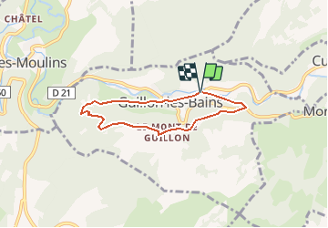
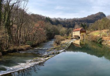
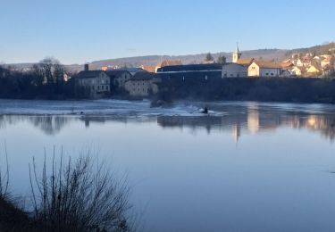
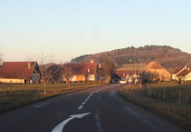
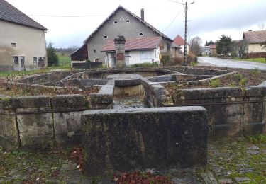
Ruta Senderismo de 5,4 km a descubrir en Borgoña-Franco Condado, Doubs, Guillon-les-Bains. Esta ruta ha sido propuesta por tracegps.
Descripción
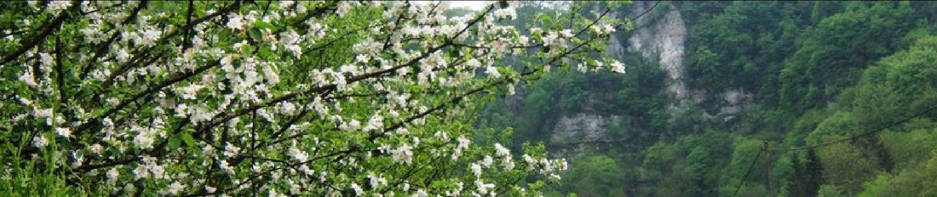
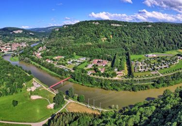
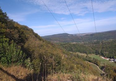
Le Doubs, réserve naturelle d’idées neuves ! Secteur géographique : Guillon-les-Bains Intérêt du parcours : Sites naturels : vallée du Cusancin, belvédère, forêt. A voir dans les environs : Source du Cusancin. Source bleue. Chapelle St Erminfroid. Château de Belvoir. Abbaye de la Grâce-Dieu. Baumes-les-Dames (abbaye, écomusée des pipes Ropp…)
Localización
Comentarios
Excursiones cerca
![Excursión Senderismo Villers-Saint-Martin - Villers st Martin](https://media.geolcdn.com/t/375/260/2c6ae54c-f240-47b2-a0d6-247007965cef.jpg&format=jpg&maxdim=2)
![Senderismo Senderismo](https://static1.geolcdn.com/sitytour/trail-icons/101.png)
Senderismo
![](/images/other/stat-length.png)
![](https://static1.geolcdn.com/siteimages/upload/files/16400158638029165_repeat_loop_refresh_sync_direction_icon.png)
![Excursión Otra actividad Cusance - Val de Cusance, source bleue - Photo](https://media.geolcdn.com/t/375/260/ext.jpg?maxdim=2&url=https%3A%2F%2Fstatic1.geolcdn.com%2Fsiteimages%2Fupload%2Ffiles%2F1545311037marcheuse_200dpi.jpg)
![Otra actividad Otra actividad](https://static1.geolcdn.com/sitytour/trail-icons/900.png)
Otra actividad
![](/images/other/stat-length.png)
![](https://static1.geolcdn.com/siteimages/upload/files/16400158638029165_repeat_loop_refresh_sync_direction_icon.png)
![Excursión A pie Esnans - Mont Dommage - Photo](https://media.geolcdn.com/t/375/260/79f418a8-7ee1-46f5-8173-ee740f887b5c.jpeg&format=jpg&maxdim=2)
![A pie A pie](https://static1.geolcdn.com/sitytour/trail-icons/100.png)
A pie
![](/images/other/stat-length.png)
![](https://static1.geolcdn.com/siteimages/upload/files/16400158638029165_repeat_loop_refresh_sync_direction_icon.png)
![Excursión A pie Baume-les-Dames - La Croix de Châtard - Photo](https://media.geolcdn.com/t/375/260/d651c9f5-c262-4fb0-99ee-1d55033f4dec.jpeg&format=jpg&maxdim=2)
![A pie A pie](https://static1.geolcdn.com/sitytour/trail-icons/100.png)
A pie
![](/images/other/stat-length.png)
![](https://static1.geolcdn.com/siteimages/upload/files/16400158638029165_repeat_loop_refresh_sync_direction_icon.png)
![Excursión A pie Baume-les-Dames - La Fente de Babre - Photo](https://media.geolcdn.com/t/375/260/f4606131-7993-4602-bc5e-c9844fe9a64f.jpeg&format=jpg&maxdim=2)
![A pie A pie](https://static1.geolcdn.com/sitytour/trail-icons/100.png)
A pie
![](/images/other/stat-length.png)
![](https://static1.geolcdn.com/siteimages/upload/files/16400158638029165_repeat_loop_refresh_sync_direction_icon.png)
![Excursión Senderismo Pont-les-Moulins - pont les moulins - Photo](https://media.geolcdn.com/t/375/260/7e6122b6-1654-426d-8833-6b2b329e62b0.jpg&format=jpg&maxdim=2)
![Senderismo Senderismo](https://static1.geolcdn.com/sitytour/trail-icons/101.png)
Senderismo
![](/images/other/stat-length.png)
![](https://static1.geolcdn.com/siteimages/upload/files/16400158638029165_repeat_loop_refresh_sync_direction_icon.png)
![Excursión Senderismo Baume-les-Dames - Baume les dames, fente de Babre - Photo](https://media.geolcdn.com/t/375/260/aa0af467-9313-4a29-a7b9-19f30e0259cd.jpg&format=jpg&maxdim=2)
![Senderismo Senderismo](https://static1.geolcdn.com/sitytour/trail-icons/101.png)
Senderismo
![](/images/other/stat-length.png)
![](https://static1.geolcdn.com/siteimages/upload/files/16400158638029165_repeat_loop_refresh_sync_direction_icon.png)
![Excursión A pie Adam-lès-Passavant - Bois de Rodolphe par Adam-lès-Passavant - Photo](https://media.geolcdn.com/t/375/260/1fbddc1c-5aaf-4c1f-8156-64b325a3aa3f.jpeg&format=jpg&maxdim=2)
![A pie A pie](https://static1.geolcdn.com/sitytour/trail-icons/100.png)
A pie
![](/images/other/stat-length.png)
![](https://static1.geolcdn.com/siteimages/upload/files/16400158638029165_repeat_loop_refresh_sync_direction_icon.png)
![Excursión Senderismo Lanans - Lanans - Photo](https://media.geolcdn.com/t/375/260/24b90f9d-51b5-4135-8b6d-d474c95ee6bd.jpg&format=jpg&maxdim=2)
![Senderismo Senderismo](https://static1.geolcdn.com/sitytour/trail-icons/101.png)
Senderismo
![](/images/other/stat-length.png)
![](https://static1.geolcdn.com/siteimages/upload/files/16400158638029165_repeat_loop_refresh_sync_direction_icon.png)