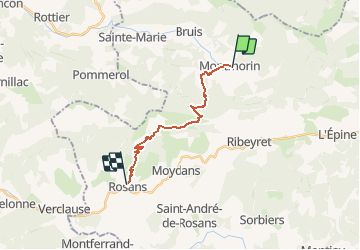
![](/images/other/stat-length.png)
![Excursión Senderismo Valdoule - Tour des Baronnies du Buëch - Montmorin - Rosans - Photo](https://media.geolcdn.com/t/1900/400/ext.pjpeg?maxdim=2&url=https%3A%2F%2Fservices.sitytrail.com%2FGeolivesWS%2FDownloadMedia.ashx%3FTrailID%3D108456%26Media%3D1168_1.jpg)
Tour des Baronnies du Buëch - Montmorin - Rosans
tracegps
Usuario
![Longitud](/images/other/stat-length.png)
![Altitud máxima](https://static1.geolcdn.com/siteimages/upload/files/1508320355ic_sort_altitude_max_24dp.png)
![Desnivel positivo](https://static1.geolcdn.com/siteimages/upload/files/1508320355ic_sort_den_pos_24dp.png)
![Km-Effort](/images/other/stat-length.png)
![Altitud mínima](https://static1.geolcdn.com/siteimages/upload/files/1508320355ic_sort_altitude_min_24dp.png)
![Desnivel negativo](https://static1.geolcdn.com/siteimages/upload/files/1508320355ic_sort_den_neg_24dp.png)
![Boucle](https://static1.geolcdn.com/siteimages/upload/files/16400158638029165_repeat_loop_refresh_sync_direction_icon.png)
![Senderismo](https://static1.geolcdn.com/sitytour/trail-icons/101.png)
4h00
Dificultad : Difícil
![Escanee este código QR para abrir la excursión en la aplicación SityTrail](https://capi.geolives.com/qq0zvz2zws4bq2lad0pu/sitytour/trails/108456/qr.png?size=200)
Aplicación GPS de excursión GRATIS
A propósito
Ruta Senderismo de 14,3 km a descubrir en Provenza-Alpes-Costa Azul, Altos Alpes, Valdoule. Esta ruta ha sido propuesta por tracegps.
Descripción
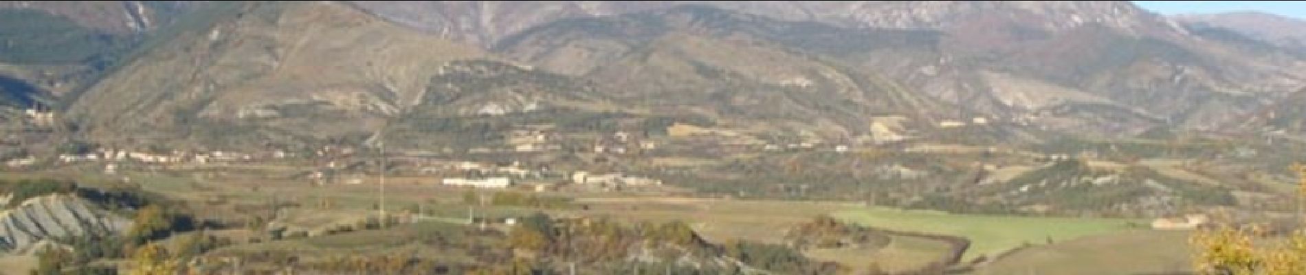
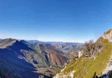
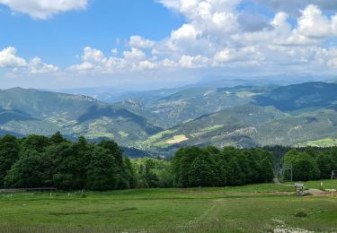
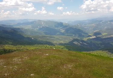
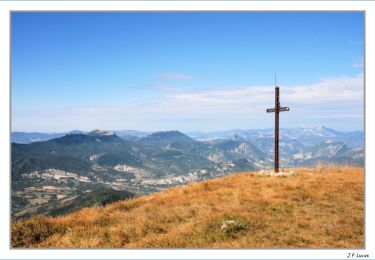
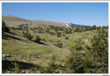
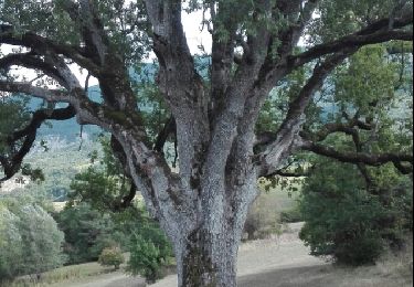
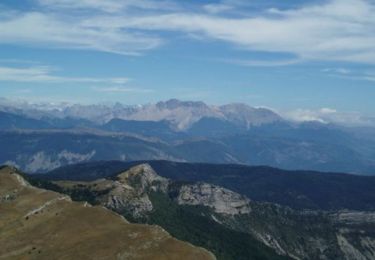
Le tout nouveau Tour des Baronnies du Buëch est un projet initié par la communauté des communes interdépartementale des Baronnies. « Colonne vertébrale » de la petite randonnée dans le Buëch, il constitue un produit d’appel pour la randonnée sur notre territoire. Cette itinéraire en crête offre des paysages somptueux tout en gardant une vue sur l’itinéraire réalisé et à parcourir. Une longue montée suivie d'une descente sur piste. Depuis Montmorin, un petit village authentique en pierres de pays, vous partez de la vallée de l'Oule, territoire encore sauvage réputé pour ses noix et ses chênes truffiers. Au Col des Pins vous découvrirez le contraste entre la montée à l'Ubac, versant à l'ombre, plus humide avec sa végétation plus dense et la descente sur l'Adret, plus ensoleillé. Une variante est possible au Col d'Archimbaou pour descendre sur sentier et éviter la piste. D’autres informations, carte et road-book sont disponibles ICI
Localización
Comentarios
Excursiones cerca
![Excursión Senderismo Valdrôme - R34 Le Duffre - Photo](https://media.geolcdn.com/t/375/260/ext.jpg?maxdim=2&url=https%3A%2F%2Fservices.sitytrail.com%2FGeolivesWS%2FDownloadMedia.ashx%3FTrailID%3D890893%26Media%3D2ca1e21a-61a3-4d74-8f49-4c0b73eea44f.jpg)
![Senderismo Senderismo](https://static1.geolcdn.com/sitytour/trail-icons/101.png)
Senderismo
![](/images/other/stat-length.png)
![](https://static1.geolcdn.com/siteimages/upload/files/16400158638029165_repeat_loop_refresh_sync_direction_icon.png)
![Excursión Senderismo Ribeyret - Sommet de la Maraysse - Photo](https://media.geolcdn.com/t/375/260/6bc9af49-4e59-47c6-a2e2-c0aff1c690e9.jpg&format=jpg&maxdim=2)
![Senderismo Senderismo](https://static1.geolcdn.com/sitytour/trail-icons/101.png)
Senderismo
![](/images/other/stat-length.png)
![](https://static1.geolcdn.com/siteimages/upload/files/16400158638029165_repeat_loop_refresh_sync_direction_icon.png)
![Excursión Senderismo Valdrôme - Valdrome - Montagne de l Aup - Photo](https://media.geolcdn.com/t/375/260/33a36926-5776-4baf-a549-88a63bd78f08.jpg&format=jpg&maxdim=2)
![Senderismo Senderismo](https://static1.geolcdn.com/sitytour/trail-icons/101.png)
Senderismo
![](/images/other/stat-length.png)
![](https://static1.geolcdn.com/siteimages/upload/files/16400158638029165_repeat_loop_refresh_sync_direction_icon.png)
![Excursión Senderismo Valdrôme - STATION DE VALDRÔME - MONTAGNE DE L' AUP - Photo](https://media.geolcdn.com/t/375/260/18404df3-c234-443d-9ed5-0984ac53c75c.jpg&format=jpg&maxdim=2)
![Senderismo Senderismo](https://static1.geolcdn.com/sitytour/trail-icons/101.png)
Senderismo
![](/images/other/stat-length.png)
![](https://static1.geolcdn.com/siteimages/upload/files/16400158638029165_repeat_loop_refresh_sync_direction_icon.png)
![Excursión Senderismo Valdrôme - Les crêtes du Duffre - Le Pré Pourri - Photo](https://media.geolcdn.com/t/375/260/ext.jpg?maxdim=2&url=https%3A%2F%2Fservices.sitytrail.com%2FGeolivesWS%2FDownloadMedia.ashx%3FTrailID%3D106195%26Media%3D10487_4.jpg)
![Senderismo Senderismo](https://static1.geolcdn.com/sitytour/trail-icons/101.png)
Senderismo
![](/images/other/stat-length.png)
![](https://static1.geolcdn.com/siteimages/upload/files/16400158638029165_repeat_loop_refresh_sync_direction_icon.png)
![Excursión Senderismo Valdrôme - L'Aup Froid - Station de Valdrôme - Photo](https://media.geolcdn.com/t/375/260/ext.jpg?maxdim=2&url=https%3A%2F%2Fservices.sitytrail.com%2FGeolivesWS%2FDownloadMedia.ashx%3FTrailID%3D105096%26Media%3D8688_3.jpg)
![Senderismo Senderismo](https://static1.geolcdn.com/sitytour/trail-icons/101.png)
Senderismo
![](/images/other/stat-length.png)
![](https://static1.geolcdn.com/siteimages/upload/files/16400158638029165_repeat_loop_refresh_sync_direction_icon.png)
![Excursión Senderismo Valdrôme - fontaine de juillet sabot de venus - Photo](https://media.geolcdn.com/t/375/260/5a5ede59-806f-495e-8531-9a0e36565d3a.jpg&format=jpg&maxdim=2)
![Senderismo Senderismo](https://static1.geolcdn.com/sitytour/trail-icons/101.png)
Senderismo
![](/images/other/stat-length.png)
![](https://static1.geolcdn.com/siteimages/upload/files/16400158638029165_repeat_loop_refresh_sync_direction_icon.png)
![Excursión Otra actividad Valdoule - 25 09 Praboyer Les Viarrands la Chèvre verte - Photo](https://media.geolcdn.com/t/375/260/ext.jpg?maxdim=2&url=https%3A%2F%2Fservices.sitytrail.com%2FGeolivesWS%2FDownloadMedia.ashx%3FTrailID%3D636249%26Media%3Dfix__20160925155707.jpg)
![Otra actividad Otra actividad](https://static1.geolcdn.com/sitytour/trail-icons/900.png)
Otra actividad
![](/images/other/stat-length.png)
![](https://static1.geolcdn.com/siteimages/upload/files/16400158638029165_repeat_loop_refresh_sync_direction_icon.png)
![Excursión Senderismo Valdoule - Le Duffre - Maison forestière de l'Adaux d'Oule - Photo](https://media.geolcdn.com/t/375/260/ext.jpg?maxdim=2&url=https%3A%2F%2Fservices.sitytrail.com%2FGeolivesWS%2FDownloadMedia.ashx%3FTrailID%3D105308%26Media%3D8998_1.jpg)
![Senderismo Senderismo](https://static1.geolcdn.com/sitytour/trail-icons/101.png)
Senderismo
![](/images/other/stat-length.png)
![](https://static1.geolcdn.com/siteimages/upload/files/16400158638029165_repeat_loop_refresh_sync_direction_icon.png)