


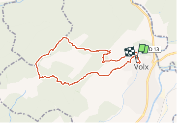

15,2 km | 22 km-effort


Usuario GUIDE


Aplicación GPS de excursión GRATIS
 SityTrail
IGN / Institutos geográficos
SityTrail World
El mundo es suyo
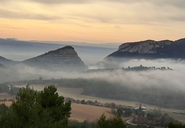
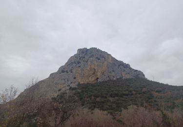
Ruta Senderismo de 9,3 km a descubrir en Provenza-Alpes-Costa Azul, Alpes de Alta Provenza, Volx. Esta ruta ha sido propuesta por RobinMicheline.
12.12.18.Belle vue , bien indiquer ,bien ombrager 210 mns 10 kms 450 m denivele
Senderismo
Senderismo
Senderismo
A pie

Bici de montaña

Senderismo
Senderismo

Senderismo
Senderismo