![](/images/other/stat-length.png)
![Excursión Bici de montaña Tuchan - Tour des châteaux du Pays Cathare - Tuchan - Caudiès - Photo](https://media.geolcdn.com/t/1900/400/ext.pjpeg?maxdim=2&url=https%3A%2F%2Fservices.sitytrail.com%2FGeolivesWS%2FDownloadMedia.ashx%3FTrailID%3D108166%26Media%3D596_3.jpg)
Tour des châteaux du Pays Cathare - Tuchan - Caudiès
tracegps
Usuario
![Longitud](/images/other/stat-length.png)
![Altitud máxima](https://static1.geolcdn.com/siteimages/upload/files/1508320355ic_sort_altitude_max_24dp.png)
![Desnivel positivo](https://static1.geolcdn.com/siteimages/upload/files/1508320355ic_sort_den_pos_24dp.png)
![Km-Effort](/images/other/stat-length.png)
![Altitud mínima](https://static1.geolcdn.com/siteimages/upload/files/1508320355ic_sort_altitude_min_24dp.png)
![Desnivel negativo](https://static1.geolcdn.com/siteimages/upload/files/1508320355ic_sort_den_neg_24dp.png)
![Boucle](https://static1.geolcdn.com/siteimages/upload/files/16400158638029165_repeat_loop_refresh_sync_direction_icon.png)
![Bici de montaña](https://static1.geolcdn.com/sitytour/trail-icons/202.png)
4h00
Dificultad : Muy difícil
![Escanee este código QR para abrir la excursión en la aplicación SityTrail](https://capi.geolives.com/qq0zvz2zws4bq2lad0pu/sitytour/trails/108166/qr.png?size=200)
Aplicación GPS de excursión GRATIS
A propósito
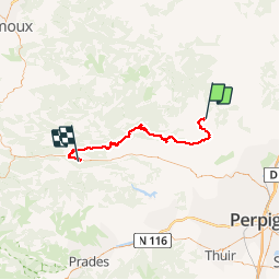
Ruta Bici de montaña de 60 km a descubrir en Occitania, Aude, Tuchan. Esta ruta ha sido propuesta por tracegps.
Descripción
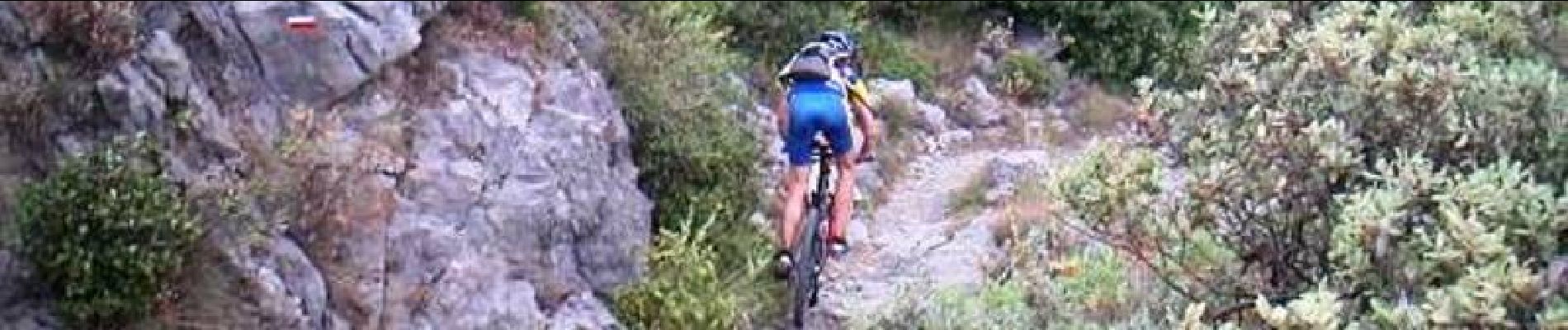
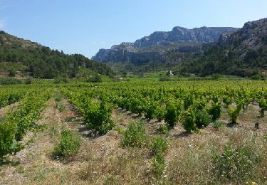
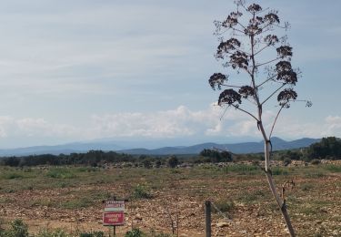
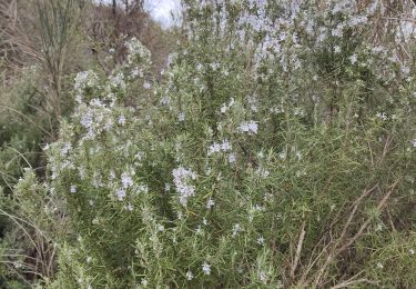
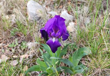
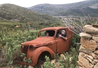
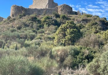
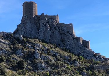
3 Aout 2004 On part de plus en plus tôt le matin…pour éviter la chaleur. 7h30 sur le vélo ce matin ! Une grande piste roulante, nous permet de prendre 500 m de dénivelée, pour atteindre le château de Quéribus. On laisse les vélos à la guitoune, pour visiter le château. Là haut, la vue est superbe, un beau 360°. On a voulu éviter la route pour rejoindre Cucugnan. Franchement, le ©GR entre Quéribus et Cucugnan est infaisable…… La montée à Peyrepurtuse se fait par la route (pas le choix). Il fait encore très chaud, le bitume renvoie la chaleur. Cette route monte vraiment dur, mais Véro nous attend en haut pour le pique nique ! ! La suite est ICI
Localización
Comentarios
Excursiones cerca
![Excursión Senderismo Vingrau - Chemin des Contrebandiers Vingrau variante - Photo](https://media.geolcdn.com/t/375/260/ext.jpg?maxdim=2&url=https%3A%2F%2Fservices.sitytrail.com%2FGeolivesWS%2FDownloadMedia.ashx%3FTrailID%3D422545%26Media%3Dfix__20140613113149.jpg)
![Senderismo Senderismo](https://static1.geolcdn.com/sitytour/trail-icons/101.png)
Senderismo
![](/images/other/stat-length.png)
![](https://static1.geolcdn.com/siteimages/upload/files/16400158638029165_repeat_loop_refresh_sync_direction_icon.png)
![Excursión Senderismo Vingrau - Vingrau - Photo](https://media.geolcdn.com/t/375/260/59157f3c-9cda-4a07-bd09-42a8a8a018aa.jpg&format=jpg&maxdim=2)
![Senderismo Senderismo](https://static1.geolcdn.com/sitytour/trail-icons/101.png)
Senderismo
![](/images/other/stat-length.png)
![](https://static1.geolcdn.com/siteimages/upload/files/16400158638029165_repeat_loop_refresh_sync_direction_icon.png)
![Excursión Senderismo Tuchan - Château d'Aguilar - Photo](https://media.geolcdn.com/t/375/260/69a75b7e-2fd5-4cd9-b695-50f60166fc32.jpg&format=jpg&maxdim=2)
![Senderismo Senderismo](https://static1.geolcdn.com/sitytour/trail-icons/101.png)
![Excursión Senderismo Paziols - paziols 19 kms - Photo](https://media.geolcdn.com/t/375/260/ddaac51d-e934-4f1b-ab1b-521ca7bf9769.jpg&format=jpg&maxdim=2)
![Senderismo Senderismo](https://static1.geolcdn.com/sitytour/trail-icons/101.png)
![Excursión Senderismo Tuchan - 20220310 Tuchan-Padern - Photo](https://media.geolcdn.com/t/375/260/89aed768-3fd6-4233-a976-b373d3d0020c.jpg&format=jpg&maxdim=2)
![Senderismo Senderismo](https://static1.geolcdn.com/sitytour/trail-icons/101.png)
Senderismo
![](/images/other/stat-length.png)
![](https://static1.geolcdn.com/siteimages/upload/files/16400158638029165_repeat_loop_refresh_sync_direction_icon.png)
![Excursión Senderismo Paziols - Paziols château d’aguilra - Photo](https://media.geolcdn.com/t/375/260/fa47ac32-1f20-4f2f-bc41-046989712c5d.jpg&format=jpg&maxdim=2)
![Senderismo Senderismo](https://static1.geolcdn.com/sitytour/trail-icons/101.png)
Senderismo
![](/images/other/stat-length.png)
![](https://static1.geolcdn.com/siteimages/upload/files/16400158638029165_repeat_loop_refresh_sync_direction_icon.png)
![Excursión Senderismo Tuchan - 20211007 Tuchan-Padern-Queribus-Cucugnan - Photo](https://media.geolcdn.com/t/375/260/762dfda7-4ad1-4ec0-abb8-e231bea8140f.jpg&format=jpg&maxdim=2)
![Senderismo Senderismo](https://static1.geolcdn.com/sitytour/trail-icons/101.png)
Senderismo
![](/images/other/stat-length.png)
![](https://static1.geolcdn.com/siteimages/upload/files/16400158638029165_repeat_loop_refresh_sync_direction_icon.png)
![Excursión Senderismo Padern - 20201231 Padern - Photo](https://media.geolcdn.com/t/375/260/3cd75579-f001-455a-9c7e-25b59625ce32.jpg&format=jpg&maxdim=2)
![Senderismo Senderismo](https://static1.geolcdn.com/sitytour/trail-icons/101.png)
![Excursión Senderismo Vingrau - 20201219 Vingrau - trauc del cavall - Photo](https://media.geolcdn.com/t/375/260/95aed09b-a0da-475c-8714-2557239cfe2a.jpg&format=jpg&maxdim=2)
![Senderismo Senderismo](https://static1.geolcdn.com/sitytour/trail-icons/101.png)
Senderismo
![](/images/other/stat-length.png)
![](https://static1.geolcdn.com/siteimages/upload/files/16400158638029165_repeat_loop_refresh_sync_direction_icon.png)