![](/images/other/stat-length.png)
![Excursión Senderismo Saint-Privat-d'Allier - St Privat d'Allier - Saugues - Chemin de Compostelle - Photo](https://media.geolcdn.com/t/1900/400/ext.pjpeg?maxdim=2&url=https%3A%2F%2Fservices.sitytrail.com%2FGeolivesWS%2FDownloadMedia.ashx%3FTrailID%3D108146%26Media%3D199_1.jpg)
St Privat d'Allier - Saugues - Chemin de Compostelle
tracegps
Usuario
![Longitud](/images/other/stat-length.png)
![Altitud máxima](https://static1.geolcdn.com/siteimages/upload/files/1508320355ic_sort_altitude_max_24dp.png)
![Desnivel positivo](https://static1.geolcdn.com/siteimages/upload/files/1508320355ic_sort_den_pos_24dp.png)
![Km-Effort](/images/other/stat-length.png)
![Altitud mínima](https://static1.geolcdn.com/siteimages/upload/files/1508320355ic_sort_altitude_min_24dp.png)
![Desnivel negativo](https://static1.geolcdn.com/siteimages/upload/files/1508320355ic_sort_den_neg_24dp.png)
![Boucle](https://static1.geolcdn.com/siteimages/upload/files/16400158638029165_repeat_loop_refresh_sync_direction_icon.png)
![Senderismo](https://static1.geolcdn.com/sitytour/trail-icons/101.png)
5h40
Dificultad : Muy difícil
![Escanee este código QR para abrir la excursión en la aplicación SityTrail](https://capi.geolives.com/qq0zvz2zws4bq2lad0pu/sitytour/trails/108146/qr.png?size=200)
Aplicación GPS de excursión GRATIS
A propósito
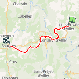
Ruta Senderismo de 20 km a descubrir en Auvergne-Rhône-Alpes, Alto Loira, Saint-Privat-d'Allier. Esta ruta ha sido propuesta por tracegps.
Descripción
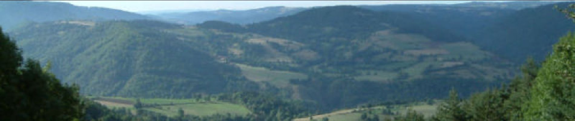
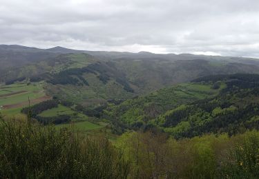
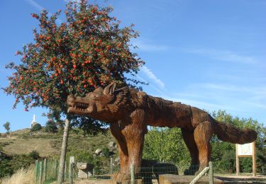
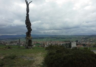
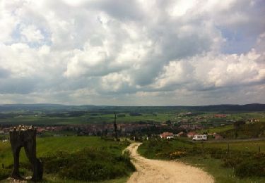
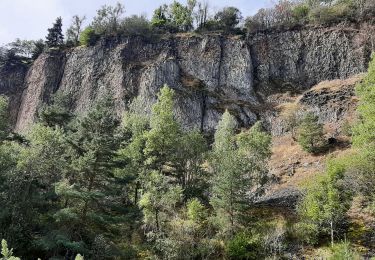
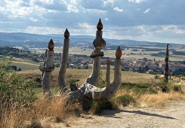
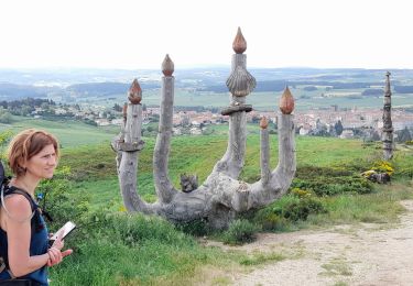
Cette étape du Chemin de Compostelle de 20,7Km nous mène de St Privat d'Allier jusqu'à Saugues en passant par Combriaux, Rochegude, Pratclaux,Monistrol d'Allier, Escluzels, Montaure, Roziers, Le Vernet et enfin Rognac. A la sortie de St Privat, le chemin s'élève durant 3,5Km jusqu'à Rochegude ( 70m de dénivelée) puis descend franchement vers la vallée pour rejoindre Monistrol d'Allier à 4.1Km (-340m de dénivelée). Du bord de l'Allier regardez Nord Ouest le petit village perché, c'est Escluzels, et vous devez y aller et plus loin encore... Le chemin monte rude durant 3,9Km pour rejoindre Montaure ( 450m de dénivelée). Ouf, le chemin devient moins dur voire presque plat sur 5,5Km jusqu'à Rognac ( 70m de dénivelée). De là s'amorce la descente vers Saugues à 3,6Km (-110m de dénivelée). D’autres informations et photos sur le Chemin de Compostelle sont disponibles ICI Balade proposée par « Les Balades et Randonnées de Fred »
Localización
Comentarios
Excursiones cerca
![Excursión Senderismo Saint-Privat-d'Allier - lac de l'oeuf / St Privat/ chapelle de Rochegude - Photo](https://media.geolcdn.com/t/375/260/9d549320-6680-4806-9ebd-0814248a01b9.jpg&format=jpg&maxdim=2)
![Senderismo Senderismo](https://static1.geolcdn.com/sitytour/trail-icons/101.png)
Senderismo
![](/images/other/stat-length.png)
![](https://static1.geolcdn.com/siteimages/upload/files/16400158638029165_repeat_loop_refresh_sync_direction_icon.png)
![Excursión Senderismo Saint-Privat-d'Allier - le chier mont Devès - Photo](https://media.geolcdn.com/t/375/260/ext.jpg?maxdim=2&url=https%3A%2F%2Fstatic1.geolcdn.com%2Fsiteimages%2Fupload%2Ffiles%2F1553511878bg_sport_marche.png)
![Senderismo Senderismo](https://static1.geolcdn.com/sitytour/trail-icons/101.png)
Senderismo
![](/images/other/stat-length.png)
![](https://static1.geolcdn.com/siteimages/upload/files/16400158638029165_repeat_loop_refresh_sync_direction_icon.png)
![Excursión Senderismo Monistrol-d'Allier - Monistrol/ Pourcheresse par le GR 470 - Photo](https://media.geolcdn.com/t/375/260/ab7973e1-5cd8-4724-a2d0-66e6171a4702.jpg&format=jpg&maxdim=2)
![Senderismo Senderismo](https://static1.geolcdn.com/sitytour/trail-icons/101.png)
Senderismo
![](/images/other/stat-length.png)
![](https://static1.geolcdn.com/siteimages/upload/files/16400158638029165_repeat_loop_refresh_sync_direction_icon.png)
![Senderismo Senderismo](https://static1.geolcdn.com/sitytour/trail-icons/101.png)
Senderismo
![](/images/other/stat-length.png)
![](https://static1.geolcdn.com/siteimages/upload/files/16400158638029165_repeat_loop_refresh_sync_direction_icon.png)
![Excursión Senderismo Saint-Privat-d'Allier - saint Privat d'Allier - Saugues - Photo](https://media.geolcdn.com/t/375/260/ext.jpg?maxdim=2&url=https%3A%2F%2Fservices.sitytrail.com%2FGeolivesWS%2FDownloadMedia.ashx%3FTrailID%3D409514%26Media%3Dfix__20150418165122.jpg)
![Senderismo Senderismo](https://static1.geolcdn.com/sitytour/trail-icons/101.png)
Senderismo
![](/images/other/stat-length.png)
![](https://static1.geolcdn.com/siteimages/upload/files/16400158638029165_repeat_loop_refresh_sync_direction_icon.png)
![Excursión Senderismo Monistrol-d'Allier - monistrol saugues - Photo](https://media.geolcdn.com/t/375/260/ext.jpg?maxdim=2&url=https%3A%2F%2Fservices.sitytrail.com%2FGeolivesWS%2FDownloadMedia.ashx%3FTrailID%3D131322%26Media%3D20120531150900.jpg)
![Senderismo Senderismo](https://static1.geolcdn.com/sitytour/trail-icons/101.png)
Senderismo
![](/images/other/stat-length.png)
![](https://static1.geolcdn.com/siteimages/upload/files/16400158638029165_repeat_loop_refresh_sync_direction_icon.png)
![Excursión Senderismo Monistrol-d'Allier - Monistrole-d'Allier - Photo](https://media.geolcdn.com/t/375/260/6d5464d8-d5dc-4cf4-a65e-1b4a38330085.jpg&format=jpg&maxdim=2)
![Senderismo Senderismo](https://static1.geolcdn.com/sitytour/trail-icons/101.png)
Senderismo
![](/images/other/stat-length.png)
![](https://static1.geolcdn.com/siteimages/upload/files/16400158638029165_repeat_loop_refresh_sync_direction_icon.png)
![Excursión sport Saint-Privat-d'Allier - Chemin de Compostelle, Le Puits Journé deux - Photo](https://media.geolcdn.com/t/375/260/ea544a02-d2e4-4f4d-9502-1b88b6edfb43.jpg&format=jpg&maxdim=2)
sport
![](/images/other/stat-length.png)
![](https://static1.geolcdn.com/siteimages/upload/files/16400158638029165_repeat_loop_refresh_sync_direction_icon.png)
![Excursión Senderismo Saint-Privat-d'Allier - live Saint Privat - Saugues - Photo](https://media.geolcdn.com/t/375/260/cbc4b65b-4a4d-4bb9-8daa-c69224559ef4.jpg&format=jpg&maxdim=2)
![Senderismo Senderismo](https://static1.geolcdn.com/sitytour/trail-icons/101.png)
Senderismo
![](/images/other/stat-length.png)
![](https://static1.geolcdn.com/siteimages/upload/files/16400158638029165_repeat_loop_refresh_sync_direction_icon.png)