![](/images/other/stat-length.png)
![Excursión Senderismo Sauxillanges - De Sauxillanges à Chabreyras - Photo](https://media.geolcdn.com/t/1900/400/ext.pjpeg?maxdim=2&url=https%3A%2F%2Fservices.sitytrail.com%2FGeolivesWS%2FDownloadMedia.ashx%3FTrailID%3D107468%26Media%3D12407_1.jpg)
De Sauxillanges à Chabreyras
tracegps
Usuario
![Longitud](/images/other/stat-length.png)
![Altitud máxima](https://static1.geolcdn.com/siteimages/upload/files/1508320355ic_sort_altitude_max_24dp.png)
![Desnivel positivo](https://static1.geolcdn.com/siteimages/upload/files/1508320355ic_sort_den_pos_24dp.png)
![Km-Effort](/images/other/stat-length.png)
![Altitud mínima](https://static1.geolcdn.com/siteimages/upload/files/1508320355ic_sort_altitude_min_24dp.png)
![Desnivel negativo](https://static1.geolcdn.com/siteimages/upload/files/1508320355ic_sort_den_neg_24dp.png)
![Boucle](https://static1.geolcdn.com/siteimages/upload/files/16400158638029165_repeat_loop_refresh_sync_direction_icon.png)
![Senderismo](https://static1.geolcdn.com/sitytour/trail-icons/101.png)
5h00
Dificultad : Difícil
![Escanee este código QR para abrir la excursión en la aplicación SityTrail](https://capi.geolives.com/qq0zvz2zws4bq2lad0pu/sitytour/trails/107468/qr.png?size=200)
Aplicación GPS de excursión GRATIS
A propósito
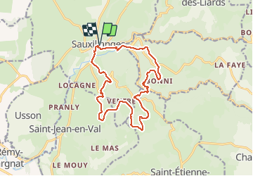
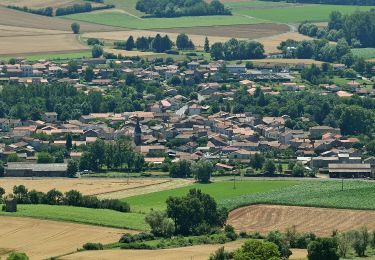
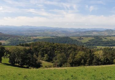
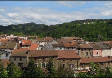
Ruta Senderismo de 15,9 km a descubrir en Auvergne-Rhône-Alpes, Puy-de-Dôme, Sauxillanges. Esta ruta ha sido propuesta por tracegps.
Descripción
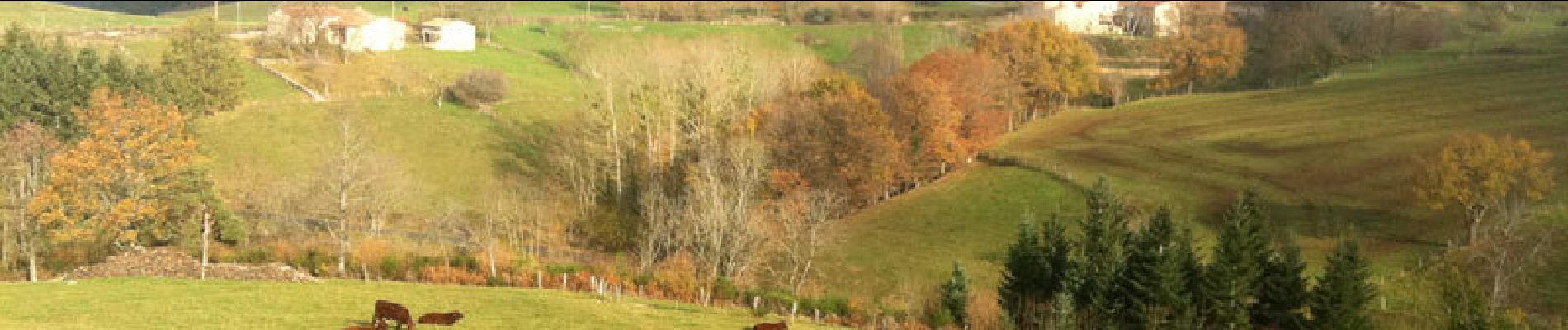
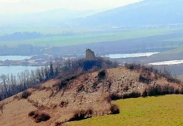
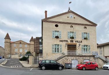
Parking et départ devant la maison du patrimoine à Sauxillanges. Un abri avec bancs pour se chausser est là, à disposition et c'est bien agréable! Très peu de route goudronnée dans ce parcours. Une belle montée après le "Civadou" venant après une longue descente, est la principale difficulté de cet itinéraire très varié.
Localización
Comentarios
Excursiones cerca
![Excursión Senderismo Brenat - Brenat_Tour_Gevillat - Photo](https://media.geolcdn.com/t/375/260/2b9dba0d-44c9-4336-a13d-50587f665150.jpg&format=jpg&maxdim=2)
![Senderismo Senderismo](https://static1.geolcdn.com/sitytour/trail-icons/101.png)
Senderismo
![](/images/other/stat-length.png)
![](https://static1.geolcdn.com/siteimages/upload/files/16400158638029165_repeat_loop_refresh_sync_direction_icon.png)
![Excursión A pie Sauxillanges - La Vallee de Civadoux - Photo](https://media.geolcdn.com/t/375/260/b4f7319b-3713-42b9-8b0d-6d7343ec86a5.jpeg&format=jpg&maxdim=2)
![A pie A pie](https://static1.geolcdn.com/sitytour/trail-icons/100.png)
A pie
![](/images/other/stat-length.png)
![](https://static1.geolcdn.com/siteimages/upload/files/16400158638029165_repeat_loop_refresh_sync_direction_icon.png)
![Excursión A pie Usson - Le Pic d'Usson - Photo](https://media.geolcdn.com/t/375/260/6a96298d-c1d0-4fd4-b2cd-7460048c5b43.jpeg&format=jpg&maxdim=2)
![A pie A pie](https://static1.geolcdn.com/sitytour/trail-icons/100.png)
A pie
![](/images/other/stat-length.png)
![](https://static1.geolcdn.com/siteimages/upload/files/16400158638029165_repeat_loop_refresh_sync_direction_icon.png)
![Excursión A pie Brenat - La Tour de Gevillat - Photo](https://media.geolcdn.com/t/375/260/12927b2d-86e8-4e4a-bbac-13d0164d4024.jpeg&format=jpg&maxdim=2)
![A pie A pie](https://static1.geolcdn.com/sitytour/trail-icons/100.png)
A pie
![](/images/other/stat-length.png)
![](https://static1.geolcdn.com/siteimages/upload/files/16400158638029165_repeat_loop_refresh_sync_direction_icon.png)
![Excursión Senderismo Sauxillanges - Sauxillanges_Sites_Clunisiens - Photo](https://media.geolcdn.com/t/375/260/a2cc4fc4-47d3-4c2f-b17d-a6b74f3d59dd.jpg&format=jpg&maxdim=2)
![Senderismo Senderismo](https://static1.geolcdn.com/sitytour/trail-icons/101.png)
Senderismo
![](/images/other/stat-length.png)
![](https://static1.geolcdn.com/siteimages/upload/files/16400158638029165_repeat_loop_refresh_sync_direction_icon.png)
![Excursión Senderismo Sauxillanges - Sauxillanges_Sentier_Claire - Photo](https://media.geolcdn.com/t/375/260/4ec33cda-8370-4996-a4fb-500774cc2d23.jpg&format=jpg&maxdim=2)
![Senderismo Senderismo](https://static1.geolcdn.com/sitytour/trail-icons/101.png)
Senderismo
![](/images/other/stat-length.png)
![](https://static1.geolcdn.com/siteimages/upload/files/16400158638029165_repeat_loop_refresh_sync_direction_icon.png)
![Excursión A pie Saint-Étienne-sur-Usson - La Ronde des Suquets - Photo](https://media.geolcdn.com/t/375/260/e7260daa-6a55-4a8a-b4e2-940285e94803.jpeg&format=jpg&maxdim=2)
![A pie A pie](https://static1.geolcdn.com/sitytour/trail-icons/100.png)
A pie
![](/images/other/stat-length.png)
![](https://static1.geolcdn.com/siteimages/upload/files/16400158638029165_repeat_loop_refresh_sync_direction_icon.png)
![Excursión Senderismo Sauxillanges - Sauxillanges_Le-Civadoux_T - Photo](https://media.geolcdn.com/t/375/260/0187ade0-2acc-4e72-9833-2644992b0db7.jpg&format=jpg&maxdim=2)
![Senderismo Senderismo](https://static1.geolcdn.com/sitytour/trail-icons/101.png)
Senderismo
![](/images/other/stat-length.png)
![](https://static1.geolcdn.com/siteimages/upload/files/16400158638029165_repeat_loop_refresh_sync_direction_icon.png)
![Excursión Senderismo Sauxillanges - Sauxillanges_Civadoux - Photo](https://media.geolcdn.com/t/375/260/75e3c30d-603a-45a5-aa00-06a4bab0ed78.jpg&format=jpg&maxdim=2)
![Senderismo Senderismo](https://static1.geolcdn.com/sitytour/trail-icons/101.png)
Senderismo
![](/images/other/stat-length.png)
![](https://static1.geolcdn.com/siteimages/upload/files/16400158638029165_repeat_loop_refresh_sync_direction_icon.png)