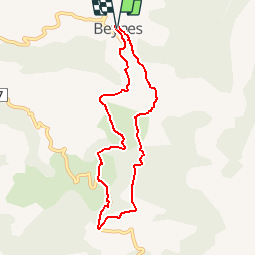
![](/images/other/stat-length.png)
![Excursión Senderismo Beynes - Boucle de Palus - Beynes - Photo](https://media.geolcdn.com/t/1900/400/ext.pjpeg?maxdim=2&url=https%3A%2F%2Fservices.sitytrail.com%2FGeolivesWS%2FDownloadMedia.ashx%3FTrailID%3D107414%26Media%3D12326_5.jpg)
Boucle de Palus - Beynes
tracegps
Usuario
![Longitud](/images/other/stat-length.png)
![Altitud máxima](https://static1.geolcdn.com/siteimages/upload/files/1508320355ic_sort_altitude_max_24dp.png)
![Desnivel positivo](https://static1.geolcdn.com/siteimages/upload/files/1508320355ic_sort_den_pos_24dp.png)
![Km-Effort](/images/other/stat-length.png)
![Altitud mínima](https://static1.geolcdn.com/siteimages/upload/files/1508320355ic_sort_altitude_min_24dp.png)
![Desnivel negativo](https://static1.geolcdn.com/siteimages/upload/files/1508320355ic_sort_den_neg_24dp.png)
![Boucle](https://static1.geolcdn.com/siteimages/upload/files/16400158638029165_repeat_loop_refresh_sync_direction_icon.png)
![Senderismo](https://static1.geolcdn.com/sitytour/trail-icons/101.png)
2h00
Dificultad : Medio
![Escanee este código QR para abrir la excursión en la aplicación SityTrail](https://capi.geolives.com/qq0zvz2zws4bq2lad0pu/sitytour/trails/107414/qr.png?size=200)
Aplicación GPS de excursión GRATIS
A propósito
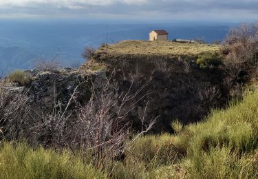
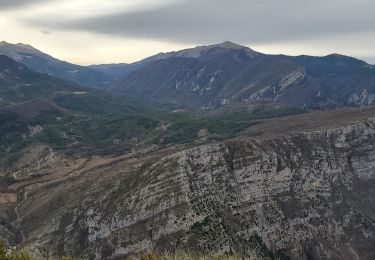
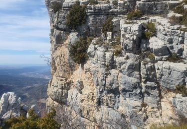
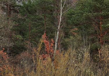
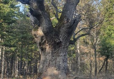
Ruta Senderismo de 7,8 km a descubrir en Provenza-Alpes-Costa Azul, Alpes de Alta Provenza, Beynes. Esta ruta ha sido propuesta por tracegps.
Descripción
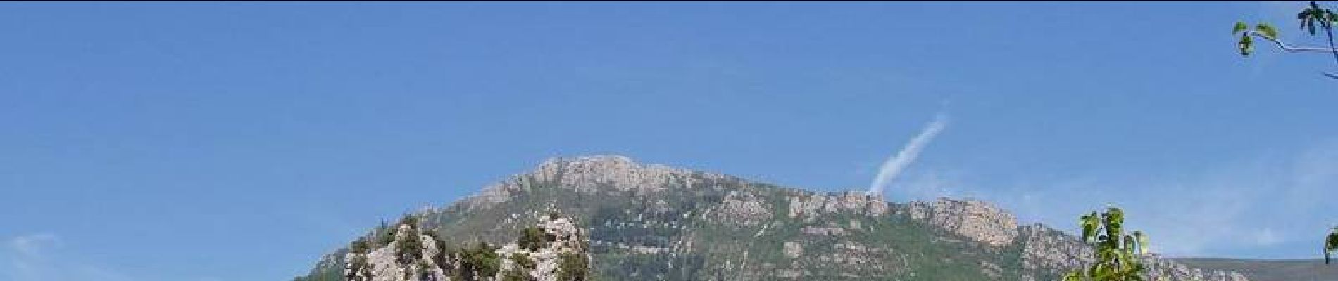
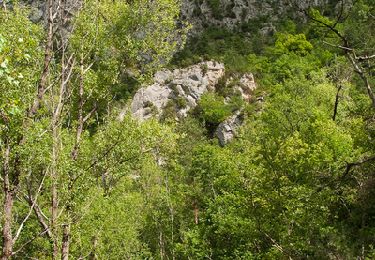
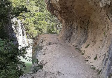
Ce circuit vous est proposé par Asse Tourisme en Provence. Au départ de ce village perché d'où la vue est magnifique, prendre le sentier qui passe par les ruines d'un château direction le haut Vériscle, col de la Croix pour un retour par Palus et le Bas Vériscle. Départ de la place de Beynes. Retrouvez la carte des circuits sur le site d'Asse Tourisme en Provence.
Localización
Comentarios
Excursiones cerca
![Excursión Senderismo Estoublon - Gorges de Trévans - Estoublon - Photo](https://media.geolcdn.com/t/375/260/ext.jpg?maxdim=2&url=https%3A%2F%2Fservices.sitytrail.com%2FGeolivesWS%2FDownloadMedia.ashx%3FTrailID%3D106721%26Media%3D11374_5.jpg)
![Senderismo Senderismo](https://static1.geolcdn.com/sitytour/trail-icons/101.png)
Senderismo
![](/images/other/stat-length.png)
![](https://static1.geolcdn.com/siteimages/upload/files/16400158638029165_repeat_loop_refresh_sync_direction_icon.png)
![Excursión Senderismo Entrages - CHABRIERES Pas de l Ane Entrages Pas des Portes clubs navette - Photo](https://media.geolcdn.com/t/375/260/ext.jpg?maxdim=2&url=https%3A%2F%2Fstatic1.geolcdn.com%2Fsiteimages%2Fupload%2Ffiles%2F1553511878bg_sport_marche.png)
![Senderismo Senderismo](https://static1.geolcdn.com/sitytour/trail-icons/101.png)
Senderismo
![](/images/other/stat-length.png)
![](https://static1.geolcdn.com/siteimages/upload/files/16400158638029165_repeat_loop_refresh_sync_direction_icon.png)
![Excursión Senderismo Estoublon - TREVANS, Chateau de Trevans, les Beluguettes. Cotes Chaudes , Belvédère des Gorges , Turquet ,o quet - Photo](https://media.geolcdn.com/t/375/260/488d605b-c812-4edd-a2c1-2f4802305dc3.jpg&format=jpg&maxdim=2)
![Senderismo Senderismo](https://static1.geolcdn.com/sitytour/trail-icons/101.png)
Senderismo
![](/images/other/stat-length.png)
![](https://static1.geolcdn.com/siteimages/upload/files/16400158638029165_repeat_loop_refresh_sync_direction_icon.png)
![Excursión Senderismo Entrages - Digne cousson courtiers 937m 15kms - Photo](https://media.geolcdn.com/t/375/260/cc588e67-50fc-4ee9-8cc3-a13b0a81a85e.jpg&format=jpg&maxdim=2)
![Senderismo Senderismo](https://static1.geolcdn.com/sitytour/trail-icons/101.png)
Senderismo
![](/images/other/stat-length.png)
![](https://static1.geolcdn.com/siteimages/upload/files/16400158638029165_repeat_loop_refresh_sync_direction_icon.png)
![Excursión Senderismo Beynes - Montagne de Beynes 11kms 720m - Photo](https://media.geolcdn.com/t/375/260/0924528c-4d8c-48ab-ad20-f85077c2766f.jpg&format=jpg&maxdim=2)
![Senderismo Senderismo](https://static1.geolcdn.com/sitytour/trail-icons/101.png)
Senderismo
![](/images/other/stat-length.png)
![](https://static1.geolcdn.com/siteimages/upload/files/16400158638029165_repeat_loop_refresh_sync_direction_icon.png)
![Excursión Senderismo Estoublon - Trevans les gorges - Photo](https://media.geolcdn.com/t/375/260/2cbe37e7-5ddf-4213-89bc-0a9ca520d8c1.jpg&format=jpg&maxdim=2)
![Senderismo Senderismo](https://static1.geolcdn.com/sitytour/trail-icons/101.png)
Senderismo
![](/images/other/stat-length.png)
![](https://static1.geolcdn.com/siteimages/upload/files/16400158638029165_repeat_loop_refresh_sync_direction_icon.png)
![Excursión Senderismo Beynes - 2023-03-17 Montagne de Beyne - Photo](https://media.geolcdn.com/t/375/260/a2f9f9ce-2317-441f-8351-fbd6bbd22b1f.jpg&format=jpg&maxdim=2)
![Senderismo Senderismo](https://static1.geolcdn.com/sitytour/trail-icons/101.png)
Senderismo
![](/images/other/stat-length.png)
![](https://static1.geolcdn.com/siteimages/upload/files/16400158638029165_repeat_loop_refresh_sync_direction_icon.png)
![Excursión Senderismo Estoublon - Gorges de Trevans par Valbonnette - Photo](https://media.geolcdn.com/t/375/260/10517f6a-6ec3-4f7b-85a2-34d58762c642.jpg&format=jpg&maxdim=2)
![Senderismo Senderismo](https://static1.geolcdn.com/sitytour/trail-icons/101.png)
Senderismo
![](/images/other/stat-length.png)
![](https://static1.geolcdn.com/siteimages/upload/files/16400158638029165_repeat_loop_refresh_sync_direction_icon.png)
![Excursión Senderismo Estoublon - 2023-02-21 Gorges de Trévans - Passerelle de la Délasse - Photo](https://media.geolcdn.com/t/375/260/0eeaaad3-f154-4199-b0d4-f7114f5176f6.jpg&format=jpg&maxdim=2)
![Senderismo Senderismo](https://static1.geolcdn.com/sitytour/trail-icons/101.png)
Senderismo
![](/images/other/stat-length.png)
![](https://static1.geolcdn.com/siteimages/upload/files/16400158638029165_repeat_loop_refresh_sync_direction_icon.png)