


4,1 km | 11,1 km-effort

Usuario


Aplicación GPS de excursión GRATIS
 SityTrail
IGN / Institutos geográficos
SityTrail World
El mundo es suyo
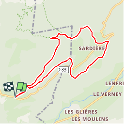
Ruta Carrera de 8,7 km a descubrir en Auvergne-Rhône-Alpes, Saboya, Aussois. Esta ruta ha sido propuesta por tracegps.
Dans ce fabuleux coin de Haute Maurienne ce petit parcours de 9km800 au départ de Plan Croix est très attractif pour reprendre "contact" et pour se décrasser physiquement, en course à pied par exemple ou bien en balade pour voir ce monolithe spectaculaire et vertigineux .Le tout à 1500m en moyenne. Attention au panneau Bramans prendre le numéro vtt 5 de droite


Senderismo

Senderismo

Senderismo

Esquí de fondo

A pie

Senderismo

Senderismo

Senderismo
Senderismo
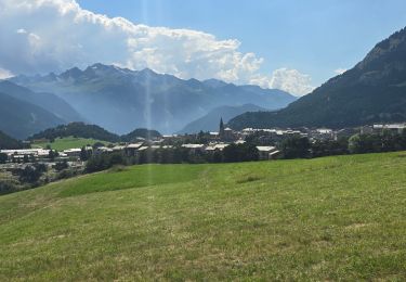
Magnifique