![](/images/other/stat-length.png)
![Excursión Bici de montaña Mandailles-Saint-Julien - Espace VTT FFC - Grand Site du Puy Mary - Vallée de la Jordanne - Circuit N°4 La vallée de la Jordanne - Photo](https://media.geolcdn.com/t/1900/400/ext.pjpeg?maxdim=2&url=https%3A%2F%2Fservices.sitytrail.com%2FGeolivesWS%2FDownloadMedia.ashx%3FTrailID%3D106128%26Media%3D10367_1.jpg)
Espace VTT FFC - Grand Site du Puy Mary - Vallée de la Jordanne - Circuit N°4 La vallée de la Jordanne
tracegps
Usuario
![Longitud](/images/other/stat-length.png)
![Altitud máxima](https://static1.geolcdn.com/siteimages/upload/files/1508320355ic_sort_altitude_max_24dp.png)
![Desnivel positivo](https://static1.geolcdn.com/siteimages/upload/files/1508320355ic_sort_den_pos_24dp.png)
![Km-Effort](/images/other/stat-length.png)
![Altitud mínima](https://static1.geolcdn.com/siteimages/upload/files/1508320355ic_sort_altitude_min_24dp.png)
![Desnivel negativo](https://static1.geolcdn.com/siteimages/upload/files/1508320355ic_sort_den_neg_24dp.png)
![Boucle](https://static1.geolcdn.com/siteimages/upload/files/16400158638029165_repeat_loop_refresh_sync_direction_icon.png)
![Bici de montaña](https://static1.geolcdn.com/sitytour/trail-icons/202.png)
4h49
Dificultad : Muy difícil
![Escanee este código QR para abrir la excursión en la aplicación SityTrail](https://capi.geolives.com/qq0zvz2zws4bq2lad0pu/sitytour/trails/106128/qr.png?size=200)
Aplicación GPS de excursión GRATIS
A propósito
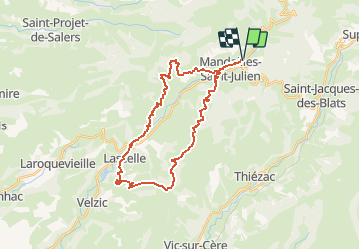
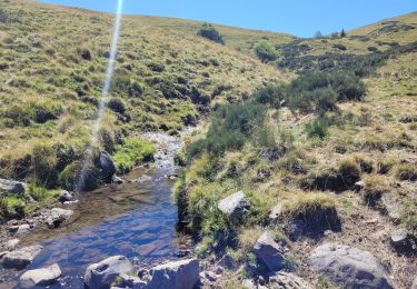
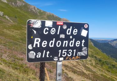
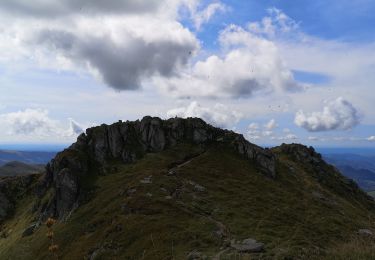
Ruta Bici de montaña de 31 km a descubrir en Auvergne-Rhône-Alpes, Cantal, Mandailles-Saint-Julien. Esta ruta ha sido propuesta por tracegps.
Descripción
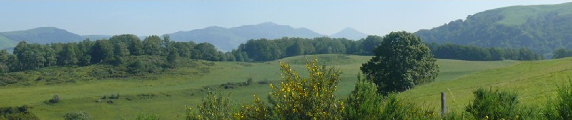
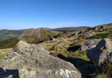
Espace VTT FFC – Grand Site du Puy Mary – Vallée de la Jordanne – Circuit N°4 La vallée de la Jordanne - Mandailles Saint Julien Circuit officiel labellisé par la Fédération Française de Cyclisme. Ce circuit reprend l’ancienne voierie rurale de la vallée de la Jordanne privilégiant des chemins vallonnés en piémont du Volcan. Vous roulez dans un bocage ombragé de St-Julien à Lascelle, riche en hameaux et villages coquets. Changement de décor sur l’autre versant avec la montagne et une succession de cols (Berganty ; Aisses ; Labro). La difficulté majeure reste l’ascension du Pempadouyre (1 289m). Vos efforts sont enfin récompensés par les « single tracks » ludiques qui vous ramènent vers la vallée et St-Julien de Jordanne.
Localización
Comentarios
Excursiones cerca
![Excursión Senderismo Mandailles-Saint-Julien - L'Elancèze - Photo](https://media.geolcdn.com/t/375/260/ext.jpg?maxdim=2&url=https%3A%2F%2Fservices.sitytrail.com%2FGeolivesWS%2FDownloadMedia.ashx%3FTrailID%3D103726%26Media%3D6387_2.jpg)
![Senderismo Senderismo](https://static1.geolcdn.com/sitytour/trail-icons/101.png)
Senderismo
![](/images/other/stat-length.png)
![](https://static1.geolcdn.com/siteimages/upload/files/16400158638029165_repeat_loop_refresh_sync_direction_icon.png)
![Excursión Senderismo Laveissière - Lioran 2023-08-18 Col de Rombière Col du Pertus A/R - Photo](https://media.geolcdn.com/t/375/260/ext.jpg?maxdim=2&url=https%3A%2F%2Fstatic1.geolcdn.com%2Fsiteimages%2Fupload%2Ffiles%2F1553511878bg_sport_marche.png)
![Senderismo Senderismo](https://static1.geolcdn.com/sitytour/trail-icons/101.png)
Senderismo
![](/images/other/stat-length.png)
![](https://static1.geolcdn.com/siteimages/upload/files/16400158638029165_repeat_loop_refresh_sync_direction_icon.png)
![Excursión Senderismo Laveissière - Lioran 2023-08-09 Puy de Seycheuse - Photo](https://media.geolcdn.com/t/375/260/ext.jpg?maxdim=2&url=https%3A%2F%2Fstatic1.geolcdn.com%2Fsiteimages%2Fupload%2Ffiles%2F1553511878bg_sport_marche.png)
![Senderismo Senderismo](https://static1.geolcdn.com/sitytour/trail-icons/101.png)
Senderismo
![](/images/other/stat-length.png)
![](https://static1.geolcdn.com/siteimages/upload/files/16400158638029165_repeat_loop_refresh_sync_direction_icon.png)
![Excursión Bicicleta híbrida Mandailles-Saint-Julien - Tournemire - Photo](https://media.geolcdn.com/t/375/260/e14f03b2-11fc-4b1e-a416-809203cb4d66.jpg&format=jpg&maxdim=2)
![Bicicleta híbrida Bicicleta híbrida](https://static1.geolcdn.com/sitytour/trail-icons/203.png)
Bicicleta híbrida
![](/images/other/stat-length.png)
![](https://static1.geolcdn.com/siteimages/upload/files/16400158638029165_repeat_loop_refresh_sync_direction_icon.png)
![Excursión Senderismo Mandailles-Saint-Julien - Mandailles Elanceze Col de Pertus - Photo](https://media.geolcdn.com/t/375/260/47acb562-9c7e-418d-99ca-e180c6cd6932.jpg&format=jpg&maxdim=2)
![Senderismo Senderismo](https://static1.geolcdn.com/sitytour/trail-icons/101.png)
Senderismo
![](/images/other/stat-length.png)
![](https://static1.geolcdn.com/siteimages/upload/files/16400158638029165_repeat_loop_refresh_sync_direction_icon.png)
![Excursión Senderismo Le Fau - Puy violent - Photo](https://media.geolcdn.com/t/375/260/abb730dc-c4ed-4c8e-b196-15e705b50c2c.jpg&format=jpg&maxdim=2)
![Senderismo Senderismo](https://static1.geolcdn.com/sitytour/trail-icons/101.png)
Senderismo
![](/images/other/stat-length.png)
![](https://static1.geolcdn.com/siteimages/upload/files/16400158638029165_repeat_loop_refresh_sync_direction_icon.png)
![Excursión Senderismo Laveissière - Lioran 2023-08-09 Puy de Seycheuse - Photo](https://media.geolcdn.com/t/375/260/2c958481-3205-4e5d-b01c-91f314f65f0b.jpg&format=jpg&maxdim=2)
![Senderismo Senderismo](https://static1.geolcdn.com/sitytour/trail-icons/101.png)
Senderismo
![](/images/other/stat-length.png)
![](https://static1.geolcdn.com/siteimages/upload/files/16400158638029165_repeat_loop_refresh_sync_direction_icon.png)
![Excursión Senderismo Le Falgoux - puy mary - Photo](https://media.geolcdn.com/t/375/260/4b95a1a6-fc74-487d-aed9-abef50730fd6.jpg&format=jpg&maxdim=2)
![Senderismo Senderismo](https://static1.geolcdn.com/sitytour/trail-icons/101.png)
Senderismo
![](/images/other/stat-length.png)
![](https://static1.geolcdn.com/siteimages/upload/files/16400158638029165_repeat_loop_refresh_sync_direction_icon.png)
![Excursión Senderismo Le Claux - Le Peyre Arse depuis le col d'Eylac - Photo](https://media.geolcdn.com/t/375/260/21ff7450-0249-4860-9e7d-c9fc3ca72740.jpg&format=jpg&maxdim=2)
![Senderismo Senderismo](https://static1.geolcdn.com/sitytour/trail-icons/101.png)
Senderismo
![](/images/other/stat-length.png)
![](https://static1.geolcdn.com/siteimages/upload/files/16400158638029165_repeat_loop_refresh_sync_direction_icon.png)