![](/images/other/stat-length.png)
![Excursión Raquetas de nieve Laveissière - Les crêtes du Cantal - Le Lioran - Photo](https://media.geolcdn.com/t/1900/400/ext.pjpeg?maxdim=2&url=https%3A%2F%2Fservices.sitytrail.com%2FGeolivesWS%2FDownloadMedia.ashx%3FTrailID%3D106123%26Media%3D10357_2.jpg)
Les crêtes du Cantal - Le Lioran
tracegps
Usuario
![Longitud](/images/other/stat-length.png)
![Altitud máxima](https://static1.geolcdn.com/siteimages/upload/files/1508320355ic_sort_altitude_max_24dp.png)
![Desnivel positivo](https://static1.geolcdn.com/siteimages/upload/files/1508320355ic_sort_den_pos_24dp.png)
![Km-Effort](/images/other/stat-length.png)
![Altitud mínima](https://static1.geolcdn.com/siteimages/upload/files/1508320355ic_sort_altitude_min_24dp.png)
![Desnivel negativo](https://static1.geolcdn.com/siteimages/upload/files/1508320355ic_sort_den_neg_24dp.png)
![Boucle](https://static1.geolcdn.com/siteimages/upload/files/16400158638029165_repeat_loop_refresh_sync_direction_icon.png)
![Raquetas de nieve](https://static1.geolcdn.com/sitytour/trail-icons/504.png)
9h00
Dificultad : Muy difícil
![Escanee este código QR para abrir la excursión en la aplicación SityTrail](https://capi.geolives.com/qq0zvz2zws4bq2lad0pu/sitytour/trails/106123/qr.png?size=200)
Aplicación GPS de excursión GRATIS
A propósito
Ruta Raquetas de nieve de 28 km a descubrir en Auvergne-Rhône-Alpes, Cantal, Laveissière. Esta ruta ha sido propuesta por tracegps.
Descripción
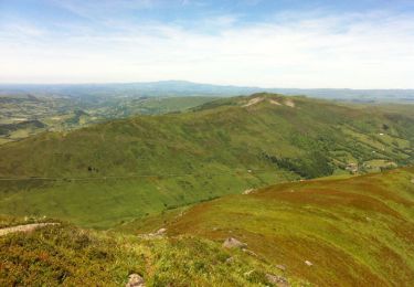
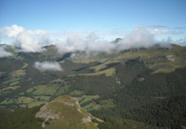
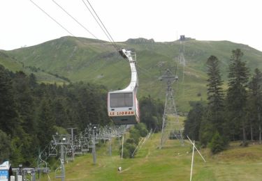
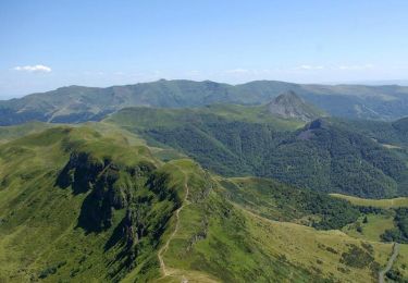
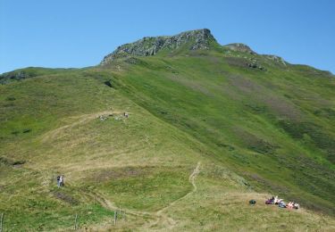
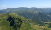
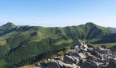
Circuit pouvant se faire sur 2 jours avec nuit à l'hôtel, maison d'hôte ou gîte d'étape à Mandailles (il y a aussi un camping à proximité) ou sur la journée pour les plus motivés (prévoir 8 bonnes heures avec le pique nique et quelques pauses). Circuit possible durant l'hiver si faible enneigement, mais prévoir crampons et piolets pour le passage ne nombreux névés sur les faces nord. Renseignez vous sur l'enneigement avant de partir. La première partie entre Le Lioran et Mandailles ne comporte pas de difficultés étant donné son profil plutôt descendant (800 m de dénivelé positif avec l'ascension du Griou). Il est possible de faire un aller/retour au sommet du Puy Griou en 30 minutes. Si vous êtes silencieux et observateur vous aurez peut être la chance de voir des marmottes sur les pentes du Griou (prévoyez les jumelles, ça vaut le coup!). S'en suit une longue descente en pente douce jusqu'au fond de la vallée de la Jordanne. La seconde partie s'avère plus ardue (1200 m de dénivelé positif) avec la montée assez raide jusqu'au Puy Chavaroche puis le Puy Mary. Sur cette partie vous pourrez apercevoir des chamois (pelage clair en été, noir en hiver, petites cornes) et des mouflons (grandes cornes en spirale chez les mâles).
Localización
Comentarios
Excursiones cerca
![Excursión Senderismo Albepierre-Bredons - Cantal - Col de Prat de Bouc Le Plomb du Cantal - 8.2km 450m 2h45 - 2019 07 06 - Photo](https://media.geolcdn.com/t/375/260/1b4e5d5e-f4da-4328-b35b-79db214ae669.jpg&format=jpg&maxdim=2)
![Senderismo Senderismo](https://static1.geolcdn.com/sitytour/trail-icons/101.png)
Senderismo
![](/images/other/stat-length.png)
![](https://static1.geolcdn.com/siteimages/upload/files/16400158638029165_repeat_loop_refresh_sync_direction_icon.png)
![Excursión Senderismo Lavigerie - Le Puy de Peyre Arse depuis la Gravière - Photo](https://media.geolcdn.com/t/375/260/ext.jpg?maxdim=2&url=https%3A%2F%2Fservices.sitytrail.com%2FGeolivesWS%2FDownloadMedia.ashx%3FTrailID%3D172317%26Media%3D13640_5.jpg)
![Senderismo Senderismo](https://static1.geolcdn.com/sitytour/trail-icons/101.png)
Senderismo
![](/images/other/stat-length.png)
![](https://static1.geolcdn.com/siteimages/upload/files/16400158638029165_repeat_loop_refresh_sync_direction_icon.png)
![Excursión Senderismo Laveissière - Le Puy Griou de Super Lioran - Photo](https://media.geolcdn.com/t/375/260/ext.jpg?maxdim=2&url=https%3A%2F%2Fservices.sitytrail.com%2FGeolivesWS%2FDownloadMedia.ashx%3FTrailID%3D105565%26Media%3D9330_5.jpg)
![Senderismo Senderismo](https://static1.geolcdn.com/sitytour/trail-icons/101.png)
Senderismo
![](/images/other/stat-length.png)
![](https://static1.geolcdn.com/siteimages/upload/files/16400158638029165_repeat_loop_refresh_sync_direction_icon.png)
![Excursión Senderismo Laveissière - Le plomb du Cantal - Le Lioran - Photo](https://media.geolcdn.com/t/375/260/ext.jpg?maxdim=2&url=https%3A%2F%2Fservices.sitytrail.com%2FGeolivesWS%2FDownloadMedia.ashx%3FTrailID%3D105562%26Media%3D9325_5.jpg)
![Senderismo Senderismo](https://static1.geolcdn.com/sitytour/trail-icons/101.png)
Senderismo
![](/images/other/stat-length.png)
![](https://static1.geolcdn.com/siteimages/upload/files/16400158638029165_repeat_loop_refresh_sync_direction_icon.png)
![Excursión Senderismo Laveissière - Les crêtes du Cantal - Le Lioran - Photo](https://media.geolcdn.com/t/375/260/ext.jpg?maxdim=2&url=https%3A%2F%2Fservices.sitytrail.com%2FGeolivesWS%2FDownloadMedia.ashx%3FTrailID%3D106122%26Media%3D10357_2.jpg)
![Senderismo Senderismo](https://static1.geolcdn.com/sitytour/trail-icons/101.png)
Senderismo
![](/images/other/stat-length.png)
![](https://static1.geolcdn.com/siteimages/upload/files/16400158638029165_repeat_loop_refresh_sync_direction_icon.png)
![Excursión Senderismo Laveissière - le Peyre Arse - Le Lioran - Photo](https://media.geolcdn.com/t/375/260/ext.jpg?maxdim=2&url=https%3A%2F%2Fservices.sitytrail.com%2FGeolivesWS%2FDownloadMedia.ashx%3FTrailID%3D103642%26Media%3D6060_2.jpg)
![Senderismo Senderismo](https://static1.geolcdn.com/sitytour/trail-icons/101.png)
Senderismo
![](/images/other/stat-length.png)
![](https://static1.geolcdn.com/siteimages/upload/files/16400158638029165_repeat_loop_refresh_sync_direction_icon.png)
![Excursión Senderismo Laveissière - Lioran 2023-08-18 Col de Rombière Col du Pertus A/R - Photo](https://media.geolcdn.com/t/375/260/ext.jpg?maxdim=2&url=https%3A%2F%2Fstatic1.geolcdn.com%2Fsiteimages%2Fupload%2Ffiles%2F1553511878bg_sport_marche.png)
![Senderismo Senderismo](https://static1.geolcdn.com/sitytour/trail-icons/101.png)
Senderismo
![](/images/other/stat-length.png)
![](https://static1.geolcdn.com/siteimages/upload/files/16400158638029165_repeat_loop_refresh_sync_direction_icon.png)
![Excursión Senderismo Laveissière - Lioran 2023-08-11 Col du Pertus - Photo](https://media.geolcdn.com/t/375/260/ext.jpg?maxdim=2&url=https%3A%2F%2Fstatic1.geolcdn.com%2Fsiteimages%2Fupload%2Ffiles%2F1553511878bg_sport_marche.png)
![Senderismo Senderismo](https://static1.geolcdn.com/sitytour/trail-icons/101.png)
Senderismo
![](/images/other/stat-length.png)
![](https://static1.geolcdn.com/siteimages/upload/files/16400158638029165_repeat_loop_refresh_sync_direction_icon.png)
![Excursión Senderismo Laveissière - Lioran 2023-08-09 Puy de Seycheuse - Photo](https://media.geolcdn.com/t/375/260/ext.jpg?maxdim=2&url=https%3A%2F%2Fstatic1.geolcdn.com%2Fsiteimages%2Fupload%2Ffiles%2F1553511878bg_sport_marche.png)
![Senderismo Senderismo](https://static1.geolcdn.com/sitytour/trail-icons/101.png)
Senderismo
![](/images/other/stat-length.png)
![](https://static1.geolcdn.com/siteimages/upload/files/16400158638029165_repeat_loop_refresh_sync_direction_icon.png)