![](/images/other/stat-length.png)
![Excursión Carrera Lesneven - Lesneven boucle 4 - Photo](https://media.geolcdn.com/t/1900/400/ext.pjpeg?maxdim=2&url=https%3A%2F%2Fstatic1.geolcdn.com%2Fsiteimages%2Fupload%2Ffiles%2F1524743154running.jpg)
Lesneven boucle 4
tracegps
Usuario
![Longitud](/images/other/stat-length.png)
Longitud
8,1 km
![Altitud máxima](https://static1.geolcdn.com/siteimages/upload/files/1508320355ic_sort_altitude_max_24dp.png)
Altitud máxima
81 m
![Desnivel positivo](https://static1.geolcdn.com/siteimages/upload/files/1508320355ic_sort_den_pos_24dp.png)
Desnivel positivo
53 m
![Km-Effort](/images/other/stat-length.png)
Km-Effort
8,8 km
![Altitud mínima](https://static1.geolcdn.com/siteimages/upload/files/1508320355ic_sort_altitude_min_24dp.png)
Altitud mínima
52 m
![Desnivel negativo](https://static1.geolcdn.com/siteimages/upload/files/1508320355ic_sort_den_neg_24dp.png)
Desnivel negativo
53 m
![Boucle](https://static1.geolcdn.com/siteimages/upload/files/16400158638029165_repeat_loop_refresh_sync_direction_icon.png)
Boucle
Sí
Fecha de creación :
2014-12-10 00:00:00.0
Última modificación :
2014-12-10 00:00:00.0
![Carrera](https://static1.geolcdn.com/sitytour/trail-icons/103.png)
1h00
Dificultad : Medio
![Escanee este código QR para abrir la excursión en la aplicación SityTrail](https://capi.geolives.com/qq0zvz2zws4bq2lad0pu/sitytour/trails/105071/qr.png?size=200)
Aplicación GPS de excursión GRATIS
A propósito
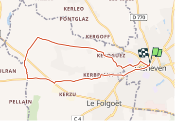
Ruta Carrera de 8,1 km a descubrir en Bretaña, Finisterre, Lesneven. Esta ruta ha sido propuesta por tracegps.
Descripción
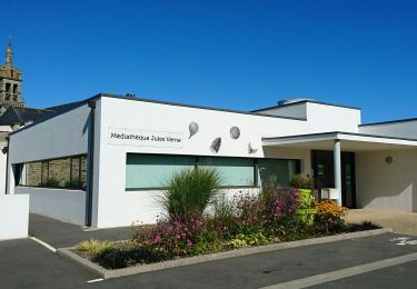
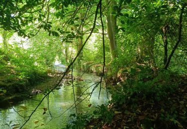
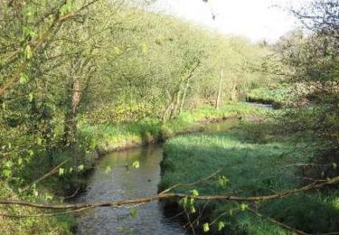
Depuis la place du Maréchal Foch de Lesneven direction la rue St Anne pour rejoindre le complexe Saint-Exupéry puis la campagne bocagère avant le retour par des chemins vicinaux.
Localización
País:
France
Región :
Bretaña
Departamento/provincia :
Finisterre
Municipio :
Lesneven
Localidad:
Unknown
Salida:(Dec)
Salida:(UTM)
402366 ; 5380828 (30U) N.
Comentarios
Excursiones cerca
![Excursión Marcha nórdica Le Drennec - le drennec Loc brevelaire - Photo](https://media.geolcdn.com/t/375/260/ab9b6792-4dee-4bbb-bccb-494bcc9e5ee2.jpg&format=jpg&maxdim=2)
![Marcha nórdica Marcha nórdica](https://static1.geolcdn.com/sitytour/trail-icons/102.png)
le drennec Loc brevelaire
Marcha nórdica
Muy fácil
Le Drennec,
Bretaña,
Finisterre,
France
![](/images/other/stat-length.png)
13 km | 14,6 km-effort
2h 48min
![](https://static1.geolcdn.com/siteimages/upload/files/16400158638029165_repeat_loop_refresh_sync_direction_icon.png)
Sí
![Excursión Marcha nórdica Saint-Méen - st méen - Photo](https://media.geolcdn.com/t/375/260/053ac6aa-b95e-4a19-92c5-ec066113aa0b.jpg&format=jpg&maxdim=2)
![Marcha nórdica Marcha nórdica](https://static1.geolcdn.com/sitytour/trail-icons/102.png)
st méen
Marcha nórdica
Muy fácil
Saint-Méen,
Bretaña,
Finisterre,
France
![](/images/other/stat-length.png)
14,9 km | 17,2 km-effort
2h 57min
![](https://static1.geolcdn.com/siteimages/upload/files/16400158638029165_repeat_loop_refresh_sync_direction_icon.png)
Sí
![Excursión A pie Lanarvily - Boucle du Pays de Lesneven - Photo](https://media.geolcdn.com/t/375/260/eeb804c4-01ae-4c34-86e2-cd1b3e03bef7.jpeg&format=jpg&maxdim=2)
![A pie A pie](https://static1.geolcdn.com/sitytour/trail-icons/100.png)
Boucle du Pays de Lesneven
A pie
Fácil
Lanarvily,
Bretaña,
Finisterre,
France
![](/images/other/stat-length.png)
5,7 km | 6,9 km-effort
1h 34min
![](https://static1.geolcdn.com/siteimages/upload/files/16400158638029165_repeat_loop_refresh_sync_direction_icon.png)
No
![Excursión A pie Plouider - Poul Sant Dider - Photo](https://media.geolcdn.com/t/375/260/66d4aee4-cd7f-42c9-b6ca-da83a1ae6e61.jpeg&format=jpg&maxdim=2)
![A pie A pie](https://static1.geolcdn.com/sitytour/trail-icons/100.png)
Poul Sant Dider
A pie
Fácil
Plouider,
Bretaña,
Finisterre,
France
![](/images/other/stat-length.png)
6,3 km | 7,4 km-effort
1h 41min
![](https://static1.geolcdn.com/siteimages/upload/files/16400158638029165_repeat_loop_refresh_sync_direction_icon.png)
Sí
![Excursión Marcha nórdica Le Drennec - le drenec. Loc brevelaire - Photo](https://media.geolcdn.com/t/375/260/740b1ba6-50e9-4a18-8c3b-78b478faa9f7.jpg&format=jpg&maxdim=2)
![Marcha nórdica Marcha nórdica](https://static1.geolcdn.com/sitytour/trail-icons/102.png)
le drenec. Loc brevelaire
Marcha nórdica
Muy fácil
Le Drennec,
Bretaña,
Finisterre,
France
![](/images/other/stat-length.png)
17,6 km | 21 km-effort
3h 43min
![](https://static1.geolcdn.com/siteimages/upload/files/16400158638029165_repeat_loop_refresh_sync_direction_icon.png)
Sí
![Excursión Senderismo Le Drennec - De Le Drennec à Lannilis le long de l'Aber Wrac'h - Photo](https://media.geolcdn.com/t/375/260/ext.jpg?maxdim=2&url=https%3A%2F%2Fservices.sitytrail.com%2FGeolivesWS%2FDownloadMedia.ashx%3FTrailID%3D109179%26Media%3D3222_1.jpg)
![Senderismo Senderismo](https://static1.geolcdn.com/sitytour/trail-icons/101.png)
De Le Drennec à Lannilis le long de l'Aber Wrac'h
Senderismo
Difícil
(1)
Le Drennec,
Bretaña,
Finisterre,
France
![](/images/other/stat-length.png)
19,4 km | 24 km-effort
4h 30min
![](https://static1.geolcdn.com/siteimages/upload/files/16400158638029165_repeat_loop_refresh_sync_direction_icon.png)
No
![Excursión Senderismo Kernouës - kernoues - Photo](https://media.geolcdn.com/t/375/260/f29b426d-e429-43f3-9cb7-94a586858472.jpg&format=jpg&maxdim=2)
![Senderismo Senderismo](https://static1.geolcdn.com/sitytour/trail-icons/101.png)
kernoues
Senderismo
Muy fácil
Kernouës,
Bretaña,
Finisterre,
France
![](/images/other/stat-length.png)
5 km | 5,9 km-effort
1h 11min
![](https://static1.geolcdn.com/siteimages/upload/files/16400158638029165_repeat_loop_refresh_sync_direction_icon.png)
No
![Excursión Senderismo Plouider - De Pont du Chatel à Treflez par la chapelle de Santez Ventroc - Photo](https://media.geolcdn.com/t/375/260/ext.jpg?maxdim=2&url=https%3A%2F%2Fstatic1.geolcdn.com%2Fsiteimages%2Fupload%2Ffiles%2F1553511878bg_sport_marche.png)
![Senderismo Senderismo](https://static1.geolcdn.com/sitytour/trail-icons/101.png)
De Pont du Chatel à Treflez par la chapelle de Santez Ventroc
Senderismo
Difícil
Plouider,
Bretaña,
Finisterre,
France
![](/images/other/stat-length.png)
20 km | 23 km-effort
5h 0min
![](https://static1.geolcdn.com/siteimages/upload/files/16400158638029165_repeat_loop_refresh_sync_direction_icon.png)
Sí
![Excursión Bici de montaña Lesneven - Lesneven boucle 4 - Photo](https://media.geolcdn.com/t/375/260/ext.jpg?maxdim=2&url=https%3A%2F%2Fstatic1.geolcdn.com%2Fsiteimages%2Fupload%2Ffiles%2F1524743154velo.jpg)
![Bici de montaña Bici de montaña](https://static1.geolcdn.com/sitytour/trail-icons/202.png)
Lesneven boucle 4
Bici de montaña
Fácil
Lesneven,
Bretaña,
Finisterre,
France
![](/images/other/stat-length.png)
8,1 km | 8,8 km-effort
30min
![](https://static1.geolcdn.com/siteimages/upload/files/16400158638029165_repeat_loop_refresh_sync_direction_icon.png)
Sí