![](/images/other/stat-length.png)
![Excursión Carrera Bruz - Bruz - Chemin de halage - Pont Rean - Boël - 16km - Photo](https://media.geolcdn.com/t/1900/400/ext.pjpeg?maxdim=2&url=https%3A%2F%2Fstatic1.geolcdn.com%2Fsiteimages%2Fupload%2Ffiles%2F1524743154running.jpg)
Bruz - Chemin de halage - Pont Rean - Boël - 16km
tracegps
Usuario
![Longitud](/images/other/stat-length.png)
![Altitud máxima](https://static1.geolcdn.com/siteimages/upload/files/1508320355ic_sort_altitude_max_24dp.png)
![Desnivel positivo](https://static1.geolcdn.com/siteimages/upload/files/1508320355ic_sort_den_pos_24dp.png)
![Km-Effort](/images/other/stat-length.png)
![Altitud mínima](https://static1.geolcdn.com/siteimages/upload/files/1508320355ic_sort_altitude_min_24dp.png)
![Desnivel negativo](https://static1.geolcdn.com/siteimages/upload/files/1508320355ic_sort_den_neg_24dp.png)
![Boucle](https://static1.geolcdn.com/siteimages/upload/files/16400158638029165_repeat_loop_refresh_sync_direction_icon.png)
![Carrera](https://static1.geolcdn.com/sitytour/trail-icons/103.png)
1h30
Dificultad : Medio
![Escanee este código QR para abrir la excursión en la aplicación SityTrail](https://capi.geolives.com/qq0zvz2zws4bq2lad0pu/sitytour/trails/104488/qr.png?size=200)
Aplicación GPS de excursión GRATIS
A propósito
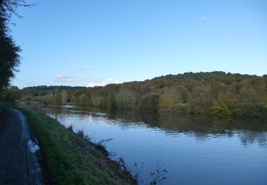
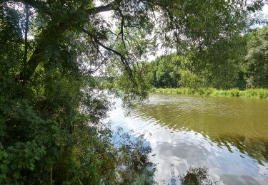
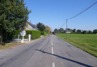
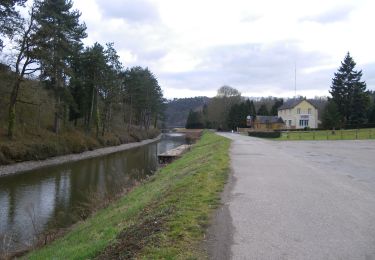
Ruta Carrera de 16 km a descubrir en Bretaña, Ille-et-Vilaine, Bruz. Esta ruta ha sido propuesta por tracegps.
Descripción
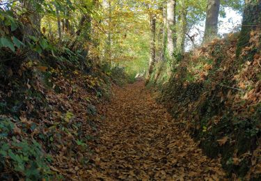
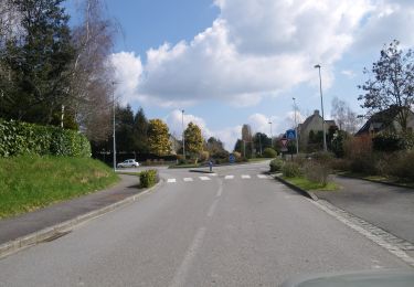
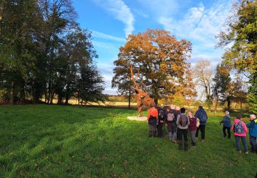
Parcours au sud ouest de Bruz. Départ via le parc de l'an 2000 avant de rejoindre le bord de Vilaine. Chemin de halage jusqu'à Pont-Réan où l'on change de rive en prenant le pont. Puis direction Le Boël, toujours par le chemin de halage. On retraverse la rive par le pont de chemin de fer. Puis retour vers Bruz via les petites routes qui permettent de découvrir de belles maisons rénovées à partir d'anciens corps de fermes. Parcours plat, aucune difficulté. un peu gras en temps de pluie
Localización
Comentarios
Excursiones cerca
![Excursión Bici de montaña Pont-Péan - Le long de la Vilaine - Pont Péan - Photo](https://media.geolcdn.com/t/375/260/ext.jpg?maxdim=2&url=https%3A%2F%2Fservices.sitytrail.com%2FGeolivesWS%2FDownloadMedia.ashx%3FTrailID%3D214889%26Media%3D15441_3.jpg)
![Bici de montaña Bici de montaña](https://static1.geolcdn.com/sitytour/trail-icons/202.png)
Bici de montaña
![](/images/other/stat-length.png)
![](https://static1.geolcdn.com/siteimages/upload/files/16400158638029165_repeat_loop_refresh_sync_direction_icon.png)
![Excursión Senderismo Pont-Péan - Randonnée autour de Pont-Péan - Photo](https://media.geolcdn.com/t/375/260/ext.jpg?maxdim=2&url=https%3A%2F%2Fservices.sitytrail.com%2FGeolivesWS%2FDownloadMedia.ashx%3FTrailID%3D191361%26Media%3D14926_3.jpg)
![Senderismo Senderismo](https://static1.geolcdn.com/sitytour/trail-icons/101.png)
Senderismo
![](/images/other/stat-length.png)
![](https://static1.geolcdn.com/siteimages/upload/files/16400158638029165_repeat_loop_refresh_sync_direction_icon.png)
![Excursión A pie Laillé - Laillé la Chapelle - Photo](https://media.geolcdn.com/t/375/260/80425336-5829-4a9b-bf94-af8dc6722242.jpeg&format=jpg&maxdim=2)
![A pie A pie](https://static1.geolcdn.com/sitytour/trail-icons/100.png)
A pie
![](/images/other/stat-length.png)
![](https://static1.geolcdn.com/siteimages/upload/files/16400158638029165_repeat_loop_refresh_sync_direction_icon.png)
![Excursión A pie Guichen - Les landes du Boël - Photo](https://media.geolcdn.com/t/375/260/1813c78e-bc32-4e6c-94ee-9a2d64ec30b9.jpeg&format=jpg&maxdim=2)
![A pie A pie](https://static1.geolcdn.com/sitytour/trail-icons/100.png)
A pie
![](/images/other/stat-length.png)
![](https://static1.geolcdn.com/siteimages/upload/files/16400158638029165_repeat_loop_refresh_sync_direction_icon.png)
![Excursión A pie Guichen - Les bords de Vilaine - Photo](https://media.geolcdn.com/t/375/260/8b284707-f183-43bc-8580-95dab992180f.jpeg&format=jpg&maxdim=2)
![A pie A pie](https://static1.geolcdn.com/sitytour/trail-icons/100.png)
A pie
![](/images/other/stat-length.png)
![](https://static1.geolcdn.com/siteimages/upload/files/16400158638029165_repeat_loop_refresh_sync_direction_icon.png)
![Excursión A pie Guichen - Pont-Réan Le Boël - Photo](https://media.geolcdn.com/t/375/260/e213902f-f4f2-441e-8674-df4f61e7aed3.jpeg&format=jpg&maxdim=2)
![A pie A pie](https://static1.geolcdn.com/sitytour/trail-icons/100.png)
A pie
![](/images/other/stat-length.png)
![](https://static1.geolcdn.com/siteimages/upload/files/16400158638029165_repeat_loop_refresh_sync_direction_icon.png)
![Excursión Senderismo Laillé - Laillé, Roche qui chome - Photo](https://media.geolcdn.com/t/375/260/420863b8-58d5-4ae8-816c-3f076cdd0c92.jpg&format=jpg&maxdim=2)
![Senderismo Senderismo](https://static1.geolcdn.com/sitytour/trail-icons/101.png)
Senderismo
![](/images/other/stat-length.png)
![](https://static1.geolcdn.com/siteimages/upload/files/16400158638029165_repeat_loop_refresh_sync_direction_icon.png)
![Excursión A pie Orgères - Circuit des deux Monts et du Télégraphe - Photo](https://media.geolcdn.com/t/375/260/610afbfe-2a2c-4336-a051-18e768a6f818.jpeg&format=jpg&maxdim=2)
![A pie A pie](https://static1.geolcdn.com/sitytour/trail-icons/100.png)
A pie
![](/images/other/stat-length.png)
![](https://static1.geolcdn.com/siteimages/upload/files/16400158638029165_repeat_loop_refresh_sync_direction_icon.png)
![Excursión Senderismo Guichen - pont rean - Photo](https://media.geolcdn.com/t/375/260/65f98fc0-d3d5-4bdf-9405-7defdae3d94b.jpg&format=jpg&maxdim=2)
![Senderismo Senderismo](https://static1.geolcdn.com/sitytour/trail-icons/101.png)
Senderismo
![](/images/other/stat-length.png)
![](https://static1.geolcdn.com/siteimages/upload/files/16400158638029165_repeat_loop_refresh_sync_direction_icon.png)