![](/images/other/stat-length.png)
![Excursión Senderismo Wancourt - Wancourt - Guémappe - Heninel - Photo](https://media.geolcdn.com/t/1900/400/ext.pjpeg?maxdim=2&url=https%3A%2F%2Fservices.sitytrail.com%2FGeolivesWS%2FDownloadMedia.ashx%3FTrailID%3D104471%26Media%3D7772_1.jpg)
Wancourt - Guémappe - Heninel
tracegps
Usuario
![Longitud](/images/other/stat-length.png)
Longitud
10,1 km
![Altitud máxima](https://static1.geolcdn.com/siteimages/upload/files/1508320355ic_sort_altitude_max_24dp.png)
Altitud máxima
90 m
![Desnivel positivo](https://static1.geolcdn.com/siteimages/upload/files/1508320355ic_sort_den_pos_24dp.png)
Desnivel positivo
89 m
![Km-Effort](/images/other/stat-length.png)
Km-Effort
11,2 km
![Altitud mínima](https://static1.geolcdn.com/siteimages/upload/files/1508320355ic_sort_altitude_min_24dp.png)
Altitud mínima
52 m
![Desnivel negativo](https://static1.geolcdn.com/siteimages/upload/files/1508320355ic_sort_den_neg_24dp.png)
Desnivel negativo
90 m
![Boucle](https://static1.geolcdn.com/siteimages/upload/files/16400158638029165_repeat_loop_refresh_sync_direction_icon.png)
Boucle
Sí
Fecha de creación :
2014-12-10 00:00:00.0
Última modificación :
2014-12-10 00:00:00.0
![Senderismo](https://static1.geolcdn.com/sitytour/trail-icons/101.png)
2h00
Dificultad : Medio
![Escanee este código QR para abrir la excursión en la aplicación SityTrail](https://capi.geolives.com/qq0zvz2zws4bq2lad0pu/sitytour/trails/104471/qr.png?size=200)
Aplicación GPS de excursión GRATIS
A propósito
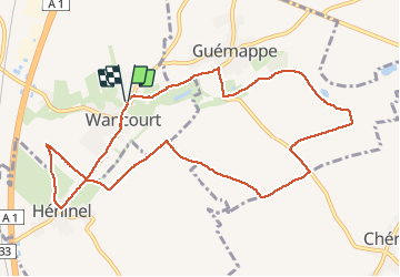
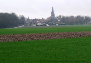
Ruta Senderismo de 10,1 km a descubrir en Alta Francia, Paso de Calais, Wancourt. Esta ruta ha sido propuesta por tracegps.
Descripción
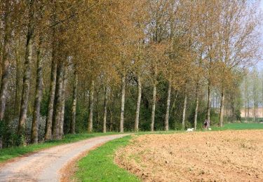
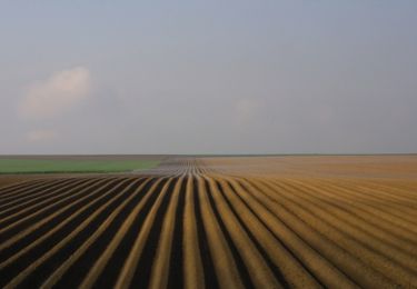
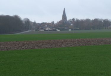
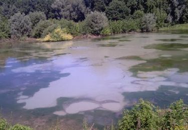
Randonnée au départ de Wancourt qui nous fait longer la petite sensée puis rejoint Heninel en empruntant des chemins de champ.
Localización
País:
France
Región :
Alta Francia
Departamento/provincia :
Paso de Calais
Municipio :
Wancourt
Localidad:
Unknown
Salida:(Dec)
Salida:(UTM)
490945 ; 5566335 (31U) N.
Comentarios
Excursiones cerca
![Excursión Senderismo Monchy-le-Preux - Le chemin du Caribou - Monchy le Preux - Photo](https://media.geolcdn.com/t/375/260/ext.jpg?maxdim=2&url=https%3A%2F%2Fservices.sitytrail.com%2FGeolivesWS%2FDownloadMedia.ashx%3FTrailID%3D109907%26Media%3D4917_5.jpg)
![Senderismo Senderismo](https://static1.geolcdn.com/sitytour/trail-icons/101.png)
Le chemin du Caribou - Monchy le Preux
Senderismo
Medio
(1)
Monchy-le-Preux,
Alta Francia,
Paso de Calais,
France
![](/images/other/stat-length.png)
9,2 km | 10,1 km-effort
2h 19min
![](https://static1.geolcdn.com/siteimages/upload/files/16400158638029165_repeat_loop_refresh_sync_direction_icon.png)
Sí
![Excursión Senderismo Neuville-Vitasse - Le chemin de la crête Picarde - Neuville-Vitasse - Photo](https://media.geolcdn.com/t/375/260/ext.jpg?maxdim=2&url=https%3A%2F%2Fservices.sitytrail.com%2FGeolivesWS%2FDownloadMedia.ashx%3FTrailID%3D110049%26Media%3D5158_4.jpg)
![Senderismo Senderismo](https://static1.geolcdn.com/sitytour/trail-icons/101.png)
Le chemin de la crête Picarde - Neuville-Vitasse
Senderismo
Medio
Neuville-Vitasse,
Alta Francia,
Paso de Calais,
France
![](/images/other/stat-length.png)
10,4 km | 11,4 km-effort
2h 40min
![](https://static1.geolcdn.com/siteimages/upload/files/16400158638029165_repeat_loop_refresh_sync_direction_icon.png)
Sí
![Excursión Senderismo Chérisy - De Chérisy à Guémappe par les verts Sablons - Photo](https://media.geolcdn.com/t/375/260/ext.jpg?maxdim=2&url=https%3A%2F%2Fservices.sitytrail.com%2FGeolivesWS%2FDownloadMedia.ashx%3FTrailID%3D191417%26Media%3D14999_1.jpg)
![Senderismo Senderismo](https://static1.geolcdn.com/sitytour/trail-icons/101.png)
De Chérisy à Guémappe par les verts Sablons
Senderismo
Medio
Chérisy,
Alta Francia,
Paso de Calais,
France
![](/images/other/stat-length.png)
10,3 km | 11,5 km-effort
2h 0min
![](https://static1.geolcdn.com/siteimages/upload/files/16400158638029165_repeat_loop_refresh_sync_direction_icon.png)
Sí
![Excursión Senderismo Wancourt - Wancourt - Héninel - Guémappe - Photo](https://media.geolcdn.com/t/375/260/ext.jpg?maxdim=2&url=https%3A%2F%2Fservices.sitytrail.com%2FGeolivesWS%2FDownloadMedia.ashx%3FTrailID%3D129614%26Media%3D13131_2.jpg)
![Senderismo Senderismo](https://static1.geolcdn.com/sitytour/trail-icons/101.png)
Wancourt - Héninel - Guémappe
Senderismo
Medio
Wancourt,
Alta Francia,
Paso de Calais,
France
![](/images/other/stat-length.png)
10,4 km | 11,3 km-effort
2h 0min
![](https://static1.geolcdn.com/siteimages/upload/files/16400158638029165_repeat_loop_refresh_sync_direction_icon.png)
Sí
![Excursión Senderismo Wancourt - Le chemin de la petite Sensée - Wancourt - Photo](https://media.geolcdn.com/t/375/260/ext.jpg?maxdim=2&url=https%3A%2F%2Fservices.sitytrail.com%2FGeolivesWS%2FDownloadMedia.ashx%3FTrailID%3D110047%26Media%3D5156_2.jpg)
![Senderismo Senderismo](https://static1.geolcdn.com/sitytour/trail-icons/101.png)
Le chemin de la petite Sensée - Wancourt
Senderismo
Medio
Wancourt,
Alta Francia,
Paso de Calais,
France
![](/images/other/stat-length.png)
10,9 km | 12,2 km-effort
2h 45min
![](https://static1.geolcdn.com/siteimages/upload/files/16400158638029165_repeat_loop_refresh_sync_direction_icon.png)
Sí
![Excursión Senderismo Wancourt - Wancourt - Heninel - Domaine des cascades - Photo](https://media.geolcdn.com/t/375/260/ext.jpg?maxdim=2&url=https%3A%2F%2Fservices.sitytrail.com%2FGeolivesWS%2FDownloadMedia.ashx%3FTrailID%3D106529%26Media%3D11084_1.jpg)
![Senderismo Senderismo](https://static1.geolcdn.com/sitytour/trail-icons/101.png)
Wancourt - Heninel - Domaine des cascades
Senderismo
Medio
Wancourt,
Alta Francia,
Paso de Calais,
France
![](/images/other/stat-length.png)
10,8 km | 12,1 km-effort
2h 0min
![](https://static1.geolcdn.com/siteimages/upload/files/16400158638029165_repeat_loop_refresh_sync_direction_icon.png)
Sí
![Excursión Senderismo Monchy-le-Preux - Monchy le Preux - Photo](https://media.geolcdn.com/t/375/260/ext.jpg?maxdim=2&url=https%3A%2F%2Fservices.sitytrail.com%2FGeolivesWS%2FDownloadMedia.ashx%3FTrailID%3D106359%26Media%3D10835_1.jpg)
![Senderismo Senderismo](https://static1.geolcdn.com/sitytour/trail-icons/101.png)
Monchy le Preux
Senderismo
Medio
Monchy-le-Preux,
Alta Francia,
Paso de Calais,
France
![](/images/other/stat-length.png)
9,7 km | 10,6 km-effort
2h 0min
![](https://static1.geolcdn.com/siteimages/upload/files/16400158638029165_repeat_loop_refresh_sync_direction_icon.png)
Sí
![Excursión Senderismo Vis-en-Artois - Vis en Artois - Rémy - Photo](https://media.geolcdn.com/t/375/260/ext.jpg?maxdim=2&url=https%3A%2F%2Fservices.sitytrail.com%2FGeolivesWS%2FDownloadMedia.ashx%3FTrailID%3D106185%26Media%3D10473_1.jpg)
![Senderismo Senderismo](https://static1.geolcdn.com/sitytour/trail-icons/101.png)
Vis en Artois - Rémy
Senderismo
Medio
Vis-en-Artois,
Alta Francia,
Paso de Calais,
France
![](/images/other/stat-length.png)
10 km | 11,1 km-effort
2h 0min
![](https://static1.geolcdn.com/siteimages/upload/files/16400158638029165_repeat_loop_refresh_sync_direction_icon.png)
Sí
![Excursión Senderismo Pelves - Pelves - Monchy le Preux - Boiry Notre Dame - Photo](https://media.geolcdn.com/t/375/260/ext.jpg?maxdim=2&url=https%3A%2F%2Fservices.sitytrail.com%2FGeolivesWS%2FDownloadMedia.ashx%3FTrailID%3D104118%26Media%3D7188_1.jpg)
![Senderismo Senderismo](https://static1.geolcdn.com/sitytour/trail-icons/101.png)
Pelves - Monchy le Preux - Boiry Notre Dame
Senderismo
Medio
Pelves,
Alta Francia,
Paso de Calais,
France
![](/images/other/stat-length.png)
9,9 km | 11,2 km-effort
2h 0min
![](https://static1.geolcdn.com/siteimages/upload/files/16400158638029165_repeat_loop_refresh_sync_direction_icon.png)
Sí