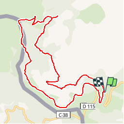
![](/images/other/stat-length.png)
![Excursión Bici de montaña Prats-de-Mollo-la-Preste - Espace VTT FFC Haut Vallespir - circuit n° 3 - La Chapelle Ste Marguerite de Prats de Mollo - Photo](https://media.geolcdn.com/t/1900/400/ext.pjpeg?maxdim=2&url=https%3A%2F%2Fservices.sitytrail.com%2FGeolivesWS%2FDownloadMedia.ashx%3FTrailID%3D104346%26Media%3D7586_2.jpg)
Espace VTT FFC Haut Vallespir - circuit n° 3 - La Chapelle Ste Marguerite de Prats de Mollo
tracegps
Usuario
![Longitud](/images/other/stat-length.png)
![Altitud máxima](https://static1.geolcdn.com/siteimages/upload/files/1508320355ic_sort_altitude_max_24dp.png)
![Desnivel positivo](https://static1.geolcdn.com/siteimages/upload/files/1508320355ic_sort_den_pos_24dp.png)
![Km-Effort](/images/other/stat-length.png)
![Altitud mínima](https://static1.geolcdn.com/siteimages/upload/files/1508320355ic_sort_altitude_min_24dp.png)
![Desnivel negativo](https://static1.geolcdn.com/siteimages/upload/files/1508320355ic_sort_den_neg_24dp.png)
![Boucle](https://static1.geolcdn.com/siteimages/upload/files/16400158638029165_repeat_loop_refresh_sync_direction_icon.png)
![Bici de montaña](https://static1.geolcdn.com/sitytour/trail-icons/202.png)
1h15
Dificultad : Fácil
![Escanee este código QR para abrir la excursión en la aplicación SityTrail](https://capi.geolives.com/qq0zvz2zws4bq2lad0pu/sitytour/trails/104346/qr.png?size=200)
Aplicación GPS de excursión GRATIS
A propósito
Ruta Bici de montaña de 12,6 km a descubrir en Occitania, Pirineos Orientales, Prats-de-Mollo-la-Preste. Esta ruta ha sido propuesta por tracegps.
Descripción
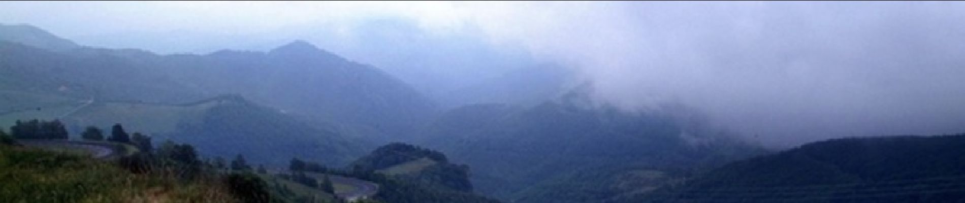
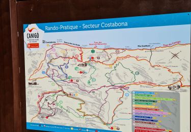
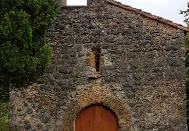
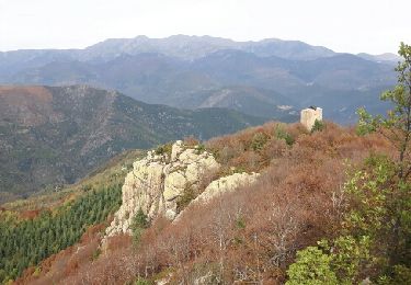
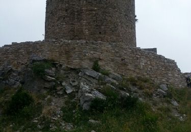
Espace VTT FFC Haut Vallespir - circuit n° 3 - La Chapelle Ste Marguerite Circuit officiel labellisé par la Fédération Française de Cyclisme. Une bonne initiation de balade à VTT en montagne, avec quelques côtes à escalader et du pédalage au dessus de1000 mètres. Aucune difficulté technique, avec une grande partie du retour qui s’effectue en sous-bois. Des paysages à couper le souffle au beau milieu “des estives” ou se côtoie chevaux lourds et vaches gasconnes. Une halte à la Tour de Mir s’impose afin de profiter d’une vue unique sur la vallée, le village et le Fort de Prats-de-Mollo. En fin de parcours testez donc l’accueil à la Catalane dans la vieille ville de Prats protégée derrière ses remparts. Sinon, en prenant de l’altitude vous pouvez aussi pousser jusqu’au col d’Ares pour jouir d’un panorama hors du commun avec vue sur la mer et la chaîne des Pyrénées.
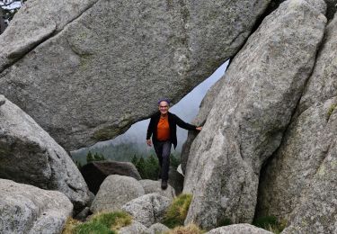
Localización
Comentarios
Excursiones cerca
![Excursión Senderismo Prats-de-Mollo-la-Preste - Parts de Mollo - Photo](https://media.geolcdn.com/t/375/260/a323d879-2e3b-49e8-a319-14cd0114ee0f.jpg&format=jpg&maxdim=2)
![Senderismo Senderismo](https://static1.geolcdn.com/sitytour/trail-icons/101.png)
Senderismo
![](/images/other/stat-length.png)
![](https://static1.geolcdn.com/siteimages/upload/files/16400158638029165_repeat_loop_refresh_sync_direction_icon.png)
![Excursión Senderismo Prats-de-Mollo-la-Preste - col du miracle a pratiquement de mollo - Photo](https://media.geolcdn.com/t/375/260/7083b552-6fd4-47f6-9fb0-9d75c7868b46.jpg&format=jpg&maxdim=2)
![Senderismo Senderismo](https://static1.geolcdn.com/sitytour/trail-icons/101.png)
Senderismo
![](/images/other/stat-length.png)
![](https://static1.geolcdn.com/siteimages/upload/files/16400158638029165_repeat_loop_refresh_sync_direction_icon.png)
![Excursión Senderismo Prats-de-Mollo-la-Preste - Costabone via Siern Esquerdes de roja Rocarodona La Preste - Photo](https://media.geolcdn.com/t/375/260/5a9b2aaa-e81c-4ab0-ba2f-ee276fb16f06.jpg&format=jpg&maxdim=2)
![Senderismo Senderismo](https://static1.geolcdn.com/sitytour/trail-icons/101.png)
Senderismo
![](/images/other/stat-length.png)
![](https://static1.geolcdn.com/siteimages/upload/files/16400158638029165_repeat_loop_refresh_sync_direction_icon.png)
![Excursión Senderismo Prats-de-Mollo-la-Preste - Le Chalet -La Forge -Col Pregon -Col de Siern - Le Chalet . - Photo](https://media.geolcdn.com/t/375/260/3225b7ee-f250-49e8-b7c0-938203cb4be0.jpg&format=jpg&maxdim=2)
![Senderismo Senderismo](https://static1.geolcdn.com/sitytour/trail-icons/101.png)
Senderismo
![](/images/other/stat-length.png)
![](https://static1.geolcdn.com/siteimages/upload/files/16400158638029165_repeat_loop_refresh_sync_direction_icon.png)
![Excursión Senderismo Molló - Tour de Mir (20/9/2018) - Photo](https://media.geolcdn.com/t/375/260/ef1914cd-274d-423f-8146-4fa054ce416c.jpg&format=jpg&maxdim=2)
![Senderismo Senderismo](https://static1.geolcdn.com/sitytour/trail-icons/101.png)
Senderismo
![](/images/other/stat-length.png)
![](https://static1.geolcdn.com/siteimages/upload/files/16400158638029165_repeat_loop_refresh_sync_direction_icon.png)
![Excursión Senderismo Lamanère - lamanere-coral_T - Photo](https://media.geolcdn.com/t/375/260/ext.jpg?maxdim=2&url=https%3A%2F%2Fservices.sitytrail.com%2FGeolivesWS%2FDownloadMedia.ashx%3FTrailID%3D796946%26Media%3D32ecc32a-7201-496c-b2f2-a04dfb66bd76.jpg)
![Senderismo Senderismo](https://static1.geolcdn.com/sitytour/trail-icons/101.png)
Senderismo
![](/images/other/stat-length.png)
![](https://static1.geolcdn.com/siteimages/upload/files/16400158638029165_repeat_loop_refresh_sync_direction_icon.png)
![Excursión Senderismo Lamanère - Lamanere_PuigDeComaNegra_T - Photo](https://media.geolcdn.com/t/375/260/ext.jpg?maxdim=2&url=https%3A%2F%2Fservices.sitytrail.com%2FGeolivesWS%2FDownloadMedia.ashx%3FTrailID%3D788626%26Media%3D47af7e63-d3c2-468b-9f31-16c9e5afa358.jpg)
![Senderismo Senderismo](https://static1.geolcdn.com/sitytour/trail-icons/101.png)
Senderismo
![](/images/other/stat-length.png)
![](https://static1.geolcdn.com/siteimages/upload/files/16400158638029165_repeat_loop_refresh_sync_direction_icon.png)
![Excursión Senderismo Lamanère - Tours de Cabrens - Photo](https://media.geolcdn.com/t/375/260/ext.jpg?maxdim=2&url=https%3A%2F%2Fservices.sitytrail.com%2FGeolivesWS%2FDownloadMedia.ashx%3FTrailID%3D655959%26Media%3Dfix__20161104114634.jpg)
![Senderismo Senderismo](https://static1.geolcdn.com/sitytour/trail-icons/101.png)
Senderismo
![](/images/other/stat-length.png)
![](https://static1.geolcdn.com/siteimages/upload/files/16400158638029165_repeat_loop_refresh_sync_direction_icon.png)
![Excursión Senderismo Prats-de-Mollo-la-Preste - La Preste_Tour du Mir_ Prats de Mollo_T - Photo](https://media.geolcdn.com/t/375/260/ext.jpg?maxdim=2&url=https%3A%2F%2Fservices.sitytrail.com%2FGeolivesWS%2FDownloadMedia.ashx%3FTrailID%3D442832%26Media%3Dfix__20150708140025.jpg)
![Senderismo Senderismo](https://static1.geolcdn.com/sitytour/trail-icons/101.png)
Senderismo
![](/images/other/stat-length.png)
![](https://static1.geolcdn.com/siteimages/upload/files/16400158638029165_repeat_loop_refresh_sync_direction_icon.png)