


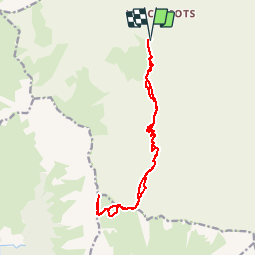


8,2 km | 13,3 km-effort


Usuario


Aplicación GPS de excursión GRATIS
 SityTrail
IGN / Institutos geográficos
SityTrail World
El mundo es suyo
Ruta Senderismo de 15,8 km a descubrir en Auvergne-Rhône-Alpes, Saboya, Les Belleville. Esta ruta ha sido propuesta por tracegps.
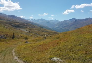
Randonnée de belle envergure mais où vous aurez très probablement comme récompense de pouvoir apercevoir (et c'est peu de le dire) des bouquetins, très nombreux dans ce massif.

Senderismo

Senderismo

Senderismo
Senderismo
Senderismo
Senderismo

Bici eléctrica
Bici de montaña

Esquí de fondo