![](/images/other/stat-length.png)
![Excursión Bici de montaña Saint-Hilaire-de-Brethmas - Oppidum et Garrigues dans le Gard - Photo](https://media.geolcdn.com/t/1900/400/ext.pjpeg?maxdim=2&url=https%3A%2F%2Fservices.sitytrail.com%2FGeolivesWS%2FDownloadMedia.ashx%3FTrailID%3D102655%26Media%3D3664_3.jpg)
Oppidum et Garrigues dans le Gard
tracegps
Usuario
![Longitud](/images/other/stat-length.png)
![Altitud máxima](https://static1.geolcdn.com/siteimages/upload/files/1508320355ic_sort_altitude_max_24dp.png)
![Desnivel positivo](https://static1.geolcdn.com/siteimages/upload/files/1508320355ic_sort_den_pos_24dp.png)
![Km-Effort](/images/other/stat-length.png)
![Altitud mínima](https://static1.geolcdn.com/siteimages/upload/files/1508320355ic_sort_altitude_min_24dp.png)
![Desnivel negativo](https://static1.geolcdn.com/siteimages/upload/files/1508320355ic_sort_den_neg_24dp.png)
![Boucle](https://static1.geolcdn.com/siteimages/upload/files/16400158638029165_repeat_loop_refresh_sync_direction_icon.png)
![Bici de montaña](https://static1.geolcdn.com/sitytour/trail-icons/202.png)
2h40
Dificultad : Medio
![Escanee este código QR para abrir la excursión en la aplicación SityTrail](https://capi.geolives.com/qq0zvz2zws4bq2lad0pu/sitytour/trails/102655/qr.png?size=200)
Aplicación GPS de excursión GRATIS
A propósito
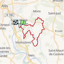
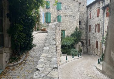
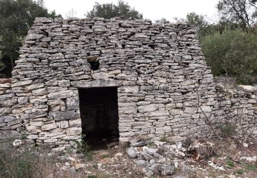
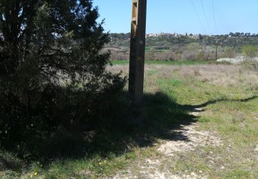
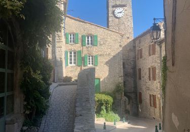
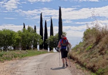
Ruta Bici de montaña de 28 km a descubrir en Occitania, Gard, Saint-Hilaire-de-Brethmas. Esta ruta ha sido propuesta por tracegps.
Descripción
Deux circuits 1 de 13km et l'autre de 30km, il y a une liaison entre les 2 circuits. Le départ et arrivée se font au temple de St Hilaire de Brethmas qui se situe à 5km d'ALES dans le GARD. A 3 km du départ un peu de poussette pour certains sur une trentaine de mètres. Pour visiter les villages il faut quitter le balisage et revenir sur ses pas.
Localización
Comentarios
Excursiones cerca
![Excursión Senderismo Vézénobres - Vézénobres - Photo](https://media.geolcdn.com/t/375/260/133326a3-8cbb-4088-be57-7b89bc312c23.jpg&format=jpg&maxdim=2)
![Senderismo Senderismo](https://static1.geolcdn.com/sitytour/trail-icons/101.png)
Senderismo
![](/images/other/stat-length.png)
![](https://static1.geolcdn.com/siteimages/upload/files/16400158638029165_repeat_loop_refresh_sync_direction_icon.png)
![Excursión Senderismo Vézénobres - Venez ivre - Photo](https://media.geolcdn.com/t/375/260/272c1169-d834-477c-80d3-e214642ba92a.jpg&format=jpg&maxdim=2)
![Senderismo Senderismo](https://static1.geolcdn.com/sitytour/trail-icons/101.png)
Senderismo
![](/images/other/stat-length.png)
![](https://static1.geolcdn.com/siteimages/upload/files/16400158638029165_repeat_loop_refresh_sync_direction_icon.png)
![Excursión Senderismo Vézénobres - Vezenobres - Photo](https://media.geolcdn.com/t/375/260/2787b8e8-8611-46cf-ab9b-ef9c6abd30ae.jpg&format=jpg&maxdim=2)
![Senderismo Senderismo](https://static1.geolcdn.com/sitytour/trail-icons/101.png)
Senderismo
![](/images/other/stat-length.png)
![](https://static1.geolcdn.com/siteimages/upload/files/16400158638029165_repeat_loop_refresh_sync_direction_icon.png)
![Excursión Senderismo Martignargues - Marsillargues-Vézenorbes 220317 - Photo](https://media.geolcdn.com/t/375/260/0648718d-e661-4ed3-9e67-4c94d80baa28.jpg&format=jpg&maxdim=2)
![Senderismo Senderismo](https://static1.geolcdn.com/sitytour/trail-icons/101.png)
Senderismo
![](/images/other/stat-length.png)
![](https://static1.geolcdn.com/siteimages/upload/files/16400158638029165_repeat_loop_refresh_sync_direction_icon.png)
![Excursión Senderismo Mons - Mons SCLC 030421 avec photos pour indication - Photo](https://media.geolcdn.com/t/375/260/428e77e1-e6ab-43cc-9016-bc97b720e07d.jpg&format=jpg&maxdim=2)
![Senderismo Senderismo](https://static1.geolcdn.com/sitytour/trail-icons/101.png)
Senderismo
![](/images/other/stat-length.png)
![](https://static1.geolcdn.com/siteimages/upload/files/16400158638029165_repeat_loop_refresh_sync_direction_icon.png)
![Excursión Senderismo Vézénobres - Vezenobres 2 - Photo](https://media.geolcdn.com/t/375/260/900e2355-3ae0-41ab-9799-d86a37523d13.jpg&format=jpg&maxdim=2)
![Senderismo Senderismo](https://static1.geolcdn.com/sitytour/trail-icons/101.png)
![Excursión Senderismo Saint-Christol-lez-Alès - Randonnée Domaine du Rouret 20 mai 2020 - Photo](https://media.geolcdn.com/t/375/260/f43d9c9c-a0b6-44a2-8831-661d46e8665d.jpg&format=jpg&maxdim=2)
![Senderismo Senderismo](https://static1.geolcdn.com/sitytour/trail-icons/101.png)
Senderismo
![](/images/other/stat-length.png)
![](https://static1.geolcdn.com/siteimages/upload/files/16400158638029165_repeat_loop_refresh_sync_direction_icon.png)
![Senderismo Senderismo](https://static1.geolcdn.com/sitytour/trail-icons/101.png)
Senderismo
![](/images/other/stat-length.png)
![](https://static1.geolcdn.com/siteimages/upload/files/16400158638029165_repeat_loop_refresh_sync_direction_icon.png)
![Senderismo Senderismo](https://static1.geolcdn.com/sitytour/trail-icons/101.png)
Senderismo
![](/images/other/stat-length.png)
![](https://static1.geolcdn.com/siteimages/upload/files/16400158638029165_repeat_loop_refresh_sync_direction_icon.png)