


6,7 km | 8,9 km-effort


Usuario


Aplicación GPS de excursión GRATIS
 SityTrail
IGN / Institutos geográficos
SityTrail World
El mundo es suyo
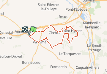
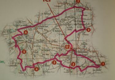
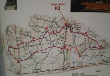
Ruta Bici de montaña de 27 km a descubrir en Normandía, Calvados, Annebault. Esta ruta ha sido propuesta por tracegps.
Petit circuit bien sympathique. Attention tout de même aux quelques descente un peu brutales qui rendent le circuit praticable pour les personnes ayant une pratique courant du VTT. Casque obligatoire. J'en profite pour proposer mes services aux lecteurs : Si vous avez des parcours à partager sur la basse Normandie et le calvados en particulier, mais que vous ne voulez pas, par manque de temps, trop difficile, etc... Les publier sur TraceGPS.com, merci de me les envoyer à manualator at aliceadsl.fr que je les fasse partager à tous. Plus y en aura, plus on rigolera ! Même adresse si vous souhaitez me faire part de vos remarques concernant mes circuits. (Ou formulez un avis dans la rubrique appropriée ! - note de TraceGps.com)

Senderismo
Senderismo
Senderismo
Senderismo
Senderismo

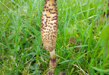
Bici de montaña
Senderismo
Senderismo
Senderismo