![](/images/other/stat-length.png)
![Excursión Bici de montaña Givonne - Espace VTT FFC Pays Sedanais Le Banet - Circuit n° 09 - Photo](https://media.geolcdn.com/t/1900/400/ext.pjpeg?maxdim=2&url=https%3A%2F%2Fservices.sitytrail.com%2FGeolivesWS%2FDownloadMedia.ashx%3FTrailID%3D102280%26Media%3D2741_1.jpg)
Espace VTT FFC Pays Sedanais Le Banet - Circuit n° 09
tracegps
Usuario
![Longitud](/images/other/stat-length.png)
![Altitud máxima](https://static1.geolcdn.com/siteimages/upload/files/1508320355ic_sort_altitude_max_24dp.png)
![Desnivel positivo](https://static1.geolcdn.com/siteimages/upload/files/1508320355ic_sort_den_pos_24dp.png)
![Km-Effort](/images/other/stat-length.png)
![Altitud mínima](https://static1.geolcdn.com/siteimages/upload/files/1508320355ic_sort_altitude_min_24dp.png)
![Desnivel negativo](https://static1.geolcdn.com/siteimages/upload/files/1508320355ic_sort_den_neg_24dp.png)
![Boucle](https://static1.geolcdn.com/siteimages/upload/files/16400158638029165_repeat_loop_refresh_sync_direction_icon.png)
![Bici de montaña](https://static1.geolcdn.com/sitytour/trail-icons/202.png)
2h00
Dificultad : Difícil
![Escanee este código QR para abrir la excursión en la aplicación SityTrail](https://capi.geolives.com/qq0zvz2zws4bq2lad0pu/sitytour/trails/102280/qr.png?size=200)
Aplicación GPS de excursión GRATIS
A propósito
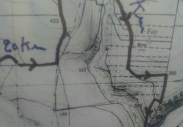
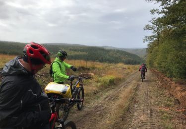
Ruta Bici de montaña de 25 km a descubrir en Gran Este, Ardenas, Givonne. Esta ruta ha sido propuesta por tracegps.
Descripción
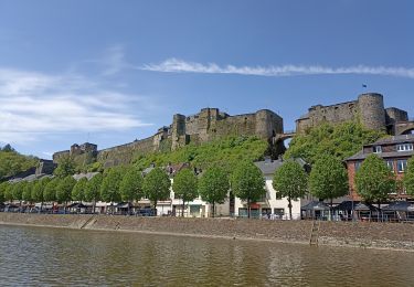
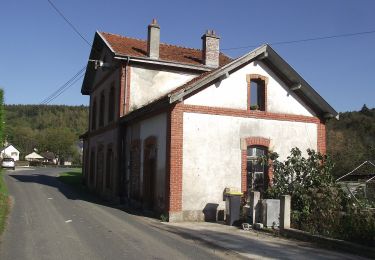
Espace VTT FFC Pays Sedanais Le Banet Circuit officiel labellisé par la Fédération Française de Cyclisme. Le Pays sedanais comporte 16 circuits balisés. Grâce à la variété des sites, les sorties sont adaptées aussi bien aux balades en famille qu'aux raids en solitaire. Votre périple pourra vous mener à l'aplomb de la vallée de la Semois entourant la superbe petite bourgade de Bouillon, en Belgique. Attention : Les pistes sont interdites les jours de chasse en batture, la nuit et par temps de neige. Sedan Sprint Club Crédit photos CIHM
Localización
Comentarios
Excursiones cerca
![Excursión Senderismo Illy - Chemin des contrebandiers - Illy - Photo](https://media.geolcdn.com/t/375/260/ext.jpg?maxdim=2&url=https%3A%2F%2Fservices.sitytrail.com%2FGeolivesWS%2FDownloadMedia.ashx%3FTrailID%3D191646%26Media%3D15295_6.jpg)
![Senderismo Senderismo](https://static1.geolcdn.com/sitytour/trail-icons/101.png)
Senderismo
![](/images/other/stat-length.png)
![](https://static1.geolcdn.com/siteimages/upload/files/16400158638029165_repeat_loop_refresh_sync_direction_icon.png)
![Excursión Paseo ecuestre La Chapelle - SityTrail - OKBOUILLON Route MADAME proposition DNF Bouillon - Photo](https://media.geolcdn.com/t/375/260/9dc51392-1e6d-4132-be55-dbd7539f47f4.png&format=jpg&maxdim=2)
![Paseo ecuestre Paseo ecuestre](https://static1.geolcdn.com/sitytour/trail-icons/301.png)
Paseo ecuestre
![](/images/other/stat-length.png)
![](https://static1.geolcdn.com/siteimages/upload/files/16400158638029165_repeat_loop_refresh_sync_direction_icon.png)
![Excursión Senderismo Bazeilles - Du milieu de la forêt à Carignon - Photo](https://media.geolcdn.com/t/375/260/ab0a3f6b-d701-4e49-bb57-67a9d1c80290.jpg&format=jpg&maxdim=2)
![Senderismo Senderismo](https://static1.geolcdn.com/sitytour/trail-icons/101.png)
Senderismo
![](/images/other/stat-length.png)
![](https://static1.geolcdn.com/siteimages/upload/files/16400158638029165_repeat_loop_refresh_sync_direction_icon.png)
![Excursión Senderismo Illy - départ d'Olly, arrivée au milieu de la forêt domaniale de Sedan, Ardennes - Photo](https://media.geolcdn.com/t/375/260/01baeed6-50a4-4bd0-93b1-19a72750ffef.jpg&format=jpg&maxdim=2)
![Senderismo Senderismo](https://static1.geolcdn.com/sitytour/trail-icons/101.png)
Senderismo
![](/images/other/stat-length.png)
![](https://static1.geolcdn.com/siteimages/upload/files/16400158638029165_repeat_loop_refresh_sync_direction_icon.png)
![Excursión Bici de montaña Sedan - 20191006 Yeyette sur la voie verte à Sedan - Photo](https://media.geolcdn.com/t/375/260/b806c0b7-e370-4e14-9be3-9a414d970f45.jpg&format=jpg&maxdim=2)
![Bici de montaña Bici de montaña](https://static1.geolcdn.com/sitytour/trail-icons/202.png)
Bici de montaña
![](/images/other/stat-length.png)
![](https://static1.geolcdn.com/siteimages/upload/files/16400158638029165_repeat_loop_refresh_sync_direction_icon.png)
![Excursión Marcha nórdica Saint-Menges - Saint Menges FFSP 4/9/22 - Photo](https://media.geolcdn.com/t/375/260/339f7c0f-af9f-4f5e-ac04-2167c1aa5322.jpg&format=jpg&maxdim=2)
![Marcha nórdica Marcha nórdica](https://static1.geolcdn.com/sitytour/trail-icons/102.png)
Marcha nórdica
![](/images/other/stat-length.png)
![](https://static1.geolcdn.com/siteimages/upload/files/16400158638029165_repeat_loop_refresh_sync_direction_icon.png)
![Excursión Enganche La Chapelle - SityTrail - FUSION ATTELAGE BOUILLON - Photo](https://media.geolcdn.com/t/375/260/ext.jpg?maxdim=2&url=https%3A%2F%2Fstatic1.geolcdn.com%2Fsiteimages%2Fupload%2Ffiles%2F1524743154cheval.jpg)
![Enganche Enganche](https://static1.geolcdn.com/sitytour/trail-icons/302.png)
Enganche
![](/images/other/stat-length.png)
![](https://static1.geolcdn.com/siteimages/upload/files/16400158638029165_repeat_loop_refresh_sync_direction_icon.png)
![Excursión A pie Illy - Sentier du Bois Talot - Photo](https://media.geolcdn.com/t/375/260/a43e25ae-69e9-4769-9a1d-35acca2d449f.jpeg&format=jpg&maxdim=2)
![A pie A pie](https://static1.geolcdn.com/sitytour/trail-icons/100.png)
A pie
![](/images/other/stat-length.png)
![](https://static1.geolcdn.com/siteimages/upload/files/16400158638029165_repeat_loop_refresh_sync_direction_icon.png)
![Excursión Bici de montaña La Chapelle - 20191004 Yeyette à Givonne jour 1 - Photo](https://media.geolcdn.com/t/375/260/7bf105db-c96e-4e0d-99a8-5fe30715a2be.jpg&format=jpg&maxdim=2)
![Bici de montaña Bici de montaña](https://static1.geolcdn.com/sitytour/trail-icons/202.png)
Bici de montaña
![](/images/other/stat-length.png)
![](https://static1.geolcdn.com/siteimages/upload/files/16400158638029165_repeat_loop_refresh_sync_direction_icon.png)