![](/images/other/stat-length.png)
![Excursión Senderismo Bubry - Espace VTT FFC La vallée du Blavet - Le circuit de Saint Clément - Photo](https://media.geolcdn.com/t/1900/400/ext.pjpeg?maxdim=2&url=https%3A%2F%2Fstatic1.geolcdn.com%2Fsiteimages%2Fupload%2Ffiles%2F1553511878bg_sport_marche.png)
Espace VTT FFC La vallée du Blavet - Le circuit de Saint Clément
tracegps
Usuario
![Longitud](/images/other/stat-length.png)
![Altitud máxima](https://static1.geolcdn.com/siteimages/upload/files/1508320355ic_sort_altitude_max_24dp.png)
![Desnivel positivo](https://static1.geolcdn.com/siteimages/upload/files/1508320355ic_sort_den_pos_24dp.png)
![Km-Effort](/images/other/stat-length.png)
![Altitud mínima](https://static1.geolcdn.com/siteimages/upload/files/1508320355ic_sort_altitude_min_24dp.png)
![Desnivel negativo](https://static1.geolcdn.com/siteimages/upload/files/1508320355ic_sort_den_neg_24dp.png)
![Boucle](https://static1.geolcdn.com/siteimages/upload/files/16400158638029165_repeat_loop_refresh_sync_direction_icon.png)
![Senderismo](https://static1.geolcdn.com/sitytour/trail-icons/101.png)
2h15
Dificultad : Medio
![Escanee este código QR para abrir la excursión en la aplicación SityTrail](https://capi.geolives.com/qq0zvz2zws4bq2lad0pu/sitytour/trails/101725/qr.png?size=200)
Aplicación GPS de excursión GRATIS
A propósito
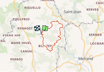
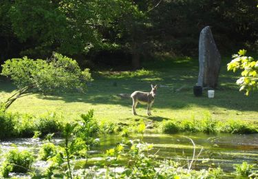
Ruta Senderismo de 9 km a descubrir en Bretaña, Morbihan, Bubry. Esta ruta ha sido propuesta por tracegps.
Descripción
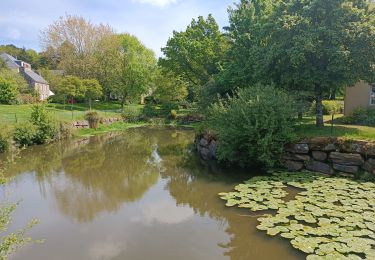
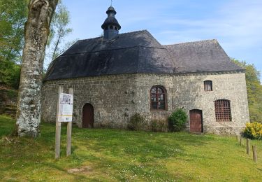
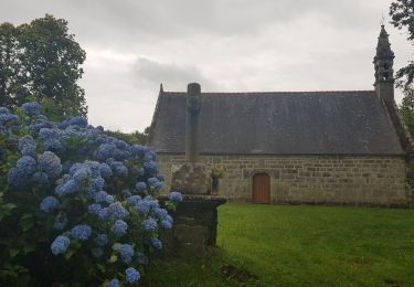
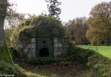
Espace VTT FFC La Vallée du Blavet Circuit labellisé par la Fédération Française de Cyclisme. Au départ de l'étang Fleuri, dont les deux moulins de Maneantoux utilisaient jadis la force hydraulique, prenez la route en direction de St-Clément. Par la petite route, vous passerez devant la croix de Kerantalam près du point culminant de la commune (177 m). À Saint-Clément, à droite du circuit, vous découvrirez une belle chapelle datant du XVIIIe siècle, ornée d’un fin clocher. À Kerotenec, prenez à droite 1 km de chemin pittoresque jusqu'à Stang-Du. Sur la route en descente à gauche, on retrouve le GR 341 et ses balises rouges et blanches. Vous rejoindrez Manebutur par un chemin creux qu’on appelait autrefois Hent Ar Baradoes (chemin du paradis). Contournez par la droite la longère à la façade ancienne remarquable. Stang-Er-Borel vous offre une très belle vue sur la Vallée da la Sarre, affluent du Blavet. Suivez le chemin d'exploitation, puis prenez sur la gauche un petit sentier qui vous mène au superbe manoir restauré de Coët-Sar-Braz, avec son four à pain. A Coët-Sar-Braz prenez l'unique petite route jusqu'au joli village ancien du Haben. Par de beaux paysages et chemins ombragés, prenez la direction de Kermain. Avant le village, tournez à droite vers Bieuzen. Une petite route, puis un chemin d'exploitation vous ramène à l'Étang Fleuri.
Localización
Comentarios
Excursiones cerca
![Excursión A pie Bubry - Grand Circuit de Bubry - Photo](https://media.geolcdn.com/t/375/260/68625dc4-819b-497f-aef0-fdd292f88c19.jpeg&format=jpg&maxdim=2)
![A pie A pie](https://static1.geolcdn.com/sitytour/trail-icons/100.png)
A pie
![](/images/other/stat-length.png)
![](https://static1.geolcdn.com/siteimages/upload/files/16400158638029165_repeat_loop_refresh_sync_direction_icon.png)
![Excursión Senderismo Melrand - PR_56_Melrand_BA_02_Circuit1b_Village-De-L-An-Mil_20220105 - Photo](https://media.geolcdn.com/t/375/260/7722898f-3527-4f61-af9d-c89d9b8bb341.jpg&format=jpg&maxdim=2)
![Senderismo Senderismo](https://static1.geolcdn.com/sitytour/trail-icons/101.png)
Senderismo
![](/images/other/stat-length.png)
![](https://static1.geolcdn.com/siteimages/upload/files/16400158638029165_repeat_loop_refresh_sync_direction_icon.png)
![Excursión Senderismo Melrand - PR_56_Melrand_AA_01_Circuit1b_Du-Guelhouit_20220501 - Photo](https://media.geolcdn.com/t/375/260/7a534f12-d368-4f88-a48e-fcfb37b72424.jpg&format=jpg&maxdim=2)
![Senderismo Senderismo](https://static1.geolcdn.com/sitytour/trail-icons/101.png)
Senderismo
![](/images/other/stat-length.png)
![](https://static1.geolcdn.com/siteimages/upload/files/16400158638029165_repeat_loop_refresh_sync_direction_icon.png)
![Excursión Senderismo Bubry - PR_56_Bubry_AA_01_Circuit1b_Le-Grand-Circuit_20200628 - Photo](https://media.geolcdn.com/t/375/260/acd1141b-bccf-4d70-979e-1fddc20d1091.jpg&format=jpg&maxdim=2)
![Senderismo Senderismo](https://static1.geolcdn.com/sitytour/trail-icons/101.png)
Senderismo
![](/images/other/stat-length.png)
![](https://static1.geolcdn.com/siteimages/upload/files/16400158638029165_repeat_loop_refresh_sync_direction_icon.png)
![Excursión Senderismo Bubry - Grand tour de Bubry - Photo](https://media.geolcdn.com/t/375/260/6e5d384d-9dd7-4ee4-849a-6f43c528566e.jpg&format=jpg&maxdim=2)
![Senderismo Senderismo](https://static1.geolcdn.com/sitytour/trail-icons/101.png)
Senderismo
![](/images/other/stat-length.png)
![](https://static1.geolcdn.com/siteimages/upload/files/16400158638029165_repeat_loop_refresh_sync_direction_icon.png)
![Excursión Caballo Bubry - Boucle de St Tremeur via St Jean - Photo](https://media.geolcdn.com/t/375/260/ext.jpg?maxdim=2&url=https%3A%2F%2Fservices.sitytrail.com%2FGeolivesWS%2FDownloadMedia.ashx%3FTrailID%3D317540%26Media%3D16787_2.jpg)
![Caballo Caballo](https://static1.geolcdn.com/sitytour/trail-icons/300.png)
Caballo
![](/images/other/stat-length.png)
![](https://static1.geolcdn.com/siteimages/upload/files/16400158638029165_repeat_loop_refresh_sync_direction_icon.png)
![Excursión Caballo Bubry - Circuit du Brandifrout - Bubry - Photo](https://media.geolcdn.com/t/375/260/ext.jpg?maxdim=2&url=https%3A%2F%2Fservices.sitytrail.com%2FGeolivesWS%2FDownloadMedia.ashx%3FTrailID%3D118804%26Media%3D13012_4.jpg)
![Caballo Caballo](https://static1.geolcdn.com/sitytour/trail-icons/300.png)
Caballo
![](/images/other/stat-length.png)
![](https://static1.geolcdn.com/siteimages/upload/files/16400158638029165_repeat_loop_refresh_sync_direction_icon.png)
![Excursión Bici de montaña Bubry - Circuit du Brandifrout - Bubry - Photo](https://media.geolcdn.com/t/375/260/ext.jpg?maxdim=2&url=https%3A%2F%2Fservices.sitytrail.com%2FGeolivesWS%2FDownloadMedia.ashx%3FTrailID%3D118803%26Media%3D13012_4.jpg)
![Bici de montaña Bici de montaña](https://static1.geolcdn.com/sitytour/trail-icons/202.png)
Bici de montaña
![](/images/other/stat-length.png)
![](https://static1.geolcdn.com/siteimages/upload/files/16400158638029165_repeat_loop_refresh_sync_direction_icon.png)
![Excursión Senderismo Bubry - Circuit du Brandifrout - Bubry - Photo](https://media.geolcdn.com/t/375/260/ext.jpg?maxdim=2&url=https%3A%2F%2Fservices.sitytrail.com%2FGeolivesWS%2FDownloadMedia.ashx%3FTrailID%3D118802%26Media%3D13012_4.jpg)
![Senderismo Senderismo](https://static1.geolcdn.com/sitytour/trail-icons/101.png)
Senderismo
![](/images/other/stat-length.png)
![](https://static1.geolcdn.com/siteimages/upload/files/16400158638029165_repeat_loop_refresh_sync_direction_icon.png)