![](/images/other/stat-length.png)
![Excursión Senderismo Plounéour-Ménez - Espace VTT-FFC Morlaix Monts d'Arrée, circuit n°6 - Le Relec - Photo](https://media.geolcdn.com/t/1900/400/ext.pjpeg?maxdim=2&url=https%3A%2F%2Fservices.sitytrail.com%2FGeolivesWS%2FDownloadMedia.ashx%3FTrailID%3D101583%26Media%3D1704_2.jpg)
Espace VTT-FFC Morlaix Monts d'Arrée, circuit n°6 - Le Relec
tracegps
Usuario
![Longitud](/images/other/stat-length.png)
![Altitud máxima](https://static1.geolcdn.com/siteimages/upload/files/1508320355ic_sort_altitude_max_24dp.png)
![Desnivel positivo](https://static1.geolcdn.com/siteimages/upload/files/1508320355ic_sort_den_pos_24dp.png)
![Km-Effort](/images/other/stat-length.png)
![Altitud mínima](https://static1.geolcdn.com/siteimages/upload/files/1508320355ic_sort_altitude_min_24dp.png)
![Desnivel negativo](https://static1.geolcdn.com/siteimages/upload/files/1508320355ic_sort_den_neg_24dp.png)
![Boucle](https://static1.geolcdn.com/siteimages/upload/files/16400158638029165_repeat_loop_refresh_sync_direction_icon.png)
![Senderismo](https://static1.geolcdn.com/sitytour/trail-icons/101.png)
3h00
Dificultad : Muy difícil
![Escanee este código QR para abrir la excursión en la aplicación SityTrail](https://capi.geolives.com/qq0zvz2zws4bq2lad0pu/sitytour/trails/101583/qr.png?size=200)
Aplicación GPS de excursión GRATIS
A propósito
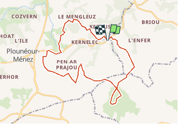
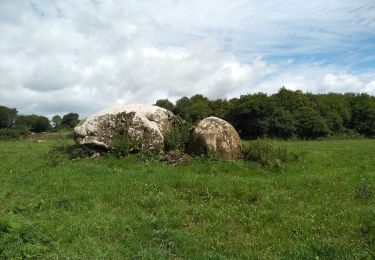
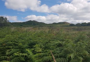
Ruta Senderismo de 18,1 km a descubrir en Bretaña, Finisterre, Plounéour-Ménez. Esta ruta ha sido propuesta por tracegps.
Descripción
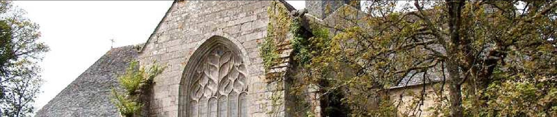
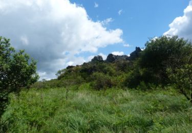
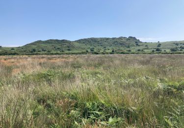
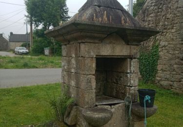
Espace VTT-FFC Morlaix Monts d’Arrée Circuit labellisé par la Fédération Française de Cyclisme. Au départ de l’abbaye cistercienne, après avoir franchi les crêtes des Monts d’Arrée, visitez Trédudon-Le-Moine, premier village résistant de Bretagne. Par les sentiers escarpés des Monts d’Arrée, rejoignez le Relec par de multiples petits villages d’architecture traditionnelle.
Localización
Comentarios
Excursiones cerca
![Excursión Bici de montaña Plounéour-Ménez - Espace VTT-FFC Morlaix Monts d'Arrée, circuit n°7 - Le Cloitre - Photo](https://media.geolcdn.com/t/375/260/ext.jpg?maxdim=2&url=https%3A%2F%2Fservices.sitytrail.com%2FGeolivesWS%2FDownloadMedia.ashx%3FTrailID%3D101604%26Media%3D1793_2.jpg)
![Bici de montaña Bici de montaña](https://static1.geolcdn.com/sitytour/trail-icons/202.png)
Bici de montaña
![](/images/other/stat-length.png)
![](https://static1.geolcdn.com/siteimages/upload/files/16400158638029165_repeat_loop_refresh_sync_direction_icon.png)
![Excursión A pie Plounéour-Ménez - Circuit de la Montagne - Photo](https://media.geolcdn.com/t/375/260/c3130118-aa43-405b-bf06-303e6c5f1e74.jpeg&format=jpg&maxdim=2)
![A pie A pie](https://static1.geolcdn.com/sitytour/trail-icons/100.png)
A pie
![](/images/other/stat-length.png)
![](https://static1.geolcdn.com/siteimages/upload/files/16400158638029165_repeat_loop_refresh_sync_direction_icon.png)
![Excursión Senderismo Plounéour-Ménez - PLONÉOUR MENEZ - Photo](https://media.geolcdn.com/t/375/260/18747b60-836a-4fea-8d5e-afb0bfbc2f19.jpg&format=jpg&maxdim=2)
![Senderismo Senderismo](https://static1.geolcdn.com/sitytour/trail-icons/101.png)
Senderismo
![](/images/other/stat-length.png)
![](https://static1.geolcdn.com/siteimages/upload/files/16400158638029165_repeat_loop_refresh_sync_direction_icon.png)
![Excursión Senderismo Plounéour-Ménez - Abbaye du Relec- Plounéour Ménez - Photo](https://media.geolcdn.com/t/375/260/ext.jpg?maxdim=2&url=https%3A%2F%2Fservices.sitytrail.com%2FGeolivesWS%2FDownloadMedia.ashx%3FTrailID%3D215232%26Media%3D15851_4.jpg)
![Senderismo Senderismo](https://static1.geolcdn.com/sitytour/trail-icons/101.png)
Senderismo
![](/images/other/stat-length.png)
![](https://static1.geolcdn.com/siteimages/upload/files/16400158638029165_repeat_loop_refresh_sync_direction_icon.png)
![Excursión Senderismo Plounéour-Ménez - Roch Trévézel - Photo](https://media.geolcdn.com/t/375/260/e0c8cd47-ed65-4046-81b3-2ba2abd5191b.jpg&format=jpg&maxdim=2)
![Senderismo Senderismo](https://static1.geolcdn.com/sitytour/trail-icons/101.png)
Senderismo
![](/images/other/stat-length.png)
![](https://static1.geolcdn.com/siteimages/upload/files/16400158638029165_repeat_loop_refresh_sync_direction_icon.png)
![Excursión Senderismo Berrien - BERRIEN - Photo](https://media.geolcdn.com/t/375/260/99e6cd0b-1e82-4917-b359-a604a63199d0.jpg&format=jpg&maxdim=2)
![Senderismo Senderismo](https://static1.geolcdn.com/sitytour/trail-icons/101.png)
![Excursión A pie Berrien - Circuit de l'abbaye du Relec - Photo](https://media.geolcdn.com/t/375/260/2092cde2-aa91-4a91-8f69-04318fbe31bd.jpeg&format=jpg&maxdim=2)
![A pie A pie](https://static1.geolcdn.com/sitytour/trail-icons/100.png)
A pie
![](/images/other/stat-length.png)
![](https://static1.geolcdn.com/siteimages/upload/files/16400158638029165_repeat_loop_refresh_sync_direction_icon.png)
![Excursión Senderismo Le Cloître-Saint-Thégonnec - Kermorgant - Photo](https://media.geolcdn.com/t/375/260/a9724d5e-2feb-4a5f-9b2e-41ef03b50db1.jpg&format=jpg&maxdim=2)
![Senderismo Senderismo](https://static1.geolcdn.com/sitytour/trail-icons/101.png)
Senderismo
![](/images/other/stat-length.png)
![](https://static1.geolcdn.com/siteimages/upload/files/16400158638029165_repeat_loop_refresh_sync_direction_icon.png)
![Excursión Senderismo Plounéour-Ménez - Balade de l'abbaye de Relecq - Photo](https://media.geolcdn.com/t/375/260/094260ee-59ef-4ea6-882a-8119688b51fa.jpg&format=jpg&maxdim=2)
![Senderismo Senderismo](https://static1.geolcdn.com/sitytour/trail-icons/101.png)
Senderismo
![](/images/other/stat-length.png)
![](https://static1.geolcdn.com/siteimages/upload/files/16400158638029165_repeat_loop_refresh_sync_direction_icon.png)