![](/images/other/stat-length.png)
![Excursión Senderismo Barbirey-sur-Ouche - Tebzima - Photo](https://media.geolcdn.com/t/1900/400/ext.pjpeg?maxdim=2&url=https%3A%2F%2Fservices.sitytrail.com%2FGeolivesWS%2FDownloadMedia.ashx%3FTrailID%3D1013095%26Media%3D20180730104607.jpg)
Tebzima
dominiq
Usuario
![Longitud](/images/other/stat-length.png)
Longitud
13,4 km
![Altitud máxima](https://static1.geolcdn.com/siteimages/upload/files/1508320355ic_sort_altitude_max_24dp.png)
Altitud máxima
560 m
![Desnivel positivo](https://static1.geolcdn.com/siteimages/upload/files/1508320355ic_sort_den_pos_24dp.png)
Desnivel positivo
506 m
![Km-Effort](/images/other/stat-length.png)
Km-Effort
20 km
![Altitud mínima](https://static1.geolcdn.com/siteimages/upload/files/1508320355ic_sort_altitude_min_24dp.png)
Altitud mínima
371 m
![Desnivel negativo](https://static1.geolcdn.com/siteimages/upload/files/1508320355ic_sort_den_neg_24dp.png)
Desnivel negativo
506 m
![Boucle](https://static1.geolcdn.com/siteimages/upload/files/16400158638029165_repeat_loop_refresh_sync_direction_icon.png)
Boucle
Sí
Fecha de creación :
2019-01-15 13:49:44.836
Última modificación :
2019-01-15 13:49:44.836
![Senderismo](https://static1.geolcdn.com/sitytour/trail-icons/101.png)
4h11
Dificultad : Medio
![Escanee este código QR para abrir la excursión en la aplicación SityTrail](https://capi.geolives.com/qq0zvz2zws4bq2lad0pu/sitytour/trails/1013095/qr.png?size=200)
Aplicación GPS de excursión GRATIS
A propósito
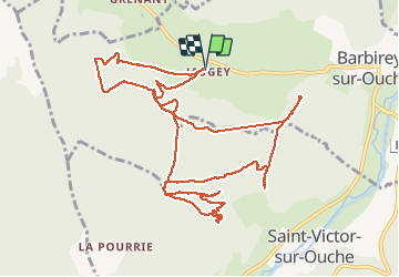
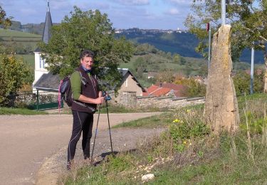
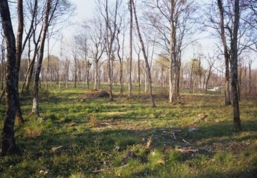
Ruta Senderismo de 13,4 km a descubrir en Borgoña-Franco Condado, Côte-d'Or, Barbirey-sur-Ouche. Esta ruta ha sido propuesta por dominiq.
Descripción
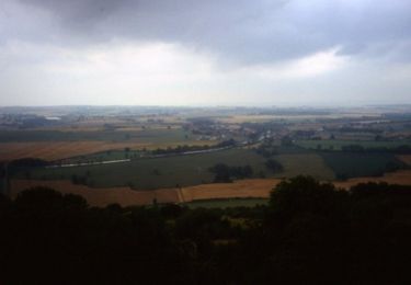
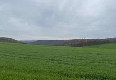
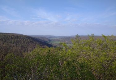
Trés belle randonnée un peu en dehors des sentiers balisés...
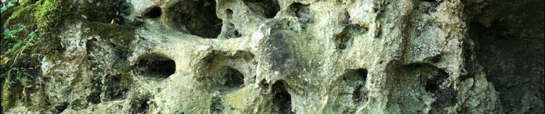
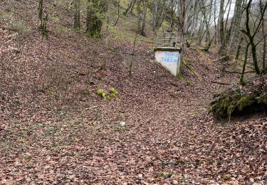
La grotte de Tebzima vaut le détour mais elle se mérite ! Les photos sont celles de la petite grotte qui est en dessous.
Localización
País:
France
Región :
Borgoña-Franco Condado
Departamento/provincia :
Côte-d'Or
Municipio :
Barbirey-sur-Ouche
Localidad:
Unknown
Salida:(Dec)
Salida:(UTM)
630800 ; 5234658 (31T) N.
Comentarios
Excursiones cerca
![Excursión Senderismo Barbirey-sur-Ouche - Le Tour de Barbiriacum - Barbirey sur Ouche - Photo](https://media.geolcdn.com/t/375/260/ext.jpg?maxdim=2&url=https%3A%2F%2Fservices.sitytrail.com%2FGeolivesWS%2FDownloadMedia.ashx%3FTrailID%3D104688%26Media%3D8091_1.jpg)
![Senderismo Senderismo](https://static1.geolcdn.com/sitytour/trail-icons/101.png)
Le Tour de Barbiriacum - Barbirey sur Ouche
Senderismo
Medio
(1)
Barbirey-sur-Ouche,
Borgoña-Franco Condado,
Côte-d'Or,
France
![](/images/other/stat-length.png)
10,5 km | 15,9 km-effort
2h 45min
![](https://static1.geolcdn.com/siteimages/upload/files/16400158638029165_repeat_loop_refresh_sync_direction_icon.png)
Sí
![Excursión Senderismo La Bussière-sur-Ouche - La Bête de l'Auxois - La Bussière sur Ouche - Photo](https://media.geolcdn.com/t/375/260/ext.jpg?maxdim=2&url=https%3A%2F%2Fservices.sitytrail.com%2FGeolivesWS%2FDownloadMedia.ashx%3FTrailID%3D104674%26Media%3D8077_1.jpg)
![Senderismo Senderismo](https://static1.geolcdn.com/sitytour/trail-icons/101.png)
La Bête de l'Auxois - La Bussière sur Ouche
Senderismo
Difícil
(1)
La Bussière-sur-Ouche,
Borgoña-Franco Condado,
Côte-d'Or,
France
![](/images/other/stat-length.png)
25 km | 33 km-effort
6h 0min
![](https://static1.geolcdn.com/siteimages/upload/files/16400158638029165_repeat_loop_refresh_sync_direction_icon.png)
Sí
![Excursión Senderismo Grenant-lès-Sombernon - Grenant les sombernon - Photo](https://media.geolcdn.com/t/375/260/df59c81b-a7ed-408e-9f72-9695d8a9e535.jpg&format=jpg&maxdim=2)
![Senderismo Senderismo](https://static1.geolcdn.com/sitytour/trail-icons/101.png)
Grenant les sombernon
Senderismo
Grenant-lès-Sombernon,
Borgoña-Franco Condado,
Côte-d'Or,
France
![](/images/other/stat-length.png)
14 km | 21 km-effort
3h 35min
![](https://static1.geolcdn.com/siteimages/upload/files/16400158638029165_repeat_loop_refresh_sync_direction_icon.png)
Sí
![Excursión Senderismo La Bussière-sur-Ouche - Pierre du druide , grotte de tebsima - Photo](https://media.geolcdn.com/t/375/260/f5fb0392-9ba6-4c1e-8853-76c9bb7fb3dc.jpg&format=jpg&maxdim=2)
![Senderismo Senderismo](https://static1.geolcdn.com/sitytour/trail-icons/101.png)
Pierre du druide , grotte de tebsima
Senderismo
Medio
La Bussière-sur-Ouche,
Borgoña-Franco Condado,
Côte-d'Or,
France
![](/images/other/stat-length.png)
15,9 km | 23 km-effort
3h 32min
![](https://static1.geolcdn.com/siteimages/upload/files/16400158638029165_repeat_loop_refresh_sync_direction_icon.png)
Sí
![Excursión Senderismo Saint-Jean-de-Bœuf - Saint JeandeBoeuf-Gissey sur Ouche - Photo](https://media.geolcdn.com/t/375/260/8855f220-19b7-4cb5-9740-2586f5619cf3.jpg&format=jpg&maxdim=2)
![Senderismo Senderismo](https://static1.geolcdn.com/sitytour/trail-icons/101.png)
Saint JeandeBoeuf-Gissey sur Ouche
Senderismo
Medio
Saint-Jean-de-Bœuf,
Borgoña-Franco Condado,
Côte-d'Or,
France
![](/images/other/stat-length.png)
22 km | 31 km-effort
8h 5min
![](https://static1.geolcdn.com/siteimages/upload/files/16400158638029165_repeat_loop_refresh_sync_direction_icon.png)
Sí
![Excursión Senderismo La Bussière-sur-Ouche - St Victor canal - Photo](https://media.geolcdn.com/t/375/260/922cca4b-d8a7-4ae9-a8f6-94d903732d88.jpg&format=jpg&maxdim=2)
![Senderismo Senderismo](https://static1.geolcdn.com/sitytour/trail-icons/101.png)
St Victor canal
Senderismo
Fácil
(1)
La Bussière-sur-Ouche,
Borgoña-Franco Condado,
Côte-d'Or,
France
![](/images/other/stat-length.png)
12,8 km | 16,5 km-effort
2h 39min
![](https://static1.geolcdn.com/siteimages/upload/files/16400158638029165_repeat_loop_refresh_sync_direction_icon.png)
Sí
![Excursión A pie Barbirey-sur-Ouche - barbirey - Photo](https://media.geolcdn.com/t/375/260/d6bd1c62-1edb-4936-a48f-393652ec8299.jpg&format=jpg&maxdim=2)
![A pie A pie](https://static1.geolcdn.com/sitytour/trail-icons/100.png)
barbirey
A pie
Medio
Barbirey-sur-Ouche,
Borgoña-Franco Condado,
Côte-d'Or,
France
![](/images/other/stat-length.png)
15,5 km | 23 km-effort
2min
![](https://static1.geolcdn.com/siteimages/upload/files/16400158638029165_repeat_loop_refresh_sync_direction_icon.png)
Sí
![Excursión Senderismo La Bussière-sur-Ouche - D'une Rive à l'Autre - La Bussière sur Ouche - Photo](https://media.geolcdn.com/t/375/260/ext.jpg?maxdim=2&url=https%3A%2F%2Fservices.sitytrail.com%2FGeolivesWS%2FDownloadMedia.ashx%3FTrailID%3D104676%26Media%3D8079_1.jpg)
![Senderismo Senderismo](https://static1.geolcdn.com/sitytour/trail-icons/101.png)
D'une Rive à l'Autre - La Bussière sur Ouche
Senderismo
Difícil
La Bussière-sur-Ouche,
Borgoña-Franco Condado,
Côte-d'Or,
France
![](/images/other/stat-length.png)
23 km | 32 km-effort
7h 0min
![](https://static1.geolcdn.com/siteimages/upload/files/16400158638029165_repeat_loop_refresh_sync_direction_icon.png)
Sí
![Excursión sport Saint-Victor-sur-Ouche - Table druide et château de marigny - Photo](https://media.geolcdn.com/t/375/260/ext.jpg?maxdim=2&url=https%3A%2F%2Fsecurestorage.geolives.com%2Fsitytour%2Ftrail-bg%2Fdefault.jpg)
Table druide et château de marigny
sport
Muy fácil
Saint-Victor-sur-Ouche,
Borgoña-Franco Condado,
Côte-d'Or,
France
![](/images/other/stat-length.png)
14,5 km | 21 km-effort
Desconocido
![](https://static1.geolcdn.com/siteimages/upload/files/16400158638029165_repeat_loop_refresh_sync_direction_icon.png)
Sí