![](/images/other/stat-length.png)
![Excursión Bici de montaña Thuir - Fontcouverte 4 Déc 05 - Photo](https://media.geolcdn.com/t/1900/400/ext.pjpeg?maxdim=2&url=https%3A%2F%2Fstatic1.geolcdn.com%2Fsiteimages%2Fupload%2Ffiles%2F1524743154velo.jpg)
Fontcouverte 4 Déc 05
tracegps
Usuario
![Longitud](/images/other/stat-length.png)
![Altitud máxima](https://static1.geolcdn.com/siteimages/upload/files/1508320355ic_sort_altitude_max_24dp.png)
![Desnivel positivo](https://static1.geolcdn.com/siteimages/upload/files/1508320355ic_sort_den_pos_24dp.png)
![Km-Effort](/images/other/stat-length.png)
![Altitud mínima](https://static1.geolcdn.com/siteimages/upload/files/1508320355ic_sort_altitude_min_24dp.png)
![Desnivel negativo](https://static1.geolcdn.com/siteimages/upload/files/1508320355ic_sort_den_neg_24dp.png)
![Boucle](https://static1.geolcdn.com/siteimages/upload/files/16400158638029165_repeat_loop_refresh_sync_direction_icon.png)
![Bici de montaña](https://static1.geolcdn.com/sitytour/trail-icons/202.png)
3h13
Dificultad : Muy difícil
![Escanee este código QR para abrir la excursión en la aplicación SityTrail](https://capi.geolives.com/qq0zvz2zws4bq2lad0pu/sitytour/trails/100722/qr.png?size=200)
Aplicación GPS de excursión GRATIS
A propósito
Ruta Bici de montaña de 38 km a descubrir en Occitania, Pirineos Orientales, Thuir. Esta ruta ha sido propuesta por tracegps.
Descripción
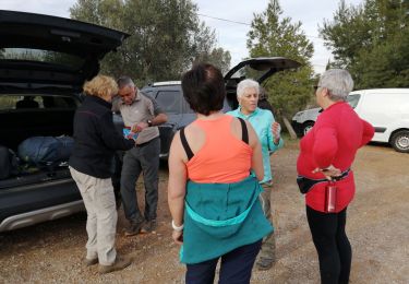
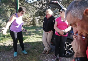
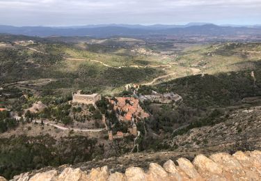
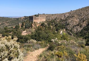
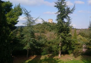
Belle randonnée dominicale organisée par le VTT club de Thuir. Quel plaisir de rouler en ce début décembre dans les Aspres sous un beau ciel bleu. La température au départ était assez basse, 5°C mais est montée assez rapidement à 16°C. Nous étions une bonne vingtaine au départ. Malgré le froid le rythme est vite monté. Le parcours était très varié avec de belles descentes techniques à fort dénivelé. J'ai eu parfois du mal à suivre car les deux à trois sorties hebdomadaire des membres du club de Thuir font la différence. Le paysage était superbe avec vue panoramique sur le Canigou et Néoulos enneigés. J'ai malheureusement constaté les dégats du dernier incendie entre Castelnou et Corbère. Si vous êtes un jour de passage à Thuir, le départ des randonnées ont lieu devant la mairie de Thuir tous les dimanche matin à 8H30 et est annoncé le samedi dans l'Indépendant.
Localización
Comentarios
Excursiones cerca
![Excursión Senderismo Llupia - 66 LLUPIA - FOURQUES - TERRATS promenade dans les ASPRES et son vignoble - Photo](https://media.geolcdn.com/t/375/260/ext.jpg?maxdim=2&url=https%3A%2F%2Fservices.sitytrail.com%2FGeolivesWS%2FDownloadMedia.ashx%3FTrailID%3D464008%26Media%3D20150825183450.jpg)
![Senderismo Senderismo](https://static1.geolcdn.com/sitytour/trail-icons/101.png)
Senderismo
![](/images/other/stat-length.png)
![](https://static1.geolcdn.com/siteimages/upload/files/16400158638029165_repeat_loop_refresh_sync_direction_icon.png)
![Excursión Senderismo Castelnou - CASTELNOU 66 - CAMELAS - ermitage San Marti de La Roca - Photo](https://media.geolcdn.com/t/375/260/ext.jpg?maxdim=2&url=https%3A%2F%2Fservices.sitytrail.com%2FGeolivesWS%2FDownloadMedia.ashx%3FTrailID%3D429684%26Media%3D20150604190036.jpg)
![Senderismo Senderismo](https://static1.geolcdn.com/sitytour/trail-icons/101.png)
Senderismo
![](/images/other/stat-length.png)
![](https://static1.geolcdn.com/siteimages/upload/files/16400158638029165_repeat_loop_refresh_sync_direction_icon.png)
![Excursión Senderismo Thuir - Thuir à Castelnou - Photo](https://media.geolcdn.com/t/375/260/ext.jpg?maxdim=2&url=https%3A%2F%2Fservices.sitytrail.com%2FGeolivesWS%2FDownloadMedia.ashx%3FTrailID%3D258395%26Media%3Dfix__20140318123220.jpg)
![Senderismo Senderismo](https://static1.geolcdn.com/sitytour/trail-icons/101.png)
Senderismo
![](/images/other/stat-length.png)
![](https://static1.geolcdn.com/siteimages/upload/files/16400158638029165_repeat_loop_refresh_sync_direction_icon.png)
![Excursión Senderismo Castelnou - Thuir - Photo](https://media.geolcdn.com/t/375/260/859f847a-b7fe-48a7-a491-a2880e534b4c.jpg&format=jpg&maxdim=2)
![Senderismo Senderismo](https://static1.geolcdn.com/sitytour/trail-icons/101.png)
Senderismo
![](/images/other/stat-length.png)
![](https://static1.geolcdn.com/siteimages/upload/files/16400158638029165_repeat_loop_refresh_sync_direction_icon.png)
![Excursión Senderismo Castelnou - castel nous - Photo](https://media.geolcdn.com/t/375/260/735ce854-126b-4b61-b12b-e2ee30b4f64c.jpg&format=jpg&maxdim=2)
![Senderismo Senderismo](https://static1.geolcdn.com/sitytour/trail-icons/101.png)
Senderismo
![](/images/other/stat-length.png)
![](https://static1.geolcdn.com/siteimages/upload/files/16400158638029165_repeat_loop_refresh_sync_direction_icon.png)
![Excursión Senderismo Sainte-Colombe-de-la-Commanderie - THUIR 66 - Castelnou - Ste Colombe de la C. - Photo](https://media.geolcdn.com/t/375/260/ext.jpg?maxdim=2&url=https%3A%2F%2Fstatic1.geolcdn.com%2Fsiteimages%2Fupload%2Ffiles%2F1553511878bg_sport_marche.png)
![Senderismo Senderismo](https://static1.geolcdn.com/sitytour/trail-icons/101.png)
Senderismo
![](/images/other/stat-length.png)
![](https://static1.geolcdn.com/siteimages/upload/files/16400158638029165_repeat_loop_refresh_sync_direction_icon.png)
![Excursión Senderismo Sainte-Colombe-de-la-Commanderie - 20230316 Sté Colombe-Castelnou - Photo](https://media.geolcdn.com/t/375/260/6a656346-91c6-4259-b6c1-08c8da8c5ca9.jpg&format=jpg&maxdim=2)
![Senderismo Senderismo](https://static1.geolcdn.com/sitytour/trail-icons/101.png)
Senderismo
![](/images/other/stat-length.png)
![](https://static1.geolcdn.com/siteimages/upload/files/16400158638029165_repeat_loop_refresh_sync_direction_icon.png)
![Excursión Senderismo Castelnou - 20210328 Castelnou-Camelas- boucl - Photo](https://media.geolcdn.com/t/375/260/e16529eb-fda5-4510-bd1d-e8469a334ea8.jpg&format=jpg&maxdim=2)
![Senderismo Senderismo](https://static1.geolcdn.com/sitytour/trail-icons/101.png)
Senderismo
![](/images/other/stat-length.png)
![](https://static1.geolcdn.com/siteimages/upload/files/16400158638029165_repeat_loop_refresh_sync_direction_icon.png)
![Excursión Senderismo Castelnou - Autour de Castelnou via St Marti de la Roca - Photo](https://media.geolcdn.com/t/375/260/daecf3a2-2fb8-4d19-b871-d41d1ec86642.jpg&format=jpg&maxdim=2)
![Senderismo Senderismo](https://static1.geolcdn.com/sitytour/trail-icons/101.png)
Senderismo
![](/images/other/stat-length.png)
![](https://static1.geolcdn.com/siteimages/upload/files/16400158638029165_repeat_loop_refresh_sync_direction_icon.png)