![](/images/other/stat-length.png)
![Excursión Senderismo Mérenvielle - De Mérenvielle à la forêt de Bouconne - Photo](https://media.geolcdn.com/t/1900/400/ext.pjpeg?maxdim=2&url=https%3A%2F%2Fservices.sitytrail.com%2FGeolivesWS%2FDownloadMedia.ashx%3FTrailID%3D100631%26Media%3D158_2.jpg)
De Mérenvielle à la forêt de Bouconne
tracegps
Usuario
![Longitud](/images/other/stat-length.png)
Longitud
20 km
![Altitud máxima](https://static1.geolcdn.com/siteimages/upload/files/1508320355ic_sort_altitude_max_24dp.png)
Altitud máxima
304 m
![Desnivel positivo](https://static1.geolcdn.com/siteimages/upload/files/1508320355ic_sort_den_pos_24dp.png)
Desnivel positivo
321 m
![Km-Effort](/images/other/stat-length.png)
Km-Effort
25 km
![Altitud mínima](https://static1.geolcdn.com/siteimages/upload/files/1508320355ic_sort_altitude_min_24dp.png)
Altitud mínima
136 m
![Desnivel negativo](https://static1.geolcdn.com/siteimages/upload/files/1508320355ic_sort_den_neg_24dp.png)
Desnivel negativo
328 m
![Boucle](https://static1.geolcdn.com/siteimages/upload/files/16400158638029165_repeat_loop_refresh_sync_direction_icon.png)
Boucle
Sí
Fecha de creación :
2014-12-10 00:00:00.0
Última modificación :
2014-12-10 00:00:00.0
![Senderismo](https://static1.geolcdn.com/sitytour/trail-icons/101.png)
4h00
Dificultad : Difícil
![Escanee este código QR para abrir la excursión en la aplicación SityTrail](https://capi.geolives.com/qq0zvz2zws4bq2lad0pu/sitytour/trails/100631/qr.png?size=200)
Aplicación GPS de excursión GRATIS
A propósito
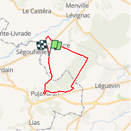
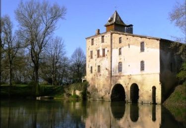
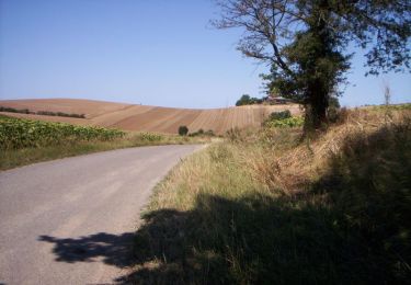
Ruta Senderismo de 20 km a descubrir en Occitania, Alto-Garona, Mérenvielle. Esta ruta ha sido propuesta por tracegps.
Descripción
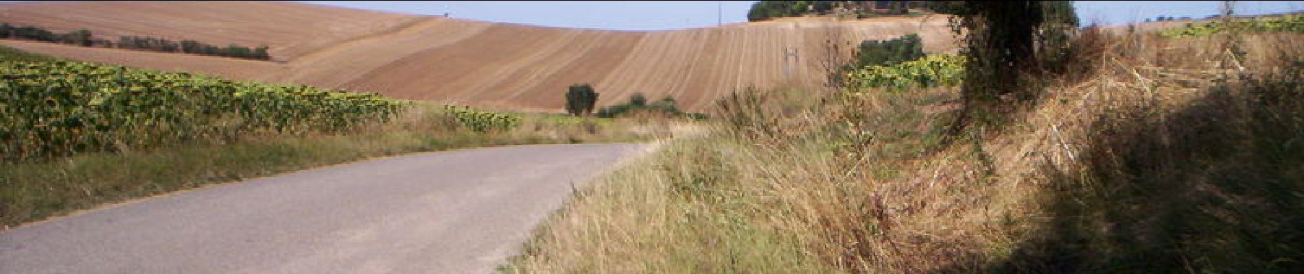
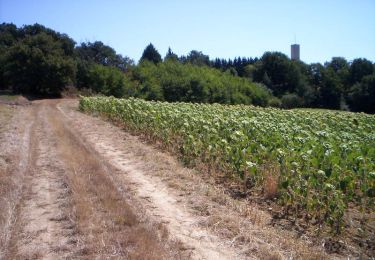
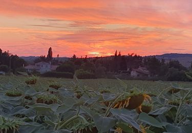
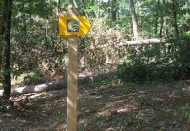
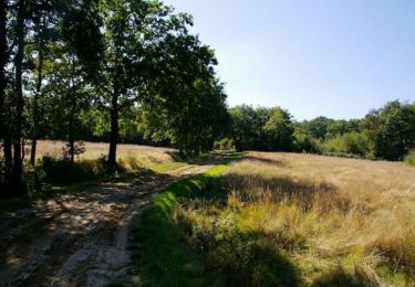
Une autre façon de se rendre en Forêt de Bouconne, la plus vaste étendue boisée de la Haute-Garonne. On y passe, on y flane, mais les routes et chemins nous attendent !
Localización
País:
France
Región :
Occitania
Departamento/provincia :
Alto-Garona
Municipio :
Mérenvielle
Localidad:
Unknown
Salida:(Dec)
Salida:(UTM)
351253 ; 4832206 (31T) N.
Comentarios
Excursiones cerca
![Excursión A pie Pujaudran - Circuit de la Forêt de Lartus - Photo](https://media.geolcdn.com/t/375/260/1cb52d3f-d5d7-422f-9927-241b0aa5f80f.jpeg&format=jpg&maxdim=2)
![A pie A pie](https://static1.geolcdn.com/sitytour/trail-icons/100.png)
Circuit de la Forêt de Lartus
A pie
Fácil
Pujaudran,
Occitania,
Gers,
France
![](/images/other/stat-length.png)
9,7 km | 12,4 km-effort
2h 49min
![](https://static1.geolcdn.com/siteimages/upload/files/16400158638029165_repeat_loop_refresh_sync_direction_icon.png)
Sí
![Excursión Carrera Pujaudran - Trois étoiles à Pujaudran - Photo](https://media.geolcdn.com/t/375/260/ext.jpg?maxdim=2&url=https%3A%2F%2Fservices.sitytrail.com%2FGeolivesWS%2FDownloadMedia.ashx%3FTrailID%3D100630%26Media%3D157_3.jpg)
![Carrera Carrera](https://static1.geolcdn.com/sitytour/trail-icons/103.png)
Trois étoiles à Pujaudran
Carrera
Difícil
Pujaudran,
Occitania,
Gers,
France
![](/images/other/stat-length.png)
18,9 km | 23 km-effort
2h 0min
![](https://static1.geolcdn.com/siteimages/upload/files/16400158638029165_repeat_loop_refresh_sync_direction_icon.png)
Sí
![Excursión Senderismo Pujaudran - Trois étoiles à Pujaudran - Photo](https://media.geolcdn.com/t/375/260/ext.jpg?maxdim=2&url=https%3A%2F%2Fservices.sitytrail.com%2FGeolivesWS%2FDownloadMedia.ashx%3FTrailID%3D100629%26Media%3D157_3.jpg)
![Senderismo Senderismo](https://static1.geolcdn.com/sitytour/trail-icons/101.png)
Trois étoiles à Pujaudran
Senderismo
Difícil
Pujaudran,
Occitania,
Gers,
France
![](/images/other/stat-length.png)
18,9 km | 23 km-effort
3h 49min
![](https://static1.geolcdn.com/siteimages/upload/files/16400158638029165_repeat_loop_refresh_sync_direction_icon.png)
Sí
![Excursión Senderismo Lasserre-Pradère - LASSERE-PRADERE rando nocturne - Photo](https://media.geolcdn.com/t/375/260/9f48f838-3bba-4aea-bd83-890db2773761.jpg&format=jpg&maxdim=2)
![Senderismo Senderismo](https://static1.geolcdn.com/sitytour/trail-icons/101.png)
LASSERE-PRADERE rando nocturne
Senderismo
Medio
Lasserre-Pradère,
Occitania,
Alto-Garona,
France
![](/images/other/stat-length.png)
8 km | 9,6 km-effort
2h 11min
![](https://static1.geolcdn.com/siteimages/upload/files/16400158638029165_repeat_loop_refresh_sync_direction_icon.png)
Sí
![Excursión Carrera Pujaudran - Entre Bouconne et Pujaudran - Photo](https://media.geolcdn.com/t/375/260/ext.jpg?maxdim=2&url=https%3A%2F%2Fservices.sitytrail.com%2FGeolivesWS%2FDownloadMedia.ashx%3FTrailID%3D129773%26Media%3D13315_2.jpg)
![Carrera Carrera](https://static1.geolcdn.com/sitytour/trail-icons/103.png)
Entre Bouconne et Pujaudran
Carrera
Difícil
Pujaudran,
Occitania,
Gers,
France
![](/images/other/stat-length.png)
12,8 km | 16 km-effort
1h 15min
![](https://static1.geolcdn.com/siteimages/upload/files/16400158638029165_repeat_loop_refresh_sync_direction_icon.png)
Sí
![Excursión Senderismo Pujaudran - Entre Bouconne et Pujaudran - Photo](https://media.geolcdn.com/t/375/260/ext.jpg?maxdim=2&url=https%3A%2F%2Fservices.sitytrail.com%2FGeolivesWS%2FDownloadMedia.ashx%3FTrailID%3D129772%26Media%3D13315_2.jpg)
![Senderismo Senderismo](https://static1.geolcdn.com/sitytour/trail-icons/101.png)
Entre Bouconne et Pujaudran
Senderismo
Difícil
Pujaudran,
Occitania,
Gers,
France
![](/images/other/stat-length.png)
12,8 km | 16 km-effort
3h 30min
![](https://static1.geolcdn.com/siteimages/upload/files/16400158638029165_repeat_loop_refresh_sync_direction_icon.png)
Sí
![Excursión Senderismo Le Castéra - Chemin de La Hire - Le Castera - Photo](https://media.geolcdn.com/t/375/260/ext.jpg?maxdim=2&url=https%3A%2F%2Fservices.sitytrail.com%2FGeolivesWS%2FDownloadMedia.ashx%3FTrailID%3D111949%26Media%3D9103_2.jpg)
![Senderismo Senderismo](https://static1.geolcdn.com/sitytour/trail-icons/101.png)
Chemin de La Hire - Le Castera
Senderismo
Medio
(1)
Le Castéra,
Occitania,
Alto-Garona,
France
![](/images/other/stat-length.png)
9,6 km | 12,8 km-effort
2h 45min
![](https://static1.geolcdn.com/siteimages/upload/files/16400158638029165_repeat_loop_refresh_sync_direction_icon.png)
Sí
![Excursión Senderismo Pujaudran - De Tellère près de la forêt de Bouconne à Lias - Photo](https://media.geolcdn.com/t/375/260/ext.jpg?maxdim=2&url=https%3A%2F%2Fservices.sitytrail.com%2FGeolivesWS%2FDownloadMedia.ashx%3FTrailID%3D110328%26Media%3D5768_1.jpg)
![Senderismo Senderismo](https://static1.geolcdn.com/sitytour/trail-icons/101.png)
De Tellère près de la forêt de Bouconne à Lias
Senderismo
Medio
Pujaudran,
Occitania,
Gers,
France
![](/images/other/stat-length.png)
15,3 km | 19,6 km-effort
4h 15min
![](https://static1.geolcdn.com/siteimages/upload/files/16400158638029165_repeat_loop_refresh_sync_direction_icon.png)
Sí
![Excursión Carrera Mérenvielle - De Mérenvielle à la forêt de Bouconne - Photo](https://media.geolcdn.com/t/375/260/ext.jpg?maxdim=2&url=https%3A%2F%2Fservices.sitytrail.com%2FGeolivesWS%2FDownloadMedia.ashx%3FTrailID%3D100632%26Media%3D158_2.jpg)
![Carrera Carrera](https://static1.geolcdn.com/sitytour/trail-icons/103.png)
De Mérenvielle à la forêt de Bouconne
Carrera
Muy difícil
Mérenvielle,
Occitania,
Alto-Garona,
France
![](/images/other/stat-length.png)
20 km | 25 km-effort
2h 0min
![](https://static1.geolcdn.com/siteimages/upload/files/16400158638029165_repeat_loop_refresh_sync_direction_icon.png)
Sí