![](/images/other/stat-length.png)
![Excursión Bici de montaña Valbonnais - Valbonnais-Beaumont - Photo](https://media.geolcdn.com/t/1900/400/ext.pjpeg?maxdim=2&url=https%3A%2F%2Fstatic1.geolcdn.com%2Fsiteimages%2Fupload%2Ffiles%2F1524743154velo.jpg)
Valbonnais-Beaumont
ericf64
Usuario
![Longitud](/images/other/stat-length.png)
Longitud
42 km
![Altitud máxima](https://static1.geolcdn.com/siteimages/upload/files/1508320355ic_sort_altitude_max_24dp.png)
Altitud máxima
1638 m
![Desnivel positivo](https://static1.geolcdn.com/siteimages/upload/files/1508320355ic_sort_den_pos_24dp.png)
Desnivel positivo
1523 m
![Km-Effort](/images/other/stat-length.png)
Km-Effort
62 km
![Altitud mínima](https://static1.geolcdn.com/siteimages/upload/files/1508320355ic_sort_altitude_min_24dp.png)
Altitud mínima
692 m
![Desnivel negativo](https://static1.geolcdn.com/siteimages/upload/files/1508320355ic_sort_den_neg_24dp.png)
Desnivel negativo
1524 m
![Boucle](https://static1.geolcdn.com/siteimages/upload/files/16400158638029165_repeat_loop_refresh_sync_direction_icon.png)
Boucle
Sí
Fecha de creación :
2019-01-15 13:06:02.984
Última modificación :
2019-01-15 13:06:02.984
![Bici de montaña](https://static1.geolcdn.com/sitytour/trail-icons/202.png)
3h59
Dificultad : Difícil
![Escanee este código QR para abrir la excursión en la aplicación SityTrail](https://capi.geolives.com/qq0zvz2zws4bq2lad0pu/sitytour/trails/1004838/qr.png?size=200)
Aplicación GPS de excursión GRATIS
A propósito
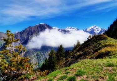
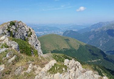
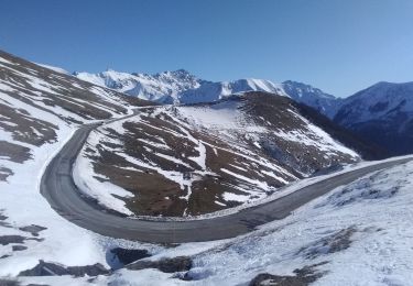
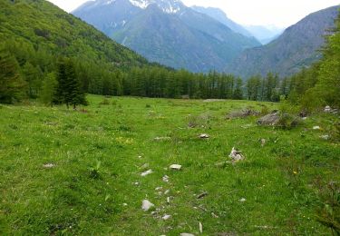
Ruta Bici de montaña de 42 km a descubrir en Auvergne-Rhône-Alpes, Isère, Valbonnais. Esta ruta ha sido propuesta por ericf64.
Descripción
Montée par la route au col de parquetout, traversée des alpages,chemin en balcon sur l'Obiou, canal du Beaumont ...
Localización
País:
France
Región :
Auvergne-Rhône-Alpes
Departamento/provincia :
Isère
Municipio :
Valbonnais
Localidad:
Unknown
Salida:(Dec)
Salida:(UTM)
730919 ; 4975716 (31T) N.
Comentarios
Excursiones cerca
![Excursión Senderismo La Salette-Fallavaux - Croix de Rougny via ND de la Salette - Photo](https://media.geolcdn.com/t/375/260/2c02e1cb-779c-4473-995c-4136efa43ee7.jpg&format=jpg&maxdim=2)
![Senderismo Senderismo](https://static1.geolcdn.com/sitytour/trail-icons/101.png)
Croix de Rougny via ND de la Salette
Senderismo
Muy difícil
(1)
La Salette-Fallavaux,
Auvergne-Rhône-Alpes,
Isère,
France
![](/images/other/stat-length.png)
10,5 km | 21 km-effort
4h 45min
![](https://static1.geolcdn.com/siteimages/upload/files/16400158638029165_repeat_loop_refresh_sync_direction_icon.png)
Sí
![Excursión Senderismo Entraigues - gargas en partant du villard - Photo](https://media.geolcdn.com/t/375/260/ext.jpg?maxdim=2&url=https%3A%2F%2Fservices.sitytrail.com%2FGeolivesWS%2FDownloadMedia.ashx%3FTrailID%3D804668%26Media%3Dfix__20170807111554.jpg)
![Senderismo Senderismo](https://static1.geolcdn.com/sitytour/trail-icons/101.png)
gargas en partant du villard
Senderismo
Muy fácil
(1)
Entraigues,
Auvergne-Rhône-Alpes,
Isère,
France
![](/images/other/stat-length.png)
15,1 km | 34 km-effort
5h 40min
![](https://static1.geolcdn.com/siteimages/upload/files/16400158638029165_repeat_loop_refresh_sync_direction_icon.png)
Sí
![Excursión Senderismo Saint-Michel-en-Beaumont - 2022-07-20_17h09m05_ND Salette - Photo](https://media.geolcdn.com/t/375/260/ext.jpg?maxdim=2&url=https%3A%2F%2Fstatic1.geolcdn.com%2Fsiteimages%2Fupload%2Ffiles%2F1553511878bg_sport_marche.png)
![Senderismo Senderismo](https://static1.geolcdn.com/sitytour/trail-icons/101.png)
2022-07-20_17h09m05_ND Salette
Senderismo
Medio
(1)
Saint-Michel-en-Beaumont,
Auvergne-Rhône-Alpes,
Isère,
France
![](/images/other/stat-length.png)
14,3 km | 23 km-effort
5h 10min
![](https://static1.geolcdn.com/siteimages/upload/files/16400158638029165_repeat_loop_refresh_sync_direction_icon.png)
Sí
![Excursión Esquí de fondo La Salette-Fallavaux - côté belle et Gargas - Photo](https://media.geolcdn.com/t/375/260/dc2d20ac-386f-4432-b67f-65443d05e523.jpg&format=jpg&maxdim=2)
![Esquí de fondo Esquí de fondo](https://static1.geolcdn.com/sitytour/trail-icons/503.png)
côté belle et Gargas
Esquí de fondo
Medio
La Salette-Fallavaux,
Auvergne-Rhône-Alpes,
Isère,
France
![](/images/other/stat-length.png)
6,3 km | 17,4 km-effort
4h 11min
![](https://static1.geolcdn.com/siteimages/upload/files/16400158638029165_repeat_loop_refresh_sync_direction_icon.png)
Sí
![Excursión Senderismo Saint-Michel-en-Beaumont - Valbonnais Cols de Parquetout-d'Hurtieres - Photo](https://media.geolcdn.com/t/375/260/ext.jpg?maxdim=2&url=https%3A%2F%2Fservices.sitytrail.com%2FGeolivesWS%2FDownloadMedia.ashx%3FTrailID%3D309864%26Media%3Dfix__20140606152454.jpg)
![Senderismo Senderismo](https://static1.geolcdn.com/sitytour/trail-icons/101.png)
Valbonnais Cols de Parquetout-d'Hurtieres
Senderismo
Medio
(1)
Saint-Michel-en-Beaumont,
Auvergne-Rhône-Alpes,
Isère,
France
![](/images/other/stat-length.png)
14,5 km | 23 km-effort
5h 20min
![](https://static1.geolcdn.com/siteimages/upload/files/16400158638029165_repeat_loop_refresh_sync_direction_icon.png)
Sí
![Excursión Senderismo Chantepérier - boucle départ le perier - Photo](https://media.geolcdn.com/t/375/260/f8464621-47d2-476f-9597-43e7568bb454.jpg&format=jpg&maxdim=2)
![Senderismo Senderismo](https://static1.geolcdn.com/sitytour/trail-icons/101.png)
boucle départ le perier
Senderismo
Muy difícil
Chantepérier,
Auvergne-Rhône-Alpes,
Isère,
France
![](/images/other/stat-length.png)
10,8 km | 21 km-effort
3h 32min
![](https://static1.geolcdn.com/siteimages/upload/files/16400158638029165_repeat_loop_refresh_sync_direction_icon.png)
Sí
![Excursión Senderismo Sainte-Luce - Côte Rouge - Photo](https://media.geolcdn.com/t/375/260/de862aa8-3a89-4016-889b-2ec83352f8c0.jpg&format=jpg&maxdim=2)
![Senderismo Senderismo](https://static1.geolcdn.com/sitytour/trail-icons/101.png)
Côte Rouge
Senderismo
Muy difícil
Sainte-Luce,
Auvergne-Rhône-Alpes,
Isère,
France
![](/images/other/stat-length.png)
10,7 km | 21 km-effort
6h 59min
![](https://static1.geolcdn.com/siteimages/upload/files/16400158638029165_repeat_loop_refresh_sync_direction_icon.png)
Sí
![Senderismo Senderismo](https://static1.geolcdn.com/sitytour/trail-icons/101.png)
La Salette-Fallavaux Marche à pied
Senderismo
Medio
La Salette-Fallavaux,
Auvergne-Rhône-Alpes,
Isère,
France
![](/images/other/stat-length.png)
6,6 km | 10,2 km-effort
2h 7min
![](https://static1.geolcdn.com/siteimages/upload/files/16400158638029165_repeat_loop_refresh_sync_direction_icon.png)
No
![Excursión Senderismo Chantepérier - Circuit de Gaudissart au départ du Périer - Photo](https://media.geolcdn.com/t/375/260/55635fd9-3a90-4b75-89c6-88e1cfea5ad6.jpg&format=jpg&maxdim=2)
![Senderismo Senderismo](https://static1.geolcdn.com/sitytour/trail-icons/101.png)
Circuit de Gaudissart au départ du Périer
Senderismo
Medio
Chantepérier,
Auvergne-Rhône-Alpes,
Isère,
France
![](/images/other/stat-length.png)
10,2 km | 0 m-effort
5h 2min
![](https://static1.geolcdn.com/siteimages/upload/files/16400158638029165_repeat_loop_refresh_sync_direction_icon.png)
Sí