


8,1 km | 9 km-effort
Arnhem: Descubra las mejores excursiones: 18 a pie y 5 en bici o bici de montaña. Todos estos circuitos, recorridos, itinerarios y actividades al aire libre están disponibles en nuestras aplicaciones SityTrail para smartphone y tablet.
A pie


• Trail created by Natuurmonumenten.
A pie
• Trail created by Natuurmonumenten.
A pie
• Voor wie houdt van een boswandeling met de nodige afwisseling is de NS-wandeling Warnsborn een goede optie. Sitio we...
A pie
• Sitio web: https://www.wandelzoekpagina.nl/groene_wissels/lijst.php
A pie
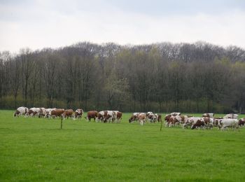
• Hoog Erf bestaat uit weilanden, akkers, loofbosjes en singels. Een mooi punt is ‘de ster’. Hier komen zes lanen van h...
A pie
• Hoog Erf bestaat uit weilanden, akkers, loofbosjes en singels. Een mooi punt is ‘de ster’. Hier komen zes lanen van h...
A pie
• Hoog Erf bestaat uit weilanden, akkers, loofbosjes en singels. Een mooi punt is ‘de ster’. Hier komen zes lanen van h...
A pie
• Trail created by Geldersch Landschap en Geldersche Kasteelen. http://www.mooigelderland.nl/data/catalog/404/361745/1...
A pie
A pie

 7.172
7.172
sport
• vooral hoogtepunten te bekijken en beleven: kerken, St Jansbeek, historische kelders en heel veel eet en drinkgelegen...

Motor
• More information on GPStracks.nl : http://www.gpstracks.nl

Bicicleta
• More information on GPStracks.nl : http://www.gpstracks.nl
Bicicleta
• More information on GPStracks.nl : http://www.gpstracks.nl
Bici de montaña
• More information on GPStracks.nl : http://www.gpstracks.nl
Bici de montaña
• More information on GPStracks.nl : http://www.gpstracks.nl
Bici de montaña
• More information on GPStracks.nl : http://www.gpstracks.nl

Senderismo
• More information on GPStracks.nl : http://www.gpstracks.nl
Senderismo
• More information on GPStracks.nl : http://www.gpstracks.nl
Senderismo
• More information on GPStracks.nl : http://www.gpstracks.nl
20 excursiones mostradas en 28
Aplicación GPS de excursión GRATIS
 SityTrail
IGN / Institutos geográficos
SityTrail World
El mundo es suyo