![](/images/other/stat-length.png)
- Excursiones
- Outdoor
- Italy
- Piamonte
- Novara
Novara, Piamonte: Los mejores itinerarios de excursión, recorridos, paseos y sendas
Novara: Descubra las mejores excursiones: 73 a pie. Todos estos circuitos, recorridos, itinerarios y actividades al aire libre están disponibles en nuestras aplicaciones SityTrail para smartphone y tablet.
Los mejores recorridos (74)
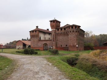
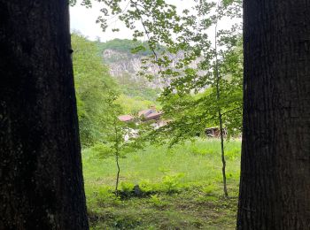
![Excursión A pie Ghemme - Sentiero Novara tappa 19 - Photo](https://media.geolcdn.com/t/350/260/431e849b-3caa-4973-8143-ce05b82bf892.jpeg&format=jpg&maxdim=2)
![A pie A pie](https://static1.geolcdn.com/sitytour/trail-icons/100.png)
Km
A pie
![](/images/other/stat-length.png)
![](https://static1.geolcdn.com/siteimages/upload/files/1508320355ic_sort_den_pos_24dp.png)
![](https://static1.geolcdn.com/siteimages/upload/files/1508320355ic_sort_den_neg_24dp.png)
![](https://static1.geolcdn.com/siteimages/upload/files/16400158638029165_repeat_loop_refresh_sync_direction_icon.png)
• Sitio web: http://www.cainovara.it
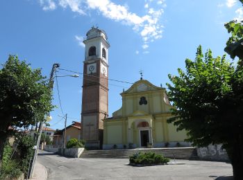
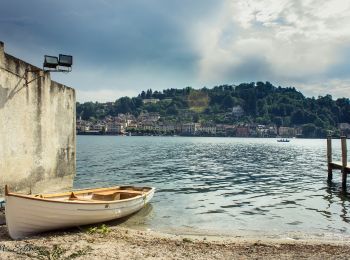
![Excursión A pie Cavallirio - Sentiero Novara tappa 18 - Photo](https://media.geolcdn.com/t/350/260/ba516fe2-0f28-4bd4-a213-e816f431534f.jpeg&format=jpg&maxdim=2)
![A pie A pie](https://static1.geolcdn.com/sitytour/trail-icons/100.png)
Km
A pie
![](/images/other/stat-length.png)
![](https://static1.geolcdn.com/siteimages/upload/files/1508320355ic_sort_den_pos_24dp.png)
![](https://static1.geolcdn.com/siteimages/upload/files/1508320355ic_sort_den_neg_24dp.png)
![](https://static1.geolcdn.com/siteimages/upload/files/16400158638029165_repeat_loop_refresh_sync_direction_icon.png)
• Sitio web: http://www.cainovara.it
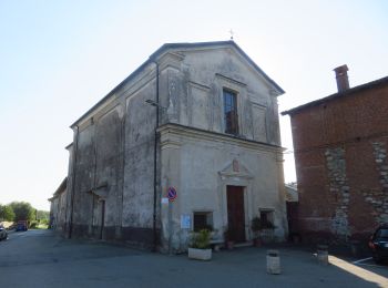
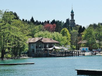
![Excursión A pie Gozzano - Sentiero Novara tappa 17 - Photo](https://media.geolcdn.com/t/350/260/0dcb942f-62c0-4d08-b93c-a07e8a48aed3.jpeg&format=jpg&maxdim=2)
![A pie A pie](https://static1.geolcdn.com/sitytour/trail-icons/100.png)
Km
A pie
![](/images/other/stat-length.png)
![](https://static1.geolcdn.com/siteimages/upload/files/1508320355ic_sort_den_pos_24dp.png)
![](https://static1.geolcdn.com/siteimages/upload/files/1508320355ic_sort_den_neg_24dp.png)
![](https://static1.geolcdn.com/siteimages/upload/files/16400158638029165_repeat_loop_refresh_sync_direction_icon.png)
• Sitio web: http://www.cainovara.it
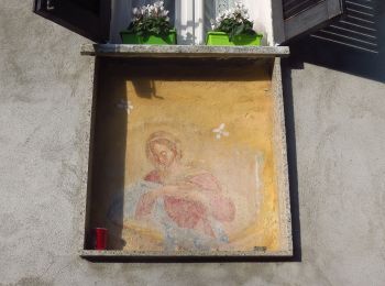
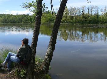
![Excursión A pie Ameno - Sentiero Novara tappa 16 - Photo](https://media.geolcdn.com/t/350/260/ef998481-f59a-4f2f-aa58-5f2447000c96.jpeg&format=jpg&maxdim=2)
![A pie A pie](https://static1.geolcdn.com/sitytour/trail-icons/100.png)
Km
A pie
![](/images/other/stat-length.png)
![](https://static1.geolcdn.com/siteimages/upload/files/1508320355ic_sort_den_pos_24dp.png)
![](https://static1.geolcdn.com/siteimages/upload/files/1508320355ic_sort_den_neg_24dp.png)
![](https://static1.geolcdn.com/siteimages/upload/files/16400158638029165_repeat_loop_refresh_sync_direction_icon.png)
• Sitio web: http://www.cainovara.it
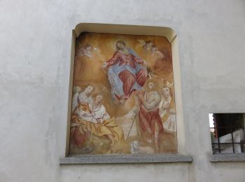
![Excursión A pie Meina - Sentiero Novara tappa 14 - Photo](https://media.geolcdn.com/t/350/260/cbc748a9-f51f-4b9d-9823-1acd52c778eb.jpeg&format=jpg&maxdim=2)
![A pie A pie](https://static1.geolcdn.com/sitytour/trail-icons/100.png)
Km
A pie
![](/images/other/stat-length.png)
![](https://static1.geolcdn.com/siteimages/upload/files/1508320355ic_sort_den_pos_24dp.png)
![](https://static1.geolcdn.com/siteimages/upload/files/1508320355ic_sort_den_neg_24dp.png)
![](https://static1.geolcdn.com/siteimages/upload/files/16400158638029165_repeat_loop_refresh_sync_direction_icon.png)
• Sitio web: http://www.cainovara.it
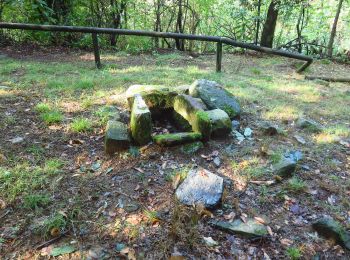
![Excursión A pie Arona - Sentiero Novara tappa 13 - Photo](https://media.geolcdn.com/t/350/260/ea42a469-100b-4563-91a8-37df6b072fad.jpeg&format=jpg&maxdim=2)
![A pie A pie](https://static1.geolcdn.com/sitytour/trail-icons/100.png)
Km
A pie
![](/images/other/stat-length.png)
![](https://static1.geolcdn.com/siteimages/upload/files/1508320355ic_sort_den_pos_24dp.png)
![](https://static1.geolcdn.com/siteimages/upload/files/1508320355ic_sort_den_neg_24dp.png)
![](https://static1.geolcdn.com/siteimages/upload/files/16400158638029165_repeat_loop_refresh_sync_direction_icon.png)
• Sitio web: http://www.cainovara.it
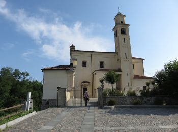
![Excursión A pie Mezzomerico - Sentiero Novara tappa 12 - Photo](https://media.geolcdn.com/t/350/260/e2440e4c-0ae4-4aed-9cf4-bbfffcb48ef1.jpeg&format=jpg&maxdim=2)
![A pie A pie](https://static1.geolcdn.com/sitytour/trail-icons/100.png)
Km
A pie
![](/images/other/stat-length.png)
![](https://static1.geolcdn.com/siteimages/upload/files/1508320355ic_sort_den_pos_24dp.png)
![](https://static1.geolcdn.com/siteimages/upload/files/1508320355ic_sort_den_neg_24dp.png)
![](https://static1.geolcdn.com/siteimages/upload/files/16400158638029165_repeat_loop_refresh_sync_direction_icon.png)
• Sitio web: http://www.cainovara.it
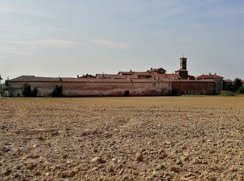
![Excursión A pie Bellinzago Novarese - Sentiero Novara tappa 11 - Photo](https://media.geolcdn.com/t/350/260/58dd5879-0012-4d90-a5a1-9907ee900afa.jpeg&format=jpg&maxdim=2)
![A pie A pie](https://static1.geolcdn.com/sitytour/trail-icons/100.png)
Km
A pie
![](/images/other/stat-length.png)
![](https://static1.geolcdn.com/siteimages/upload/files/1508320355ic_sort_den_pos_24dp.png)
![](https://static1.geolcdn.com/siteimages/upload/files/1508320355ic_sort_den_neg_24dp.png)
![](https://static1.geolcdn.com/siteimages/upload/files/16400158638029165_repeat_loop_refresh_sync_direction_icon.png)
• Sitio web: http://www.cainovara.it
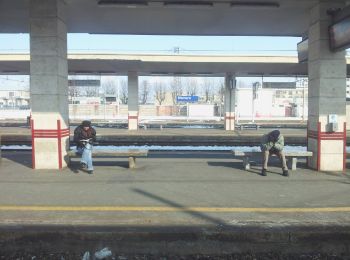
![Excursión A pie Novara - Sentiero Novara tappa 0 nord - Photo](https://media.geolcdn.com/t/350/260/3263948a-ca4a-49ae-83c7-2017e71880e5.jpeg&format=jpg&maxdim=2)
![A pie A pie](https://static1.geolcdn.com/sitytour/trail-icons/100.png)
Km
A pie
![](/images/other/stat-length.png)
![](https://static1.geolcdn.com/siteimages/upload/files/1508320355ic_sort_den_pos_24dp.png)
![](https://static1.geolcdn.com/siteimages/upload/files/1508320355ic_sort_den_neg_24dp.png)
![](https://static1.geolcdn.com/siteimages/upload/files/16400158638029165_repeat_loop_refresh_sync_direction_icon.png)
• Sitio web: http://www.cainovara.it
![Excursión A pie Galliate - Sentiero Novara tappa 10 - Photo](https://media.geolcdn.com/t/350/260/58dd5879-0012-4d90-a5a1-9907ee900afa.jpeg&format=jpg&maxdim=2)
![A pie A pie](https://static1.geolcdn.com/sitytour/trail-icons/100.png)
Km
A pie
![](/images/other/stat-length.png)
![](https://static1.geolcdn.com/siteimages/upload/files/1508320355ic_sort_den_pos_24dp.png)
![](https://static1.geolcdn.com/siteimages/upload/files/1508320355ic_sort_den_neg_24dp.png)
![](https://static1.geolcdn.com/siteimages/upload/files/16400158638029165_repeat_loop_refresh_sync_direction_icon.png)
• Sitio web: http://www.cainovara.it
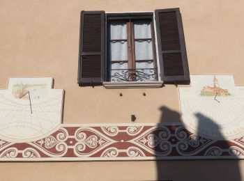
![Excursión A pie Casaleggio Novara - Sentiero Novara tappa 2 - Photo](https://media.geolcdn.com/t/350/260/51056485-08d2-4882-b97f-8e3a007e21a8.jpeg&format=jpg&maxdim=2)
![A pie A pie](https://static1.geolcdn.com/sitytour/trail-icons/100.png)
Km
A pie
![](/images/other/stat-length.png)
![](https://static1.geolcdn.com/siteimages/upload/files/1508320355ic_sort_den_pos_24dp.png)
![](https://static1.geolcdn.com/siteimages/upload/files/1508320355ic_sort_den_neg_24dp.png)
![](https://static1.geolcdn.com/siteimages/upload/files/16400158638029165_repeat_loop_refresh_sync_direction_icon.png)
• Sitio web: http://www.cainovara.it
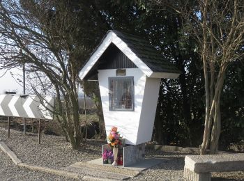
![Excursión A pie Casalvolone - Sentiero Novara tappa 3 - Photo](https://media.geolcdn.com/t/350/260/d0d4b614-fcb5-454d-bfb3-6f7d7164eaf3.jpeg&format=jpg&maxdim=2)
![A pie A pie](https://static1.geolcdn.com/sitytour/trail-icons/100.png)
Km
A pie
![](/images/other/stat-length.png)
![](https://static1.geolcdn.com/siteimages/upload/files/1508320355ic_sort_den_pos_24dp.png)
![](https://static1.geolcdn.com/siteimages/upload/files/1508320355ic_sort_den_neg_24dp.png)
![](https://static1.geolcdn.com/siteimages/upload/files/16400158638029165_repeat_loop_refresh_sync_direction_icon.png)
• Sitio web: http://www.cainovara.it
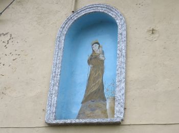
![Excursión A pie Massino Visconti - VH2 - Massino Visconti fraz. Monte - Alpe Canà - Photo](https://media.geolcdn.com/t/350/260/716244ea-49c1-4be0-a07d-2ea8d6d38c71.jpeg&format=jpg&maxdim=2)
![A pie A pie](https://static1.geolcdn.com/sitytour/trail-icons/100.png)
Km
A pie
![](/images/other/stat-length.png)
![](https://static1.geolcdn.com/siteimages/upload/files/1508320355ic_sort_den_pos_24dp.png)
![](https://static1.geolcdn.com/siteimages/upload/files/1508320355ic_sort_den_neg_24dp.png)
![](https://static1.geolcdn.com/siteimages/upload/files/16400158638029165_repeat_loop_refresh_sync_direction_icon.png)
• Symbol: unmarked Sitio web: http://www.estmonterosa.it/catasto-percorsi-vco-vergante-settore-v.html
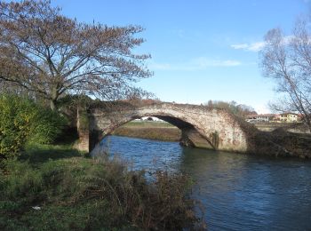
![Excursión A pie Briona - Sentiero Novara tappa 1 - Photo](https://media.geolcdn.com/t/350/260/a5811112-4250-4fff-bb1b-37f87f198e4d.jpeg&format=jpg&maxdim=2)
![A pie A pie](https://static1.geolcdn.com/sitytour/trail-icons/100.png)
Km
A pie
![](/images/other/stat-length.png)
![](https://static1.geolcdn.com/siteimages/upload/files/1508320355ic_sort_den_pos_24dp.png)
![](https://static1.geolcdn.com/siteimages/upload/files/1508320355ic_sort_den_neg_24dp.png)
![](https://static1.geolcdn.com/siteimages/upload/files/16400158638029165_repeat_loop_refresh_sync_direction_icon.png)
• Sitio web: http://www.cainovara.it
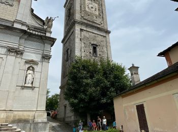
![Excursión Senderismo Armeno - 20.06.2023 - Armeno - L'arrière pays du Lac d'Orta - 1 - Photo](https://media.geolcdn.com/t/350/260/e55d708d-2878-4fe8-803e-a98c16a9ca08.jpg&format=jpg&maxdim=2)
![Senderismo Senderismo](https://static1.geolcdn.com/sitytour/trail-icons/101.png)
Km
Senderismo
![](/images/other/stat-length.png)
![](https://static1.geolcdn.com/siteimages/upload/files/1508320355ic_sort_den_pos_24dp.png)
![](https://static1.geolcdn.com/siteimages/upload/files/1508320355ic_sort_den_neg_24dp.png)
![](https://static1.geolcdn.com/siteimages/upload/files/16400158638029165_repeat_loop_refresh_sync_direction_icon.png)
![Excursión Senderismo Pella - Sentier Picasso - Photo](https://media.geolcdn.com/t/350/260/19a529f7-8879-4385-a41e-edbf0a449af7.jpg&format=jpg&maxdim=2)
![Senderismo Senderismo](https://static1.geolcdn.com/sitytour/trail-icons/101.png)
Km
Senderismo
![](/images/other/stat-length.png)
![](https://static1.geolcdn.com/siteimages/upload/files/1508320355ic_sort_den_pos_24dp.png)
![](https://static1.geolcdn.com/siteimages/upload/files/1508320355ic_sort_den_neg_24dp.png)
![](https://static1.geolcdn.com/siteimages/upload/files/16400158638029165_repeat_loop_refresh_sync_direction_icon.png)
![Excursión A pie Pettenasco - IT-VP9 - Photo](https://media.geolcdn.com/t/350/260/3fd97710-7bdb-4dae-9a90-d41194ae9a4a.jpeg&format=jpg&maxdim=2)
![A pie A pie](https://static1.geolcdn.com/sitytour/trail-icons/100.png)
Km
A pie
![](/images/other/stat-length.png)
![](https://static1.geolcdn.com/siteimages/upload/files/1508320355ic_sort_den_pos_24dp.png)
![](https://static1.geolcdn.com/siteimages/upload/files/1508320355ic_sort_den_neg_24dp.png)
![](https://static1.geolcdn.com/siteimages/upload/files/16400158638029165_repeat_loop_refresh_sync_direction_icon.png)
![Excursión A pie Orta San Giulio - IT-TU2 - Photo](https://media.geolcdn.com/t/350/260/3caffe93-f915-45d2-b7b2-f8b40eecaac7.jpeg&format=jpg&maxdim=2)
![A pie A pie](https://static1.geolcdn.com/sitytour/trail-icons/100.png)
Km
A pie
![](/images/other/stat-length.png)
![](https://static1.geolcdn.com/siteimages/upload/files/1508320355ic_sort_den_pos_24dp.png)
![](https://static1.geolcdn.com/siteimages/upload/files/1508320355ic_sort_den_neg_24dp.png)
![](https://static1.geolcdn.com/siteimages/upload/files/16400158638029165_repeat_loop_refresh_sync_direction_icon.png)
![Excursión A pie Arona - Le attività produttive - Photo](https://media.geolcdn.com/t/350/260/ea42a469-100b-4563-91a8-37df6b072fad.jpeg&format=jpg&maxdim=2)
![A pie A pie](https://static1.geolcdn.com/sitytour/trail-icons/100.png)
Km
A pie
![](/images/other/stat-length.png)
![](https://static1.geolcdn.com/siteimages/upload/files/1508320355ic_sort_den_pos_24dp.png)
![](https://static1.geolcdn.com/siteimages/upload/files/1508320355ic_sort_den_neg_24dp.png)
![](https://static1.geolcdn.com/siteimages/upload/files/16400158638029165_repeat_loop_refresh_sync_direction_icon.png)
![Excursión A pie Comignago - Le zone umide - Photo](https://media.geolcdn.com/t/350/260/4557603d-e50c-4368-8a1c-dc3ca91b87e2.jpeg&format=jpg&maxdim=2)
![A pie A pie](https://static1.geolcdn.com/sitytour/trail-icons/100.png)
Km
A pie
![](/images/other/stat-length.png)
![](https://static1.geolcdn.com/siteimages/upload/files/1508320355ic_sort_den_pos_24dp.png)
![](https://static1.geolcdn.com/siteimages/upload/files/1508320355ic_sort_den_neg_24dp.png)
![](https://static1.geolcdn.com/siteimages/upload/files/16400158638029165_repeat_loop_refresh_sync_direction_icon.png)
20 excursiones mostradas en 74
Aplicación GPS de excursión GRATIS
Actividades
Regiones próximas
- Ameno
- Armeno
- Arona
- Bellinzago Novarese
- Boca
- Bolzano Novarese
- Borgomanero
- Briona
- Casaleggio Novara
- Casalino
- Casalvolone
- Cavallirio
- Cerano
- Colazza
- Comignago
- Dormelletto
- Galliate
- Gargallo
- Ghemme
- Gozzano
- Granozzo con Monticello
- Grignasco
- Invorio
- Lesa
- Maggiora
- Massino Visconti
- Meina
- Mezzomerico
- Miasino
- Nebbiuno
- Novara
- Oleggio Castello
- Orta San Giulio
- Pella
- Pettenasco
- Pogno
- Prato Sesia
- Recetto
- Romentino
- Terdobbiate
- Trecate
- Vespolate