![](/images/other/stat-length.png)
- Excursiones
- Outdoor
- Italy
- Toscana
- Massa-Carrara
Massa-Carrara, Toscana: Los mejores itinerarios de excursión, recorridos, paseos y sendas
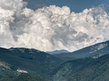
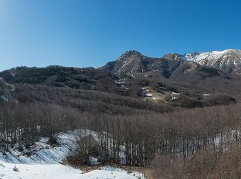
Massa-Carrara: Descubra las mejores excursiones: 103 a pie y 1 en bici o bici de montaña. Todos estos circuitos, recorridos, itinerarios y actividades al aire libre están disponibles en nuestras aplicaciones SityTrail para smartphone y tablet.
Los mejores recorridos (104)
![Excursión A pie Fosdinovo - 284 - Photo](https://media.geolcdn.com/t/350/260/8ef48164-0955-4b10-948c-c8b2647942ce.jpeg&format=jpg&maxdim=2)
![A pie A pie](https://static1.geolcdn.com/sitytour/trail-icons/100.png)
Km
A pie
![](/images/other/stat-length.png)
![](https://static1.geolcdn.com/siteimages/upload/files/1508320355ic_sort_den_pos_24dp.png)
![](https://static1.geolcdn.com/siteimages/upload/files/1508320355ic_sort_den_neg_24dp.png)
![](https://static1.geolcdn.com/siteimages/upload/files/16400158638029165_repeat_loop_refresh_sync_direction_icon.png)
• Trail created by Cai Sarzana.
![Excursión A pie Zeri - Zeri No 1 - Photo](https://media.geolcdn.com/t/350/260/14361c0c-49b5-4bbf-a18d-574f53535223.jpeg&format=jpg&maxdim=2)
![A pie A pie](https://static1.geolcdn.com/sitytour/trail-icons/100.png)
Km
A pie
![](/images/other/stat-length.png)
![](https://static1.geolcdn.com/siteimages/upload/files/1508320355ic_sort_den_pos_24dp.png)
![](https://static1.geolcdn.com/siteimages/upload/files/1508320355ic_sort_den_neg_24dp.png)
![](https://static1.geolcdn.com/siteimages/upload/files/16400158638029165_repeat_loop_refresh_sync_direction_icon.png)
• Trail created by Comune di Zeri.
![Excursión A pie Zeri - Zeri No 3 - Photo](https://media.geolcdn.com/t/350/260/14361c0c-49b5-4bbf-a18d-574f53535223.jpeg&format=jpg&maxdim=2)
![A pie A pie](https://static1.geolcdn.com/sitytour/trail-icons/100.png)
Km
A pie
![](/images/other/stat-length.png)
![](https://static1.geolcdn.com/siteimages/upload/files/1508320355ic_sort_den_pos_24dp.png)
![](https://static1.geolcdn.com/siteimages/upload/files/1508320355ic_sort_den_neg_24dp.png)
![](https://static1.geolcdn.com/siteimages/upload/files/16400158638029165_repeat_loop_refresh_sync_direction_icon.png)
• Trail created by Comune di Zeri. Sitio web: https://lunigiana.uk/wp-content/uploads/2020/09/Zeri_Walks.pdf
![Excursión A pie Fivizzano - (SI L20) Passo del Cerreto - Rifugio Sarzana al Monte Acuto - Photo](https://media.geolcdn.com/t/350/260/517caf56-276f-40c9-a884-2c512ca00215.jpeg&format=jpg&maxdim=2)
![A pie A pie](https://static1.geolcdn.com/sitytour/trail-icons/100.png)
Km
A pie
![](/images/other/stat-length.png)
![](https://static1.geolcdn.com/siteimages/upload/files/1508320355ic_sort_den_pos_24dp.png)
![](https://static1.geolcdn.com/siteimages/upload/files/1508320355ic_sort_den_neg_24dp.png)
![](https://static1.geolcdn.com/siteimages/upload/files/16400158638029165_repeat_loop_refresh_sync_direction_icon.png)
• Sentiero Italia CAI 2020
![Excursión A pie Pontremoli - Via Francigena, Toscana var Montelungo-Pontremoli - Photo](https://media.geolcdn.com/t/350/260/f706e338-7002-43b1-bdde-63e1dfa3f596.jpeg&format=jpg&maxdim=2)
![A pie A pie](https://static1.geolcdn.com/sitytour/trail-icons/100.png)
Km
A pie
![](/images/other/stat-length.png)
![](https://static1.geolcdn.com/siteimages/upload/files/1508320355ic_sort_den_pos_24dp.png)
![](https://static1.geolcdn.com/siteimages/upload/files/1508320355ic_sort_den_neg_24dp.png)
![](https://static1.geolcdn.com/siteimages/upload/files/16400158638029165_repeat_loop_refresh_sync_direction_icon.png)
• Trail created by AVFAL. Route from Passo del Righetto to SP38 surveyed 26.12.19 by Damiano. Route from SP38 to Migne...
![Excursión A pie Fivizzano - Pratizzano - Collagna - Cerreto Alpi - Lago Pranda - Passo Crocetta - Photo](https://media.geolcdn.com/t/350/260/05af87f4-bd42-46e4-be0b-3613e20411be.jpeg&format=jpg&maxdim=2)
![A pie A pie](https://static1.geolcdn.com/sitytour/trail-icons/100.png)
Km
A pie
![](/images/other/stat-length.png)
![](https://static1.geolcdn.com/siteimages/upload/files/1508320355ic_sort_den_pos_24dp.png)
![](https://static1.geolcdn.com/siteimages/upload/files/1508320355ic_sort_den_neg_24dp.png)
![](https://static1.geolcdn.com/siteimages/upload/files/16400158638029165_repeat_loop_refresh_sync_direction_icon.png)
• Symbol: 679 on white red flags
![Excursión A pie Fivizzano - Trekking Lunigiana 12 - Photo](https://media.geolcdn.com/t/350/260/8ef48164-0955-4b10-948c-c8b2647942ce.jpeg&format=jpg&maxdim=2)
![A pie A pie](https://static1.geolcdn.com/sitytour/trail-icons/100.png)
Km
A pie
![](/images/other/stat-length.png)
![](https://static1.geolcdn.com/siteimages/upload/files/1508320355ic_sort_den_pos_24dp.png)
![](https://static1.geolcdn.com/siteimages/upload/files/1508320355ic_sort_den_neg_24dp.png)
![](https://static1.geolcdn.com/siteimages/upload/files/16400158638029165_repeat_loop_refresh_sync_direction_icon.png)
• Trail created by Comunità montana della Lunigiana. Monzone to Pulica survey undertaken 27.08.19. Pulica to Monte Car...
![Excursión A pie Bagnone - IT-118 - Photo](https://media.geolcdn.com/t/350/260/76e178af-5e8c-46d9-b676-274a641592b3.jpeg&format=jpg&maxdim=2)
![A pie A pie](https://static1.geolcdn.com/sitytour/trail-icons/100.png)
Km
A pie
![](/images/other/stat-length.png)
![](https://static1.geolcdn.com/siteimages/upload/files/1508320355ic_sort_den_pos_24dp.png)
![](https://static1.geolcdn.com/siteimages/upload/files/1508320355ic_sort_den_neg_24dp.png)
![](https://static1.geolcdn.com/siteimages/upload/files/16400158638029165_repeat_loop_refresh_sync_direction_icon.png)
• Symbol: 118 on white red flags
![Excursión A pie Fosdinovo - 293 - Photo](https://media.geolcdn.com/t/350/260/3fe1c984-425f-4ca4-8559-4e33a984f98a.jpeg&format=jpg&maxdim=2)
![A pie A pie](https://static1.geolcdn.com/sitytour/trail-icons/100.png)
Km
A pie
![](/images/other/stat-length.png)
![](https://static1.geolcdn.com/siteimages/upload/files/1508320355ic_sort_den_pos_24dp.png)
![](https://static1.geolcdn.com/siteimages/upload/files/1508320355ic_sort_den_neg_24dp.png)
![](https://static1.geolcdn.com/siteimages/upload/files/16400158638029165_repeat_loop_refresh_sync_direction_icon.png)
• Trail created by Club Alpino Italiano Sezione Sarzana.
![Excursión A pie Licciana Nardi - Greenway Fiume Magra - Photo](https://media.geolcdn.com/t/350/260/a51527c1-86c6-4d05-9f1d-72510286b35b.jpeg&format=jpg&maxdim=2)
![A pie A pie](https://static1.geolcdn.com/sitytour/trail-icons/100.png)
Km
A pie
![](/images/other/stat-length.png)
![](https://static1.geolcdn.com/siteimages/upload/files/1508320355ic_sort_den_pos_24dp.png)
![](https://static1.geolcdn.com/siteimages/upload/files/1508320355ic_sort_den_neg_24dp.png)
![](https://static1.geolcdn.com/siteimages/upload/files/16400158638029165_repeat_loop_refresh_sync_direction_icon.png)
• Trail created by Unione di Comuni Montagna Lunigiana. Whole route surveyed on foot 8.12.19
![Excursión A pie Fosdinovo - Trekking Lunigiana 13 - Photo](https://media.geolcdn.com/t/350/260/0d6197d8-fdd3-4cec-93b8-a3746a316ef7.jpeg&format=jpg&maxdim=2)
![A pie A pie](https://static1.geolcdn.com/sitytour/trail-icons/100.png)
Km
A pie
![](/images/other/stat-length.png)
![](https://static1.geolcdn.com/siteimages/upload/files/1508320355ic_sort_den_pos_24dp.png)
![](https://static1.geolcdn.com/siteimages/upload/files/1508320355ic_sort_den_neg_24dp.png)
![](https://static1.geolcdn.com/siteimages/upload/files/16400158638029165_repeat_loop_refresh_sync_direction_icon.png)
• Trail created by Comunità montana della Lunigiana.
![Excursión A pie Casola in Lunigiana - Trekking Lunigiana 11 - Photo](https://media.geolcdn.com/t/350/260/29e3053d-e137-426f-a694-c169165cf535.jpeg&format=jpg&maxdim=2)
![A pie A pie](https://static1.geolcdn.com/sitytour/trail-icons/100.png)
Km
A pie
![](/images/other/stat-length.png)
![](https://static1.geolcdn.com/siteimages/upload/files/1508320355ic_sort_den_pos_24dp.png)
![](https://static1.geolcdn.com/siteimages/upload/files/1508320355ic_sort_den_neg_24dp.png)
![](https://static1.geolcdn.com/siteimages/upload/files/16400158638029165_repeat_loop_refresh_sync_direction_icon.png)
• Trail created by Comunità montana della Lunigiana. Route from Casola to Ugliancaldo surveyed by Damiano 26.11.19. Ro...
![Excursión A pie Aulla - Trekking Lunigiana 1 - Photo](https://media.geolcdn.com/t/350/260/0d6197d8-fdd3-4cec-93b8-a3746a316ef7.jpeg&format=jpg&maxdim=2)
![A pie A pie](https://static1.geolcdn.com/sitytour/trail-icons/100.png)
Km
A pie
![](/images/other/stat-length.png)
![](https://static1.geolcdn.com/siteimages/upload/files/1508320355ic_sort_den_pos_24dp.png)
![](https://static1.geolcdn.com/siteimages/upload/files/1508320355ic_sort_den_neg_24dp.png)
![](https://static1.geolcdn.com/siteimages/upload/files/16400158638029165_repeat_loop_refresh_sync_direction_icon.png)
• Trail created by Comunità montana della Lunigiana.
![Excursión A pie Fivizzano - Trekking Lunigiana 10 - Photo](https://media.geolcdn.com/t/350/260/11f76e1c-b7b4-46f7-9d67-d2d9df154e4c.jpeg&format=jpg&maxdim=2)
![A pie A pie](https://static1.geolcdn.com/sitytour/trail-icons/100.png)
Km
A pie
![](/images/other/stat-length.png)
![](https://static1.geolcdn.com/siteimages/upload/files/1508320355ic_sort_den_pos_24dp.png)
![](https://static1.geolcdn.com/siteimages/upload/files/1508320355ic_sort_den_neg_24dp.png)
![](https://static1.geolcdn.com/siteimages/upload/files/16400158638029165_repeat_loop_refresh_sync_direction_icon.png)
• Trail created by Comunità montana della Lunigiana. Route from Casola to Mommio surveyed by Damiano 2.1.20. Route fro...
![Excursión A pie Comano - Trekking Lunigiana 9 - Photo](https://media.geolcdn.com/t/350/260/2f29e5cf-60e6-4b6a-a036-ef65b3172819.jpeg&format=jpg&maxdim=2)
![A pie A pie](https://static1.geolcdn.com/sitytour/trail-icons/100.png)
Km
A pie
![](/images/other/stat-length.png)
![](https://static1.geolcdn.com/siteimages/upload/files/1508320355ic_sort_den_pos_24dp.png)
![](https://static1.geolcdn.com/siteimages/upload/files/1508320355ic_sort_den_neg_24dp.png)
![](https://static1.geolcdn.com/siteimages/upload/files/16400158638029165_repeat_loop_refresh_sync_direction_icon.png)
• Trail created by Comunità montana della Lunigiana. Route from Castello di Comano to Monte Rozzo surveyed by Damiano ...
![Excursión A pie Pontremoli - Trekking Lunigiana 3 - Photo](https://media.geolcdn.com/t/350/260/14361c0c-49b5-4bbf-a18d-574f53535223.jpeg&format=jpg&maxdim=2)
![A pie A pie](https://static1.geolcdn.com/sitytour/trail-icons/100.png)
Km
A pie
![](/images/other/stat-length.png)
![](https://static1.geolcdn.com/siteimages/upload/files/1508320355ic_sort_den_pos_24dp.png)
![](https://static1.geolcdn.com/siteimages/upload/files/1508320355ic_sort_den_neg_24dp.png)
![](https://static1.geolcdn.com/siteimages/upload/files/16400158638029165_repeat_loop_refresh_sync_direction_icon.png)
• Trail created by Comunità montana della Lunigiana.
![Excursión A pie Tresana - Trekking Lunigiana 2 - Photo](https://media.geolcdn.com/t/350/260/14361c0c-49b5-4bbf-a18d-574f53535223.jpeg&format=jpg&maxdim=2)
![A pie A pie](https://static1.geolcdn.com/sitytour/trail-icons/100.png)
Km
A pie
![](/images/other/stat-length.png)
![](https://static1.geolcdn.com/siteimages/upload/files/1508320355ic_sort_den_pos_24dp.png)
![](https://static1.geolcdn.com/siteimages/upload/files/1508320355ic_sort_den_neg_24dp.png)
![](https://static1.geolcdn.com/siteimages/upload/files/16400158638029165_repeat_loop_refresh_sync_direction_icon.png)
• Trail created by Comunità montana della Lunigiana. Castello to Montereggio survey undertaken 24.06.19
![Excursión A pie Licciana Nardi - Trekking Lunigiana 8 - Photo](https://media.geolcdn.com/t/350/260/cdb86e0d-0b7d-4ed7-803a-2d89164a357d.jpeg&format=jpg&maxdim=2)
![A pie A pie](https://static1.geolcdn.com/sitytour/trail-icons/100.png)
Km
A pie
![](/images/other/stat-length.png)
![](https://static1.geolcdn.com/siteimages/upload/files/1508320355ic_sort_den_pos_24dp.png)
![](https://static1.geolcdn.com/siteimages/upload/files/1508320355ic_sort_den_neg_24dp.png)
![](https://static1.geolcdn.com/siteimages/upload/files/16400158638029165_repeat_loop_refresh_sync_direction_icon.png)
• Trail created by Comunità montana della Lunigiana.
![Excursión A pie Fivizzano - (SI L20OLD) Passo del Cerreto - Rifugio Sarzana al Monte Acuto - Diga del Lagastrello - Pratospilla - Photo](https://media.geolcdn.com/t/350/260/62540591-420b-4e4d-8416-7c39d58c5ec8.jpeg&format=jpg&maxdim=2)
![A pie A pie](https://static1.geolcdn.com/sitytour/trail-icons/100.png)
Km
A pie
![](/images/other/stat-length.png)
![](https://static1.geolcdn.com/siteimages/upload/files/1508320355ic_sort_den_pos_24dp.png)
![](https://static1.geolcdn.com/siteimages/upload/files/1508320355ic_sort_den_neg_24dp.png)
![](https://static1.geolcdn.com/siteimages/upload/files/16400158638029165_repeat_loop_refresh_sync_direction_icon.png)
• Sentiero Italia CAI 2019
![Excursión A pie Carrara - IT-182 - Photo](https://media.geolcdn.com/t/350/260/d1ba23f6-c896-42e7-96f2-f1803f6f5405.jpeg&format=jpg&maxdim=2)
![A pie A pie](https://static1.geolcdn.com/sitytour/trail-icons/100.png)
Km
A pie
![](/images/other/stat-length.png)
![](https://static1.geolcdn.com/siteimages/upload/files/1508320355ic_sort_den_pos_24dp.png)
![](https://static1.geolcdn.com/siteimages/upload/files/1508320355ic_sort_den_neg_24dp.png)
![](https://static1.geolcdn.com/siteimages/upload/files/16400158638029165_repeat_loop_refresh_sync_direction_icon.png)
• Trail created by Club Alpino Italiano.
20 excursiones mostradas en 104
Aplicación GPS de excursión GRATIS