


8,2 km | 11,8 km-effort
Ancona: Descubra las mejores excursiones: 71 a pie. Todos estos circuitos, recorridos, itinerarios y actividades al aire libre están disponibles en nuestras aplicaciones SityTrail para smartphone y tablet.
A pie


• Trail created by Associazione Amici del Cammino dalla Porta d'Oriente.
A pie
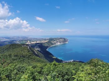
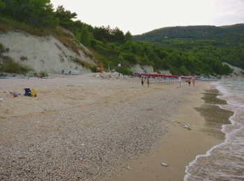
• Trail created by Ente Parco Naturale Regionale del Conero. Symbol: red and white stripes
A pie
• Trail created by Ente Parco Naturale Regionale del Conero. Symbol: red and white stripes
A pie
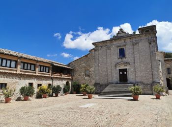
• Trail created by Parco Gola della Rossa e Frasassi. Symbol: red and white stripes
A pie
• Trail created by Parco Gola della Rossa e Frasassi. Symbol: red and white stripes

A pie
• Trail created by Parco Gola della Rossa e Frasassi. Symbol: red and white stripes
A pie
• Trail created by Parco Gola della Rossa e Frasassi. Symbol: red and white stripes
A pie
• Trail created by Parco Gola della Rossa e Frasassi. Symbol: red and white stripes
A pie
• Trail created by Parco Gola della Rossa e Frasassi. Symbol: red and white stripes
A pie
• Trail created by Parco Gola della Rossa e Frasassi. Symbol: red and white stripes
A pie
• Trail created by Club Alpino Italiano. Symbol: red and white stripes
A pie
• Trail created by Club Alpino Italiano. Symbol: red and white stripes
A pie
• Trail created by Club Alpino Italiano. Symbol: red and white stripes
A pie
• Trail created by Club Alpino Italiano. Symbol: red and white stripes
A pie
• Trail created by Club Alpino Italiano. Symbol: red and white stripes
A pie
• Trail created by Club Alpino Italiano. Symbol: red and white stripes
A pie
• Trail created by Parco Gola della Rossa e Frasassi. Symbol: red and white stripes
A pie
• Trail created by Parco Gola della Rossa e Frasassi.
A pie
• Trail created by Parco Gola della Rossa e Frasassi. Symbol: red and white stripes
A pie
• Trail created by Ente Parco Naturale Regionale del Conero. Symbol: red and white stripes
20 excursiones mostradas en 71
Aplicación GPS de excursión GRATIS
 SityTrail
IGN / Institutos geográficos
SityTrail World
El mundo es suyo