


18,5 km | 28 km-effort
Modena: Descubra las mejores excursiones: 154 a pie. Todos estos circuitos, recorridos, itinerarios y actividades al aire libre están disponibles en nuestras aplicaciones SityTrail para smartphone y tablet.
A pie


• Sentiero Italia CAI 2020
A pie
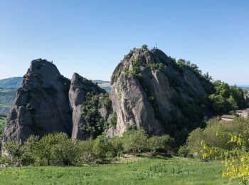
• Trail created by Parco Regionale dei Sassi di Roccamalatina.
A pie
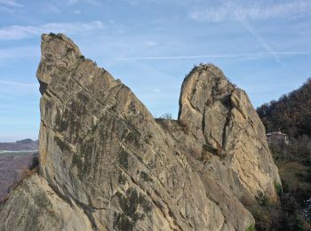
• Trail created by Parco Regionale dei Sassi di Roccamalatina.
A pie
• Trail created by Parco Regionale dei Sassi di Roccamalatina.

A pie
• Symbol: 520 on white red flags
A pie
• Symbol: 488 on white red flags
A pie
• Symbol: 526 on white red flags
A pie
• Symbol: 518 on white red flags
A pie
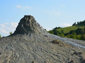
• Trail created by Riserva Naturale Regionale delle Salse di Nirano.

A pie
• Trail created by Comunità Montana Modena Ovest.
A pie
• Symbol: 572 on white red flags
A pie
• Trail created by Comunità Montana Modena Ovest.
A pie
• Trail created by CAI Serramazzoni.
A pie
• Trail created by Comunità Montana Appennino Modena Est.
A pie
• Trail created by Comunità Montana Appennino Modena Est. Symbol: 442 on white red flags
A pie
• Trail created by CAI Modena.
A pie
• Trail created by Comunità Montana Appennino Modena Est.
A pie
• Trail created by Comunità Montana Appennino Modena Est.
A pie
• Trail created by CAI Modena.
A pie
• Trail created by Comunità Montana Appennino Modena Est.
20 excursiones mostradas en 154
Aplicación GPS de excursión GRATIS
 SityTrail
IGN / Institutos geográficos
SityTrail World
El mundo es suyo