![](/images/other/stat-length.png)
Ventasso, Reggio nell'Emilia: Los mejores itinerarios de excursión, recorridos, paseos y sendas
Ventasso: Descubra las mejores excursiones: 31 a pie. Todos estos circuitos, recorridos, itinerarios y actividades al aire libre están disponibles en nuestras aplicaciones SityTrail para smartphone y tablet.
Los mejores recorridos (31)
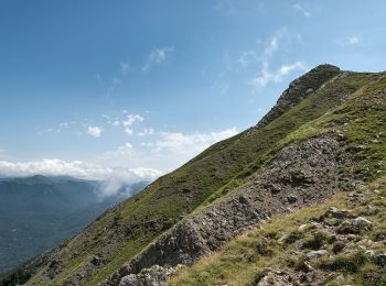
![Excursión A pie Ventasso - (SI L21) Rifugio Sarzana al Monte Acuto - Pratospilla - Photo](https://media.geolcdn.com/t/350/260/9a2754e8-988c-4aa1-9d72-a42a1a850adb.jpeg&format=jpg&maxdim=2)
![A pie A pie](https://static1.geolcdn.com/sitytour/trail-icons/100.png)
Km
A pie
![](/images/other/stat-length.png)
![](https://static1.geolcdn.com/siteimages/upload/files/1508320355ic_sort_den_pos_24dp.png)
![](https://static1.geolcdn.com/siteimages/upload/files/1508320355ic_sort_den_neg_24dp.png)
![](https://static1.geolcdn.com/siteimages/upload/files/16400158638029165_repeat_loop_refresh_sync_direction_icon.png)
• Sentiero Italia CAI 2020
![Excursión A pie Ventasso - IT-673 - Photo](https://media.geolcdn.com/t/350/260/8e86ac16-9816-4d6e-ac93-aebd63dc1989.jpeg&format=jpg&maxdim=2)
![A pie A pie](https://static1.geolcdn.com/sitytour/trail-icons/100.png)
Km
A pie
![](/images/other/stat-length.png)
![](https://static1.geolcdn.com/siteimages/upload/files/1508320355ic_sort_den_pos_24dp.png)
![](https://static1.geolcdn.com/siteimages/upload/files/1508320355ic_sort_den_neg_24dp.png)
![](https://static1.geolcdn.com/siteimages/upload/files/16400158638029165_repeat_loop_refresh_sync_direction_icon.png)
• Trail created by CAI Reggio Emilia. Symbol: 673 on white red flags
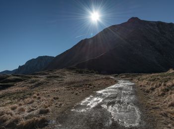
![Excursión A pie Ventasso - (SI L19) Passo di Pradarena - Passo del Cerreto - Photo](https://media.geolcdn.com/t/350/260/05af87f4-bd42-46e4-be0b-3613e20411be.jpeg&format=jpg&maxdim=2)
![A pie A pie](https://static1.geolcdn.com/sitytour/trail-icons/100.png)
Km
A pie
![](/images/other/stat-length.png)
![](https://static1.geolcdn.com/siteimages/upload/files/1508320355ic_sort_den_pos_24dp.png)
![](https://static1.geolcdn.com/siteimages/upload/files/1508320355ic_sort_den_neg_24dp.png)
![](https://static1.geolcdn.com/siteimages/upload/files/16400158638029165_repeat_loop_refresh_sync_direction_icon.png)
• Sentiero Italia CAI 2019
![Excursión A pie Ventasso - (SI L18) Passo di Lama Lite - Passo di Pradarena - Photo](https://media.geolcdn.com/t/350/260/9cf08777-6857-455e-97b5-5f4485cc8793.jpeg&format=jpg&maxdim=2)
![A pie A pie](https://static1.geolcdn.com/sitytour/trail-icons/100.png)
Km
A pie
![](/images/other/stat-length.png)
![](https://static1.geolcdn.com/siteimages/upload/files/1508320355ic_sort_den_pos_24dp.png)
![](https://static1.geolcdn.com/siteimages/upload/files/1508320355ic_sort_den_neg_24dp.png)
![](https://static1.geolcdn.com/siteimages/upload/files/16400158638029165_repeat_loop_refresh_sync_direction_icon.png)
• Sentiero Italia CAI 2019
![Excursión A pie Ventasso - Cervarezza - Lago Calamone - Passo di Pratizzano - Passo della Scalucchia - Buca del Moro - Monte Casarola - Alpe di Succiso - Photo](https://media.geolcdn.com/t/350/260/1d678adc-7757-43e4-a475-27356a06e935.jpeg&format=jpg&maxdim=2)
![A pie A pie](https://static1.geolcdn.com/sitytour/trail-icons/100.png)
Km
A pie
![](/images/other/stat-length.png)
![](https://static1.geolcdn.com/siteimages/upload/files/1508320355ic_sort_den_pos_24dp.png)
![](https://static1.geolcdn.com/siteimages/upload/files/1508320355ic_sort_den_neg_24dp.png)
![](https://static1.geolcdn.com/siteimages/upload/files/16400158638029165_repeat_loop_refresh_sync_direction_icon.png)
• Trail created by CAI Reggio Emilia.
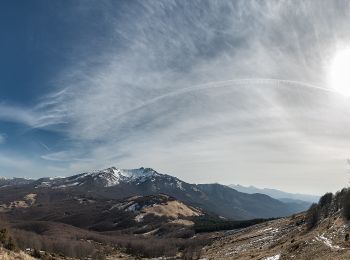
![Excursión A pie Ventasso - Ramiseto - Pratizzano - Capiola - Ospedalaccio - Photo](https://media.geolcdn.com/t/350/260/9298b27a-d21d-4081-ae51-5634855d6843.jpeg&format=jpg&maxdim=2)
![A pie A pie](https://static1.geolcdn.com/sitytour/trail-icons/100.png)
Km
A pie
![](/images/other/stat-length.png)
![](https://static1.geolcdn.com/siteimages/upload/files/1508320355ic_sort_den_pos_24dp.png)
![](https://static1.geolcdn.com/siteimages/upload/files/1508320355ic_sort_den_neg_24dp.png)
![](https://static1.geolcdn.com/siteimages/upload/files/16400158638029165_repeat_loop_refresh_sync_direction_icon.png)
• Trail created by Club Alpino Italiano. Symbol: 677 on white red flags
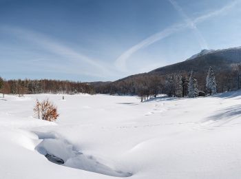
![Excursión A pie Ventasso - Nismozza - Bivacco Santa Maria Maddalena - Lago Calamone - Ventasso Laghi - Photo](https://media.geolcdn.com/t/350/260/60b9dc79-0142-4b04-a68e-8afeeee269e7.jpeg&format=jpg&maxdim=2)
![A pie A pie](https://static1.geolcdn.com/sitytour/trail-icons/100.png)
Km
A pie
![](/images/other/stat-length.png)
![](https://static1.geolcdn.com/siteimages/upload/files/1508320355ic_sort_den_pos_24dp.png)
![](https://static1.geolcdn.com/siteimages/upload/files/1508320355ic_sort_den_neg_24dp.png)
![](https://static1.geolcdn.com/siteimages/upload/files/16400158638029165_repeat_loop_refresh_sync_direction_icon.png)
• Trail created by CAI Reggio Emilia.
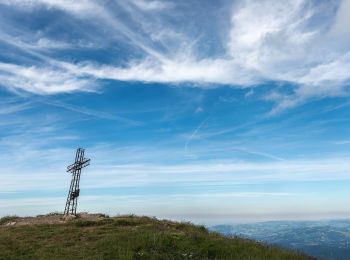
![Excursión A pie Ventasso - SS63 - Bivacco Santa Maria Maddalena - Monte Ventasso - Lago Calamone - Photo](https://media.geolcdn.com/t/350/260/0aabdc19-21b5-4869-914a-a3fcdc10712e.jpeg&format=jpg&maxdim=2)
![A pie A pie](https://static1.geolcdn.com/sitytour/trail-icons/100.png)
Km
A pie
![](/images/other/stat-length.png)
![](https://static1.geolcdn.com/siteimages/upload/files/1508320355ic_sort_den_pos_24dp.png)
![](https://static1.geolcdn.com/siteimages/upload/files/1508320355ic_sort_den_neg_24dp.png)
![](https://static1.geolcdn.com/siteimages/upload/files/16400158638029165_repeat_loop_refresh_sync_direction_icon.png)
• Trail created by Club Alpino Italiano. Symbol: 661 on white red flags
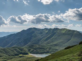
![Excursión A pie Ventasso - IT-653 - Photo](https://media.geolcdn.com/t/350/260/4cd80b0a-761c-40f0-927f-87ef1b7a0fe3.jpeg&format=jpg&maxdim=2)
![A pie A pie](https://static1.geolcdn.com/sitytour/trail-icons/100.png)
Km
A pie
![](/images/other/stat-length.png)
![](https://static1.geolcdn.com/siteimages/upload/files/1508320355ic_sort_den_pos_24dp.png)
![](https://static1.geolcdn.com/siteimages/upload/files/1508320355ic_sort_den_neg_24dp.png)
![](https://static1.geolcdn.com/siteimages/upload/files/16400158638029165_repeat_loop_refresh_sync_direction_icon.png)
• Trail created by CAI Reggio Emilia.
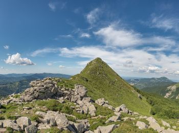
![Excursión A pie Ventasso - Cecciola - in Cima ai Ronchi - La Selva - Lago Gora - Lago di Monte Acuto - Sella di Monte Acuto - Photo](https://media.geolcdn.com/t/350/260/e8e3f3db-1a15-4fc3-a05e-cfb6c4e333e4.jpeg&format=jpg&maxdim=2)
![A pie A pie](https://static1.geolcdn.com/sitytour/trail-icons/100.png)
Km
A pie
![](/images/other/stat-length.png)
![](https://static1.geolcdn.com/siteimages/upload/files/1508320355ic_sort_den_pos_24dp.png)
![](https://static1.geolcdn.com/siteimages/upload/files/1508320355ic_sort_den_neg_24dp.png)
![](https://static1.geolcdn.com/siteimages/upload/files/16400158638029165_repeat_loop_refresh_sync_direction_icon.png)
• Trail created by Club Alpino Italiano.
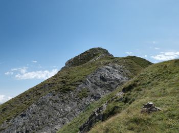
![Excursión A pie Ventasso - Cerreto dell'Alpi - Capiola - Costa della Brancia - Monte Casarola - Photo](https://media.geolcdn.com/t/350/260/1d678adc-7757-43e4-a475-27356a06e935.jpeg&format=jpg&maxdim=2)
![A pie A pie](https://static1.geolcdn.com/sitytour/trail-icons/100.png)
Km
A pie
![](/images/other/stat-length.png)
![](https://static1.geolcdn.com/siteimages/upload/files/1508320355ic_sort_den_pos_24dp.png)
![](https://static1.geolcdn.com/siteimages/upload/files/1508320355ic_sort_den_neg_24dp.png)
![](https://static1.geolcdn.com/siteimages/upload/files/16400158638029165_repeat_loop_refresh_sync_direction_icon.png)
• Trail created by Club Alpino Italiano. Symbol: 651 on white red flags
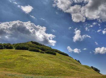
![Excursión A pie Ventasso - La Gabellina - Sorgenti del Secchia - Sella di Monte Casarola - Rifugio Rio Pascolo - Photo](https://media.geolcdn.com/t/350/260/29de0cc0-a9bb-44da-9888-67b7bb103c86.jpeg&format=jpg&maxdim=2)
![A pie A pie](https://static1.geolcdn.com/sitytour/trail-icons/100.png)
Km
A pie
![](/images/other/stat-length.png)
![](https://static1.geolcdn.com/siteimages/upload/files/1508320355ic_sort_den_pos_24dp.png)
![](https://static1.geolcdn.com/siteimages/upload/files/1508320355ic_sort_den_neg_24dp.png)
![](https://static1.geolcdn.com/siteimages/upload/files/16400158638029165_repeat_loop_refresh_sync_direction_icon.png)
• Symbol: 675 on white red flag Sitio web: http://www.caibismantova.it/
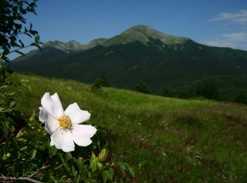
![Excursión A pie Ventasso - Cerreto dell'Alpi - Poggio Colombara - Passo del Lupo - Passo di Cavorsella - Photo](https://media.geolcdn.com/t/350/260/d132b8d9-6e83-4bfe-b555-4444a988aaeb.jpeg&format=jpg&maxdim=2)
![A pie A pie](https://static1.geolcdn.com/sitytour/trail-icons/100.png)
Km
A pie
![](/images/other/stat-length.png)
![](https://static1.geolcdn.com/siteimages/upload/files/1508320355ic_sort_den_pos_24dp.png)
![](https://static1.geolcdn.com/siteimages/upload/files/1508320355ic_sort_den_neg_24dp.png)
![](https://static1.geolcdn.com/siteimages/upload/files/16400158638029165_repeat_loop_refresh_sync_direction_icon.png)
• Trail created by CAI Castelnovo Ne' Monti. Symbol: 647 on white red flags
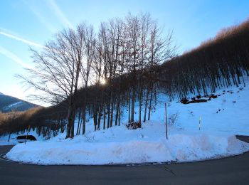
![Excursión A pie Ventasso - IT-643 - Photo](https://media.geolcdn.com/t/350/260/e9e02c55-b877-44f1-887d-3f1ad69c22cd.jpeg&format=jpg&maxdim=2)
![A pie A pie](https://static1.geolcdn.com/sitytour/trail-icons/100.png)
Km
A pie
![](/images/other/stat-length.png)
![](https://static1.geolcdn.com/siteimages/upload/files/1508320355ic_sort_den_pos_24dp.png)
![](https://static1.geolcdn.com/siteimages/upload/files/1508320355ic_sort_den_neg_24dp.png)
![](https://static1.geolcdn.com/siteimages/upload/files/16400158638029165_repeat_loop_refresh_sync_direction_icon.png)
• Trail created by CAI Castelnovo Ne' Monti. Symbol: 643 on white red flags
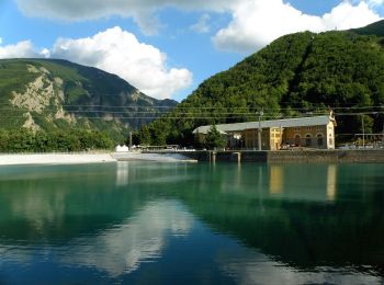
![Excursión A pie Ventasso - Ligonchio - Presa Bassa - Presa Alta - Cascate del Lavacchiello - Prati di Sara - Photo](https://media.geolcdn.com/t/350/260/d2d9af88-1a49-4cd0-916f-59a95bd2b3ce.jpeg&format=jpg&maxdim=2)
![A pie A pie](https://static1.geolcdn.com/sitytour/trail-icons/100.png)
Km
A pie
![](/images/other/stat-length.png)
![](https://static1.geolcdn.com/siteimages/upload/files/1508320355ic_sort_den_pos_24dp.png)
![](https://static1.geolcdn.com/siteimages/upload/files/1508320355ic_sort_den_neg_24dp.png)
![](https://static1.geolcdn.com/siteimages/upload/files/16400158638029165_repeat_loop_refresh_sync_direction_icon.png)
• Trail created by CAI Reggio Emilia. Symbol: 635 on white red flags
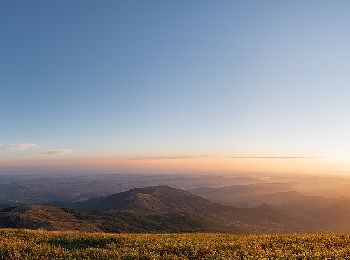
![Excursión A pie Ventasso - Casalino - Prati di Sara - Le Prese - Monte Cusna - Photo](https://media.geolcdn.com/t/350/260/0b2c7967-7e42-4b0f-a909-dc2f526472ba.jpeg&format=jpg&maxdim=2)
![A pie A pie](https://static1.geolcdn.com/sitytour/trail-icons/100.png)
Km
A pie
![](/images/other/stat-length.png)
![](https://static1.geolcdn.com/siteimages/upload/files/1508320355ic_sort_den_pos_24dp.png)
![](https://static1.geolcdn.com/siteimages/upload/files/1508320355ic_sort_den_neg_24dp.png)
![](https://static1.geolcdn.com/siteimages/upload/files/16400158638029165_repeat_loop_refresh_sync_direction_icon.png)
• Trail created by CAI Reggio Emilia. Symbol: 625 on white red flags
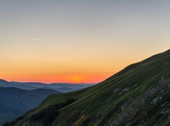
![Excursión A pie Ventasso - Presa Alta - Rifugio Battisti - Photo](https://media.geolcdn.com/t/350/260/77682ea7-19c6-46e5-94d7-3fec41c5f55d.jpeg&format=jpg&maxdim=2)
![A pie A pie](https://static1.geolcdn.com/sitytour/trail-icons/100.png)
Km
A pie
![](/images/other/stat-length.png)
![](https://static1.geolcdn.com/siteimages/upload/files/1508320355ic_sort_den_pos_24dp.png)
![](https://static1.geolcdn.com/siteimages/upload/files/1508320355ic_sort_den_neg_24dp.png)
![](https://static1.geolcdn.com/siteimages/upload/files/16400158638029165_repeat_loop_refresh_sync_direction_icon.png)
• Trail created by CAI Reggio Emilia.
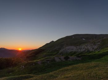
![Excursión A pie Ventasso - Ligonchio - Il Groppo - Passo di Romecchio - Rifugio Bargetana - Passo di Lama Lite - Bocca di Massa - Photo](https://media.geolcdn.com/t/350/260/d792107e-6dab-4d1b-a19c-5b8f96006962.jpeg&format=jpg&maxdim=2)
![A pie A pie](https://static1.geolcdn.com/sitytour/trail-icons/100.png)
Km
A pie
![](/images/other/stat-length.png)
![](https://static1.geolcdn.com/siteimages/upload/files/1508320355ic_sort_den_pos_24dp.png)
![](https://static1.geolcdn.com/siteimages/upload/files/1508320355ic_sort_den_neg_24dp.png)
![](https://static1.geolcdn.com/siteimages/upload/files/16400158638029165_repeat_loop_refresh_sync_direction_icon.png)
• Trail created by CAI Reggio Emilia.
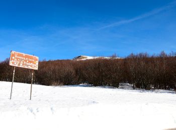
![Excursión A pie Ventasso - Presa Alta - Lama di Mezzo - Lama di Rio Re - Passo di Pradarena - Photo](https://media.geolcdn.com/t/350/260/b8007017-a4bc-43c3-b653-27e60d2c5ec3.jpeg&format=jpg&maxdim=2)
![A pie A pie](https://static1.geolcdn.com/sitytour/trail-icons/100.png)
Km
A pie
![](/images/other/stat-length.png)
![](https://static1.geolcdn.com/siteimages/upload/files/1508320355ic_sort_den_pos_24dp.png)
![](https://static1.geolcdn.com/siteimages/upload/files/1508320355ic_sort_den_neg_24dp.png)
![](https://static1.geolcdn.com/siteimages/upload/files/16400158638029165_repeat_loop_refresh_sync_direction_icon.png)
• Trail created by CAI Reggio Emilia. Symbol: 639 on white red flags
![Excursión A pie Ventasso - Garfagnana Trekking - Tappa 7 - Photo](https://media.geolcdn.com/t/350/260/b8007017-a4bc-43c3-b653-27e60d2c5ec3.jpeg&format=jpg&maxdim=2)
![A pie A pie](https://static1.geolcdn.com/sitytour/trail-icons/100.png)
Km
A pie
![](/images/other/stat-length.png)
![](https://static1.geolcdn.com/siteimages/upload/files/1508320355ic_sort_den_pos_24dp.png)
![](https://static1.geolcdn.com/siteimages/upload/files/1508320355ic_sort_den_neg_24dp.png)
![](https://static1.geolcdn.com/siteimages/upload/files/16400158638029165_repeat_loop_refresh_sync_direction_icon.png)
20 excursiones mostradas en 31
Aplicación GPS de excursión GRATIS