![](/images/other/stat-length.png)
- Excursiones
- Outdoor
- France
- Nueva Aquitania
- Corrèze
- Lamazière-Haute
Lamazière-Haute, Corrèze: Los mejores itinerarios de excursión, recorridos, paseos y sendas
Lamazière-Haute: Descubra las mejores excursiones: 3 a pie. Todos estos circuitos, recorridos, itinerarios y actividades al aire libre están disponibles en nuestras aplicaciones SityTrail para smartphone y tablet.
Los mejores recorridos (3)
![Excursión Senderismo Lamazière-Haute - Eygurande-140630 - Lamazière-VieillesPierres-Bruyères - Photo](https://media.geolcdn.com/t/350/260/ext.jpg?maxdim=2&url=https%3A%2F%2Fservices.sitytrail.com%2FGeolivesWS%2FDownloadMedia.ashx%3FTrailID%3D319686%26Media%3D96373513-caa3-4d4b-9b6e-c5838301481b.jpg)
![Senderismo Senderismo](https://static1.geolcdn.com/sitytour/trail-icons/101.png)
Km
#1 - Eygurande-140630 - Lamazière-VieillesPierres-Bruyères
Senderismo
Fácil
Lamazière-Haute,
Nueva Aquitania,
Corrèze,
France
![](/images/other/stat-length.png)
14,4 km | 18,3 km-effort
5h 0min
![](https://static1.geolcdn.com/siteimages/upload/files/1508320355ic_sort_den_pos_24dp.png)
293 m
![](https://static1.geolcdn.com/siteimages/upload/files/1508320355ic_sort_den_neg_24dp.png)
288 m
![](https://static1.geolcdn.com/siteimages/upload/files/16400158638029165_repeat_loop_refresh_sync_direction_icon.png)
Sí
randodan
•
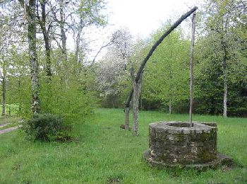
Eygurande, 30 juin 2014
- Circuit des Vieilles Pierres et des Bruyères -
9h30, départ de Lamazière . Beaucoup...
![Excursión Senderismo Lamazière-Haute - 1 - Photo](https://media.geolcdn.com/t/350/260/ext.jpg?maxdim=2&url=https%3A%2F%2Fstatic1.geolcdn.com%2Fsiteimages%2Fupload%2Ffiles%2F1553511878bg_sport_marche.png)
![Senderismo Senderismo](https://static1.geolcdn.com/sitytour/trail-icons/101.png)
Km
#2 - 1
Senderismo
Fácil
Lamazière-Haute,
Nueva Aquitania,
Corrèze,
France
![](/images/other/stat-length.png)
4,4 km | 5,4 km-effort
1h 45min
![](https://static1.geolcdn.com/siteimages/upload/files/1508320355ic_sort_den_pos_24dp.png)
80 m
![](https://static1.geolcdn.com/siteimages/upload/files/1508320355ic_sort_den_neg_24dp.png)
80 m
![](https://static1.geolcdn.com/siteimages/upload/files/16400158638029165_repeat_loop_refresh_sync_direction_icon.png)
Sí
guy.presier
![Excursión Senderismo Lamazière-Haute - sa - Photo](https://media.geolcdn.com/t/350/260/ext.jpg?maxdim=2&url=https%3A%2F%2Fstatic1.geolcdn.com%2Fsiteimages%2Fupload%2Ffiles%2F1553511878bg_sport_marche.png)
![Senderismo Senderismo](https://static1.geolcdn.com/sitytour/trail-icons/101.png)
Km
#3 - sa
Senderismo
Muy fácil
Lamazière-Haute,
Nueva Aquitania,
Corrèze,
France
![](/images/other/stat-length.png)
22 km | 28 km-effort
6h 49min
![](https://static1.geolcdn.com/siteimages/upload/files/1508320355ic_sort_den_pos_24dp.png)
401 m
![](https://static1.geolcdn.com/siteimages/upload/files/1508320355ic_sort_den_neg_24dp.png)
404 m
![](https://static1.geolcdn.com/siteimages/upload/files/16400158638029165_repeat_loop_refresh_sync_direction_icon.png)
Sí
Moureau
3 excursiones mostradas en 3
Aplicación GPS de excursión GRATIS