


11 km | 14,3 km-effort
Gaujac: Descubra las mejores excursiones: 21 a pie. Todos estos circuitos, recorridos, itinerarios y actividades al aire libre están disponibles en nuestras aplicaciones SityTrail para smartphone y tablet.
Senderismo


Senderismo
Senderismo
Senderismo
Senderismo
Senderismo

Senderismo
Senderismo
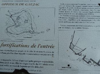
• opidum
Senderismo
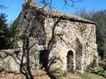
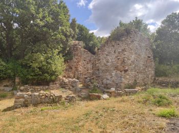
• GAUJAC – OPPIDUM 13.1Km - 04:00 Départ randonnée : du terrain de sport de Gaujac (Gard 30) Carte IGN 2941est. balisag...

Marcha nórdica
A pie
Senderismo
Senderismo
Senderismo
Senderismo
Senderismo
Senderismo
Senderismo
Senderismo
Otra actividad
20 excursiones mostradas en 22
Aplicación GPS de excursión GRATIS
 SityTrail
IGN / Institutos geográficos
SityTrail World
El mundo es suyo