


7,7 km | 11,1 km-effort
Planfoy: Descubra las mejores excursiones: 17 a pie y 2 en bici o bici de montaña. Todos estos circuitos, recorridos, itinerarios y actividades al aire libre están disponibles en nuestras aplicaciones SityTrail para smartphone y tablet.
Senderismo


Senderismo
Senderismo
Senderismo
•
Vía ferrata
Senderismo

Bici de montaña
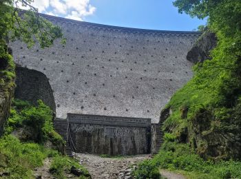
• Tour des barrages
Senderismo
• facile
Senderismo
• facile

Motor
Motor
• 50km dans le parc du pilat
Motor
• 50km dans le parc du pilat
Senderismo
•

 9.586
9.586
sport
Senderismo
Bici de montaña
Senderismo
Senderismo

Esquí de fondo
Senderismo
20 excursiones mostradas en 26
Aplicación GPS de excursión GRATIS
 SityTrail
IGN / Institutos geográficos
SityTrail World
El mundo es suyo