![](/images/other/stat-length.png)
- Excursiones
- Outdoor
- Germany
- Baja Sajonia
- Landkreis Helmstedt
Landkreis Helmstedt, Baja Sajonia: Los mejores itinerarios de excursión, recorridos, paseos y sendas
Landkreis Helmstedt: Descubra las mejores excursiones: 44 a pie y 1 en bici o bici de montaña. Todos estos circuitos, recorridos, itinerarios y actividades al aire libre están disponibles en nuestras aplicaciones SityTrail para smartphone y tablet.
Los mejores recorridos (45)
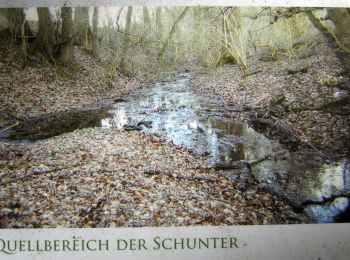
![Excursión A pie Schöningen - Elmkreisel - Photo](https://media.geolcdn.com/t/350/260/12247816-37b7-43cb-8585-e0c954f32e78.jpeg&format=jpg&maxdim=2)
![A pie A pie](https://static1.geolcdn.com/sitytour/trail-icons/100.png)
Km
A pie
![](/images/other/stat-length.png)
![](https://static1.geolcdn.com/siteimages/upload/files/1508320355ic_sort_den_pos_24dp.png)
![](https://static1.geolcdn.com/siteimages/upload/files/1508320355ic_sort_den_neg_24dp.png)
![](https://static1.geolcdn.com/siteimages/upload/files/16400158638029165_repeat_loop_refresh_sync_direction_icon.png)
• Trail created by Naturpark Elm-Lappwald. Symbol: gruener Kringel mit Blatt
![Excursión A pie Räbke - Zielwanderweg Schöningen Schunterquelle - Photo](https://media.geolcdn.com/t/350/260/12247816-37b7-43cb-8585-e0c954f32e78.jpeg&format=jpg&maxdim=2)
![A pie A pie](https://static1.geolcdn.com/sitytour/trail-icons/100.png)
Km
A pie
![](/images/other/stat-length.png)
![](https://static1.geolcdn.com/siteimages/upload/files/1508320355ic_sort_den_pos_24dp.png)
![](https://static1.geolcdn.com/siteimages/upload/files/1508320355ic_sort_den_neg_24dp.png)
![](https://static1.geolcdn.com/siteimages/upload/files/16400158638029165_repeat_loop_refresh_sync_direction_icon.png)
• Trail created by Naturpark Elm-Lappwald. Symbol: stylisierte Wassermühle (rotes Dach [Dreieck mit Schornstein], schw...
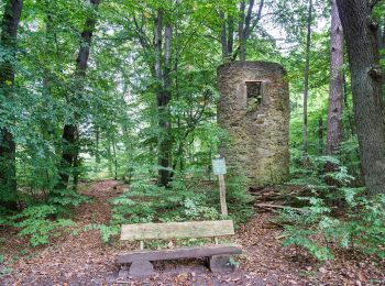
![Excursión A pie Helmstedt - Lappwald Rundwanderweg 7 - Photo](https://media.geolcdn.com/t/350/260/b5ca48e1-401f-4a48-ad25-8fd40f4f809e.jpeg&format=jpg&maxdim=2)
![A pie A pie](https://static1.geolcdn.com/sitytour/trail-icons/100.png)
Km
A pie
![](/images/other/stat-length.png)
![](https://static1.geolcdn.com/siteimages/upload/files/1508320355ic_sort_den_pos_24dp.png)
![](https://static1.geolcdn.com/siteimages/upload/files/1508320355ic_sort_den_neg_24dp.png)
![](https://static1.geolcdn.com/siteimages/upload/files/16400158638029165_repeat_loop_refresh_sync_direction_icon.png)
• Trail created by Naturpark Elm-Lappwald. Symbol: schwarze 7 auf weißem Quadrat
![Excursión A pie Helmstedt - Lappwald Rundwanderweg 1 - Photo](https://media.geolcdn.com/t/350/260/5e2cc03e-716e-464f-9bb5-7251531e9e49.jpeg&format=jpg&maxdim=2)
![A pie A pie](https://static1.geolcdn.com/sitytour/trail-icons/100.png)
Km
A pie
![](/images/other/stat-length.png)
![](https://static1.geolcdn.com/siteimages/upload/files/1508320355ic_sort_den_pos_24dp.png)
![](https://static1.geolcdn.com/siteimages/upload/files/1508320355ic_sort_den_neg_24dp.png)
![](https://static1.geolcdn.com/siteimages/upload/files/16400158638029165_repeat_loop_refresh_sync_direction_icon.png)
• Trail created by Naturpark Elm-Lappwald. Symbol: schwarze 1 auf weißem Quadrat
![Excursión A pie Helmstedt - Lappwald Rundwanderweg 2 - Photo](https://media.geolcdn.com/t/350/260/5897bc14-82f8-4235-8323-3be9e68c362f.jpeg&format=jpg&maxdim=2)
![A pie A pie](https://static1.geolcdn.com/sitytour/trail-icons/100.png)
Km
A pie
![](/images/other/stat-length.png)
![](https://static1.geolcdn.com/siteimages/upload/files/1508320355ic_sort_den_pos_24dp.png)
![](https://static1.geolcdn.com/siteimages/upload/files/1508320355ic_sort_den_neg_24dp.png)
![](https://static1.geolcdn.com/siteimages/upload/files/16400158638029165_repeat_loop_refresh_sync_direction_icon.png)
• Trail created by Naturpark Elm-Lappwald. Symbol: schwarze 2 auf weißem Quadrat
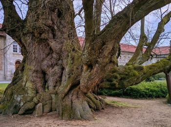
![Excursión A pie Königslutter am Elm - Zielwanderweg Königslutter-Lutterspring-Tetzelstein - Photo](https://media.geolcdn.com/t/350/260/25408fdf-ef2c-4225-870c-d188ac72ab24.jpeg&format=jpg&maxdim=2)
![A pie A pie](https://static1.geolcdn.com/sitytour/trail-icons/100.png)
Km
A pie
![](/images/other/stat-length.png)
![](https://static1.geolcdn.com/siteimages/upload/files/1508320355ic_sort_den_pos_24dp.png)
![](https://static1.geolcdn.com/siteimages/upload/files/1508320355ic_sort_den_neg_24dp.png)
![](https://static1.geolcdn.com/siteimages/upload/files/16400158638029165_repeat_loop_refresh_sync_direction_icon.png)
• Trail created by Naturpark Elm-Lappwald. Symbol: Rechteckumriß auf grünen oder weißem Grund (je nach Version der Mar...
![Excursión A pie Helmstedt - Drillingskiefer Rundweg - Photo](https://media.geolcdn.com/t/350/260/b5ca48e1-401f-4a48-ad25-8fd40f4f809e.jpeg&format=jpg&maxdim=2)
![A pie A pie](https://static1.geolcdn.com/sitytour/trail-icons/100.png)
Km
A pie
![](/images/other/stat-length.png)
![](https://static1.geolcdn.com/siteimages/upload/files/1508320355ic_sort_den_pos_24dp.png)
![](https://static1.geolcdn.com/siteimages/upload/files/1508320355ic_sort_den_neg_24dp.png)
![](https://static1.geolcdn.com/siteimages/upload/files/16400158638029165_repeat_loop_refresh_sync_direction_icon.png)
• Trail created by Naturpark Elm-Lappwald. Symbol: schwarze 9 auf weißem Quadrat
![Excursión A pie Bad Helmstedt - Großer Waldrundweg - Photo](https://media.geolcdn.com/t/350/260/b5ca48e1-401f-4a48-ad25-8fd40f4f809e.jpeg&format=jpg&maxdim=2)
![A pie A pie](https://static1.geolcdn.com/sitytour/trail-icons/100.png)
Km
A pie
![](/images/other/stat-length.png)
![](https://static1.geolcdn.com/siteimages/upload/files/1508320355ic_sort_den_pos_24dp.png)
![](https://static1.geolcdn.com/siteimages/upload/files/1508320355ic_sort_den_neg_24dp.png)
![](https://static1.geolcdn.com/siteimages/upload/files/16400158638029165_repeat_loop_refresh_sync_direction_icon.png)
• Trail created by Naturpark Elm-Lappwald. Symbol: schwarze 5 auf weißem Quadrat
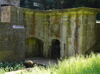
![Excursión A pie Königslutter - Zielwanderweg Reitling-Lutterspring - Photo](https://media.geolcdn.com/t/350/260/ab56771c-b59c-4160-82ac-ebec1574843c.jpeg&format=jpg&maxdim=2)
![A pie A pie](https://static1.geolcdn.com/sitytour/trail-icons/100.png)
Km
A pie
![](/images/other/stat-length.png)
![](https://static1.geolcdn.com/siteimages/upload/files/1508320355ic_sort_den_pos_24dp.png)
![](https://static1.geolcdn.com/siteimages/upload/files/1508320355ic_sort_den_neg_24dp.png)
![](https://static1.geolcdn.com/siteimages/upload/files/16400158638029165_repeat_loop_refresh_sync_direction_icon.png)
• Trail created by Naturpark Elm-Lappwald. Symbol: schwarzes Kreuz auf grünem Quadrat
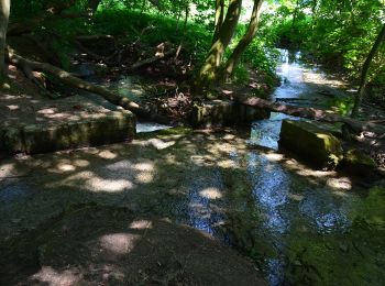
![Excursión A pie Räbke - Zielwanderweg Königslutter Schunterquelle - Photo](https://media.geolcdn.com/t/350/260/99229cce-47ed-471a-825b-63f657e5f92e.jpeg&format=jpg&maxdim=2)
![A pie A pie](https://static1.geolcdn.com/sitytour/trail-icons/100.png)
Km
A pie
![](/images/other/stat-length.png)
![](https://static1.geolcdn.com/siteimages/upload/files/1508320355ic_sort_den_pos_24dp.png)
![](https://static1.geolcdn.com/siteimages/upload/files/1508320355ic_sort_den_neg_24dp.png)
![](https://static1.geolcdn.com/siteimages/upload/files/16400158638029165_repeat_loop_refresh_sync_direction_icon.png)
• Trail created by Naturpark Elm-Lappwald. Symbol: grüner Diamand
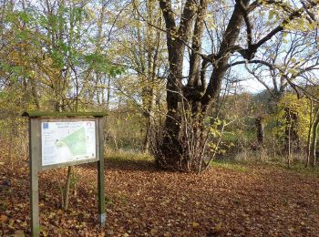
![Excursión A pie Königslutter am Elm - Zielwanderweg Erkerode-Heinrichsruh - Photo](https://media.geolcdn.com/t/350/260/d149467e-e9a7-4319-beea-c6db868f7f50.jpeg&format=jpg&maxdim=2)
![A pie A pie](https://static1.geolcdn.com/sitytour/trail-icons/100.png)
Km
A pie
![](/images/other/stat-length.png)
![](https://static1.geolcdn.com/siteimages/upload/files/1508320355ic_sort_den_pos_24dp.png)
![](https://static1.geolcdn.com/siteimages/upload/files/1508320355ic_sort_den_neg_24dp.png)
![](https://static1.geolcdn.com/siteimages/upload/files/16400158638029165_repeat_loop_refresh_sync_direction_icon.png)
• Trail created by Naturpark Elm-Lappwald. Symbol: grünes Trapez auf weißem Grund
![Excursión A pie Mariental - Lappwald Rundwanderweg 11 - Photo](https://media.geolcdn.com/t/350/260/e64d4f0a-79b0-469a-91ac-561acbaa5d21.jpeg&format=jpg&maxdim=2)
![A pie A pie](https://static1.geolcdn.com/sitytour/trail-icons/100.png)
Km
A pie
![](/images/other/stat-length.png)
![](https://static1.geolcdn.com/siteimages/upload/files/1508320355ic_sort_den_pos_24dp.png)
![](https://static1.geolcdn.com/siteimages/upload/files/1508320355ic_sort_den_neg_24dp.png)
![](https://static1.geolcdn.com/siteimages/upload/files/16400158638029165_repeat_loop_refresh_sync_direction_icon.png)
• Trail created by Naturpark Elm-Lappwald. Symbol: schwarze 11 auf weißem Quadrat
![Excursión A pie Räbke - Elm Rundwanderweg 12 - Photo](https://media.geolcdn.com/t/350/260/12247816-37b7-43cb-8585-e0c954f32e78.jpeg&format=jpg&maxdim=2)
![A pie A pie](https://static1.geolcdn.com/sitytour/trail-icons/100.png)
Km
A pie
![](/images/other/stat-length.png)
![](https://static1.geolcdn.com/siteimages/upload/files/1508320355ic_sort_den_pos_24dp.png)
![](https://static1.geolcdn.com/siteimages/upload/files/1508320355ic_sort_den_neg_24dp.png)
![](https://static1.geolcdn.com/siteimages/upload/files/16400158638029165_repeat_loop_refresh_sync_direction_icon.png)
• Trail created by Naturpark Elm-Lappwald. Symbol: schwarze 12 auf weißem Quadrat
![Excursión A pie Königslutter - Elm Rundwanderweg 20 - Photo](https://media.geolcdn.com/t/350/260/b71e1ce4-1661-4b0e-8118-f9adb4a14c89.jpeg&format=jpg&maxdim=2)
![A pie A pie](https://static1.geolcdn.com/sitytour/trail-icons/100.png)
Km
A pie
![](/images/other/stat-length.png)
![](https://static1.geolcdn.com/siteimages/upload/files/1508320355ic_sort_den_pos_24dp.png)
![](https://static1.geolcdn.com/siteimages/upload/files/1508320355ic_sort_den_neg_24dp.png)
![](https://static1.geolcdn.com/siteimages/upload/files/16400158638029165_repeat_loop_refresh_sync_direction_icon.png)
• Trail created by Naturpark Elm-Lappwald. Symbol: schwarze 20 auf weißem Quadrat
![Excursión A pie Königslutter am Elm - Elm Rundwanderweg 22 - Photo](https://media.geolcdn.com/t/350/260/b71e1ce4-1661-4b0e-8118-f9adb4a14c89.jpeg&format=jpg&maxdim=2)
![A pie A pie](https://static1.geolcdn.com/sitytour/trail-icons/100.png)
Km
A pie
![](/images/other/stat-length.png)
![](https://static1.geolcdn.com/siteimages/upload/files/1508320355ic_sort_den_pos_24dp.png)
![](https://static1.geolcdn.com/siteimages/upload/files/1508320355ic_sort_den_neg_24dp.png)
![](https://static1.geolcdn.com/siteimages/upload/files/16400158638029165_repeat_loop_refresh_sync_direction_icon.png)
• Trail created by Naturpark Elm-Lappwald. Symbol: schwarze 22 auf weißem Quadrat
![Excursión A pie Räbke - Elm Rundwanderweg 28 - Photo](https://media.geolcdn.com/t/350/260/12247816-37b7-43cb-8585-e0c954f32e78.jpeg&format=jpg&maxdim=2)
![A pie A pie](https://static1.geolcdn.com/sitytour/trail-icons/100.png)
Km
A pie
![](/images/other/stat-length.png)
![](https://static1.geolcdn.com/siteimages/upload/files/1508320355ic_sort_den_pos_24dp.png)
![](https://static1.geolcdn.com/siteimages/upload/files/1508320355ic_sort_den_neg_24dp.png)
![](https://static1.geolcdn.com/siteimages/upload/files/16400158638029165_repeat_loop_refresh_sync_direction_icon.png)
• Trail created by Naturpark Elm-Lappwald. Symbol: schwarze 28 auf weißem Quadrat
![Excursión A pie Königslutter - Elm Rundwanderweg 17 - Photo](https://media.geolcdn.com/t/350/260/d149467e-e9a7-4319-beea-c6db868f7f50.jpeg&format=jpg&maxdim=2)
![A pie A pie](https://static1.geolcdn.com/sitytour/trail-icons/100.png)
Km
A pie
![](/images/other/stat-length.png)
![](https://static1.geolcdn.com/siteimages/upload/files/1508320355ic_sort_den_pos_24dp.png)
![](https://static1.geolcdn.com/siteimages/upload/files/1508320355ic_sort_den_neg_24dp.png)
![](https://static1.geolcdn.com/siteimages/upload/files/16400158638029165_repeat_loop_refresh_sync_direction_icon.png)
• Trail created by Naturpark Elm-Lappwald. Symbol: schwarze 17 auf weißem Quadrat
![Excursión A pie Königslutter - Elm Rundwanderweg 18 - Photo](https://media.geolcdn.com/t/350/260/88eb1617-4761-4b99-97e8-6bd1122c4ee8.jpeg&format=jpg&maxdim=2)
![A pie A pie](https://static1.geolcdn.com/sitytour/trail-icons/100.png)
Km
A pie
![](/images/other/stat-length.png)
![](https://static1.geolcdn.com/siteimages/upload/files/1508320355ic_sort_den_pos_24dp.png)
![](https://static1.geolcdn.com/siteimages/upload/files/1508320355ic_sort_den_neg_24dp.png)
![](https://static1.geolcdn.com/siteimages/upload/files/16400158638029165_repeat_loop_refresh_sync_direction_icon.png)
• Trail created by Naturpark Elm-Lappwald. Symbol: schwarze 18 auf weißem Quadrat
![Excursión A pie Mariental - 4 Wälder Rundweg - Photo](https://media.geolcdn.com/t/350/260/b5ca48e1-401f-4a48-ad25-8fd40f4f809e.jpeg&format=jpg&maxdim=2)
![A pie A pie](https://static1.geolcdn.com/sitytour/trail-icons/100.png)
Km
A pie
![](/images/other/stat-length.png)
![](https://static1.geolcdn.com/siteimages/upload/files/1508320355ic_sort_den_pos_24dp.png)
![](https://static1.geolcdn.com/siteimages/upload/files/1508320355ic_sort_den_neg_24dp.png)
![](https://static1.geolcdn.com/siteimages/upload/files/16400158638029165_repeat_loop_refresh_sync_direction_icon.png)
• Trail created by Naturpark Elm-Lappwald. Symbol: schwarzer Wanderschuh auf blauem Quadrat
![Excursión A pie Königslutter am Elm - Elm Rundwanderweg 19 - Photo](https://media.geolcdn.com/t/350/260/c4d0f2d7-a188-4e3f-823b-9265ca8536b2.jpeg&format=jpg&maxdim=2)
![A pie A pie](https://static1.geolcdn.com/sitytour/trail-icons/100.png)
Km
A pie
![](/images/other/stat-length.png)
![](https://static1.geolcdn.com/siteimages/upload/files/1508320355ic_sort_den_pos_24dp.png)
![](https://static1.geolcdn.com/siteimages/upload/files/1508320355ic_sort_den_neg_24dp.png)
![](https://static1.geolcdn.com/siteimages/upload/files/16400158638029165_repeat_loop_refresh_sync_direction_icon.png)
• Trail created by Naturpark Elm-Lappwald. Symbol: schwarze 19 auf weißem Quadrat
20 excursiones mostradas en 45
Aplicación GPS de excursión GRATIS