


5,4 km | 5,9 km-effort
Unterlüß: Descubra las mejores excursiones: 6 a pie. Todos estos circuitos, recorridos, itinerarios y actividades al aire libre están disponibles en nuestras aplicaciones SityTrail para smartphone y tablet.
A pie


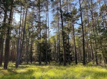
• Die Wanderung des W9 "Wo die Wölfe ihre Fährten ziehen" führt durch die ausgedehnten Wälder bei Unterlüß und begibt s...
A pie
• Die Wanderung des W9 "Wo die Wölfe ihre Fährten ziehen" führt durch die ausgedehnten Wälder bei Unterlüß und begibt s...
A pie
• Die Wanderung des W9 "Wo die Wölfe ihre Fährten ziehen" führt durch die ausgedehnten Wälder bei Unterlüß und begibt s...
A pie
• Die Wanderung als Rundweg führt durch das ausgedehnte Waldgebiet südlich von Unterlüß: einem echten Urwald! Sitio we...
A pie
• Der etwa 7500 ha große Lüßwald östlich von Unterlüß gehört zu den größten zusammenhängenden Waldgebieten Deutschlands...
A pie
• Der Walderlebnispfad als Rundweg führt durch den einzigen Urwald der Lüneburger Heide. Wandern Sie als Tagestour durc...
6 excursiones mostradas en 6
Aplicación GPS de excursión GRATIS
 SityTrail
IGN / Institutos geográficos
SityTrail World
El mundo es suyo