![](/images/other/stat-length.png)
- Excursiones
- Outdoor
- Germany
- Baja Sajonia
- Landkreis Celle
Landkreis Celle, Baja Sajonia: Los mejores itinerarios de excursión, recorridos, paseos y sendas
Landkreis Celle: Descubra las mejores excursiones: 62 a pie. Todos estos circuitos, recorridos, itinerarios y actividades al aire libre están disponibles en nuestras aplicaciones SityTrail para smartphone y tablet.
Los mejores recorridos (62)
![Excursión A pie Celle - Rundwanderweg Altencelle C1 - Photo](https://media.geolcdn.com/t/350/260/974a058b-3c88-4bd1-b865-e80792b2024b.jpeg&format=jpg&maxdim=2)
![A pie A pie](https://static1.geolcdn.com/sitytour/trail-icons/100.png)
Km
A pie
![](/images/other/stat-length.png)
![](https://static1.geolcdn.com/siteimages/upload/files/1508320355ic_sort_den_pos_24dp.png)
![](https://static1.geolcdn.com/siteimages/upload/files/1508320355ic_sort_den_neg_24dp.png)
![](https://static1.geolcdn.com/siteimages/upload/files/16400158638029165_repeat_loop_refresh_sync_direction_icon.png)
• Trail created by Fördergemeinschaft Historisches Altencelle e.V., Stadt Celle, Fachdienst Stadtplanung.
![Excursión A pie Eschede - Südheide 'Beim Hecht im Karpfenteich' W14l (lange Tour) - Photo](https://media.geolcdn.com/t/350/260/cd2db2d9-fbcf-4fe7-90c0-c5d9a667393a.jpeg&format=jpg&maxdim=2)
![A pie A pie](https://static1.geolcdn.com/sitytour/trail-icons/100.png)
Km
A pie
![](/images/other/stat-length.png)
![](https://static1.geolcdn.com/siteimages/upload/files/1508320355ic_sort_den_pos_24dp.png)
![](https://static1.geolcdn.com/siteimages/upload/files/1508320355ic_sort_den_neg_24dp.png)
![](https://static1.geolcdn.com/siteimages/upload/files/16400158638029165_repeat_loop_refresh_sync_direction_icon.png)
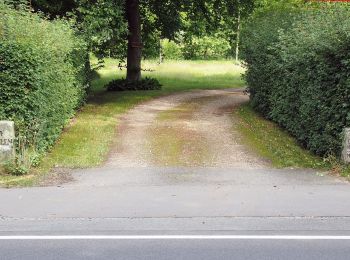
• Die beiden Wanderungen des W14 „Beim Hecht im Karpfenteich“ führen durch die ausgedehnte Wasserlandschaft der Aschau-...
![Excursión A pie Eschede - Südheide 'Beim Hecht im Karpfenteich' W14k (kurze Tour) - Photo](https://media.geolcdn.com/t/350/260/cd2db2d9-fbcf-4fe7-90c0-c5d9a667393a.jpeg&format=jpg&maxdim=2)
![A pie A pie](https://static1.geolcdn.com/sitytour/trail-icons/100.png)
Km
A pie
![](/images/other/stat-length.png)
![](https://static1.geolcdn.com/siteimages/upload/files/1508320355ic_sort_den_pos_24dp.png)
![](https://static1.geolcdn.com/siteimages/upload/files/1508320355ic_sort_den_neg_24dp.png)
![](https://static1.geolcdn.com/siteimages/upload/files/16400158638029165_repeat_loop_refresh_sync_direction_icon.png)
• Die beiden Wanderungen des W14 „Beim Hecht im Karpfenteich“ führen durch die ausgedehnte Wasserlandschaft der Aschaut...
![Excursión A pie Eschede - Südheide 'Im Land der Esche' W19k (kurze Tour) - Photo](https://media.geolcdn.com/t/350/260/97d45ee2-293d-43ca-8309-4bfb97482e63.jpeg&format=jpg&maxdim=2)
![A pie A pie](https://static1.geolcdn.com/sitytour/trail-icons/100.png)
Km
A pie
![](/images/other/stat-length.png)
![](https://static1.geolcdn.com/siteimages/upload/files/1508320355ic_sort_den_pos_24dp.png)
![](https://static1.geolcdn.com/siteimages/upload/files/1508320355ic_sort_den_neg_24dp.png)
![](https://static1.geolcdn.com/siteimages/upload/files/16400158638029165_repeat_loop_refresh_sync_direction_icon.png)
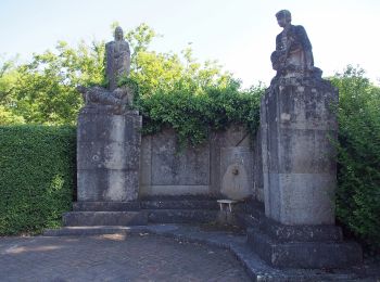
• Die Wanderung des Rundwanderweges W19 "Im Land der Esche" führt in den südöstlichen Teil des Naturparks Südheide, ent...
![Excursión A pie Eschede - Südheide 'Im Land der Esche' W19m (mittlere Tour) - Photo](https://media.geolcdn.com/t/350/260/97d45ee2-293d-43ca-8309-4bfb97482e63.jpeg&format=jpg&maxdim=2)
![A pie A pie](https://static1.geolcdn.com/sitytour/trail-icons/100.png)
Km
A pie
![](/images/other/stat-length.png)
![](https://static1.geolcdn.com/siteimages/upload/files/1508320355ic_sort_den_pos_24dp.png)
![](https://static1.geolcdn.com/siteimages/upload/files/1508320355ic_sort_den_neg_24dp.png)
![](https://static1.geolcdn.com/siteimages/upload/files/16400158638029165_repeat_loop_refresh_sync_direction_icon.png)
• Die Wanderung des Rundwanderweges W19 "Im Land der Esche" führt in den südöstlichen Teil des Naturparks Südheide, ent...
![Excursión A pie Eschede - Südheide 'Im Land der Esche' W19l (lange Tour) - Photo](https://media.geolcdn.com/t/350/260/38f1fdfc-f42b-4a99-ab3b-c8046922951c.jpeg&format=jpg&maxdim=2)
![A pie A pie](https://static1.geolcdn.com/sitytour/trail-icons/100.png)
Km
A pie
![](/images/other/stat-length.png)
![](https://static1.geolcdn.com/siteimages/upload/files/1508320355ic_sort_den_pos_24dp.png)
![](https://static1.geolcdn.com/siteimages/upload/files/1508320355ic_sort_den_neg_24dp.png)
![](https://static1.geolcdn.com/siteimages/upload/files/16400158638029165_repeat_loop_refresh_sync_direction_icon.png)
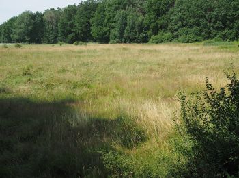
• Die Wanderung des Rundwanderweges W19 "Im Land der Esche" führt in den südöstlichen Teil des Naturparks Südheide, ent...
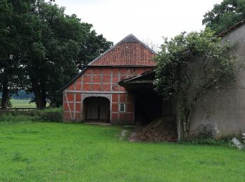
![Excursión A pie Eschede - Südheide 'Magische Orte längs des Weges' W20l (lange Tour) - Photo](https://media.geolcdn.com/t/350/260/571c1a85-4b8a-478a-86a5-9aab9cbd21e0.jpeg&format=jpg&maxdim=2)
![A pie A pie](https://static1.geolcdn.com/sitytour/trail-icons/100.png)
Km
A pie
![](/images/other/stat-length.png)
![](https://static1.geolcdn.com/siteimages/upload/files/1508320355ic_sort_den_pos_24dp.png)
![](https://static1.geolcdn.com/siteimages/upload/files/1508320355ic_sort_den_neg_24dp.png)
![](https://static1.geolcdn.com/siteimages/upload/files/16400158638029165_repeat_loop_refresh_sync_direction_icon.png)
• Die Wanderung führt in den südöstlichen Bereich des Naturparks Südheide, durch die Felder und Wälder im Umfeld von Sc...
![Excursión A pie Eschede - Südheide 'Magische Orte längs des Weges' W20m (mittere Tour) - Photo](https://media.geolcdn.com/t/350/260/38f1fdfc-f42b-4a99-ab3b-c8046922951c.jpeg&format=jpg&maxdim=2)
![A pie A pie](https://static1.geolcdn.com/sitytour/trail-icons/100.png)
Km
A pie
![](/images/other/stat-length.png)
![](https://static1.geolcdn.com/siteimages/upload/files/1508320355ic_sort_den_pos_24dp.png)
![](https://static1.geolcdn.com/siteimages/upload/files/1508320355ic_sort_den_neg_24dp.png)
![](https://static1.geolcdn.com/siteimages/upload/files/16400158638029165_repeat_loop_refresh_sync_direction_icon.png)
• Die Wanderung führt in den südöstlichen Bereich des Naturparks Südheide, durch die Felder und Wälder im Umfeld von Sc...
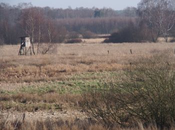
![Excursión A pie Eldingen - Südheide 'Kühe in Halbtrauer' W21m (mittlere Tour) - Photo](https://media.geolcdn.com/t/350/260/e9ddb2d5-ad44-46a9-9d7c-c34b7f25a9d7.jpeg&format=jpg&maxdim=2)
![A pie A pie](https://static1.geolcdn.com/sitytour/trail-icons/100.png)
Km
A pie
![](/images/other/stat-length.png)
![](https://static1.geolcdn.com/siteimages/upload/files/1508320355ic_sort_den_pos_24dp.png)
![](https://static1.geolcdn.com/siteimages/upload/files/1508320355ic_sort_den_neg_24dp.png)
![](https://static1.geolcdn.com/siteimages/upload/files/16400158638029165_repeat_loop_refresh_sync_direction_icon.png)
• Sumpfige Moorlandschaft, kristallklares Heideflüsschen und schwarzbunte Kühe - Wandern in der Südheide Sitio web: ht...
![Excursión A pie Eldingen - Südheide 'Kühe in Halbtrauer' W21k (kurze Tour) - Photo](https://media.geolcdn.com/t/350/260/e9ddb2d5-ad44-46a9-9d7c-c34b7f25a9d7.jpeg&format=jpg&maxdim=2)
![A pie A pie](https://static1.geolcdn.com/sitytour/trail-icons/100.png)
Km
A pie
![](/images/other/stat-length.png)
![](https://static1.geolcdn.com/siteimages/upload/files/1508320355ic_sort_den_pos_24dp.png)
![](https://static1.geolcdn.com/siteimages/upload/files/1508320355ic_sort_den_neg_24dp.png)
![](https://static1.geolcdn.com/siteimages/upload/files/16400158638029165_repeat_loop_refresh_sync_direction_icon.png)
• Die Wanderung führt durch die Feldfluren und kleinere Wälder im Umfeld von Bargfeld und Endeholz im Naturpark Südheid...
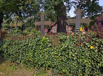
![Excursión A pie Lachendorf - Südheide 'Im Himmelreich' W23m (mittlere Tour) - Photo](https://media.geolcdn.com/t/350/260/a1f0e194-c8e3-4083-bf52-ee831bdffe17.jpeg&format=jpg&maxdim=2)
![A pie A pie](https://static1.geolcdn.com/sitytour/trail-icons/100.png)
Km
A pie
![](/images/other/stat-length.png)
![](https://static1.geolcdn.com/siteimages/upload/files/1508320355ic_sort_den_pos_24dp.png)
![](https://static1.geolcdn.com/siteimages/upload/files/1508320355ic_sort_den_neg_24dp.png)
![](https://static1.geolcdn.com/siteimages/upload/files/16400158638029165_repeat_loop_refresh_sync_direction_icon.png)
• Wanderweg Im Himmelreich: Die Wanderung führt entlang der Lutter und der Lachte auf schmalen Pfaden. Der Weg verläuft...
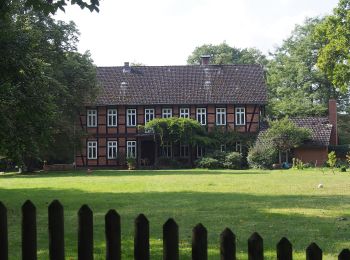
![Excursión A pie Eschede - Südheide 'Reine Luft zu sehen' W18l (lange Tour) - Photo](https://media.geolcdn.com/t/350/260/b607a840-ed82-432b-bd02-7c8fc2b0a01e.jpeg&format=jpg&maxdim=2)
![A pie A pie](https://static1.geolcdn.com/sitytour/trail-icons/100.png)
Km
A pie
![](/images/other/stat-length.png)
![](https://static1.geolcdn.com/siteimages/upload/files/1508320355ic_sort_den_pos_24dp.png)
![](https://static1.geolcdn.com/siteimages/upload/files/1508320355ic_sort_den_neg_24dp.png)
![](https://static1.geolcdn.com/siteimages/upload/files/16400158638029165_repeat_loop_refresh_sync_direction_icon.png)
• Die Wanderung des Rundwanderweges W18 "Reine Luft zu sehen" führt in den südwestlichen Teil des Naturparks Südheide, ...
![Excursión A pie Eschede - Südheide 'Reine Luft zu sehen' W18m (mittlere Tour) - Photo](https://media.geolcdn.com/t/350/260/b607a840-ed82-432b-bd02-7c8fc2b0a01e.jpeg&format=jpg&maxdim=2)
![A pie A pie](https://static1.geolcdn.com/sitytour/trail-icons/100.png)
Km
A pie
![](/images/other/stat-length.png)
![](https://static1.geolcdn.com/siteimages/upload/files/1508320355ic_sort_den_pos_24dp.png)
![](https://static1.geolcdn.com/siteimages/upload/files/1508320355ic_sort_den_neg_24dp.png)
![](https://static1.geolcdn.com/siteimages/upload/files/16400158638029165_repeat_loop_refresh_sync_direction_icon.png)
• Die Wanderung des Rundwanderweges W18 "Reine Luft zu sehen" führt in den südwestlichen Teil des Naturparks Südheide, ...
![Excursión A pie Eschede - Südheide 'Reine Luft zu sehen' W18k (kurze Tour) - Photo](https://media.geolcdn.com/t/350/260/b607a840-ed82-432b-bd02-7c8fc2b0a01e.jpeg&format=jpg&maxdim=2)
![A pie A pie](https://static1.geolcdn.com/sitytour/trail-icons/100.png)
Km
A pie
![](/images/other/stat-length.png)
![](https://static1.geolcdn.com/siteimages/upload/files/1508320355ic_sort_den_pos_24dp.png)
![](https://static1.geolcdn.com/siteimages/upload/files/1508320355ic_sort_den_neg_24dp.png)
![](https://static1.geolcdn.com/siteimages/upload/files/16400158638029165_repeat_loop_refresh_sync_direction_icon.png)
• Die Wanderung des Rundwanderweges W18 "Reine Luft zu sehen" führt in den südwestlichen Teil des Naturparks Südheide, ...
![Excursión A pie Faßberg - Südheide 'Kieselgur - das Gold der Heide' W5m (mittlere Tour) - Photo](https://media.geolcdn.com/t/350/260/3555edef-0186-4411-99f9-d0fa1c69e96a.jpeg&format=jpg&maxdim=2)
![A pie A pie](https://static1.geolcdn.com/sitytour/trail-icons/100.png)
Km
A pie
![](/images/other/stat-length.png)
![](https://static1.geolcdn.com/siteimages/upload/files/1508320355ic_sort_den_pos_24dp.png)
![](https://static1.geolcdn.com/siteimages/upload/files/1508320355ic_sort_den_neg_24dp.png)
![](https://static1.geolcdn.com/siteimages/upload/files/16400158638029165_repeat_loop_refresh_sync_direction_icon.png)
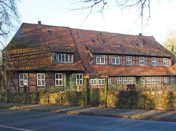
• Die Touren des W5 "Kieselgur, das Gold der Heide" führen über ausgedehnte Heideflächen durch das ehemalige Kieselgur-...
![Excursión A pie Faßberg - Südheide 'Kieselgur - das Gold der Heide' W5l (lange Tour) - Photo](https://media.geolcdn.com/t/350/260/54bf5156-66e4-415f-8629-aa416bfecc07.jpeg&format=jpg&maxdim=2)
![A pie A pie](https://static1.geolcdn.com/sitytour/trail-icons/100.png)
Km
A pie
![](/images/other/stat-length.png)
![](https://static1.geolcdn.com/siteimages/upload/files/1508320355ic_sort_den_pos_24dp.png)
![](https://static1.geolcdn.com/siteimages/upload/files/1508320355ic_sort_den_neg_24dp.png)
![](https://static1.geolcdn.com/siteimages/upload/files/16400158638029165_repeat_loop_refresh_sync_direction_icon.png)
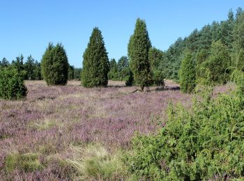
• Die Rundwanderwege des W5 "Kieselgur, das Gold der Heide" führen über ausgedehnte Heideflächen durch das ehemalige Ki...
![Excursión A pie Faßberg - Südheide 'Kieselgur - das Gold der Heide' W5k (kurze Tour) - Photo](https://media.geolcdn.com/t/350/260/3555edef-0186-4411-99f9-d0fa1c69e96a.jpeg&format=jpg&maxdim=2)
![A pie A pie](https://static1.geolcdn.com/sitytour/trail-icons/100.png)
Km
A pie
![](/images/other/stat-length.png)
![](https://static1.geolcdn.com/siteimages/upload/files/1508320355ic_sort_den_pos_24dp.png)
![](https://static1.geolcdn.com/siteimages/upload/files/1508320355ic_sort_den_neg_24dp.png)
![](https://static1.geolcdn.com/siteimages/upload/files/16400158638029165_repeat_loop_refresh_sync_direction_icon.png)
• Die Touren des W5 "Kieselgur, das Gold der Heide" führen über ausgedehnte Heideflächen durch das ehemalige Kieselgur-...
![Excursión A pie Südheide - Südheide 'Gauß'scher Vermessungspunkt im Bergland der Südheide' W7m (mittlere Tour) - Photo](https://media.geolcdn.com/t/350/260/a7f8ab60-3650-4396-99b1-73fbb949c38a.jpeg&format=jpg&maxdim=2)
![A pie A pie](https://static1.geolcdn.com/sitytour/trail-icons/100.png)
Km
A pie
![](/images/other/stat-length.png)
![](https://static1.geolcdn.com/siteimages/upload/files/1508320355ic_sort_den_pos_24dp.png)
![](https://static1.geolcdn.com/siteimages/upload/files/1508320355ic_sort_den_neg_24dp.png)
![](https://static1.geolcdn.com/siteimages/upload/files/16400158638029165_repeat_loop_refresh_sync_direction_icon.png)
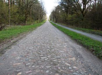
• Die Wanderung W7 "Gauß'sche Vermessungspunkte im Bergland der Südheide" folgt den Spuren des berühmten Göttinger Math...
![Excursión A pie Südheide - Südheide 'Gauß'scher Vermessungspunkt im Bergland der Südheide' W7l (lange Tour) - Photo](https://media.geolcdn.com/t/350/260/54bf5156-66e4-415f-8629-aa416bfecc07.jpeg&format=jpg&maxdim=2)
![A pie A pie](https://static1.geolcdn.com/sitytour/trail-icons/100.png)
Km
A pie
![](/images/other/stat-length.png)
![](https://static1.geolcdn.com/siteimages/upload/files/1508320355ic_sort_den_pos_24dp.png)
![](https://static1.geolcdn.com/siteimages/upload/files/1508320355ic_sort_den_neg_24dp.png)
![](https://static1.geolcdn.com/siteimages/upload/files/16400158638029165_repeat_loop_refresh_sync_direction_icon.png)
• Die Wanderung W7 "Gauß'sche Vermessungspunkte im Bergland der Südheide" folgt den Spuren des berühmten Göttinger Math...
![Excursión A pie Südheide - Südheide 'Auf den Spuren des großen Waldbrandes' W11m (mittlere Tour) - Photo](https://media.geolcdn.com/t/350/260/846828bc-e0e3-4c57-bd53-395e709b2ffc.jpeg&format=jpg&maxdim=2)
![A pie A pie](https://static1.geolcdn.com/sitytour/trail-icons/100.png)
Km
A pie
![](/images/other/stat-length.png)
![](https://static1.geolcdn.com/siteimages/upload/files/1508320355ic_sort_den_pos_24dp.png)
![](https://static1.geolcdn.com/siteimages/upload/files/1508320355ic_sort_den_neg_24dp.png)
![](https://static1.geolcdn.com/siteimages/upload/files/16400158638029165_repeat_loop_refresh_sync_direction_icon.png)
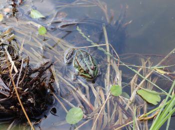
• Die Wanderungen des W11 "Auf den Spuren des großen Waldbrandes" veranschaulichen, wie sich die Natur die Landschaft n...
20 excursiones mostradas en 62
Aplicación GPS de excursión GRATIS