![](/images/other/stat-length.png)
- Excursiones
- Outdoor
- Germany
- Hesse
- Landkreis Fulda
- Gersfeld
Gersfeld, Landkreis Fulda: Los mejores itinerarios de excursión, recorridos, paseos y sendas
Gersfeld: Descubra las mejores excursiones: 14 a pie. Todos estos circuitos, recorridos, itinerarios y actividades al aire libre están disponibles en nuestras aplicaciones SityTrail para smartphone y tablet.
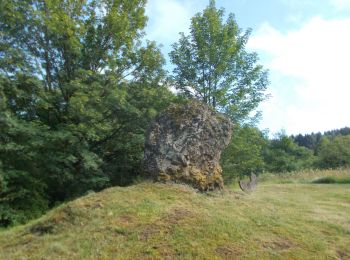
Los mejores recorridos (14)
![Excursión A pie Gersfeld - Rhön-Rundweg 3 Gersfeld - Photo](https://media.geolcdn.com/t/350/260/89cc5337-13ef-4a24-a2c4-3580cba71dc8.jpeg&format=jpg&maxdim=2)
![A pie A pie](https://static1.geolcdn.com/sitytour/trail-icons/100.png)
Km
A pie
![](/images/other/stat-length.png)
![](https://static1.geolcdn.com/siteimages/upload/files/1508320355ic_sort_den_pos_24dp.png)
![](https://static1.geolcdn.com/siteimages/upload/files/1508320355ic_sort_den_neg_24dp.png)
![](https://static1.geolcdn.com/siteimages/upload/files/16400158638029165_repeat_loop_refresh_sync_direction_icon.png)
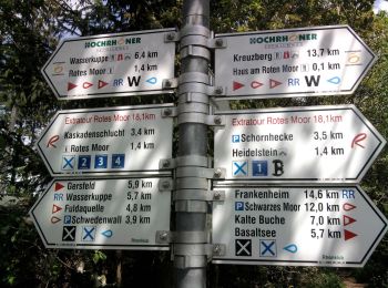
• Trail created by Naturpark Hessische Rhön. complete Symbol: white 3 on blue
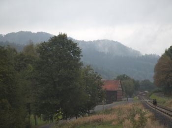
![Excursión A pie Gersfeld - Rhön-Rundweg 4 Gersfeld - Photo](https://media.geolcdn.com/t/350/260/89cc5337-13ef-4a24-a2c4-3580cba71dc8.jpeg&format=jpg&maxdim=2)
![A pie A pie](https://static1.geolcdn.com/sitytour/trail-icons/100.png)
Km
A pie
![](/images/other/stat-length.png)
![](https://static1.geolcdn.com/siteimages/upload/files/1508320355ic_sort_den_pos_24dp.png)
![](https://static1.geolcdn.com/siteimages/upload/files/1508320355ic_sort_den_neg_24dp.png)
![](https://static1.geolcdn.com/siteimages/upload/files/16400158638029165_repeat_loop_refresh_sync_direction_icon.png)
• Trail created by Naturpark Hessische Rhön. incomplete Symbol: white 4 on blue
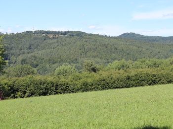
![Excursión A pie Gersfeld - Rhön-Rundweg 4 Wasserkuppe - Photo](https://media.geolcdn.com/t/350/260/3ebc1f0b-88dd-4cfe-aab8-8a19ff3e07f7.jpeg&format=jpg&maxdim=2)
![A pie A pie](https://static1.geolcdn.com/sitytour/trail-icons/100.png)
Km
A pie
![](/images/other/stat-length.png)
![](https://static1.geolcdn.com/siteimages/upload/files/1508320355ic_sort_den_pos_24dp.png)
![](https://static1.geolcdn.com/siteimages/upload/files/1508320355ic_sort_den_neg_24dp.png)
![](https://static1.geolcdn.com/siteimages/upload/files/16400158638029165_repeat_loop_refresh_sync_direction_icon.png)
• Trail created by Naturpark Hessische Rhön. Symbol: white 4 on blue
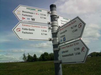
![Excursión A pie Gersfeld - Rhön-Rundweg 3 Spielberg - Photo](https://media.geolcdn.com/t/350/260/947d798c-23d7-4cd4-8adf-464f7d011f68.jpeg&format=jpg&maxdim=2)
![A pie A pie](https://static1.geolcdn.com/sitytour/trail-icons/100.png)
Km
A pie
![](/images/other/stat-length.png)
![](https://static1.geolcdn.com/siteimages/upload/files/1508320355ic_sort_den_pos_24dp.png)
![](https://static1.geolcdn.com/siteimages/upload/files/1508320355ic_sort_den_neg_24dp.png)
![](https://static1.geolcdn.com/siteimages/upload/files/16400158638029165_repeat_loop_refresh_sync_direction_icon.png)
• Trail created by Naturpark Hessische Rhön. Symbol: white 3 on blue
![Excursión A pie Gersfeld - Rhön-Rundweg 1 Spielberg - Photo](https://media.geolcdn.com/t/350/260/947d798c-23d7-4cd4-8adf-464f7d011f68.jpeg&format=jpg&maxdim=2)
![A pie A pie](https://static1.geolcdn.com/sitytour/trail-icons/100.png)
Km
A pie
![](/images/other/stat-length.png)
![](https://static1.geolcdn.com/siteimages/upload/files/1508320355ic_sort_den_pos_24dp.png)
![](https://static1.geolcdn.com/siteimages/upload/files/1508320355ic_sort_den_neg_24dp.png)
![](https://static1.geolcdn.com/siteimages/upload/files/16400158638029165_repeat_loop_refresh_sync_direction_icon.png)
• Trail created by Naturpark Hessische Rhön. Symbol: white 1 on blue
![Excursión A pie Gersfeld - Rhön-Rundweg 1 Gersfeld - Photo](https://media.geolcdn.com/t/350/260/34228992-3cd5-492e-9b7a-53edf294da8c.jpeg&format=jpg&maxdim=2)
![A pie A pie](https://static1.geolcdn.com/sitytour/trail-icons/100.png)
Km
A pie
![](/images/other/stat-length.png)
![](https://static1.geolcdn.com/siteimages/upload/files/1508320355ic_sort_den_pos_24dp.png)
![](https://static1.geolcdn.com/siteimages/upload/files/1508320355ic_sort_den_neg_24dp.png)
![](https://static1.geolcdn.com/siteimages/upload/files/16400158638029165_repeat_loop_refresh_sync_direction_icon.png)
• Trail created by Naturpark Hessische Rhön. Symbol: white 1 on blue
![Excursión A pie Gersfeld - Rhön-Rundweg 3 Dalherda - Photo](https://media.geolcdn.com/t/350/260/508915a8-6988-4c95-b465-c3ee89a15ee6.jpeg&format=jpg&maxdim=2)
![A pie A pie](https://static1.geolcdn.com/sitytour/trail-icons/100.png)
Km
A pie
![](/images/other/stat-length.png)
![](https://static1.geolcdn.com/siteimages/upload/files/1508320355ic_sort_den_pos_24dp.png)
![](https://static1.geolcdn.com/siteimages/upload/files/1508320355ic_sort_den_neg_24dp.png)
![](https://static1.geolcdn.com/siteimages/upload/files/16400158638029165_repeat_loop_refresh_sync_direction_icon.png)
• Trail created by Naturpark Hessische Rhön. complete ? Symbol: white 3 on blue
![Excursión A pie Gersfeld - Rhön-Rundweg 2 Dalherda - Photo](https://media.geolcdn.com/t/350/260/508915a8-6988-4c95-b465-c3ee89a15ee6.jpeg&format=jpg&maxdim=2)
![A pie A pie](https://static1.geolcdn.com/sitytour/trail-icons/100.png)
Km
A pie
![](/images/other/stat-length.png)
![](https://static1.geolcdn.com/siteimages/upload/files/1508320355ic_sort_den_pos_24dp.png)
![](https://static1.geolcdn.com/siteimages/upload/files/1508320355ic_sort_den_neg_24dp.png)
![](https://static1.geolcdn.com/siteimages/upload/files/16400158638029165_repeat_loop_refresh_sync_direction_icon.png)
• Trail created by Naturpark Hessische Rhön. incomplete Symbol: white 2 on blue
![Excursión A pie Gersfeld - Rhön-Rundweg 2 Horstberg - Photo](https://media.geolcdn.com/t/350/260/180e4496-d0e2-409e-98f9-c36e2540c0a3.jpeg&format=jpg&maxdim=2)
![A pie A pie](https://static1.geolcdn.com/sitytour/trail-icons/100.png)
Km
A pie
![](/images/other/stat-length.png)
![](https://static1.geolcdn.com/siteimages/upload/files/1508320355ic_sort_den_pos_24dp.png)
![](https://static1.geolcdn.com/siteimages/upload/files/1508320355ic_sort_den_neg_24dp.png)
![](https://static1.geolcdn.com/siteimages/upload/files/16400158638029165_repeat_loop_refresh_sync_direction_icon.png)
• Trail created by Naturpark Hessische Rhön. complete? Symbol: white 2 on blue
![Excursión A pie Gersfeld - Rhön-Rundweg 1 Horstberg - Photo](https://media.geolcdn.com/t/350/260/c47a0b08-6dcc-41a2-b412-9d3d18edb3b4.jpeg&format=jpg&maxdim=2)
![A pie A pie](https://static1.geolcdn.com/sitytour/trail-icons/100.png)
Km
A pie
![](/images/other/stat-length.png)
![](https://static1.geolcdn.com/siteimages/upload/files/1508320355ic_sort_den_pos_24dp.png)
![](https://static1.geolcdn.com/siteimages/upload/files/1508320355ic_sort_den_neg_24dp.png)
![](https://static1.geolcdn.com/siteimages/upload/files/16400158638029165_repeat_loop_refresh_sync_direction_icon.png)
• Trail created by Naturpark Hessische Rhön. incomplete Symbol: white 1 on blue
![Excursión A pie Gersfeld - Rhön-Rundweg 11 Wachtkueppel - Photo](https://media.geolcdn.com/t/350/260/4d0391f6-7c4e-42ec-95d7-af5fb8138470.jpeg&format=jpg&maxdim=2)
![A pie A pie](https://static1.geolcdn.com/sitytour/trail-icons/100.png)
Km
A pie
![](/images/other/stat-length.png)
![](https://static1.geolcdn.com/siteimages/upload/files/1508320355ic_sort_den_pos_24dp.png)
![](https://static1.geolcdn.com/siteimages/upload/files/1508320355ic_sort_den_neg_24dp.png)
![](https://static1.geolcdn.com/siteimages/upload/files/16400158638029165_repeat_loop_refresh_sync_direction_icon.png)
• Trail created by Naturpark Hessische Rhön. complete? Symbol: white 11 on blue
![Excursión A pie Gersfeld - Extratour Guckaisee - Photo](https://media.geolcdn.com/t/350/260/c8727d26-644d-4342-86fc-c86a2c534386.jpeg&format=jpg&maxdim=2)
![A pie A pie](https://static1.geolcdn.com/sitytour/trail-icons/100.png)
Km
A pie
![](/images/other/stat-length.png)
![](https://static1.geolcdn.com/siteimages/upload/files/1508320355ic_sort_den_pos_24dp.png)
![](https://static1.geolcdn.com/siteimages/upload/files/1508320355ic_sort_den_neg_24dp.png)
![](https://static1.geolcdn.com/siteimages/upload/files/16400158638029165_repeat_loop_refresh_sync_direction_icon.png)
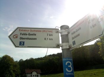
• Trail created by Rhönklub. Sitio web: http://rhoenklub.de/wanderungen/10-extratour-guckaisee
![Excursión A pie Gersfeld - Rotes Moor Rundweg 2 - Photo](https://media.geolcdn.com/t/350/260/30e9cb81-4e17-4973-983a-410b04052f15.jpeg&format=jpg&maxdim=2)
![A pie A pie](https://static1.geolcdn.com/sitytour/trail-icons/100.png)
Km
A pie
![](/images/other/stat-length.png)
![](https://static1.geolcdn.com/siteimages/upload/files/1508320355ic_sort_den_pos_24dp.png)
![](https://static1.geolcdn.com/siteimages/upload/files/1508320355ic_sort_den_neg_24dp.png)
![](https://static1.geolcdn.com/siteimages/upload/files/16400158638029165_repeat_loop_refresh_sync_direction_icon.png)
![Excursión A pie Gersfeld - Rotes Moor Rundweg 4 - Photo](https://media.geolcdn.com/t/350/260/34228992-3cd5-492e-9b7a-53edf294da8c.jpeg&format=jpg&maxdim=2)
![A pie A pie](https://static1.geolcdn.com/sitytour/trail-icons/100.png)
Km
A pie
![](/images/other/stat-length.png)
![](https://static1.geolcdn.com/siteimages/upload/files/1508320355ic_sort_den_pos_24dp.png)
![](https://static1.geolcdn.com/siteimages/upload/files/1508320355ic_sort_den_neg_24dp.png)
![](https://static1.geolcdn.com/siteimages/upload/files/16400158638029165_repeat_loop_refresh_sync_direction_icon.png)
14 excursiones mostradas en 14
Aplicación GPS de excursión GRATIS